Benyellary

Hill, Mountain in Kirkcudbrightshire

Scotland

Benyellary

Coniferous plantation seen through stream gully The stream descending through the trough is a tributary of the Whiteland Burn. The slopes rising to the right reach the minor summit of Bennan, an outlying feature of Benyellary.
Coniferous plantation seen through stream gully Credit: Trevor Littlewood

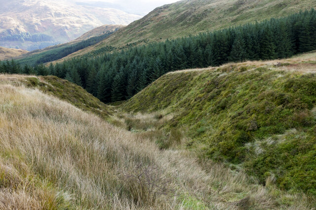
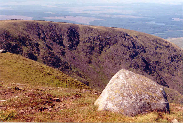
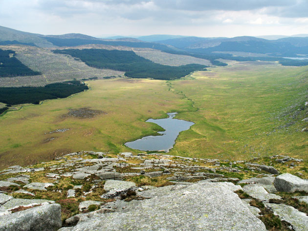
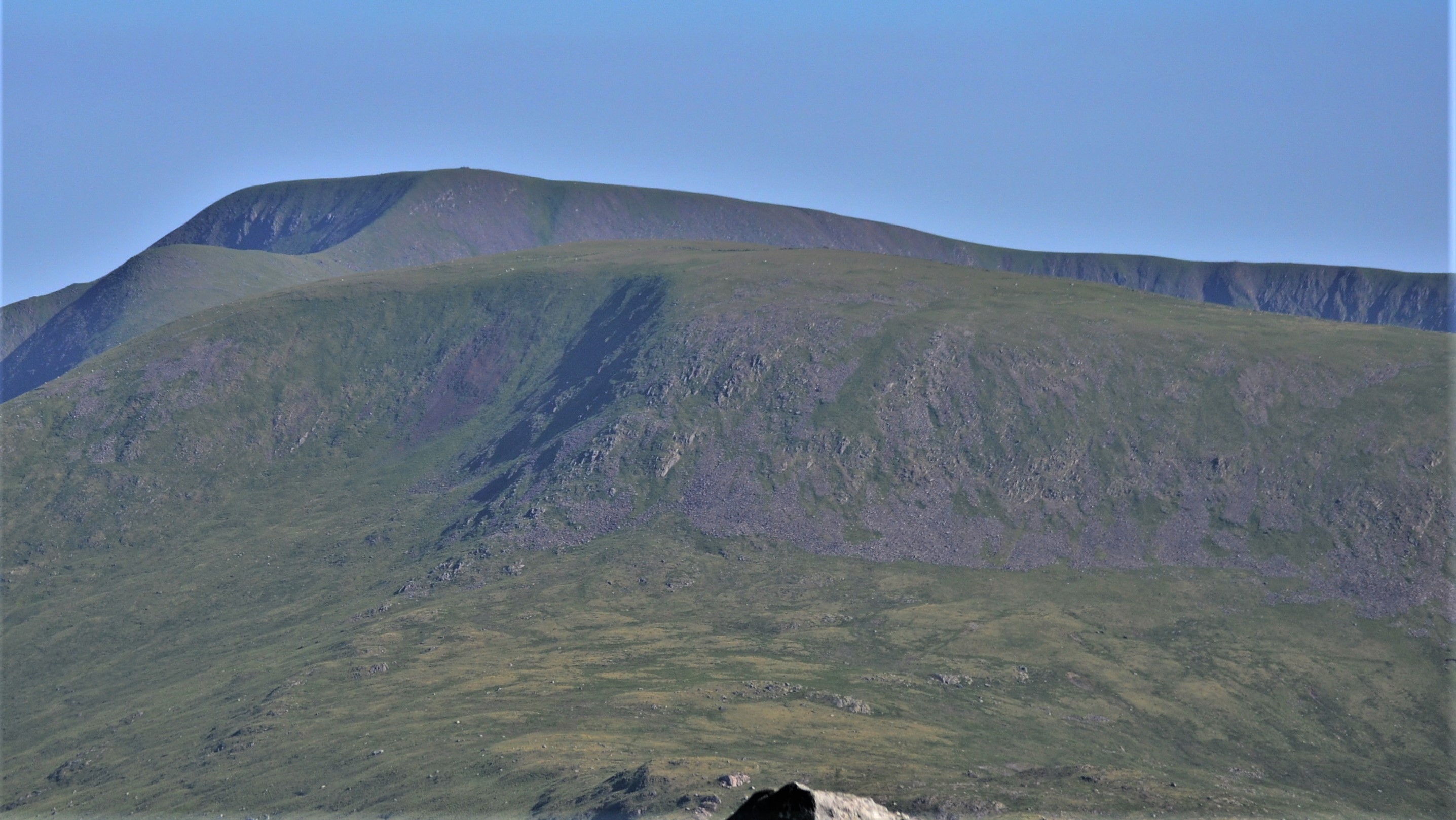
Benyellary is a prominent hill located in Kirkcudbrightshire, in the southern region of Scotland. It is part of the Galloway Hills range and stands at an impressive height of 719 meters (2,359 feet) above sea level. Benyellary is a popular destination for hikers and outdoor enthusiasts due to its stunning views of the surrounding landscape and its challenging terrain.

The hill is known for its rugged and rocky slopes, which provide a challenging yet rewarding climb for experienced hikers. The summit of Benyellary offers panoramic views of the rolling hills, forests, and lochs that make up the picturesque landscape of Kirkcudbrightshire.

The area surrounding Benyellary is rich in wildlife, making it a popular spot for birdwatching and nature enthusiasts. Visitors may spot a variety of bird species, including red grouse, peregrine falcons, and golden eagles, as well as other wildlife such as red deer and mountain hares.

Overall, Benyellary in Kirkcudbrightshire offers a true outdoor adventure for those looking to explore the rugged beauty of the Scottish countryside.

If you have any feedback on the listing, please let us know in the comments section below.

Benyellary Images

Images are sourced within 2km of 55.124112/-4.4873973 or Grid Reference NX4183. Thanks to Geograph Open Source API. All images are credited.

Coniferous plantation seen through stream gully The stream descending through the trough is a tributary of the Whiteland Burn. The slopes rising to the right reach the minor summit of Bennan, an outlying feature of Benyellary.
Coniferous plantation seen through stream gully
The stream descending through the trough is a tributary of the Whiteland Burn. The slopes rising to the right reach the minor summit of Bennan, an outlying feature of Benyellary.
Deer fence crossing moorland The fence crosses the 'tourist path' for The Merrick at the camera position.
The rising ground to the left reaches a high point at the minor summit of Bennan, where there's an aerial nearby.
Deer fence crossing moorland
The fence crosses the 'tourist path' for The Merrick at the camera position. The rising ground to the left reaches a high point at the minor summit of Bennan, where there's an aerial nearby.
Rig of the Gloon The Galloway hills are full of curiously named locations; Rig of the Gloon is one of them. It's effectively the south ridge of The Merrick but rather than descending directly from that summit, it branches away from the broad ridge connecting the main hill with Benyellary. It's seen from the path to The Merrick which begins in Glen Trool.
Rig of the Gloon
The Galloway hills are full of curiously named locations; Rig of the Gloon is one of them. It's effectively the south ridge of The Merrick but rather than descending directly from that summit, it branches away from the broad ridge connecting the main hill with Benyellary. It's seen from the path to The Merrick which begins in Glen Trool.
Ruined dry stone wall along Neive of the Spit The Neive of the Spit is the name given to part of the ridge connecting Benyellary with The Merrick.
Craignaw is in the middle distance at the left side of the image and Loch Neldricken is at the centre of it.
Ruined dry stone wall along Neive of the Spit
The Neive of the Spit is the name given to part of the ridge connecting Benyellary with The Merrick. Craignaw is in the middle distance at the left side of the image and Loch Neldricken is at the centre of it.
Gap in wall climbing to Benyellary The wall is rising north-eastwards towards the hill's summit. The gap has the suggestion of being a gateway with the gate missing but its actual appearance suggests not. There are no gateposts, the sides of the aperture are imperfectly finished and if a gate were to be fixed there in the space as it currently appears, it is hard to see how it would swing and close.
Gap in wall climbing to Benyellary
The wall is rising north-eastwards towards the hill's summit. The gap has the suggestion of being a gateway with the gate missing but its actual appearance suggests not. There are no gateposts, the sides of the aperture are imperfectly finished and if a gate were to be fixed there in the space as it currently appears, it is hard to see how it would swing and close.
The rear of Culsharg Culsharg is a small building beside the main path for the ascent of The Merrick out of Glen Trool.
When visited on this occasion the bothy, as it tends to be called, was in a less than ideal state: the door was missing, a window was broken and the interior was in a very scruffy condition. Things have been both worse and better at Culsharg: Alan Reid's image from 1977 shows the place as a ruin - <a title="https://www.geograph.org.uk/photo/5072248" href="https://www.geograph.org.uk/photo/5072248">Link</a> , whilst that from Chris Andrews, August 2012, shows it to be in good order - <a title="https://www.geograph.org.uk/photo/3086935" href="https://www.geograph.org.uk/photo/3086935">Link</a> .
The rear of Culsharg
Culsharg is a small building beside the main path for the ascent of The Merrick out of Glen Trool. When visited on this occasion the bothy, as it tends to be called, was in a less than ideal state: the door was missing, a window was broken and the interior was in a very scruffy condition. Things have been both worse and better at Culsharg: Alan Reid's image from 1977 shows the place as a ruin - Link , whilst that from Chris Andrews, August 2012, shows it to be in good order - Link .
Walled enclosures and forest planting at Culsharg
Icy patches on Benyellary
Ruinous Culsharg
Ruinous Culsharg
Benyellary From the Glentrool~Straiton road
Benyellary
From the Glentrool~Straiton road
Ruined dry stone wall crossing path The path is the well maintained one climbing from the car park in Glen Trool to The Merrick. The deserted building ahead is Culsharg.
Ruined dry stone wall crossing path
The path is the well maintained one climbing from the car park in Glen Trool to The Merrick. The deserted building ahead is Culsharg.
Minor rocks near summit of Benyellary The view from Benyellary towards Merrick from close to the summit cairn. The connecting ridge is named Neive of the Spit and the roughness below it is known as The Scars of Benyellary.
Minor rocks near summit of Benyellary
The view from Benyellary towards Merrick from close to the summit cairn. The connecting ridge is named Neive of the Spit and the roughness below it is known as The Scars of Benyellary.
Benyellary With view over Neive of the Spit to the Merrick.
Benyellary
With view over Neive of the Spit to the Merrick.
Buchan Hill With view to Loch Valley.
Buchan Hill
With view to Loch Valley.
The Merrick With view to Benyellary.
The Merrick
With view to Benyellary.
Black Gairy
Black Gairy
Culsharg bothy A bothy en route to Merrick, seemingly tended by the Forestry Commission.
Culsharg bothy
A bothy en route to Merrick, seemingly tended by the Forestry Commission.
The Gloon Burn viewed from Benyellary The Gloon Burn has just appeared through the cloud as viewed from a lunch stop on Benyellary.  The summit of Merrick is somewhere through the clouds to the top left; fortunately, it soon revealed itself.
The Gloon Burn viewed from Benyellary
The Gloon Burn has just appeared through the cloud as viewed from a lunch stop on Benyellary. The summit of Merrick is somewhere through the clouds to the top left; fortunately, it soon revealed itself.
Show me another place!

Benyellary is located at Grid Ref: NX4183 (Lat: 55.124112, Lng: -4.4873973)

Unitary Authority: Dumfries and Galloway

Police Authority: Dumfries and Galloway

What 3 Words

///slab.plot.whimpered. Near Newton Stewart, Dumfries & Galloway

Nearby Locations

Benyellary

Related Wikis

Merrick (Galloway)

The Merrick, or simply Merrick (Scottish Gaelic: A' Mhearag), is a mountain in the Range of the Awful Hand, a sub-range of the Galloway Hills range, part...

Silver Flowe-Merrick Kells

Situated in south-west Scotland, the Silver Flowe-Merrick Kells biosphere reserve is composed of two separate sites. Silver Flowe is a unique bog formation...

Kirriereoch Hill

Kirriereoch Hill is a hill in the Range of the Awful Hand, a sub-range of the Galloway Hills range, part of the Southern Uplands of Scotland. It lies on...

Loch Neldricken

Loch Neldricken is a loch in Galloway to the south-east of Merrick, south of Craig Neldricken and west of Craignaw. The loch is almost bisected by a long...

Nearby Amenities

Located within 500m of 55.124112,-4.4873973
Benyellary
Ele: 719.3
Natural: peak
Note: OS7: 2360 feet
Source: OS7
Wikidata: Q4890738
Lat/Long: 55.1240808/-4.4869753
The data included in this document is from www.openstreetmap.org. The data is made available under ODbL.

Have you been to Benyellary?

Leave your review of Benyellary below (or comments, questions and feedback).