Auchness Hill

Hill, Mountain in Wigtownshire

Scotland

Auchness Hill

Rocky ground, Cairndoon A lot of land around Burrow Head is very rocky.
Rocky ground, Cairndoon Credit: Richard Webb

Auchness Hill is a prominent landmark located in Wigtownshire, Dumfries and Galloway, Scotland. Rising to an elevation of 235 meters (771 feet), it is classified as a hill rather than a mountain. The hill is situated in a rural area, surrounded by picturesque countryside and offering stunning panoramic views of the surrounding landscape.

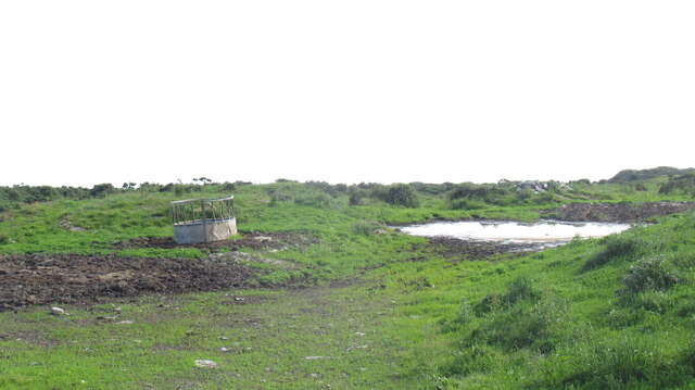
Auchness Hill is characterized by its distinct conical shape and is covered with a mix of grasses and heather. Its slopes are relatively gentle, making it accessible to hikers and nature enthusiasts of various skill levels. The hill is part of a larger network of outdoor recreational areas, including walking trails and nature reserves, making it a popular destination for outdoor activities.

The hill is also home to a diverse range of flora and fauna, with several species of birds, butterflies, and wildflowers found in the area. It provides a habitat for various wildlife, including rabbits, foxes, and deer, adding to its natural appeal. Due to its ecological significance, Auchness Hill has been designated as a Site of Special Scientific Interest.

Auchness Hill holds historical and cultural significance as well. It has been a subject of local folklore and is said to have inspired numerous myths and legends. The hill offers a sense of tranquility and a chance to connect with nature, making it a favorite spot for photographers, artists, and those seeking a peaceful retreat.

Overall, Auchness Hill is a beautiful and accessible natural landmark that offers visitors an opportunity to immerse themselves in the stunning Scottish countryside and enjoy the rich biodiversity of the area.

If you have any feedback on the listing, please let us know in the comments section below.

Auchness Hill Images

Images are sourced within 2km of 54.73839/-4.5017094 or Grid Reference NX3941. Thanks to Geograph Open Source API. All images are credited.

Rocky ground, Cairndoon A lot of land around Burrow Head is very rocky.
Rocky ground, Cairndoon
A lot of land around Burrow Head is very rocky.
View of the Scares Along with the Mull of Galloway, seen from the A747.
View of the Scares
Along with the Mull of Galloway, seen from the A747.
Rocky farmland, Garrarie
Rough grazing, Garrarie
A 747  at Garrarie
A 747 at Garrarie
Field at Garrarie looking out to sea
Garrarie View along the A747 in the direction of Glasserton.
Garrarie
View along the A747 in the direction of Glasserton.
Garrarie View along the A747 in the direction of Monreith.
Garrarie
View along the A747 in the direction of Monreith.
Garrarie View across to Garrarie Cottage, Bungalow and Farm.
Garrarie
View across to Garrarie Cottage, Bungalow and Farm.
Quarry View across to the site of this former quarry at the side of the A747 near Garrarie.
Quarry
View across to the site of this former quarry at the side of the A747 near Garrarie.
Garrarie Three in One View of the entrance road to the cottage, bungalow and farm. The entrance is in grid NX3739, the cottage (left) and bungalow (right) are in NX3839 and the farm at the top of the road is in NX3840. Another novel Geograph covering three grids.
Garrarie Three in One
View of the entrance road to the cottage, bungalow and farm. The entrance is in grid NX3739, the cottage (left) and bungalow (right) are in NX3839 and the farm at the top of the road is in NX3840. Another novel Geograph covering three grids.
Garrarie Bungalow View of the bungalow just at the side of the main road up to the farm.
Garrarie Bungalow
View of the bungalow just at the side of the main road up to the farm.
Garrarie Cottage View of this cottage which is at the side of the access road that leads up to Garrarie Farm.
Garrarie Cottage
View of this cottage which is at the side of the access road that leads up to Garrarie Farm.
Cairndoon View across open farmland towards Garrarie Farm.
Cairndoon
View across open farmland towards Garrarie Farm.
Cairndoon Farm View along the entrance track to the farm.
Cairndoon Farm
View along the entrance track to the farm.
Cairndoon View from near to the farm along the A747 past Cairndoon Plantation left of picture.
Cairndoon
View from near to the farm along the A747 past Cairndoon Plantation left of picture.
Farmland near Monreith Cairnsmore of Fleet is in the distance.
Farmland near Monreith
Cairnsmore of Fleet is in the distance.
Old Milestone by the A747, Cairndoon Plantation, Glasserton Parish By the A747, in parish of Glasserton (Wigtownshire District), East end of wood, on verge, north side of road.

Inscription reads:- : W (Whithorn) / {arrow} / 4 : : P (Port William) / {arrow} / 4 :

Surveyed

Milestone Society National ID: DG_WHPW04
Old Milestone by the A747, Cairndoon Plantation, Glasserton Parish
By the A747, in parish of Glasserton (Wigtownshire District), East end of wood, on verge, north side of road. Inscription reads:- : W (Whithorn) / {arrow} / 4 : : P (Port William) / {arrow} / 4 : Surveyed Milestone Society National ID: DG_WHPW04
Show me another place!

Auchness Hill is located at Grid Ref: NX3941 (Lat: 54.73839, Lng: -4.5017094)

Unitary Authority: Dumfries and Galloway

Police Authority: Dumfries and Galloway

What 3 Words

///neon.universal.thrashing. Near Whithorn, Dumfries & Galloway

Related Wikis

Wren's Egg

The Wren's Egg (grid reference NX 3610 4199) is the name given to a set of late Neolithic or Bronze Age stone monuments in the parish of Glasserton, Wigtownshire...

Monreith

Monreith ([mɒn'ri:θ] / 'mon-REETH'; Scottish Gaelic: Am Monadh Rèidh) is a small seaside village in the Machars, in the historical county of Wigtownshire...

Monreith House

Monreith House is a category A listed Georgian mansion located 1.5 kilometres (0.93 mi) east of the village of Port William in Mochrum parish in the historical...

Glasserton

Glasserton is a civil parish in Dumfries and Galloway, south-west Scotland. It is on the Machars peninsula, in the traditional county of Wigtownshire....

Have you been to Auchness Hill?

Leave your review of Auchness Hill below (or comments, questions and feedback).