Beinn a' Chroin

Hill, Mountain in Perthshire

Scotland

Beinn a' Chroin

Summit of An Caisteal
Summit of An Caisteal Credit: Steven Brown

Beinn a' Chroin is a prominent hill located in the southern Highlands of Scotland, specifically in Perthshire. It is part of the larger Arrochar Alps range within the Loch Lomond and The Trossachs National Park. With an elevation of 942 meters (3,091 feet), Beinn a' Chroin is classified as a Corbett, which means it falls just short of being classified as a Munro (a Scottish mountain over 3,000 feet).

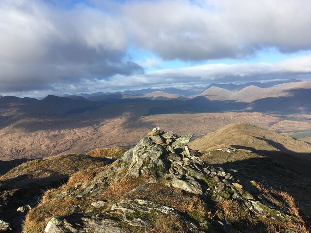
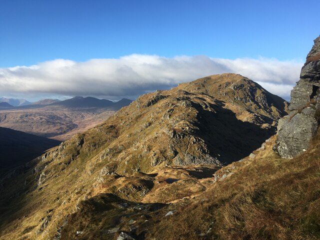
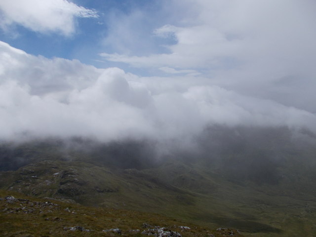
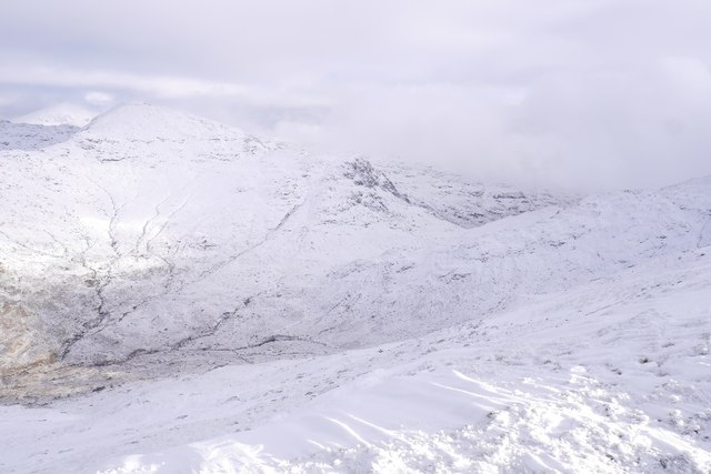
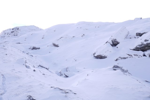
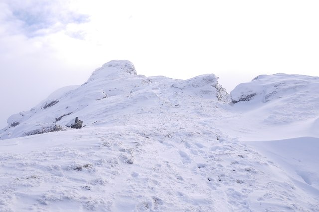
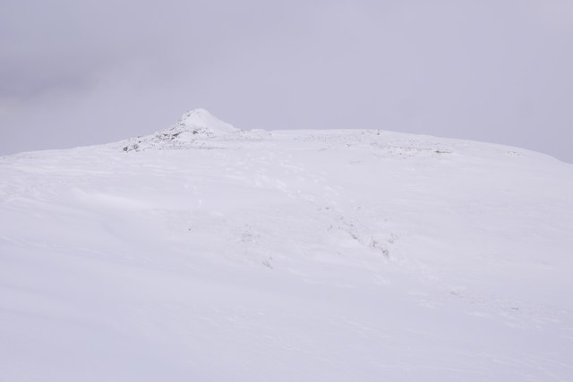
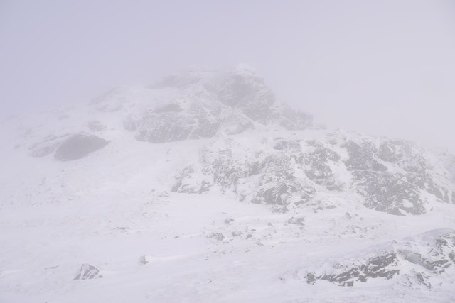
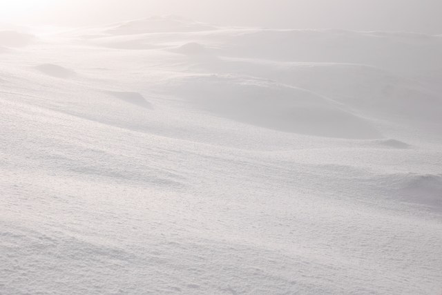
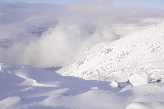
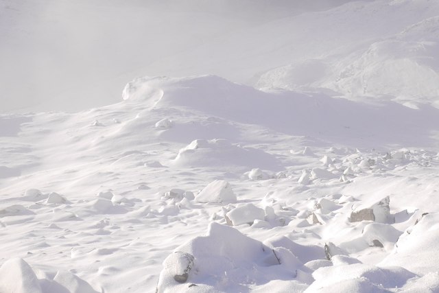
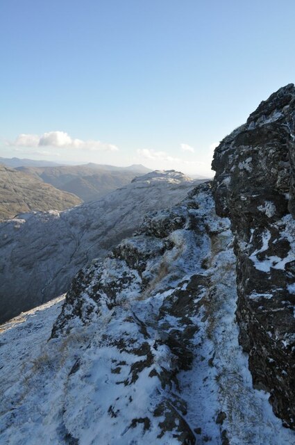
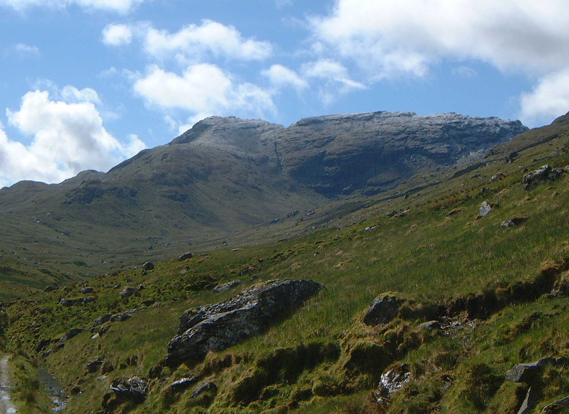
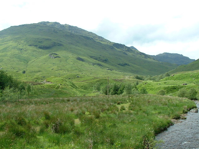
The hill is renowned for its rugged and dramatic landscape, featuring steep slopes, crags, and rocky outcrops. Its distinctive pyramid-shaped peak makes it easily recognizable among the surrounding hills. Beinn a' Chroin is composed mainly of granite, which gives it a unique appearance and provides a challenging terrain for hikers and climbers.

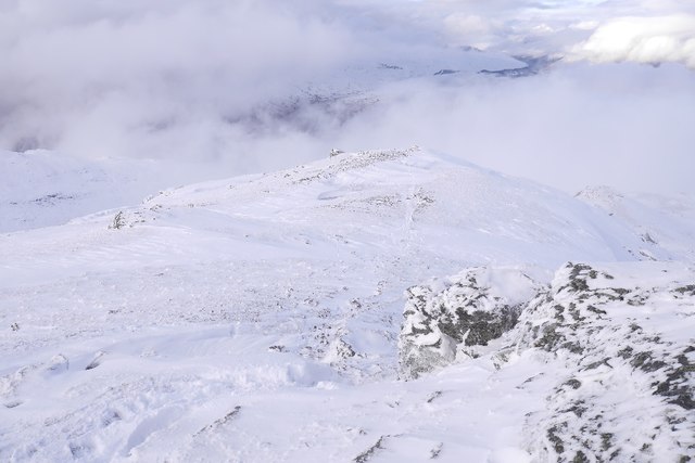
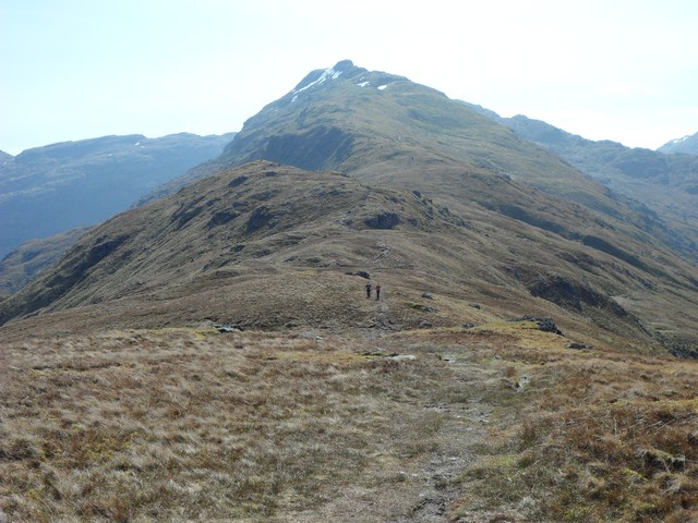
The ascent of Beinn a' Chroin typically starts from the village of Inverarnan, following a path that leads through Glen Falloch before ascending the steep slopes of the hill. The route offers breathtaking views of the surrounding mountains, including its neighboring peak, An Caisteal. The summit provides panoramic vistas of Loch Lomond and the surrounding Highland landscape, making it a popular destination for outdoor enthusiasts and photographers.

Due to its location within a national park, Beinn a' Chroin is home to a diverse range of flora and fauna. Golden eagles, red deer, and wild goats are often spotted in the area, adding to the natural beauty and wildlife diversity of the hill.

Overall, Beinn a' Chroin is a challenging yet rewarding hill that offers spectacular views, unique geological features, and opportunities for outdoor exploration in the heart of Perthshire's stunning countryside.

If you have any feedback on the listing, please let us know in the comments section below.

Beinn a' Chroin Images

Images are sourced within 2km of 56.332051/-4.6096237 or Grid Reference NN3818. Thanks to Geograph Open Source API. All images are credited.

Summit of An Caisteal
Bealach Buidhe towards An Caisteal
Garbh (spur of Beinn a' Chroin) as seen from Beinn Tulaichean Ben Lui & Ben Oss are visible on the skyline.
Garbh (spur of Beinn a' Chroin) as seen from Beinn Tulaichean
Ben Lui & Ben Oss are visible on the skyline.
Low cloud over Beinn a' Chroin View from the Cruach Ardrain summit ridge.
Low cloud over Beinn a' Chroin
View from the Cruach Ardrain summit ridge.
Bealach between Cruach Ardrain and Beinn a' Choin A pass between the head of Glen Falloch and the headwaters of the Forth beyond Inverlochlarig.
Bealach between Cruach Ardrain and Beinn a' Choin
A pass between the head of Glen Falloch and the headwaters of the Forth beyond Inverlochlarig.
Parallel ridges, An Caisteal Landslip features on Twistin Hill, here there are two ridges with a cleft between them.
Parallel ridges, An Caisteal
Landslip features on Twistin Hill, here there are two ridges with a cleft between them.
The Castle A rock feature near the end of the Twistin Hill ridge on An Caisteal.  Normally it goes easily but today fresh snow smoothed down by parties in front of me made an ascent difficult and after a long period of umming and arhhing on one secure foothold I down climbed what is normally a trivial obstacle and went round the base.  

The rocks and clefts here are landslip features.
The Castle
A rock feature near the end of the Twistin Hill ridge on An Caisteal. Normally it goes easily but today fresh snow smoothed down by parties in front of me made an ascent difficult and after a long period of umming and arhhing on one secure foothold I down climbed what is normally a trivial obstacle and went round the base. The rocks and clefts here are landslip features.
North ridge, An Caisteal Looking down the ridge, through the clouds towards Crianlarich .
North ridge, An Caisteal
Looking down the ridge, through the clouds towards Crianlarich .
Summit area, An Caisteal There are a few candidates for highest point and a couple of cairns up here.
Summit area, An Caisteal
There are a few candidates for highest point and a couple of cairns up here.
West ridge, An Caisteal Like neighbouring Beinn Chabhar, finding your way through the crags off the hill is tricky.
West ridge, An Caisteal
Like neighbouring Beinn Chabhar, finding your way through the crags off the hill is tricky.
Snowfield, An Caisteal Shortlived snow, lying directly on the ground which is unusual for the time of year. By now there should be a build up of snow over the Winter.  A result of this is that you are walking not on the snow, but the ground beneath - you cannot see what is there, so every step is lucky dip. Hit a slabby rock and over you go.  As the day wore on, I accumulated damage like a computer game character and was a bit wrecked when I got down.
Pretty though!
Snowfield, An Caisteal
Shortlived snow, lying directly on the ground which is unusual for the time of year. By now there should be a build up of snow over the Winter. A result of this is that you are walking not on the snow, but the ground beneath - you cannot see what is there, so every step is lucky dip. Hit a slabby rock and over you go. As the day wore on, I accumulated damage like a computer game character and was a bit wrecked when I got down. Pretty though!
West side of An Caisteal The headwall of Coire Andoran.  Lots of broken crags.
West side of An Caisteal
The headwall of Coire Andoran. Lots of broken crags.
Snow covered boulders, An Caisteal On the west ridge. The  snow was fresh and shortlived, lying directly on the ground which is unusual for the time of year. By now there should be a build up of snow over the Winter.  A result of this is that you are walking not on the snow, but the ground beneath - you cannot see what is there, so every step is lucky dip. Hit a slabby rock and over you go.  As the day wore on, I accumulated damage like a computer game character and was a bit wrecked when I got down.
Pretty though!
Snow covered boulders, An Caisteal
On the west ridge. The snow was fresh and shortlived, lying directly on the ground which is unusual for the time of year. By now there should be a build up of snow over the Winter. A result of this is that you are walking not on the snow, but the ground beneath - you cannot see what is there, so every step is lucky dip. Hit a slabby rock and over you go. As the day wore on, I accumulated damage like a computer game character and was a bit wrecked when I got down. Pretty though!
On the Stob Glas ridge of An Caisteal Taking a breather on one of many steps on this undulating ridge. The Ben Lui group of Munros rise snow-clad in the distance.
On the Stob Glas ridge of An Caisteal
Taking a breather on one of many steps on this undulating ridge. The Ben Lui group of Munros rise snow-clad in the distance.
A bouldery step near the summit of An Caisteal
Marshiness between tops of Beinn a' Chroin Beinn a' Chroin is a Munro with two tops of a similar height 942 m. and 940 m.. The image shows the col between those tops with a view through the gap to the north.
Marshiness between tops of Beinn a' Chroin
Beinn a' Chroin is a Munro with two tops of a similar height 942 m. and 940 m.. The image shows the col between those tops with a view through the gap to the north.
An Caisteal Icicles Icicles hang from the crags near the summit of An Caisteal. In the distance is Ben More.
An Caisteal Icicles
Icicles hang from the crags near the summit of An Caisteal. In the distance is Ben More.
An Caisteal Path This icy path near the summit of An Caisteal wasn't as precarious as it looks.
An Caisteal Path
This icy path near the summit of An Caisteal wasn't as precarious as it looks.
Show me another place!

Beinn a' Chroin is located at Grid Ref: NN3818 (Lat: 56.332051, Lng: -4.6096237)

Unitary Authority: Stirling

Police Authority: Forth Valley

What 3 Words

///gushes.presides.winner. Near Tyndrum, Stirling

Related Wikis

Beinn a' Chroin

Beinn a' Chroin is a mountain in the Breadalbane region of the Scottish Highlands, six kilometres south of Crianlarich. With a height of 941 metres (3...

An Caisteal

An Caisteal (Scottish Gaelic for 'the castle') is a mountain in the Breadalbane region of the Scottish Highlands, south of the village of Crianlarich....

Beinn Chabhair

Beinn Chabhair (Gaelic: Beinn a' Chabhair) is a Scottish mountain. It has fine views down to Loch Lomond. A common approach is from Inverarnan, up a steep...

Beinn Tulaichean

Beinn Tulaichean is a Scottish mountain. It is not much more than the southern top of Cruach Ardrain, with a descent of only 120m before the ascent to...

Nearby Amenities

Located within 500m of 56.332051,-4.6096237
Beinn a' Chroin
Description: Hill of harm or danger
Ele: 942
Munro: yes
Munro Number: M231
Natural: peak
Note: gps shows this as the true top.
Prominence: 137
Source: NPE
Wikidata: Q4881350
Wikipedia: en:Beinn a' Chroin
Lat/Long: 56.3323177/-4.6084964
Ele: 941
Natural: peak
Lat/Long: 56.3320039/-4.6096084
The data included in this document is from www.openstreetmap.org. The data is made available under ODbL.

Have you been to Beinn a' Chroin?

Leave your review of Beinn a' Chroin below (or comments, questions and feedback).