Hill Top

Settlement in Nottinghamshire Broxtowe

England

Hill Top

Playing fields No one is using the pitches at the moment.
Playing fields Credit: Malcolm Neal

Hill Top is a small village located in the county of Nottinghamshire, England. Situated about 6 miles north of the city of Nottingham, this rural settlement is nestled in a picturesque countryside setting. The village is part of the wider parish of Arnold, which is known for its rich history and scenic landscapes.

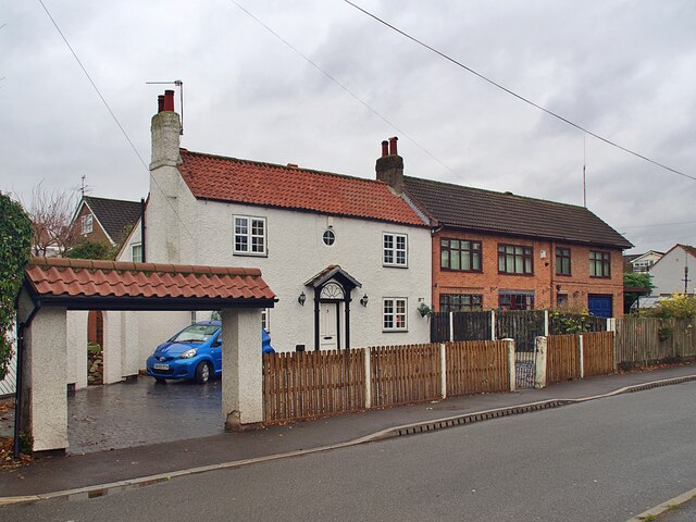
Hill Top is characterized by its quaint and traditional charm, with a mix of old stone cottages and newer residential developments. The village is home to a tight-knit community, fostering a strong sense of belonging and neighborly support. Residents often engage in community activities and events, such as summer fairs and local gatherings.

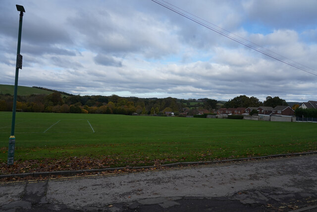
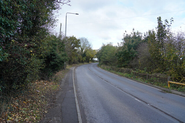
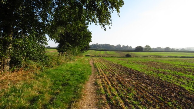
The village enjoys a peaceful and tranquil atmosphere, making it an ideal place for families or those seeking a serene environment away from the hustle and bustle of city life. Surrounded by lush green fields and woodlands, Hill Top offers ample opportunities for outdoor activities. There are several walking and cycling trails nearby, perfect for exploring the stunning Nottinghamshire countryside.

While Hill Top itself is a predominantly residential area, it benefits from its proximity to nearby towns and cities. Nottingham offers a wide range of amenities, including shopping centers, restaurants, and cultural attractions, all just a short drive away. Additionally, the village benefits from excellent transportation links, with easy access to major roads and public transport services.

Overall, Hill Top provides residents with a peaceful and idyllic place to call home, while still enjoying the convenience of nearby urban centers. Its beautiful surroundings, strong community spirit, and close-knit atmosphere make it a desirable place to live.

If you have any feedback on the listing, please let us know in the comments section below.
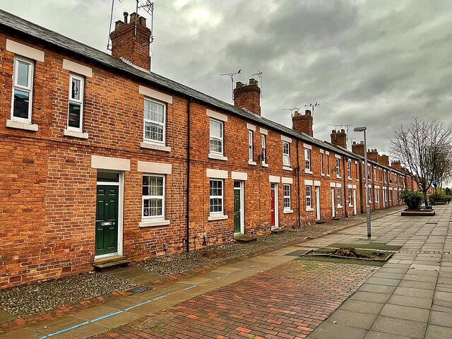
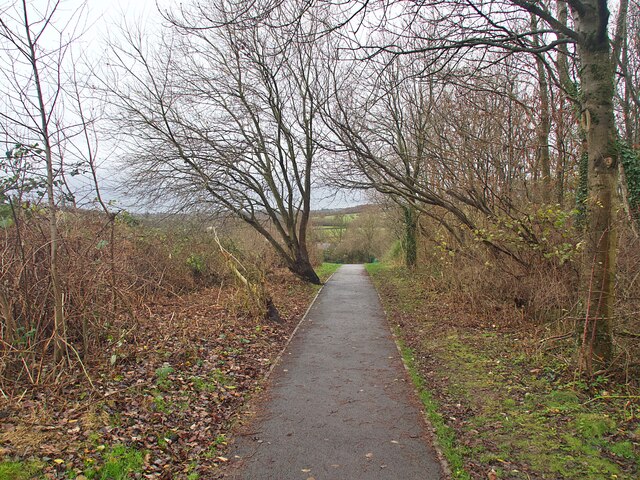
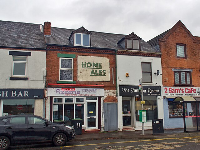
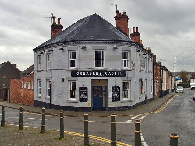
Hill Top Images

Images are sourced within 2km of 53.015013/-1.289996 or Grid Reference SK4746. Thanks to Geograph Open Source API. All images are credited.

Playing fields No one is using the pitches at the moment.
Playing fields
No one is using the pitches at the moment.
Mansfield Road Autumnal leaf fall on the edge of Mansfield Road.
Mansfield Road
Autumnal leaf fall on the edge of Mansfield Road.
On the Robin Hood Way northwest of Kimberley
Robin Hood Way leading northeast towards Greasley
St Mary's Church, Greasley
D.H. Lawrence Birthplace Museum The Museum is located in the childhood home of the author D.H. Lawrence in the ex-mining town of Eastwood.
D.H. Lawrence Birthplace Museum
The Museum is located in the childhood home of the author D.H. Lawrence in the ex-mining town of Eastwood.
Princes Street, Eastwood One of a group of streets known locally as "the squares" this now pedestrianised street of terraced houses was built by the local colliery company in the 1850s.  DH Lawrence's home was nearby <a href="https://www.geograph.org.uk/photo/7043172">SK4647 : D.H. Lawrence Birthplace Museum</a> and he later described the houses as "sordid and hideous". They look very clean and smart today.
Princes Street, Eastwood
One of a group of streets known locally as "the squares" this now pedestrianised street of terraced houses was built by the local colliery company in the 1850s. DH Lawrence's home was nearby SK4647 : D.H. Lawrence Birthplace Museum and he later described the houses as "sordid and hideous". They look very clean and smart today.
The Erewash Canal at Bridge #25 Approaching Shipley Lock
The Erewash Canal at Bridge #25
Approaching Shipley Lock
Bridge #25 on the Erewash Canal Below Shipley Lock #72 on the canal.
Bridge #25 on the Erewash Canal
Below Shipley Lock #72 on the canal.
The Old Slaughterhouse Where worn-out canal tow horses came at the end of their working life.
The Old Slaughterhouse
Where worn-out canal tow horses came at the end of their working life.
Shipley Lock Lock #72 on the Erewash Canal
Shipley Lock
Lock #72 on the Erewash Canal
The Erewash Canal below Eastwood Lock Lock #73 on the canal. The towpath switches to the opposite bank here.
The Erewash Canal below Eastwood Lock
Lock #73 on the canal. The towpath switches to the opposite bank here.
The Erewash Canal and towpath south of bridge #26
Ghost sign on Derby Road, Eastwood It appears that this sign for Neville's Garage was mostly covered by an advertising hoarding when the gable end was repainted, obliterating part of the N and G when the hoarding was removed and the sign re-appeared.
Ghost sign on Derby Road, Eastwood
It appears that this sign for Neville's Garage was mostly covered by an advertising hoarding when the gable end was repainted, obliterating part of the N and G when the hoarding was removed and the sign re-appeared.
Public footpath in Eastwood Running between Garden Road and Walker Street
Public footpath in Eastwood
Running between Garden Road and Walker Street
Ghost sign on Nottingham Road For Home Ales, a brand which disappeared in the 1990s but I believe used to supply the Greasley Castle opposite <a href="https://www.geograph.org.uk/photo/7045094">SK4746 : The Greasley Castle</a>
Ghost sign on Nottingham Road
For Home Ales, a brand which disappeared in the 1990s but I believe used to supply the Greasley Castle opposite SK4746 : The Greasley Castle
The Greasley Castle Public House at the Castle Street/Raglan Street junction.  I believe the pub used to sell Home Ales, for which beer there remains a ghost sign opposite on Nottingham Road <a href="https://www.geograph.org.uk/photo/7045090">SK4746 : Ghost sign on Nottingham Road</a>
The Greasley Castle
Public House at the Castle Street/Raglan Street junction. I believe the pub used to sell Home Ales, for which beer there remains a ghost sign opposite on Nottingham Road SK4746 : Ghost sign on Nottingham Road
Houses on Pinfold Road, Giltbrook
Show me another place!

Hill Top is located at Grid Ref: SK4746 (Lat: 53.015013, Lng: -1.289996)

Administrative County: Nottinghamshire

District: Broxtowe

Police Authority: Nottinghamshire

What 3 Words

///vacancies.sensible.folds. Near Eastwood, Nottinghamshire

Nearby Locations

Hill Top Newthorpe Common

Related Wikis

Newthorpe, Nottinghamshire

Newthorpe is a village in the English county of Nottinghamshire. It is in the Broxtowe Borough Council ward of Greasley (Giltbrook and Newthorpe). It forms...

Eastwood Town F.C.

Eastwood Town Football Club was an English football club based in Eastwood, Nottinghamshire. The club last participated in the Northern Premier League...

Eastwood C.F.C.

Eastwood Community Football Club is a football club based in Eastwood, Nottinghamshire, England. They are currently members of the United Counties League...

Eastwood, Nottinghamshire

Eastwood is a former coal mining town in the Broxtowe district of Nottinghamshire, England, 8 miles (13 km) northwest of Nottingham and 10 miles (16 km...

Related Videos

Walk through English Woodland in December

No food on this one, just a walk through some of the most beautiful woodland near to me at Moorgreen, Nottinghamshire just up ...

A SOLO HIKE UK 4K - through a medieval forest.

Decided to go for another hike as we haven't been out camping in a few weeks. It did not disappoint, what a place. even stopped ...

Nearby Amenities

Located within 500m of 53.015013,-1.289996
Turning Circle
Lat/Long: 53.0183634/-1.2922413
Turning Circle
Lat/Long: 53.0174798/-1.2935825
Turning Circle
Lat/Long: 53.0124325/-1.2882537
Bus Stop
Mill Road
Bench: yes
Bus: yes
Local Ref: BR0123
Naptan AtcoCode: 3300BR0123
Naptan Bearing: NE
Naptan CommonName: Mill Road
Naptan Crossing: Mill Lane
Naptan Indicator: adj
Naptan NaptanCode: ntsdptwd
Naptan Notes: none
Naptan Street: Beauvale Road
Naptan Verified: yes
Public Transport: platform
Shelter: yes
Source: naptan_import
Lat/Long: 53.0175578/-1.2872087
Bus Stop
Mill Road
Bench: no
Bin: no
Bus: yes
Local Ref: BR0156
Naptan AtcoCode: 3300BR0156
Naptan Bearing: SW
Naptan CommonName: Mill Road
Naptan Crossing: Mill Road
Naptan Indicator: opp
Naptan NaptanCode: ntsdawat
Naptan Notes: none
Naptan Street: Beauvale Road
Naptan Verified: yes
Public Transport: platform
Shelter: no
Source: naptan_import
Lat/Long: 53.0172297/-1.2879595
Bus Stop
Abbey Road
Bus: yes
Naptan AtcoCode: 3300BR0174
Naptan Bearing: SE
Naptan CommonName: Abbey Road
Naptan Crossing: Abbey Road
Naptan Indicator: opp
Naptan NaptanCode: ntsawgwa
Naptan Notes: none
Naptan Street: Mill Road
Naptan Verified: no
Public Transport: platform
Source: naptan_import
Lat/Long: 53.0184046/-1.2905042
Bus Stop
Edward Road
Bus: yes
Naptan AtcoCode: 3300BR0327
Naptan NaptanCode: ntsdpwjg
Public Transport: platform
Lat/Long: 53.0158019/-1.2970787
Bus Stop
Edward Road
Bus: yes
Naptan AtcoCode: 3300BR0328
Naptan NaptanCode: ntsdpwjm
Public Transport: platform
Lat/Long: 53.0156649/-1.2969054
Bus Stop
Newthorpe Common
Bus: yes
Naptan AtcoCode: 3300BR0333
Naptan NaptanCode: ntsdadmd
Public Transport: platform
Shelter: no
Lat/Long: 53.0111952/-1.2899733
Bus Stop
Newthorpe Common
Bus: yes
Public Transport: platform
Shelter: yes
Lat/Long: 53.0106713/-1.2895059
Bus Stop
Castle Street
Bus: yes
Public Transport: platform
Shelter: yes
Lat/Long: 53.0142715/-1.2939664
Bus Stop
Castle Street
Bus: yes
Public Transport: platform
Shelter: yes
Lat/Long: 53.014115/-1.2934601
Bus Stop
Nottingham Road
Bus: yes
Naptan AtcoCode: 3300BR0387
Naptan Bearing: NE
Naptan CommonName: Nottingham Road
Naptan Crossing: Nottingham Road
Naptan Indicator: adj
Naptan NaptanCode: ntsatpja
Naptan Notes: BW--3300BR0493
Naptan Street: Newthorpe Common
Naptan Verified: no
Public Transport: platform
Source: naptan_import
Lat/Long: 53.0106987/-1.2901984
Bus Stop
Greenacres Close
Bus: yes
Naptan AtcoCode: 3300BR0452
Naptan Bearing: SW
Naptan CommonName: Greenacres Close
Naptan Crossing: Greenacres Close
Naptan Indicator: adj
Naptan NaptanCode: ntsdmdat
Naptan Notes: None
Naptan Street: Main Street
Naptan Verified: no
Public Transport: platform
Source: naptan_import
Lat/Long: 53.0137587/-1.2833064
Bus Stop
Bartons Close
Bus: yes
Naptan AtcoCode: 3300BR0453
Naptan Bearing: SE
Naptan CommonName: Bartons Close
Naptan Crossing: Bartons Close
Naptan Indicator: opp
Naptan NaptanCode: ntsdmdaw
Naptan Notes: None
Naptan Street: Main Street
Naptan Verified: no
Public Transport: platform
Source: naptan_import
Lat/Long: 53.0156266/-1.2829773
Nottingham Road
Naptan AtcoCode: 3300BR0493
Naptan Bearing: SW
Naptan BusStopType: CUS
Naptan CommonName: Nottingham Road
Naptan Crossing: Nottingham Road
Naptan Indicator: opp
Naptan NaptanCode: ntsgjptj
Naptan Notes: CUS--3300BR0387
Naptan Street: Newthorpe Common
Naptan Verified: no
Source: naptan_import
Lat/Long: 53.0106088/-1.2901999
Barrier: cycle_barrier
Ele: 103.0000000
Lat/Long: 53.0163861/-1.2970396
Ele: 104.0000000
Lat/Long: 53.0174662/-1.2955626
Entrance: main
Lat/Long: 53.0138392/-1.2936794
Entrance: main
Lat/Long: 53.0141349/-1.2940119
Post Box
Collection Times: Mo-Fr 17:00; Sa 11:45
Post Box Type: lamp
Ref: NG16 3
Royal Cypher: EIIR
Royal Cypher Wikidata: Q33102113
Source: survey
Lat/Long: 53.0138936/-1.2929758
Crossing
Crossing: uncontrolled
Crossing Island: yes
Crossing Ref: zebra
Tactile Paving: yes
Lat/Long: 53.01388/-1.2930981
Greasley Sports Centre
Addr City: Nottingham
Addr Postcode: NG16 3QN
Addr Street: Dovecote Road
Addr Suburb: Newthorpe
Leisure: sports_centre
Old Fhrs Id: 566767
Source: survey
Source Addr: FSA Food Hygiene Open Data Broxtowe
Lat/Long: 53.0166275/-1.2884614
Entrance: main
Lat/Long: 53.0181978/-1.2854427
Post Box
Collection Times: Mo-Fr 09:00; Sa 07:00
Old Ref: NG16 31
Post Box Type: wall
Ref: NG16 31D
Royal Cypher: GR
Royal Cypher Wikidata: Q33102273
Source: survey
Lat/Long: 53.0133556/-1.2840515
Barrier: cycle_barrier
Lat/Long: 53.0162239/-1.2853097
Recycling
Recycling Type: container
Source: survey
Lat/Long: 53.016783/-1.2878968
Bicycle Parking
Bicycle Parking: stands
Source: survey
Lat/Long: 53.0168422/-1.2873569
Leisure: playground
Source: survey
Lat/Long: 53.0169942/-1.2882016
Entrance: main
Lat/Long: 53.0144513/-1.2939398
Entrance: main
Lat/Long: 53.0142368/-1.2935642
Entrance: main
Lat/Long: 53.0141948/-1.2934882
Entrance: main
Lat/Long: 53.0145339/-1.294129
Entrance: main
Lat/Long: 53.0145988/-1.2942674
Entrance: main
Lat/Long: 53.0108686/-1.2893071
Entrance: main
Lat/Long: 53.0139689/-1.2930715
Entrance: main
Lat/Long: 53.0143814/-1.2944378
Entrance: main
Lat/Long: 53.0141353/-1.2933789
Entrance: main
Lat/Long: 53.0141249/-1.2933598
Building: yes
Entrance: main
Lat/Long: 53.0141825/-1.2940763
Post Box
Collection Times: Mo-Fr 09:00; Sa 07:00
Old Ref: NG16 101
Post Box Type: pillar
Ref: NG16 101D
Royal Cypher: EIIR
Royal Cypher Wikidata: Q33102113
Source: survey
Lat/Long: 53.0107847/-1.2898948
Telephone
Booth: KX100
Source: survey
Lat/Long: 53.0138975/-1.2933338
Historic: memorial
Memorial: war_memorial
Lat/Long: 53.0154402/-1.2958289
Post Box
Collection Times: Mo-Fr 09:00; Sa 07:00
Old Ref: NG16 33
Post Box Type: lamp
Ref: NG16 33
Royal Cypher: EIIR
Royal Cypher Wikidata: Q33102113
Source: survey
Lat/Long: 53.0168404/-1.2836686
Addr City: Nottingham
Addr Housenumber: 217A;219A
Addr Postcode: NG16 3GS
Addr Street: Nottingham Road
Addr Suburb: Eastwood
Entrance: main
Source: survey
Source Addr Postcode: interpolation
Use: residential
Lat/Long: 53.0141866/-1.2934733
Addr City: Nottingham
Addr Housenumber: 223A
Addr Postcode: NG16 3GS
Addr Street: Nottingham Road
Addr Suburb: Eastwood
Entrance: main
Source: survey
Source Addr Postcode: interpolation
Use: residential
Lat/Long: 53.01413/-1.2933692
Revolution Fitness
Addr City: Nottingham
Addr Street: Nottingham Road
Addr Suburb: Eastwood
Entrance: main
Leisure: fitness_centre
Source: survey
Lat/Long: 53.0148852/-1.2953035
Crossing
Crossing: uncontrolled
Crossing Ref: zebra
Source: survey
Lat/Long: 53.0109342/-1.2897718
Entrance: main
Lat/Long: 53.0134477/-1.2926589
Entrance: main
Lat/Long: 53.0139108/-1.2926897
Entrance: main
Lat/Long: 53.0139244/-1.2929822
Bench
Source: survey
Lat/Long: 53.0139309/-1.2933781
Entrance: garage
Lat/Long: 53.0139591/-1.2930524
Bicycle Parking
Bicycle Parking: stands
Capacity: 6
Covered: yes
Source: survey
Lat/Long: 53.0139852/-1.2938918
Entrance: main
Lat/Long: 53.0139865/-1.2928988
Entrance: service
Lat/Long: 53.0139952/-1.2931229
Bench
Source: survey
Lat/Long: 53.0139995/-1.2936115
Entrance: main
Lat/Long: 53.0140188/-1.2931667
Entrance: main
Lat/Long: 53.014026/-1.2925493
Entrance: main
Lat/Long: 53.0140332/-1.2931946
Entrance: main
Lat/Long: 53.0140717/-1.2932657
Entrance: main
Lat/Long: 53.0140733/-1.292517
Entrance: service
Lat/Long: 53.014078/-1.2932766
Entrance: main
Lat/Long: 53.0140853/-1.2932894
Entrance: main
Lat/Long: 53.0141225/-1.2924834
Atm
Lat/Long: 53.014145/-1.2940319
Entrance: main
Lat/Long: 53.0141785/-1.2934585
Entrance: service
Lat/Long: 53.0142726/-1.2936084
Entrance: main
Lat/Long: 53.0143017/-1.2936636
Entrance: garage
Lat/Long: 53.0143099/-1.2936799
Entrance: main
Lat/Long: 53.0143231/-1.2937061
Entrance: main
Lat/Long: 53.0143524/-1.2937614
Entrance: main
Lat/Long: 53.0143916/-1.2938406
Entrance: main
Lat/Long: 53.0144113/-1.293856
Entrance: service
Lat/Long: 53.0144638/-1.2939661
Entrance: main
Lat/Long: 53.0144781/-1.29401
Entrance: yes
Lat/Long: 53.0144974/-1.2940507
Entrance: main
Lat/Long: 53.014524/-1.2941078
Entrance: yes
Lat/Long: 53.0145559/-1.2941759
Entrance: main
Lat/Long: 53.0145634/-1.2941919
Entrance: service
Lat/Long: 53.0146276/-1.2943289
Entrance: main
Lat/Long: 53.0146664/-1.295112
Entrance: main
Lat/Long: 53.0147374/-1.2944318
Entrance: main
Lat/Long: 53.0150495/-1.2958394
Bench
Lat/Long: 53.0154162/-1.2959544
Entrance: main
Lat/Long: 53.0131607/-1.2927106
Entrance: main
Lat/Long: 53.0158874/-1.2952003
Entrance: main
Lat/Long: 53.0175429/-1.2875921
Historic: memorial_plaque
Inscription: D.H. Lawrence was a pupil here 1893-1898
Source: survey
Lat/Long: 53.0175475/-1.2876332
Community Centre
New Horizon Church Community Impact Centre
Addr Postcode: NG16 2EZ
Addr Street: Beauvale
Religion: christian
Website: https://www.newhorizonchurch.org.uk/
Lat/Long: 53.0175848/-1.2875448
Entrance: main
Lat/Long: 53.014395/-1.2945059
Entrance: main
Lat/Long: 53.0144336/-1.2945884
Addr Housenumber: 46A
Addr Postcode: NG16 2EY
Addr Street: Beauvale
Entrance: home
Source Addr: survey
Source Addr Postcode: OS Opendata Codepoint
Lat/Long: 53.0180503/-1.2845203
Direction: 125
Generator Method: photovoltaic
Generator Output Electricity: yes
Generator Solar Modules: 16
Generator Source: solar
Generator Type: solar_photovoltaic_panel
Location: roof
Power: generator
Lat/Long: 53.016366/-1.2846405
Direction: SSW
Generator Method: photovoltaic
Generator Output Electricity: yes
Generator Solar Modules: 18
Generator Source: solar
Generator Type: solar_photovoltaic_panel
Location: roof
Power: generator
Lat/Long: 53.0142474/-1.2862041
Direction: 215
Generator Method: photovoltaic
Generator Output Electricity: yes
Generator Solar Modules: 16
Generator Source: solar
Generator Type: solar_photovoltaic_panel
Location: roof
Power: generator
Lat/Long: 53.0143111/-1.2861258
Direction: 145
Generator Method: photovoltaic
Generator Output Electricity: yes
Generator Solar Modules: 16
Generator Source: solar
Generator Type: solar_photovoltaic_panel
Location: roof
Power: generator
Lat/Long: 53.0141731/-1.2883285
Direction: 145
Generator Method: photovoltaic
Generator Output Electricity: yes
Generator Solar Modules: 16
Generator Source: solar
Generator Type: solar_photovoltaic_panel
Location: roof
Power: generator
Lat/Long: 53.0133142/-1.2882675
Direction: 145
Generator Method: photovoltaic
Generator Output Electricity: yes
Generator Solar Modules: 16
Generator Source: solar
Generator Type: solar_photovoltaic_panel
Location: roof
Power: generator
Lat/Long: 53.0124545/-1.2872784
Direction: 145
Generator Method: photovoltaic
Generator Output Electricity: yes
Generator Solar Modules: 20
Generator Source: solar
Generator Type: solar_photovoltaic_panel
Location: roof
Power: generator
Lat/Long: 53.0125977/-1.286807
Direction: 145
Generator Method: photovoltaic
Generator Output Electricity: yes
Generator Solar Modules: 18
Generator Source: solar
Generator Type: solar_photovoltaic_panel
Location: roof
Power: generator
Lat/Long: 53.0125166/-1.2867292
Direction: 145
Generator Method: photovoltaic
Generator Output Electricity: yes
Generator Solar Modules: 16
Generator Source: solar
Generator Type: solar_photovoltaic_panel
Location: roof
Power: generator
Lat/Long: 53.0122012/-1.2863377
Direction: 145
Generator Method: photovoltaic
Generator Output Electricity: yes
Generator Solar Modules: 20
Generator Source: solar
Generator Type: solar_photovoltaic_panel
Location: roof
Power: generator
Lat/Long: 53.0123581/-1.2865019
Direction: WSW
Generator Method: photovoltaic
Generator Output Electricity: yes
Generator Solar Modules: 15
Generator Source: solar
Generator Type: solar_photovoltaic_panel
Location: roof
Power: generator
Lat/Long: 53.0117122/-1.2877405
Direction: SSE
Generator Method: photovoltaic
Generator Output Electricity: yes
Generator Solar Modules: 12
Generator Source: solar
Generator Type: solar_photovoltaic_panel
Location: roof
Power: generator
Lat/Long: 53.0114055/-1.2883975
Direction: 215
Generator Method: photovoltaic
Generator Output Electricity: yes
Generator Solar Modules: 16
Generator Source: solar
Generator Type: solar_photovoltaic_panel
Location: roof
Power: generator
Lat/Long: 53.0114322/-1.285665
Direction: SSW
Generator Method: photovoltaic
Generator Output Electricity: yes
Generator Solar Modules: 15
Generator Source: solar
Generator Type: solar_photovoltaic_panel
Location: roof
Power: generator
Lat/Long: 53.0118122/-1.2847511
Direction: SW
Generator Method: photovoltaic
Generator Output Electricity: yes
Generator Solar Modules: 16
Generator Source: solar
Generator Type: solar_photovoltaic_panel
Location: roof
Power: generator
Lat/Long: 53.0134865/-1.2833637
Direction: 145
Generator Method: photovoltaic
Generator Output Electricity: yes
Generator Solar Modules: 16
Generator Source: solar
Generator Type: solar_photovoltaic_panel
Location: roof
Power: generator
Lat/Long: 53.0139125/-1.2833463
Direction: 125
Generator Method: photovoltaic
Generator Output Electricity: yes
Generator Solar Modules: 15
Generator Source: solar
Generator Type: solar_photovoltaic_panel
Location: roof
Power: generator
Lat/Long: 53.0176433/-1.2936816
Direction: 125
Generator Method: photovoltaic
Generator Output Electricity: yes
Generator Solar Modules: 16
Generator Source: solar
Generator Type: solar_photovoltaic_panel
Location: roof
Power: generator
Lat/Long: 53.0173138/-1.2936882
Direction: 215
Generator Method: photovoltaic
Generator Output Electricity: yes
Generator Solar Modules: 14
Generator Source: solar
Generator Type: solar_photovoltaic_panel
Location: roof
Power: generator
Lat/Long: 53.0168885/-1.2931307
Direction: 215
Generator Method: photovoltaic
Generator Output Electricity: yes
Generator Solar Modules: 16
Generator Source: solar
Generator Type: solar_photovoltaic_panel
Location: roof
Power: generator
Lat/Long: 53.016697/-1.2927935
Direction: 215
Generator Method: photovoltaic
Generator Output Electricity: yes
Generator Solar Modules: 16
Generator Source: solar
Generator Type: solar_photovoltaic_panel
Location: roof
Power: generator
Lat/Long: 53.0172052/-1.2906994
Direction: SSE
Generator Method: photovoltaic
Generator Output Electricity: yes
Generator Solar Modules: 14
Generator Source: solar
Generator Type: solar_photovoltaic_panel
Location: roof
Power: generator
Lat/Long: 53.0120184/-1.2897137
Direction: SSE
Generator Method: photovoltaic
Generator Output Electricity: yes
Generator Solar Modules: 19
Generator Source: solar
Generator Type: solar_photovoltaic_panel
Location: roof
Power: generator
Lat/Long: 53.0121345/-1.2892537
Direction: SSE
Generator Method: photovoltaic
Generator Output Electricity: yes
Generator Solar Modules: 12
Generator Source: solar
Generator Type: solar_photovoltaic_panel
Location: roof
Power: generator
Lat/Long: 53.0121685/-1.2898022
Direction: 145
Generator Method: photovoltaic
Generator Output Electricity: yes
Generator Solar Modules: 18
Generator Source: solar
Generator Type: solar_photovoltaic_panel
Location: roof
Power: generator
Lat/Long: 53.0127603/-1.2898471
Direction: 125
Generator Method: photovoltaic
Generator Output Electricity: yes
Generator Solar Modules: 8
Generator Source: solar
Generator Type: solar_photovoltaic_panel
Location: roof
Power: generator
Lat/Long: 53.0153194/-1.2939435
Direction: 215
Generator Method: photovoltaic
Generator Output Electricity: yes
Generator Solar Modules: 8
Generator Source: solar
Generator Type: solar_photovoltaic_panel
Location: roof
Power: generator
Lat/Long: 53.0152742/-1.2940156
Direction: SW
Generator Method: photovoltaic
Generator Output Electricity: yes
Generator Solar Modules: 10
Generator Source: solar
Generator Type: solar_photovoltaic_panel
Location: roof
Power: generator
Lat/Long: 53.015766/-1.2946459
Direction: SE
Generator Method: photovoltaic
Generator Output Electricity: yes
Generator Solar Modules: 20
Generator Source: solar
Generator Type: solar_photovoltaic_panel
Location: roof
Power: generator
Lat/Long: 53.0166455/-1.2964051
Direction: SE
Generator Method: photovoltaic
Generator Output Electricity: yes
Generator Solar Modules: 20
Generator Source: solar
Generator Type: solar_photovoltaic_panel
Location: roof
Power: generator
Lat/Long: 53.0166081/-1.2963262
Direction: SW
Generator Method: photovoltaic
Generator Output Electricity: yes
Generator Solar Modules: 16
Generator Source: solar
Generator Type: solar_photovoltaic_panel
Location: roof
Power: generator
Lat/Long: 53.0166186/-1.2942851
Direction: 215
Generator Method: photovoltaic
Generator Output Electricity: yes
Generator Solar Modules: 10
Generator Source: solar
Generator Type: solar_photovoltaic_panel
Location: roof
Power: generator
Lat/Long: 53.0164514/-1.2928029
Direction: SE
Generator Method: photovoltaic
Generator Output Electricity: yes
Generator Solar Modules: 37
Generator Source: solar
Generator Type: solar_photovoltaic_panel
Location: roof
Power: generator
Lat/Long: 53.0162235/-1.2899116
Direction: 215
Generator Method: photovoltaic
Generator Output Electricity: yes
Generator Solar Modules: 16
Generator Source: solar
Generator Type: solar_photovoltaic_panel
Location: roof
Power: generator
Lat/Long: 53.0178971/-1.292613
Direction: ESE
Generator Method: photovoltaic
Generator Output Electricity: yes
Generator Solar Modules: 61
Generator Source: solar
Generator Type: solar_photovoltaic_panel
Location: roof
Power: generator
Lat/Long: 53.0150309/-1.2926611
Direction: SW
Generator Method: photovoltaic
Generator Output Electricity: yes
Generator Solar Modules: 8
Generator Source: solar
Generator Type: solar_photovoltaic_panel
Location: roof
Power: generator
Lat/Long: 53.0142878/-1.2922197
Direction: 145
Generator Method: photovoltaic
Generator Output Electricity: yes
Generator Solar Modules: 10
Generator Source: solar
Generator Type: solar_photovoltaic_panel
Location: roof
Power: generator
Lat/Long: 53.0130586/-1.2908602
Direction: SSW
Generator Method: photovoltaic
Generator Output Electricity: yes
Generator Solar Modules: 10
Generator Source: solar
Generator Type: solar_photovoltaic_panel
Location: roof
Power: generator
Lat/Long: 53.0118107/-1.2943212
Direction: ESE
Generator Method: photovoltaic
Generator Output Electricity: yes
Generator Solar Modules: 8
Generator Source: solar
Generator Type: solar_photovoltaic_panel
Location: roof
Power: generator
Lat/Long: 53.0117879/-1.2943957
Direction: 145
Generator Method: photovoltaic
Generator Output Electricity: yes
Generator Solar Modules: 12
Generator Source: solar
Generator Type: solar_photovoltaic_panel
Location: roof
Power: generator
Lat/Long: 53.0132401/-1.2852285
Direction: 145
Generator Method: photovoltaic
Generator Output Electricity: yes
Generator Solar Modules: 18
Generator Source: solar
Generator Type: solar_photovoltaic_panel
Location: roof
Power: generator
Lat/Long: 53.012875/-1.2871848
Restaurant
Caprinos Pizza
Addr Housenumber: 226
Addr Postcode: NG16 3GR
Addr Street: Nottingham Road
Brand: Caprinos
Brand Wikidata: Q125623745
Fhrs Id: 1284552
Website: https://eastwood.caprinospizza.co.uk
Lat/Long: 53.014391/-1.2947263
Direction: 125
Generator Method: photovoltaic
Generator Output Electricity: yes
Generator Solar Modules: 11
Generator Source: solar
Generator Type: solar_photovoltaic_panel
Location: roof
Power: generator
Lat/Long: 53.0168696/-1.295106
Direction: 125
Generator Method: photovoltaic
Generator Output Electricity: yes
Generator Solar Modules: 12
Generator Source: solar
Generator Type: solar_photovoltaic_panel
Location: roof
Power: generator
Lat/Long: 53.0163121/-1.2952776
Direction: 215
Generator Method: photovoltaic
Generator Output Electricity: yes
Generator Source: solar
Generator Type: solar_photovoltaic_panel
Location: roof
Note: suspect 10 modules but needs ground survye
Power: generator
Lat/Long: 53.0153473/-1.2923604
Direction: 215
Generator Method: photovoltaic
Generator Output Electricity: yes
Generator Solar Modules: 16
Generator Source: solar
Generator Type: solar_photovoltaic_panel
Location: roof
Power: generator
Lat/Long: 53.0177718/-1.2907652
Direction: SSE
Generator Method: photovoltaic
Generator Output Electricity: yes
Generator Solar Modules: 10
Generator Source: solar
Generator Type: solar_photovoltaic_panel
Location: roof
Power: generator
Lat/Long: 53.0135512/-1.2946805
The data included in this document is from www.openstreetmap.org. The data is made available under ODbL.

Have you been to Hill Top?

Leave your review of Hill Top below (or comments, questions and feedback).