Beinn Challuim

Hill, Mountain in Perthshire

Scotland

Beinn Challuim

Stob a' Bhiora at the head of Glen Lochay Lots of new planting and fences in the glen.
Stob a' Bhiora at the head of Glen Lochay Credit: ian shiell

The requested URL returned error: 429 Too Many Requests

If you have any feedback on the listing, please let us know in the comments section below.

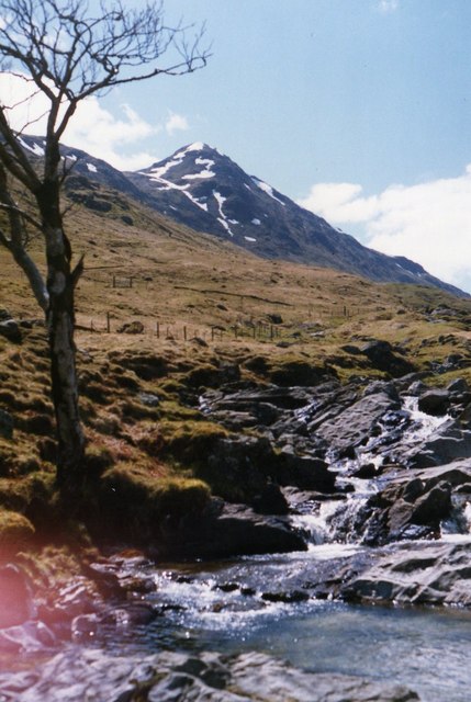
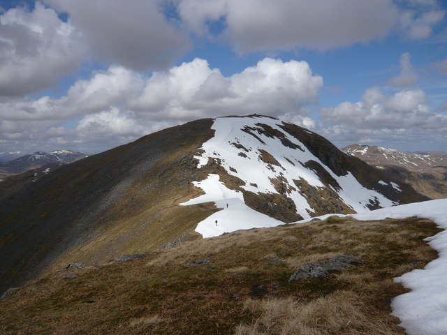
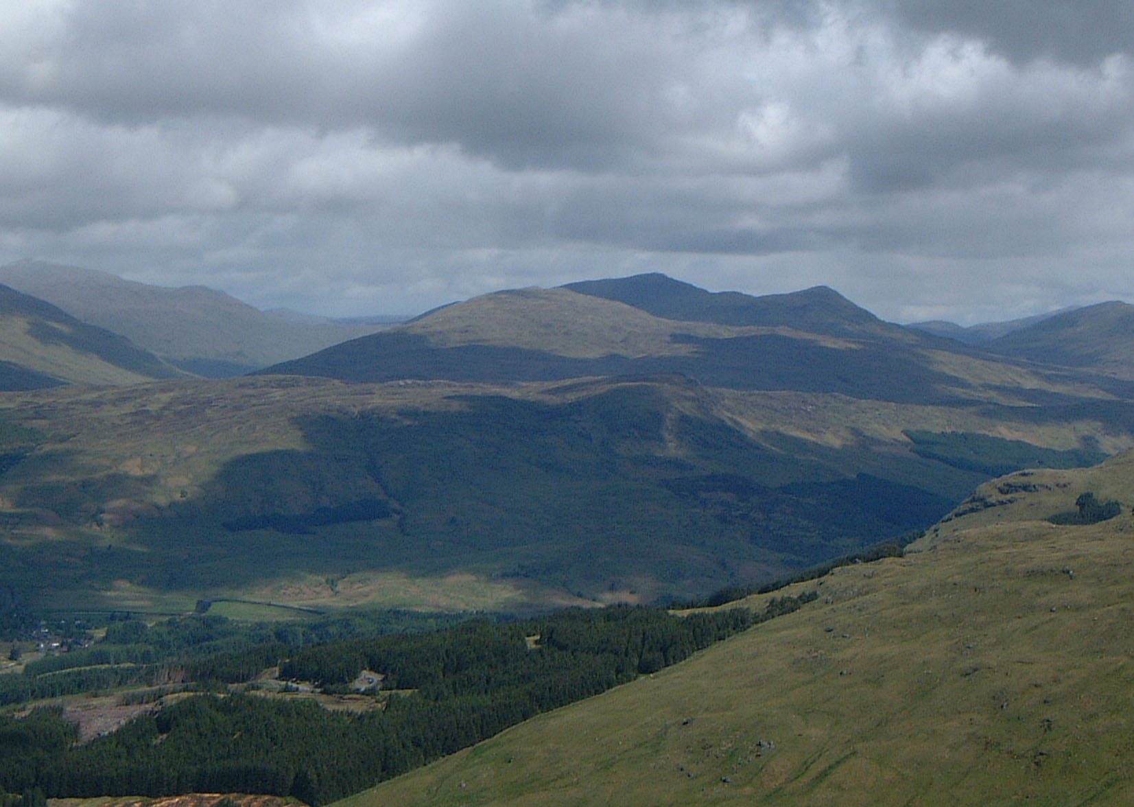
Beinn Challuim Images

Images are sourced within 2km of 56.454594/-4.6192263 or Grid Reference NN3832. Thanks to Geograph Open Source API. All images are credited.

Stob a' Bhiora at the head of Glen Lochay Lots of new planting and fences in the glen.
Stob a' Bhiora at the head of Glen Lochay
Lots of new planting and fences in the glen.
Stob a' Bhiora from near Batavaime in Glen Lochay
Slopes of Beinn Challuim in Mamlorn Forest
Fence line on southern slopes of Ben Challum
Towards the southern top of Ben Challum
Summit of Ben Challum
Towards the summit of Ben Challuim
Allt Challuim Sorry about the sun flare, it was an untypically sunny day, and warm. Summit of recently conquered hill in the background. Hot toes were dabbled in cool river shortly after the picture was taken.
Allt Challuim
Sorry about the sun flare, it was an untypically sunny day, and warm. Summit of recently conquered hill in the background. Hot toes were dabbled in cool river shortly after the picture was taken.
Access Track to Water Catchment Works on the Allt Challum
Water catchment for hydro electricity The water goes through the grille into an underground aqueduct to Lochay power station near Killin. Looking down Glen Lochay.
Water catchment for hydro electricity
The water goes through the grille into an underground aqueduct to Lochay power station near Killin. Looking down Glen Lochay.
Eastern slopes of Beinn Challuim Ben More, Stob Binnein and Cruach Ardrain across the mists in Glen Dochart.
Eastern slopes of Beinn Challuim
Ben More, Stob Binnein and Cruach Ardrain across the mists in Glen Dochart.
South ridge and top of Bein Challuim With Cruach Ardrain on the left across the mist in Glen Dochart.
South ridge and top of Bein Challuim
With Cruach Ardrain on the left across the mist in Glen Dochart.
View over Glen Lochay From summit of Bein Challuim.
View over Glen Lochay
From summit of Bein Challuim.
Summit cairn on Beinn Challuim Ben More, Stob Binnein and Cruach Ardrain to right of cairn.
Summit cairn on Beinn Challuim
Ben More, Stob Binnein and Cruach Ardrain to right of cairn.
South top of Bein Challuim Ben More and Stob Binnein in the distance..
South top of Bein Challuim
Ben More and Stob Binnein in the distance..
Between the south and north tops of Beinn Challuim Some walkers are crossing one of the remaining snow patches on the bealach in the approach to the higher north top.
Between the south and north tops of Beinn Challuim
Some walkers are crossing one of the remaining snow patches on the bealach in the approach to the higher north top.
Moorland with Ben More in background.
Approaching Beinn Challuim northern summit The summit ridge of Beinn Challuim, an outstanding viewpoint. This mountain has two "tops", with the northern summit the highest at 1025 metres.
Approaching Beinn Challuim northern summit
The summit ridge of Beinn Challuim, an outstanding viewpoint. This mountain has two "tops", with the northern summit the highest at 1025 metres.
Show me another place!

Beinn Challuim is located at Grid Ref: NN3832 (Lat: 56.454594, Lng: -4.6192263)

Unitary Authority: Stirling

Police Authority: Forth Valley

What 3 Words

///amplified.agent.tributes. Near Tyndrum, Stirling

Nearby Locations

Beinn Challuim

Related Wikis

Beinn Challuim

Beinn Challuim (English: Ben Challum) is a mountain in the Breadalbane region of the Scottish Highlands. It is east of the village of Tyndrum, in the Forest...

Creag Mhòr

Creag Mhòr is a mountain in the Breadalbane region of the Scottish Highlands. It is in the Forest of Mamlorn, ten kilometres northeast of Tyndrum, and...

Meall Glas

Meall Glas is a mountain situated in the southern highlands of Scotland. It stands on the northern border of the Loch Lomond and the Trossachs National...

Loch Essan

Loch Essan is a freshwater trout loch, located 2 miles north of Loch Dochart, within the Stirling Council Area, Scotland. == Settlements == On the mid...

Nearby Amenities

Located within 500m of 56.454594,-4.6192263
Beinn Chaluim
Description: Callum's hill
Ele: 1025
Marilyn: yes
Munro: yes
Munro Number: M106
Name En: Ben Challum
Natural: peak
Note: Gaelic name use as this is the right name for this Mountain, other name is a also a miss spelt
Prominence: 450
Source: NPE
Wikidata: Q3397111
Wikipedia: en:Beinn Challuim
Lat/Long: 56.4546681/-4.6192551
Man Made: cairn
Lat/Long: 56.4545851/-4.6193339
The data included in this document is from www.openstreetmap.org. The data is made available under ODbL.

Have you been to Beinn Challuim?

Leave your review of Beinn Challuim below (or comments, questions and feedback).