Beinn Uamha

Hill, Mountain in Perthshire

Scotland

Beinn Uamha

Beinn Uamha (summit) MacAoidh on the summit of Beinn Uamha.
Beinn Uamha (summit) Credit: Raibeart MacAoidh

Beinn Uamha is a prominent hill located in Perthshire, Scotland. It stands at an impressive height of 548 meters (1,798 feet) above sea level, making it a popular destination for hikers and outdoor enthusiasts. The hill is situated within the picturesque Loch Rannoch and Tummel National Scenic Area, offering stunning views of the surrounding landscape.

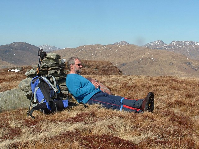
Beinn Uamha is characterized by its rugged and rocky terrain, with steep slopes that provide a challenging yet rewarding ascent. The main path leading to the summit starts from the small village of Kinloch Rannoch, offering a variety of routes for different skill levels. As hikers make their way up, they can witness the gradual transformation of the landscape, from lush greenery at lower altitudes to more barren and rocky sections as they reach higher elevations.

At the top of Beinn Uamha, visitors are rewarded with breathtaking panoramic views of the surrounding countryside. On clear days, it is possible to see as far as the Cairngorms National Park and the Grampian Mountains to the northeast. The hill also overlooks Loch Rannoch, providing a stunning vista of the shimmering waters nestled among rolling hills.

Beinn Uamha is not only a haven for hikers but also a sanctuary for wildlife. The hill is home to various bird species, including golden eagles and peregrine falcons, making it a popular spot for birdwatching. Additionally, the surrounding area is rich in flora, with heather, moss, and wildflowers dotting the landscape, creating a colorful and vibrant environment.

Overall, Beinn Uamha offers an exhilarating outdoor experience, combining challenging hiking trails, stunning views, and a diverse range of wildlife. It is a must-visit destination for nature enthusiasts and those seeking a true taste of the Scottish Highlands.

If you have any feedback on the listing, please let us know in the comments section below.

Beinn Uamha Images

Images are sourced within 2km of 56.227256/-4.6043629 or Grid Reference NN3806. Thanks to Geograph Open Source API. All images are credited.

Beinn Uamha (summit) MacAoidh on the summit of Beinn Uamha.
Beinn Uamha (summit)
MacAoidh on the summit of Beinn Uamha.
Firebreak (NN398066) A large area of trees had been felled and replanted at the time this photo was taken. But the firebreak at NN398066 led all the way down to Loch Choin.
Firebreak (NN398066)
A large area of trees had been felled and replanted at the time this photo was taken. But the firebreak at NN398066 led all the way down to Loch Choin.
Beinn Uamha (Allt nan Seanganan) Looking towards Beinn Uamha and Allt nan Seanganan.
Beinn Uamha (Allt nan Seanganan)
Looking towards Beinn Uamha and Allt nan Seanganan.
Slopes of Beinn Uamha That is some very rough going in there.
Slopes of Beinn Uamha
That is some very rough going in there.
View down the Abhainn Gaoithe A young woodland north of Ben Lomond. It is established and no longer fenced.
View down the Abhainn Gaoithe
A young woodland north of Ben Lomond. It is established and no longer fenced.
Young trees, Gleann Gaoithe Some of the extensive new plantings of native trees north of Ben Lomond.
Young trees, Gleann Gaoithe
Some of the extensive new plantings of native trees north of Ben Lomond.
Gleann Gaoithe Head of Gleann Dubh, north of Ben Lomond. There has been a lot of native woodland planting here.
Gleann Gaoithe
Head of Gleann Dubh, north of Ben Lomond. There has been a lot of native woodland planting here.
Gleann Gaoithe The fence here is starting to fall to bits. View up towards Beinn Uamha.
Gleann Gaoithe
The fence here is starting to fall to bits. View up towards Beinn Uamha.
Road under Beinn Uamha It rains a lot here. The road links Comer and Cailness.
Road under Beinn Uamha
It rains a lot here. The road links Comer and Cailness.
Woodland, Gleann Gaoithe A young native woodland with lots of oaks, which is no longer fenced in.
Woodland, Gleann Gaoithe
A young native woodland with lots of oaks, which is no longer fenced in.
Gleann Gaoithe Looking downstream, from the road to Cailness.  There is a young native woodland here.
Gleann Gaoithe
Looking downstream, from the road to Cailness. There is a young native woodland here.
Gleann Gaoithe Downstream view from the Cailness road.
Gleann Gaoithe
Downstream view from the Cailness road.
Native woodland, Gleann Gaoithe One of several small native woodlands in the area around Comer.
Native woodland, Gleann Gaoithe
One of several small native woodlands in the area around Comer.
Cailness to Comer road, Gleann Gaoithe Well surfaced here, but the descent to Loch Lomond is very steep and the track there is in bad condition.
Cailness to Comer road, Gleann Gaoithe
Well surfaced here, but the descent to Loch Lomond is very steep and the track there is in bad condition.
Comer to Cailness road A track from Loch Ard Forest to Loch Lomond.
Comer to Cailness road
A track from Loch Ard Forest to Loch Lomond.
Ruin in Gleann Gaoithe On the edge of a small native woodland plantation.
Ruin in Gleann Gaoithe
On the edge of a small native woodland plantation.
Beinn Uamha A cloud inversion (caused by cold air pooling in the glens) made this a day to be on the hill. The summit of Beinn Uamha, looking north to Beinn Laoigh.
Beinn Uamha
A cloud inversion (caused by cold air pooling in the glens) made this a day to be on the hill. The summit of Beinn Uamha, looking north to Beinn Laoigh.
Hillside From the southern side of Loch Arkle looking towards Beinn Uamha
Hillside
From the southern side of Loch Arkle looking towards Beinn Uamha
Show me another place!

Beinn Uamha is located at Grid Ref: NN3806 (Lat: 56.227256, Lng: -4.6043629)

Unitary Authority: Stirling

Police Authority: Forth Valley

What 3 Words

///typical.harmonica.saunas. Near Garelochhead, Argyll & Bute

Nearby Locations

Beinn Uamha

Related Wikis

Loch Arklet

Loch Arklet is a freshwater loch and reservoir in the Trossachs area of the Scottish Highlands. It is within the historic county and registration county...

Loch Lomond and The Trossachs National Park

Loch Lomond and The Trossachs National Park (Scottish Gaelic: Pàirc Nàiseanta Loch Laomainn is nan Tròisichean) is a national park in Scotland centred...

Loch Chon

Loch Chon is a freshwater loch situated west of the village of Aberfoyle, near the small village of Kinlochard, Stirling, Scotland, UK. Loch Chon lies...

Loch Dubh (Loch Ard Forest)

Loch Dubh ("Black Loch") is a lochan on the Duchray Water in the western part of Loch Ard Forest in the Central Highlands of Scotland. == Location == Loch...

Nearby Amenities

Located within 500m of 56.227256,-4.6043629
Beinn Uamha
Corbett: no
Description: Hill of the cave
Ele: 596
Graham: no
Marilyn: yes
Munro: no
Natural: peak
Prominence: 264
Lat/Long: 56.2273214/-4.6043913
The data included in this document is from www.openstreetmap.org. The data is made available under ODbL.

Have you been to Beinn Uamha?

Leave your review of Beinn Uamha below (or comments, questions and feedback).