Aberthin

Settlement in Glamorgan

Wales

Aberthin

Fredwell Café and Patisserie Business on the Pant Wilkin estate.
Fredwell Café and Patisserie Credit: Alan Hughes

Aberthin is a small village located in the Vale of Glamorgan, Wales. Situated approximately 11 miles west of Cardiff, it is part of the rural community of Llanblethian. With a population of around 250 residents, Aberthin is known for its picturesque landscapes and charming countryside setting.

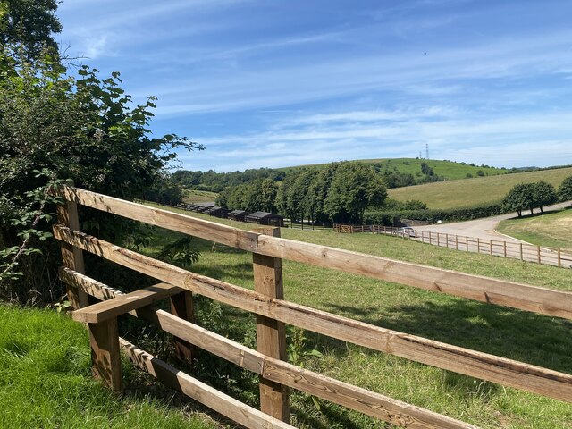
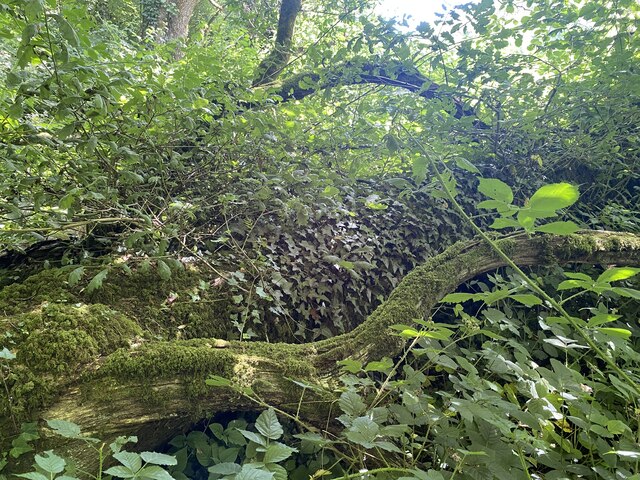
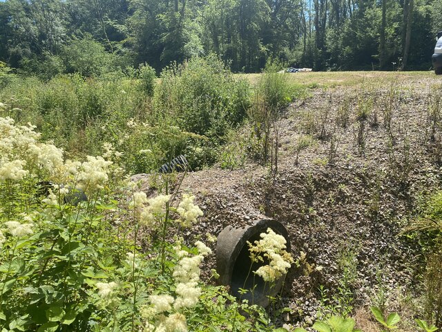
The village is surrounded by rolling hills and farmlands, offering stunning panoramic views of the Welsh countryside. The nearby St. David's Church, a Grade II listed building, adds to the village's historical charm. The church, dating back to the 13th century, features a distinctive bell tower and beautiful stained glass windows.

Aberthin is a close-knit community, with a strong sense of community spirit. The village hosts various events throughout the year, including a summer fete and a harvest festival, bringing residents together and fostering a sense of belonging.

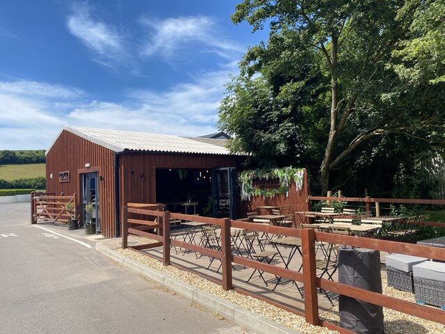
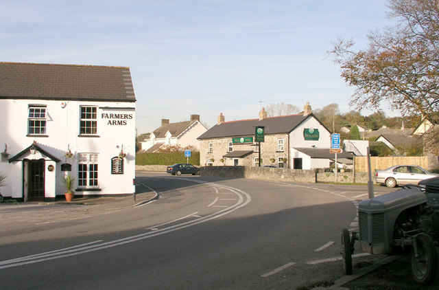
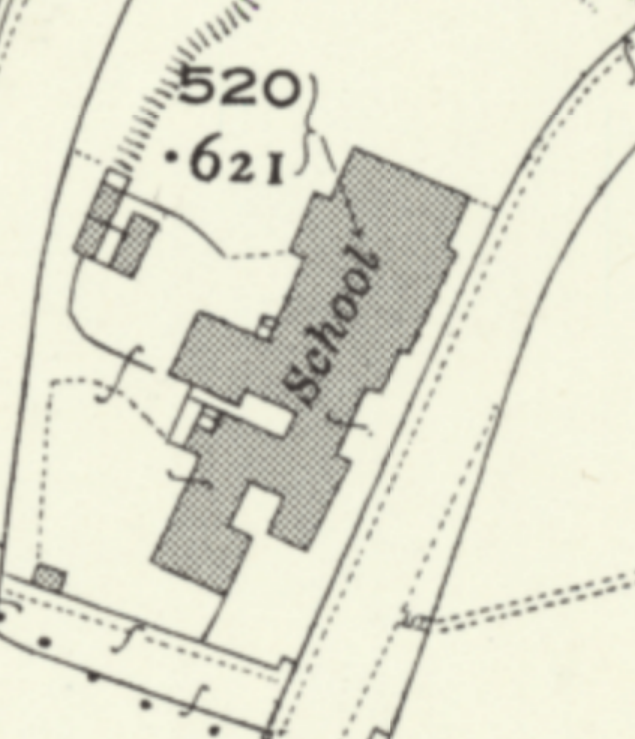
Although small in size, Aberthin offers a range of amenities for its residents. These include a village hall, a local pub, and a primary school. The village hall serves as a hub for community activities and events, while the local pub provides a place for residents to socialize and enjoy a drink.

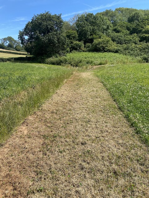
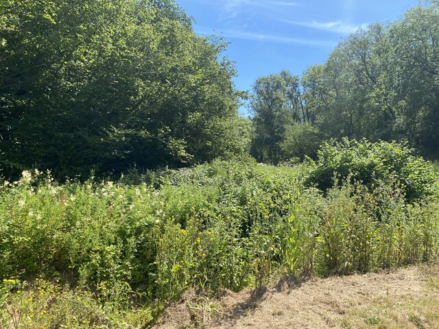
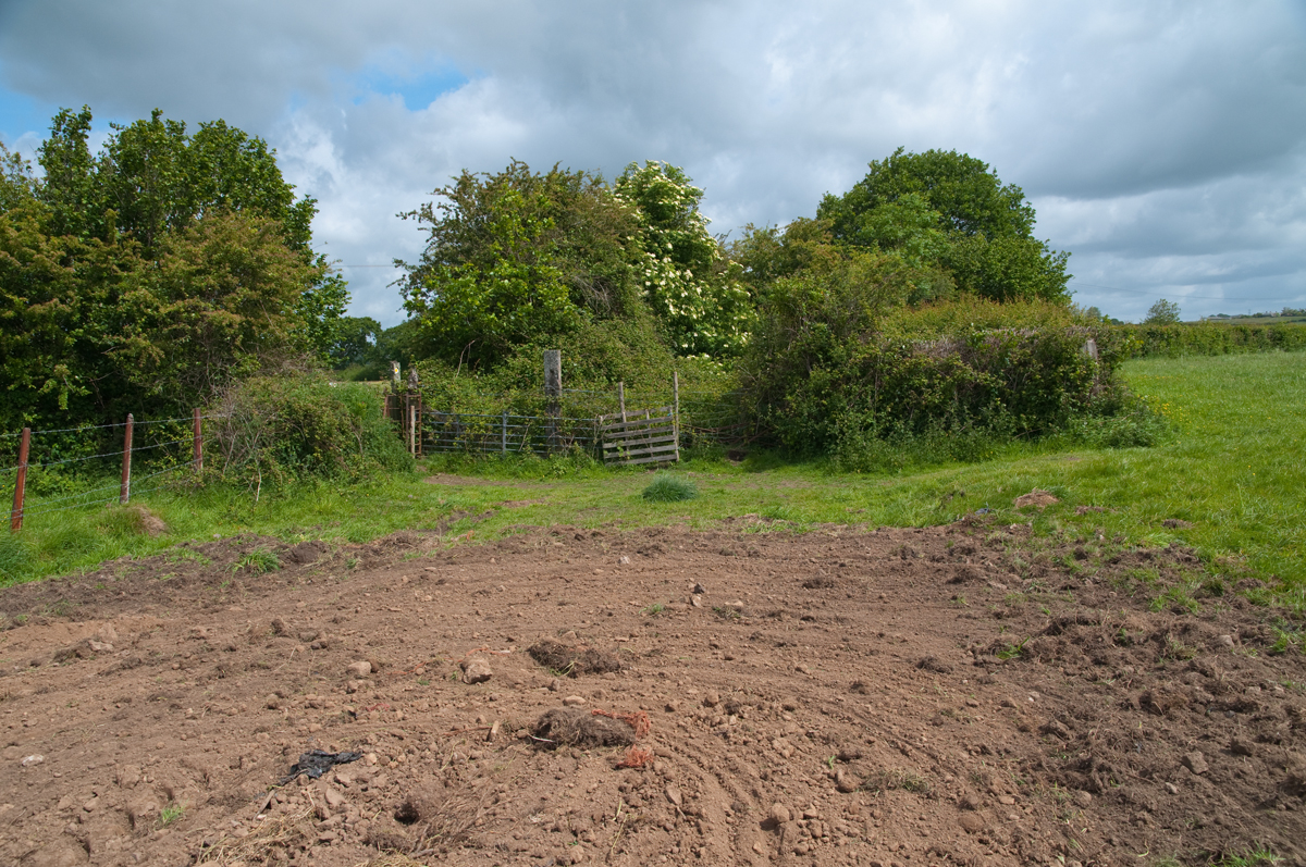
For those seeking outdoor activities, Aberthin is surrounded by numerous walking and cycling routes, allowing residents to explore the beautiful countryside. The nearby market town of Cowbridge offers additional amenities and services, including shops, restaurants, and healthcare facilities.

Overall, Aberthin is a charming village that offers a peaceful and idyllic rural lifestyle, making it an attractive place to live for those seeking a close-knit community and a connection to nature.

If you have any feedback on the listing, please let us know in the comments section below.

Aberthin Images

Images are sourced within 2km of 51.46657/-3.427645 or Grid Reference ST0075. Thanks to Geograph Open Source API. All images are credited.

Fredwell Café and Patisserie Business on the Pant Wilkin estate.
Fredwell Café and Patisserie
Business on the Pant Wilkin estate.
New stile on an ancient path The path appears to go in stages from Cowbridge to Pendoylan and beyond, passing the Iron Age hillforts at Llanquian and Castell Coch.  Much of the footpath is at present unpassable.
New stile on an ancient path
The path appears to go in stages from Cowbridge to Pendoylan and beyond, passing the Iron Age hillforts at Llanquian and Castell Coch. Much of the footpath is at present unpassable.
Ditch, path and track
Mown path This mown section of the footpath looks promising … so far!
Mown path
This mown section of the footpath looks promising … so far!
Impenetrable footpath See <a href="https://www.geograph.org.uk/photo/7224446">ST0274 : Mown path</a>

… but soon degenerates into an impenetrable jungle.
Impenetrable footpath
See ST0274 : Mown path … but soon degenerates into an impenetrable jungle.
Fallen tree and undergrowth A fallen tree and dense undergrowth make the public footpath impassable.
Fallen tree and undergrowth
A fallen tree and dense undergrowth make the public footpath impassable.
A path of chippings over a culvert It would seem that the only reason for this path of chippings is to give access to the footpath. But after just a few yards the public footpath is impenetrable.
A path of chippings over a culvert
It would seem that the only reason for this path of chippings is to give access to the footpath. But after just a few yards the public footpath is impenetrable.
Trying to find the footpath
Overgrown track Still searching for the ancient track that goes through Mynydd y Coed.
Overgrown track
Still searching for the ancient track that goes through Mynydd y Coed.
Thick undergrowth 20m ahead is another footpath - but that one is also inaccessible.
Thick undergrowth
20m ahead is another footpath - but that one is also inaccessible.
Culvert and bridleway
Finding the way … Somewhere close ahead is a public footpath!
Finding the way …
Somewhere close ahead is a public footpath!
Track junction near Pant Wilkin
St Hilary transmitter
Temperatures may reach 29C in parts of South Wales
Pant Wilkin Equestrian centre in the Vale of Glamorgan.

<span class="nowrap"><a title="https://www.pantwilkinequestrian.com" rel="nofollow ugc noopener" href="https://www.pantwilkinequestrian.com">Link</a><img style="margin-left:2px;" alt="External link" title="External link - shift click to open in new window" src="https://s1.geograph.org.uk/img/external.png" width="10" height="10"/></span>
Pant Wilkin
Equestrian centre in the Vale of Glamorgan. LinkExternal link
Ordnance Survey Pivot This OS pivot can be found on the rock NE side of the track. It marks a point 115.723m above mean sea level.
Ordnance Survey Pivot
This OS pivot can be found on the rock NE side of the track. It marks a point 115.723m above mean sea level.
Ordnance Survey Cut Mark This OS cut mark can be found on the wall north side of the road. It marks a point 73.963m above mean sea level.
Ordnance Survey Cut Mark
This OS cut mark can be found on the wall north side of the road. It marks a point 73.963m above mean sea level.
Show me another place!

Aberthin is located at Grid Ref: ST0075 (Lat: 51.46657, Lng: -3.427645)

Unitary Authority: The Vale of Glamorgan

Police Authority: South Wales

What 3 Words

///defeated.elastic.springing. Near Cowbridge, Vale of Glamorgan

Nearby Locations

Aberthin

Related Wikis

Aberthin

Aberthin is a small village, just outside Cowbridge in the Vale of Glamorgan, South Wales, on the north side of a shallow valley, less than a mile northeast...

Aberthin Platform railway station

Aberthin Platform railway station was a short lived Taff Vale Railway station which served Aberthin, a village north east of Cowbridge in the Welsh county...

Battle of Stalling Down

The Battle of Stalling Down, also known as the Battle of Bryn Owain, is reputed to have taken place between late autumn or early winter of 1403 or 1405...

Cowbridge Girls School

Cowbridge Girls School is a former school in the Vale of Glamorgan, Wales. Designed by Robert Williams and built in 1896, it was the first school for...

Nearby Amenities

Located within 500m of 51.46657,-3.427645
Aberthin
Place: village
Wikidata: Q4667195
Wikipedia: en:Aberthin
Lat/Long: 51.467166/-3.4293566
Noexit: yes
Lat/Long: 51.4665411/-3.4301586
Noexit: yes
Lat/Long: 51.4688394/-3.4264854
Turning Circle
Lat/Long: 51.4687283/-3.4269292
Turning Circle
Lat/Long: 51.4683813/-3.4267582
Noexit: yes
Lat/Long: 51.4692663/-3.42764
Noexit: yes
Lat/Long: 51.4675256/-3.4251324
Turning Circle
Lat/Long: 51.467523/-3.4268887
Ford: yes
Lat/Long: 51.4658673/-3.4256441
Power: tower
Lat/Long: 51.4644888/-3.4216079
Power: tower
Lat/Long: 51.4644956/-3.423373
Pub
Hare & Hounds
Addr Postcode: CF71 7LG
Addr Street: Maendy Road
Fhrs Id: 966952
Source Addr: FHRS Open Data
Wheelchair: yes
Wikidata: Q80859333
Lat/Long: 51.4674478/-3.4292916
Pub
Farmers Arms
Addr Postcode: CF71 7LG
Addr Street: Maendy Road
Fhrs Id: 966379
Source Addr: FHRS Open Data
Wikidata: Q80859319
Lat/Long: 51.4672139/-3.4296349
Power: pole
Lat/Long: 51.4634215/-3.4274607
Power: pole
Lat/Long: 51.4643434/-3.4291774
Power: pole
Lat/Long: 51.465298/-3.4309851
Power: pole
Lat/Long: 51.4659313/-3.4328036
Power: pole
Lat/Long: 51.4624902/-3.425704
Noexit: yes
Lat/Long: 51.4652464/-3.4267961
Noexit: yes
Lat/Long: 51.4686529/-3.425619
Noexit: yes
Lat/Long: 51.4689631/-3.4248669
Noexit: yes
Lat/Long: 51.4684232/-3.4247438
Ford: yes
Note: Need wellington boots in winter
Lat/Long: 51.4663351/-3.4256999
Direction: 175
Generator Method: photovoltaic
Generator Output Electricity: yes
Generator Solar Modules: 14
Generator Source: solar
Generator Type: solar_photovoltaic_panel
Location: roof
Power: generator
Lat/Long: 51.4681184/-3.4269518
Direction: SSW
Generator Method: photovoltaic
Generator Output Electricity: yes
Generator Solar Modules: 12
Generator Source: solar
Generator Type: solar_photovoltaic_panel
Location: roof
Power: generator
Lat/Long: 51.4689324/-3.4270461
Direction: SSW
Generator Method: photovoltaic
Generator Output Electricity: yes
Generator Solar Modules: 10
Generator Source: solar
Generator Type: solar_photovoltaic_panel
Location: roof
Power: generator
Lat/Long: 51.4689035/-3.4269435
Direction: 145
Generator Method: photovoltaic
Generator Output Electricity: yes
Generator Solar Modules: 24
Generator Source: solar
Generator Type: solar_photovoltaic_panel
Location: roof
Note: module count uncertain
Power: generator
Lat/Long: 51.4683302/-3.4246146
Direction: 235
Generator Method: photovoltaic
Generator Output Electricity: yes
Generator Solar Modules: 12
Generator Source: solar
Generator Type: solar_photovoltaic_panel
Location: roof
Power: generator
Lat/Long: 51.4648131/-3.425775
Telephone
Booth: K6
Covered: booth
Listed Status: Grade II
Operator: BT
Phone: +44 1446 772010
Lat/Long: 51.4670367/-3.4297813
Defibrillator
Defibrillator Location: outside Aberthin Village Hall
Emergency: defibrillator
Indoor: no
Lat/Long: 51.4665705/-3.4292047
Noexit: yes
Lat/Long: 51.4674929/-3.4298282
Post Box
Collection Times: Mo-Fr 09:00; Sa 07:00
Operator: Royal Mail
Post Box Mounting: wooden_pole
Post Box Type: lamp
Ref: CF71 75D
Royal Cypher: EIIR
Lat/Long: 51.4670372/-3.4294944
Noexit: yes
Lat/Long: 51.4673619/-3.4274876
Leisure: playground
Lat/Long: 51.4689969/-3.4272516
Noexit: yes
Lat/Long: 51.4696702/-3.4300907
Crossing
Crossing: unmarked
Crossing Island: no
Crossing Markings: no
Kerb: lowered
Tactile Paving: yes
Lat/Long: 51.4680002/-3.4278014
Crossing
Crossing: unmarked
Crossing Island: no
Crossing Markings: no
Kerb: lowered
Tactile Paving: yes
Lat/Long: 51.4677212/-3.4288985
Crossing
Crossing: unmarked
Crossing Island: no
Crossing Markings: no
Kerb: lowered
Tactile Paving: yes
Lat/Long: 51.4679462/-3.4281583
Hiking: yes
Information: guidepost
Tourism: information
Lat/Long: 51.4679232/-3.4279451
Hiking: yes
Information: guidepost
Tourism: information
Lat/Long: 51.4671173/-3.4280958
Hiking: yes
Information: guidepost
Tourism: information
Lat/Long: 51.4656044/-3.4235642
Hiking: yes
Information: guidepost
Tourism: information
Lat/Long: 51.4632906/-3.4233029
Hiking: yes
Information: guidepost
Tourism: information
Lat/Long: 51.4643312/-3.4247424
Hiking: yes
Information: guidepost
Tourism: information
Lat/Long: 51.4670085/-3.4273937
Noexit: yes
Lat/Long: 51.4657796/-3.427556
Noexit: yes
Lat/Long: 51.4658105/-3.4278108
Addr City: Cowbridge
Addr Housename: Summit View
Addr Postcode: CF71 7HB
Addr Street: Pen-Y-Lan Road
Addr Suburb: Aberthin
Lat/Long: 51.4637986/-3.4246646
The data included in this document is from www.openstreetmap.org. The data is made available under ODbL.

Have you been to Aberthin?

Leave your review of Aberthin below (or comments, questions and feedback).