Càrn na Cloiche Mòire

Hill, Mountain in Ross-shire

Scotland

Càrn na Cloiche Mòire

Loch a' Mhuilinn
Loch a' Mhuilinn Credit: valenta

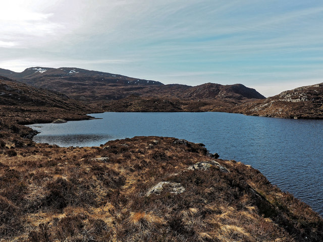
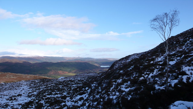
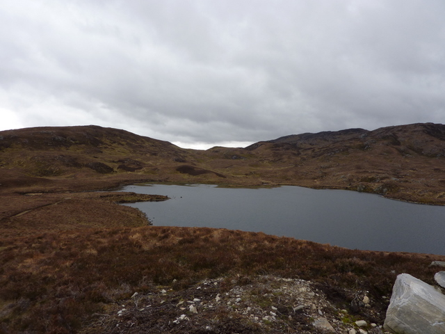
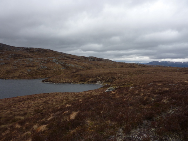
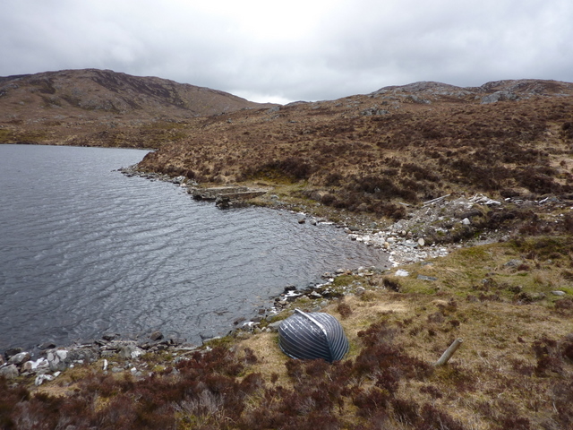
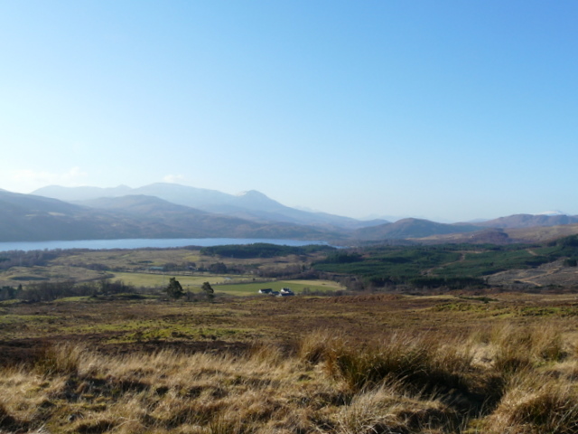
Càrn na Cloiche Mòire is a prominent hill located in the county of Ross-shire, Scotland. It is part of the larger range known as the Northern Highlands and sits at an elevation of approximately 799 meters (2,621 feet) above sea level. The hill is situated within the vast and picturesque landscape of the Scottish Highlands, surrounded by rugged mountains, sparkling lochs, and lush greenery.

Càrn na Cloiche Mòire offers breathtaking panoramic views of the surrounding area, making it a popular destination for hikers, mountaineers, and nature enthusiasts alike. The climb to the summit can be challenging, requiring a moderate level of fitness and experience, but the reward is an awe-inspiring vista that stretches across the vast expanse of the Highlands.

The hill is characterized by its rocky terrain, with scattered boulders and craggy outcrops dotting the landscape. The slopes are covered in heather and grass, providing a striking contrast against the rugged rocks. Wildlife is abundant in the area, with the chance to spot various bird species, including golden eagles and ptarmigans, as well as deer and other mountain animals.

Càrn na Cloiche Mòire offers a peaceful and serene environment, far away from the hustle and bustle of city life. It provides an opportunity for visitors to connect with nature, embrace the tranquility of the Highlands, and immerse themselves in the breathtaking beauty of this unspoiled Scottish landscape.

If you have any feedback on the listing, please let us know in the comments section below.

Càrn na Cloiche Mòire Images

Images are sourced within 2km of 57.538998/-4.7244811 or Grid Reference NH3753. Thanks to Geograph Open Source API. All images are credited.

Loch a' Mhuilinn
Loch a' Mhuilinn
Sole birch tree above Strathconon There was one solitary tree on the open moorland, protected from the many red deer by its location on a steep bank above a deep burn gully.  Loch Achilty in the distance
Sole birch tree above Strathconon
There was one solitary tree on the open moorland, protected from the many red deer by its location on a steep bank above a deep burn gully. Loch Achilty in the distance
Track to Orrin Reservoir from Strathconon Loch Sgolbaidh in the distance and Ben Wyvis in the far distance on the skyline.
Track to Orrin Reservoir from Strathconon
Loch Sgolbaidh in the distance and Ben Wyvis in the far distance on the skyline.
Track to Orrin Reservoir from Strathconon In the distance:- Loch Sgolbaidh on the left, Loch an Fheoir and Fairburn Windfarm on the right.
Track to Orrin Reservoir from Strathconon
In the distance:- Loch Sgolbaidh on the left, Loch an Fheoir and Fairburn Windfarm on the right.
Loch Aradaidh Viewed from track to Orrin Reservoir from Strathconon. Maoile Lunndaidh through the col in the distance.
Loch Aradaidh
Viewed from track to Orrin Reservoir from Strathconon. Maoile Lunndaidh through the col in the distance.
Moorland and moorland track above Loch Aradaidh Viewed from track to Orrin Reservoir from Strathconon.
Moorland and moorland track above Loch Aradaidh
Viewed from track to Orrin Reservoir from Strathconon.
Moorland above Loch Aradaidh Viewed from track to Orrin Reservoir from Strathconon.
Moorland above Loch Aradaidh
Viewed from track to Orrin Reservoir from Strathconon.
Upturned boat and ruined boathouse, Loch Aradaidh Remote loch below the track to Orrin Reservoir from Strathconon.
Upturned boat and ruined boathouse, Loch Aradaidh
Remote loch below the track to Orrin Reservoir from Strathconon.
Ruined boathouse on Loch Aradaidh Remote loch below the track to Orrin Reservoir from Strathconon.
Ruined boathouse on Loch Aradaidh
Remote loch below the track to Orrin Reservoir from Strathconon.
Meall nan Damh The summit area of Meall nan Damh, a fine vantage point, although the view to the east of this hill has recently been embellished by a large wind farm.
Meall nan Damh
The summit area of Meall nan Damh, a fine vantage point, although the view to the east of this hill has recently been embellished by a large wind farm.
Local downpour Heavy rain and the occasional rumble of thunder passing over hills in Easter Ross, viewed from the summit of Meall nam Damh, which fortunately for me, remained dry all afternoon.
Local downpour
Heavy rain and the occasional rumble of thunder passing over hills in Easter Ross, viewed from the summit of Meall nam Damh, which fortunately for me, remained dry all afternoon.
Knoll overlooking Coire Buidhe above Loch Meig, Strathconon
Loch an Uillt Ghuibhais above Strathconon
Loch na Larach Blaire above Strathconon
Loch Carn na Cloiche Moire in Scatwell Forest above Strathconon
Old boundary fence on Carn na Cloiche Moire in Scatwell Forest above Strathconon
Knoll north-east of Coire Buidhe above Strathconon
Ridge west of carns Airich Beag and Airich Mor above Strathconon
Show me another place!

Càrn na Cloiche Mòire is located at Grid Ref: NH3753 (Lat: 57.538998, Lng: -4.7244811)

Unitary Authority: Highland

Police Authority: Highlands and Islands

What 3 Words

///masters.rephrase.rollover. Near Strathpeffer, Highland

Related Wikis

Loch Achilty

Loch Achilty is a large picturesque lowland freshwater loch set within a sloping birch and oakwood forest, and located near to Contin in Ross-shire, Scottish...

Garve railway station

Garve railway station is a railway station on the Kyle of Lochalsh Line, serving the village of Garve in the north of Scotland. Garve is located at the...

Garve

Garve (Scottish Gaelic: Gairbh) is a village on the Black Water river, in Ross-shire, and is in the Highland Council area of Scotland. It is situated 5...
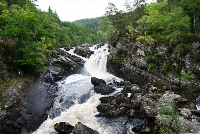
Rogie Falls

Rogie Falls (Gaelic: Eas Rothagaidh) are a series of waterfalls on the Black Water, a river in Ross-shire in the Highlands of Scotland. The falls are about...

Contin Island

Contin Island is an inhabited riverine islet in Ross and Cromarty within the Highland council area of Scotland. Located in the Black Water, a tributary...

Contin

Contin (Gaelic: Cunndainn) is a Ross-shire village, and a civil parish and community council area between Strathpeffer and Garve in the Highland council...

Gorstan

Gorstan (Scottish Gaelic: An Goirtean) is a small hamlet in Garve, Ross-shire region in the Scottish council area of Highland. == References ==

Beinn a' Bhathaich Àrd

Beinn a' Bhathaich Àrd is mountain on the northern side of Glen Strathfarrar, in the Highlands of Scotland. It is situated at the eastern end of the glen...

Have you been to Càrn na Cloiche Mòire?

Leave your review of Càrn na Cloiche Mòire below (or comments, questions and feedback).