Sabhàl Mòr

Hill, Mountain in Sutherland

Scotland

Sabhàl Mòr

On Creachan Thormaid
On Creachan Thormaid Credit: David Brown

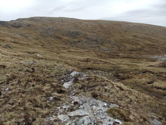
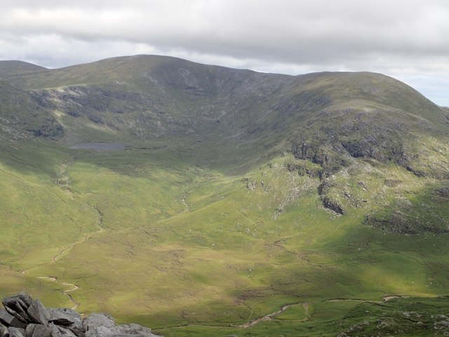
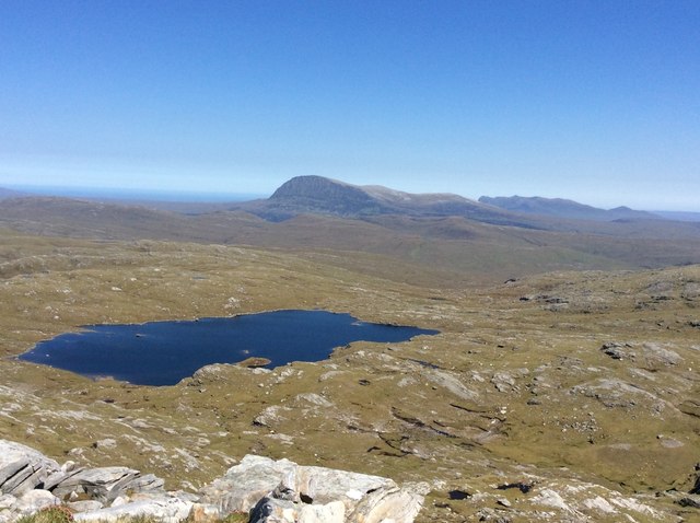
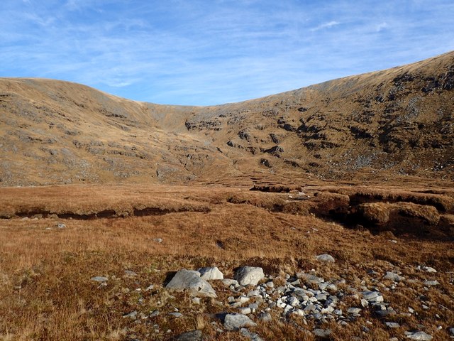
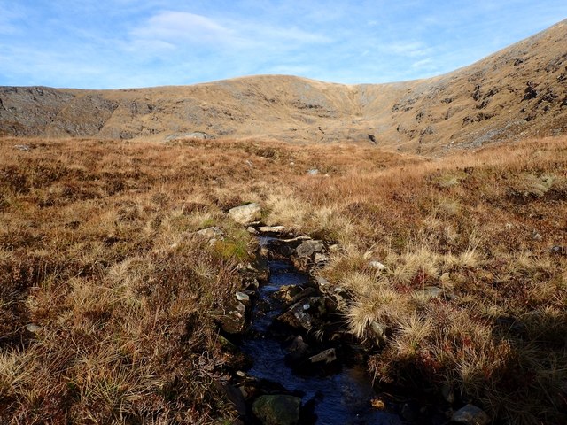
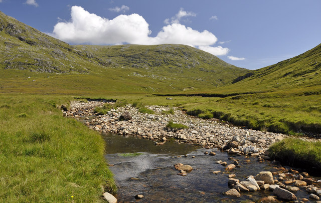
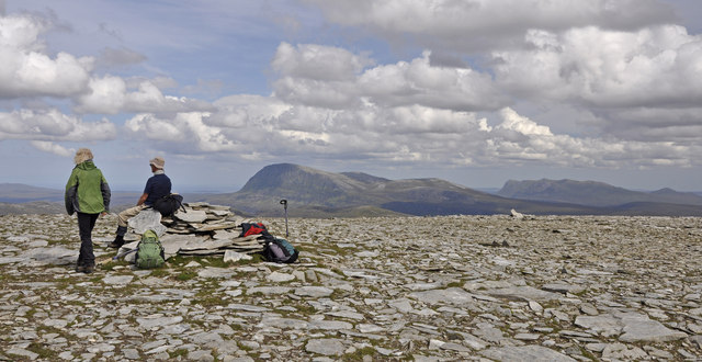
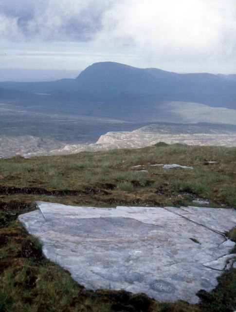
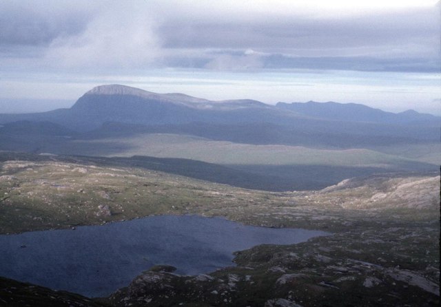
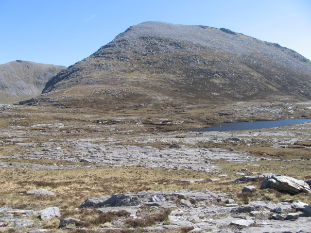
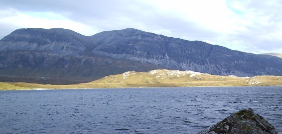
Sabhàl Mòr is a mountain located in Sutherland, Scotland. It is part of the Northwest Highlands of Scotland, known for its rugged and mountainous terrain. Sabhàl Mòr stands at a height of 767 meters (2,516 feet) above sea level, making it one of the prominent peaks in the area.

The mountain is characterized by its rocky slopes, steep cliffs, and stunning panoramic views of the surrounding landscape. Sabhàl Mòr is a popular destination for hikers and outdoor enthusiasts looking to challenge themselves with a rewarding climb.

The name Sabhàl Mòr translates to "big barn" in English, and the mountain is often referred to as "The Barn" due to its distinctive shape and size. The summit of Sabhàl Mòr offers breathtaking views of the surrounding mountains, valleys, and coastline, making it a favorite spot for photographers and nature lovers.

Overall, Sabhàl Mòr is a striking and iconic mountain in Sutherland, Scotland, offering a challenging yet rewarding hiking experience for those who venture to its summit.

If you have any feedback on the listing, please let us know in the comments section below.

Sabhàl Mòr Images

Images are sourced within 2km of 58.354084/-4.8042241 or Grid Reference NC3644. Thanks to Geograph Open Source API. All images are credited.

On Creachan Thormaid
North from Meall Horn Loch Eriboll in the distance
North from Meall Horn
Loch Eriboll in the distance
Summit ridge, Meall Horn
Cùl a' Chada Chumhainn
Coire Granda Seen from near the top of Sail Rac. NC3543 is to the right of Loch a' Choire Ghranda.
Coire Granda
Seen from near the top of Sail Rac. NC3543 is to the right of Loch a' Choire Ghranda.
Bridge over Allt Bealach Eadar dha Shabhal This stream is called "stream of the bealach between two barns" in Gaelic, the two barns being the hills Sabhal Mor and Sabhal Beag.
Bridge over Allt Bealach Eadar dha Shabhal
This stream is called "stream of the bealach between two barns" in Gaelic, the two barns being the hills Sabhal Mor and Sabhal Beag.
Loch na Seilge Taken from near the top of Sabhal Mor. Ben Hope in the background.
Loch na Seilge
Taken from near the top of Sabhal Mor. Ben Hope in the background.
Slopes Going Down from Coire Granda Rough grassland, boggy in places. Quinag in the distance.
Slopes Going Down from Coire Granda
Rough grassland, boggy in places. Quinag in the distance.
Loch a' Choire Ghranda Seen in early morning November sunshine.
Loch a' Choire Ghranda
Seen in early morning November sunshine.
Eroded Peat in Coire Granda The area was grassy and very rough. Often it was easier to walk along the bottom of the peaty hollows than to try to stay higher. The western cliffs of Sabhal Mor can be seen ahead.
Eroded Peat in Coire Granda
The area was grassy and very rough. Often it was easier to walk along the bottom of the peaty hollows than to try to stay higher. The western cliffs of Sabhal Mor can be seen ahead.
Looking Up Coire Granda An area of grass and eroded peat, with some exposed rocks. Seen in November sunshine.
Looking Up Coire Granda
An area of grass and eroded peat, with some exposed rocks. Seen in November sunshine.
Small Burn Running off Coire Granda This joins Allt a' Choire Ghranda further south.
Small Burn Running off Coire Granda
This joins Allt a' Choire Ghranda further south.
Sabhal Beag from Strath Luib na Seilich The two Sabhals, Mor and Beag, are confusing in that Sabhal Beag (732m) is higher than Sabhal Mor (703m).
Sabhal Beag from Strath Luib na Seilich
The two Sabhals, Mor and Beag, are confusing in that Sabhal Beag (732m) is higher than Sabhal Mor (703m).
The summit cairn on Sabhal Beag Ben Hope and Ben Loyal in the background
The summit cairn on Sabhal Beag
Ben Hope and Ben Loyal in the background
The steep north face of Meall Horn A clearance reveals corrie lochans way below
The steep north face of Meall Horn
A clearance reveals corrie lochans way below
Moorland overlooking Srath Dionard Ben Hope in the background
Moorland overlooking Srath Dionard
Ben Hope in the background
Loch na Seilge Ben Hope catches the last of the day's sun
Loch na Seilge
Ben Hope catches the last of the day's sun
Cùl a' Chadha Chumhainn Ascent of Meall Horn.
Cùl a' Chadha Chumhainn
Ascent of Meall Horn.
Show me another place!

Sabhàl Mòr is located at Grid Ref: NC3644 (Lat: 58.354084, Lng: -4.8042241)

Unitary Authority: Highland

Police Authority: Highlands and Islands

What 3 Words

///scooped.bandaged.dolphins. Near Oldshoremore, Highland

Related Wikis

Meallan Liath Coire Mhic Dhùghaill

Meallan Liath Coire Mhic Dhughaill (801 m) is a mountain in the Northwest Highlands, Scotland. It lies in the far north of Scotland between Lairg and Durness...

Loch Dionard

Loch Dionard is a medium-sized loch in the Durness Parish, in Sutherland, Highland Council Area, Northern Scotland. It is in the North-Western Highlands...

North West Sutherland National Scenic Area

North West Sutherland is a national scenic area (NSA) covering the mountains and coastal scenery of the northwestern part of the county of Sutherland...

Arkle (Sutherland)

Arkle (Scottish Gaelic: Airceil) is a mountain in Sutherland, in the far north-west corner of the Scottish Highlands. Like its sister Foinaven, the mountain...

Nearby Amenities

Located within 500m of 58.354084,-4.8042241
Saval More
Ele: 697
Ele Ft: 2288
Natural: peak
Source: OS7
Lat/Long: 58.3536347/-4.8037103
The data included in this document is from www.openstreetmap.org. The data is made available under ODbL.

Have you been to Sabhàl Mòr?

Leave your review of Sabhàl Mòr below (or comments, questions and feedback).