Barquhill Hill

Hill, Mountain in Wigtownshire

Scotland

Barquhill Hill

Craigdow Moor and the Craigdow Burn The Craigdow Burn snakes its way across Craigdow Moor.
Craigdow Moor and the Craigdow Burn Credit: David Baird

Barquhill Hill is a prominent hill located in Wigtownshire, a historic county in the southwestern part of Scotland. With an elevation of 275 meters (902 feet), it is considered one of the higher peaks in the region. The hill is situated near the village of Kirkcowan, about 11 kilometers (7 miles) southeast of Wigtown, the county town.

Barquhill Hill is known for its distinct shape, featuring a broad, rounded summit that provides stunning panoramic views of the surrounding countryside. The hill is primarily composed of sedimentary rocks, with layers of sandstone and limestone visible in certain areas. Its unique geological features make it a site of interest for geologists and nature enthusiasts alike.

The hill is covered in a mixture of heather, grasses, and scattered shrubs, creating a picturesque landscape that attracts visitors throughout the year. It is also home to a variety of wildlife, including birds, rabbits, and occasional deer.

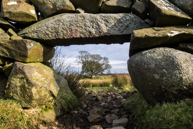
Barquhill Hill offers several walking trails and paths, allowing visitors to explore its natural beauty and enjoy the fresh air. The hill provides a moderate level of challenge, making it suitable for both experienced hikers and those looking for a leisurely stroll.

Due to its location in Wigtownshire, Barquhill Hill is conveniently accessible from nearby towns and villages, making it a popular destination for locals and tourists seeking outdoor activities and a peaceful retreat in the Scottish countryside.

If you have any feedback on the listing, please let us know in the comments section below.

Barquhill Hill Images

Images are sourced within 2km of 54.869192/-4.5706427 or Grid Reference NX3555. Thanks to Geograph Open Source API. All images are credited.

Craigdow Moor and the Craigdow Burn The Craigdow Burn snakes its way across Craigdow Moor.
Craigdow Moor and the Craigdow Burn
The Craigdow Burn snakes its way across Craigdow Moor.
Craigdow A long abandoned farm lying on the moor southwest of Clugston Loch. It was noted to be in ruins on the 1850 6" OS map.
Craigdow
A long abandoned farm lying on the moor southwest of Clugston Loch. It was noted to be in ruins on the 1850 6" OS map.
Through the lunky hole A lunky hole is built in a drystone dyke to allow sheep to pass through it while holding back cattle. It can easily be blocked up with a small gate, board or stones. This one is in the dyke enclosing the old ruined farm of Craigdow.
Through the lunky hole
A lunky hole is built in a drystone dyke to allow sheep to pass through it while holding back cattle. It can easily be blocked up with a small gate, board or stones. This one is in the dyke enclosing the old ruined farm of Craigdow.
The Craigdow Burn The Craigdow Burn runs down from Craigdow Moor into the southern end of Clugston Loch.
The Craigdow Burn
The Craigdow Burn runs down from Craigdow Moor into the southern end of Clugston Loch.
Farmland at Knockmononday
Farmland at Knockmononday With a view to the River Bladnoch, you can just see the river.
Farmland at Knockmononday
With a view to the River Bladnoch, you can just see the river.
River Bladnoch
River Bladnoch
Woodland on Knockmononday
Red Squirrel We currently have a healthy population of red squirrels in Galloway - in fact there seem to be more now than I can ever remember from years gone by. However the greys are beginning to encroach. Occasional individuals are turning up west of the River Cree, and their arrival often seems to be followed by the disappearance of the reds.
Red Squirrel
We currently have a healthy population of red squirrels in Galloway - in fact there seem to be more now than I can ever remember from years gone by. However the greys are beginning to encroach. Occasional individuals are turning up west of the River Cree, and their arrival often seems to be followed by the disappearance of the reds.
Greater spotted woodpecker
Red Squirrel We currently have a healthy population of red squirrels in Galloway - in fact there seem to be more now than I can ever remember from years gone by. However the greys are beginning to encroach. Occasional individuals are turning up west of the River Cree, and their arrival often seems to be followed by the disappearance of the reds.
Red Squirrel
We currently have a healthy population of red squirrels in Galloway - in fact there seem to be more now than I can ever remember from years gone by. However the greys are beginning to encroach. Occasional individuals are turning up west of the River Cree, and their arrival often seems to be followed by the disappearance of the reds.
Nuthatch Previously very scarce in Scotland, the nuthatch is gradually extending its range northwards - this is the first time I have seen them this far west in Dumfries and Galloway. Over the summer months I was lucky enough to be able to watch and photograph a pair of nuthatches and their offspring within this square.
Nuthatch
Previously very scarce in Scotland, the nuthatch is gradually extending its range northwards - this is the first time I have seen them this far west in Dumfries and Galloway. Over the summer months I was lucky enough to be able to watch and photograph a pair of nuthatches and their offspring within this square.
Crouse Moor This is as far as I decided to walk on this trip out on to Crouse Moor, within a matter of minutes of arriving at this point using a farm track from Crouse Farm a weather front passed over me which drove hail and snow into my back. Although it was sunny at times the temperature dropped quite quickly so I decided to call it a day and head back. The view here is over the moor towards Ballaird Farm centre horizon by a small group of trees.
Crouse Moor
This is as far as I decided to walk on this trip out on to Crouse Moor, within a matter of minutes of arriving at this point using a farm track from Crouse Farm a weather front passed over me which drove hail and snow into my back. Although it was sunny at times the temperature dropped quite quickly so I decided to call it a day and head back. The view here is over the moor towards Ballaird Farm centre horizon by a small group of trees.
Crouse Moor View across the moor towards Ballaird Farm, two minutes later the sleet and snow was going sideways and the scene looked quite different. <a href="https://www.geograph.org.uk/photo/2837233">NX3554 : Crouse Moor</a>
Crouse Moor
View across the moor towards Ballaird Farm, two minutes later the sleet and snow was going sideways and the scene looked quite different. NX3554 : Crouse Moor
Track on to Crouse Moor Right of picture by the stane wall is a farm track that leads from Crouse Farm to this point and beyond to a feed store centre of picture on the horizon.
Track on to Crouse Moor
Right of picture by the stane wall is a farm track that leads from Crouse Farm to this point and beyond to a feed store centre of picture on the horizon.
Farm track on Crouse Moor Centre is a track that leads here from Crouse Farm and carries on to the left for another half mile or so to a feed store. I had to take refuge by this stane wall for a while as a weather front moved in suddenly with hail and snow within two minutes of taking this picture. <a href="https://www.geograph.org.uk/photo/2837233">NX3554 : Crouse Moor</a>
Farm track on Crouse Moor
Centre is a track that leads here from Crouse Farm and carries on to the left for another half mile or so to a feed store. I had to take refuge by this stane wall for a while as a weather front moved in suddenly with hail and snow within two minutes of taking this picture. NX3554 : Crouse Moor
White Hill View to White Hill left of picture and track which runs back down to Crouse Farm. The wooded area centre horizon hides a cattle barn and Crouse Farm.
White Hill
View to White Hill left of picture and track which runs back down to Crouse Farm. The wooded area centre horizon hides a cattle barn and Crouse Farm.
Crouse Moor View of the track that leads off the moor past Crouse Farm, the weather front starting to move left to right across the moor.
Crouse Moor
View of the track that leads off the moor past Crouse Farm, the weather front starting to move left to right across the moor.
Show me another place!

Barquhill Hill is located at Grid Ref: NX3555 (Lat: 54.869192, Lng: -4.5706427)

Unitary Authority: Dumfries and Galloway

Police Authority: Dumfries and Galloway

What 3 Words

///rely.domestic.clincher. Near Newton Stewart, Dumfries & Galloway

Related Wikis

Torhouse

The Standing Stones of Torhouse (also Torhousekie) are a stone circle of nineteen granite boulders on the land of Torhouse, three miles west of Wigtown...

Kirkcowan

Kirkcowan is an area about 15 miles in length, and from nearly two to nearly seven miles in breadth, comprising 30,580 acres, of which 7000 are arable...

Mochrum Loch

Mochrum Loch is a large, irregular shaped, shallow, freshwater loch in Dumfries and Galloway, in the Southern Uplands of south-west Scotland. It lies approximately...

Kirkcowan railway station

Kirkcowan railway station served the village of Kirkcowan, Dumfries and Galloway, Scotland from 1861 to 1965 on the Portpatrick and Wigtownshire Joint...

Castle Loch, Dumfries and Galloway

Castle Loch is a large, shallow, freshwater loch in Dumfries and Galloway, in the Southern Uplands of south-west Scotland. It lies to the west of Mochrum...

Castle Loch

Castle Loch is a shallow eutrophic loch covering an area of around 100 hectares in the town of Lochmaben in Dumfries and Galloway, Scotland. It lies to...

Doon of May

The Doon of May is a conifer plantation associated with an Iron Age hill fort in Dumfries and Galloway, south-west Scotland. Located around 14 kilometres...

Machars

The Machars (Scottish Gaelic: Machair Ghallghaidhealaibh) is a peninsula in the historical county of Wigtownshire in Galloway in the south-west of Scotland...

Nearby Amenities

Located within 500m of 54.869192,-4.5706427
Power: pole
Lat/Long: 54.8675989/-4.5635218
Power: pole
Lat/Long: 54.867824/-4.5649103
Power: pole
Lat/Long: 54.8679454/-4.5656506
Power: pole
Lat/Long: 54.867313/-4.5665443
Power: pole
Lat/Long: 54.867622/-4.5660936
Power: pole
Lat/Long: 54.868814/-4.5655547
Power: pole
Lat/Long: 54.8694154/-4.5650676
Power: pole
Lat/Long: 54.8701548/-4.5644462
Power: pole
Lat/Long: 54.8707839/-4.5639322
The data included in this document is from www.openstreetmap.org. The data is made available under ODbL.

Have you been to Barquhill Hill?

Leave your review of Barquhill Hill below (or comments, questions and feedback).