Hill Green

Settlement in Essex Uttlesford

England

Hill Green

Arkesden church
Arkesden church Credit: mym

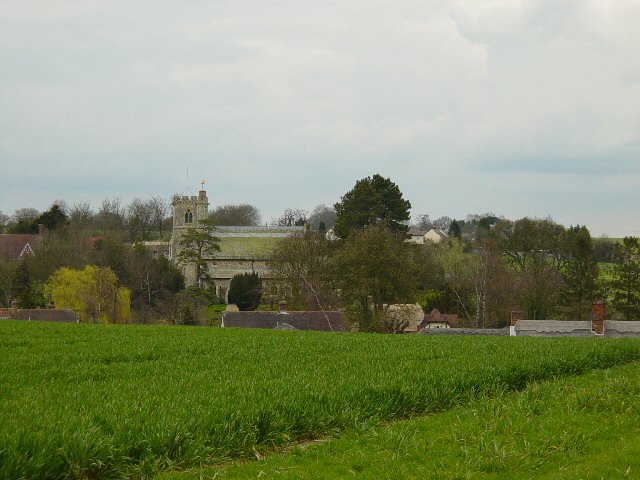
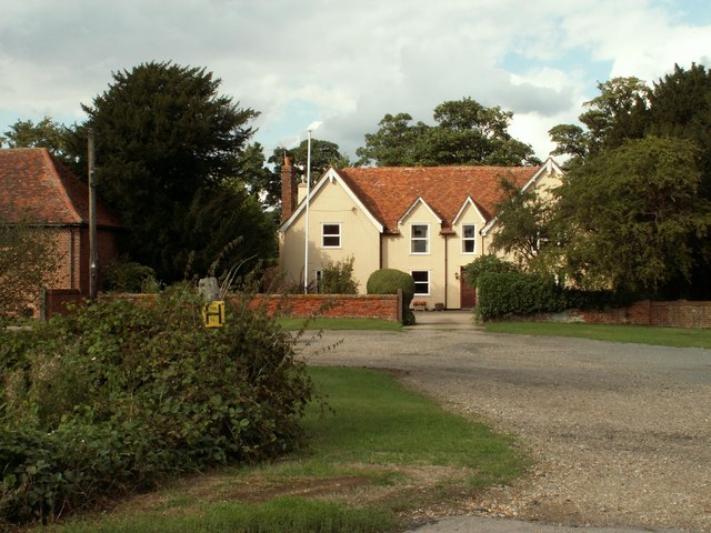
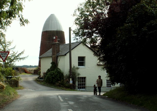
Hill Green is a quaint village located in the county of Essex, England. Situated in the southeastern part of the county, it is nestled amidst picturesque countryside, offering residents and visitors a tranquil and idyllic setting.

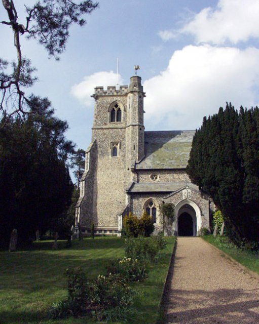
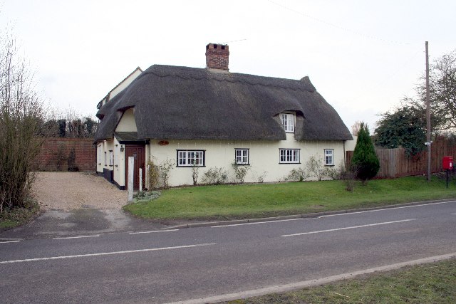
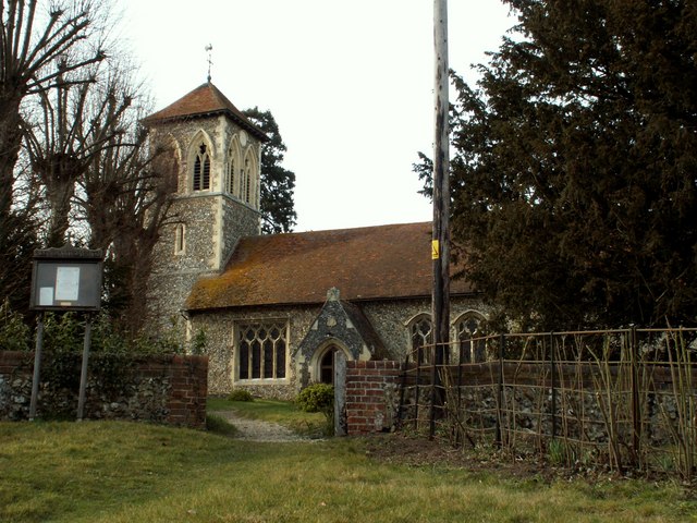
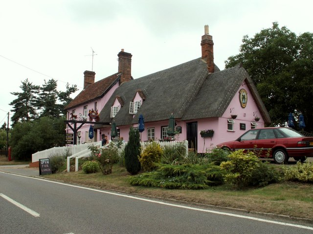
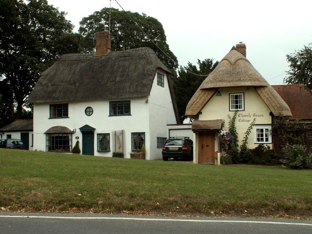
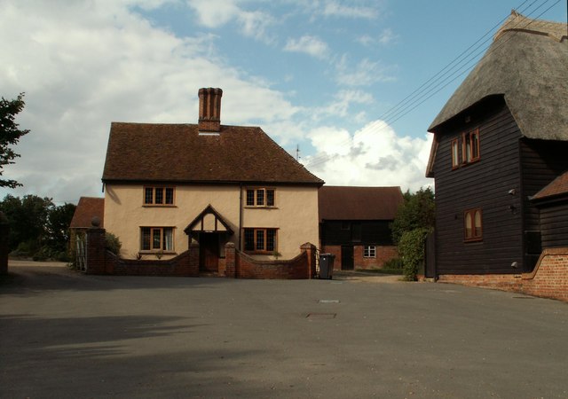
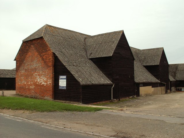
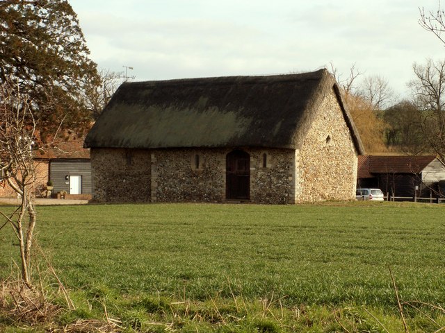
The village is characterized by its charming cottages and traditional architecture, showcasing the area's rich history and heritage. The local community is small but close-knit, fostering a friendly and welcoming atmosphere. Hill Green is a tight-knit community where neighbors often come together for social gatherings and events.

Surrounded by lush green fields and rolling hills, Hill Green is a haven for nature lovers. The village offers various walking paths and trails, allowing residents and visitors to explore the stunning countryside and enjoy the breathtaking views. The village is also home to a beautiful village green, where locals gather for leisurely picnics and outdoor activities.

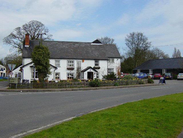
Despite its rural setting, Hill Green is conveniently located near several amenities. The village has a well-regarded primary school, providing quality education to the local children. Additionally, there are a few local shops and pubs, offering essential supplies and a place to socialize.

For those seeking a peaceful and serene lifestyle, Hill Green provides an ideal retreat. Its picturesque surroundings, sense of community, and access to nature make it a desirable place to live or visit in Essex. Whether exploring the countryside or simply enjoying the tranquility of village life, Hill Green offers a slice of traditional English charm.

If you have any feedback on the listing, please let us know in the comments section below.

Hill Green Images

Images are sourced within 2km of 51.972058/0.156824 or Grid Reference TL4832. Thanks to Geograph Open Source API. All images are credited.

Arkesden church
Arkesden church
Ford Keeper's Cottage This is known as the old ford keeper's cottage in Clavering, Essex - It has been suggested that a house that stood next to this, which burnt down in the 19th century, was the real ford keeper's cottage. I've been told that this is the smallest house in Essex.
Ford Keeper's Cottage
This is known as the old ford keeper's cottage in Clavering, Essex - It has been suggested that a house that stood next to this, which burnt down in the 19th century, was the real ford keeper's cottage. I've been told that this is the smallest house in Essex.
Rickling Church
Rickling Church
Thatched cottage in Wicken Bonhunt
Clavering, Essex This picture shows the approach to St. Mary and St. Clement's church, a 14th century building with many interesting features. The fine 15th century house is believed to have originally been built as almshouses.
Clavering, Essex
This picture shows the approach to St. Mary and St. Clement's church, a 14th century building with many interesting features. The fine 15th century house is believed to have originally been built as almshouses.
St. Margaret's church, Wicken Bonhunt, Essex Apart from the 13th century chancel, this church was a complete rebuild in 1858-9 and designed by John Hanson Sperling.
St. Margaret's church, Wicken Bonhunt, Essex
Apart from the 13th century chancel, this church was a complete rebuild in 1858-9 and designed by John Hanson Sperling.
The Cricketers, Clavering This is the childhood home of chef Jamie Oliver and he learnt to cook here at the age of eight. The Cricketers is still owned by Jamie Olivers parents Trevor and Sally Oliver.
<span class="nowrap"><a title="http://www.design-digerati.com/the_cricketers/restaurant.asp" rel="nofollow ugc noopener" href="http://www.design-digerati.com/the_cricketers/restaurant.asp">Link</a><img style="margin-left:2px;" alt="External link" title="External link - shift click to open in new window" src="https://s1.geograph.org.uk/img/external.png" width="10" height="10"/></span>
The Cricketers, Clavering
This is the childhood home of chef Jamie Oliver and he learnt to cook here at the age of eight. The Cricketers is still owned by Jamie Olivers parents Trevor and Sally Oliver. LinkExternal link
Arable Land and pylons, Hill Green Looking towards Hill Green from Clavering triangulation pillar.
Arable Land and pylons, Hill Green
Looking towards Hill Green from Clavering triangulation pillar.
Arkesden Church Looking towards Arkesden.
Arkesden Church
Looking towards Arkesden.
'Coach & Horses' inn, Wicken Bonhunt, Essex The carved wooden sign that stands out from the inn, as seen in the photo, used to be right across the width of the road some years ago.
'Coach & Horses' inn, Wicken Bonhunt, Essex
The carved wooden sign that stands out from the inn, as seen in the photo, used to be right across the width of the road some years ago.
Cottages at Arkesden, Essex Arkesden is a very pretty village and has many lovely thatched cottages such as these two that stand by the small green, immediately south of the church.
Cottages at Arkesden, Essex
Arkesden is a very pretty village and has many lovely thatched cottages such as these two that stand by the small green, immediately south of the church.
'The Axe & Compasses' inn, Arkesden, Essex
Clavering Court, Stickling Green, Clavering, Essex
Clavering Place Farm, Stickling Green, Clavering, Essex
Clavering Mill, Clavering, Essex A short distance north of this windmill without sails is another without sails. Both have been restored for living accommodation.
Clavering Mill, Clavering, Essex
A short distance north of this windmill without sails is another without sails. Both have been restored for living accommodation.
Clavering village sign, Essex
Rickling Road This is the view as you leave Wicken Bonhunt.
Rickling Road
This is the view as you leave Wicken Bonhunt.
Barn at Clavering Hall Farm
Show me another place!

Hill Green is located at Grid Ref: TL4832 (Lat: 51.972058, Lng: 0.156824)

Administrative County: Essex

District: Uttlesford

Police Authority: Essex

What 3 Words

///removers.transmits.juggled. Near Elsenham, Essex

Nearby Locations

Hill Green

Related Wikis

Wicken Bonhunt

Wicken Bonhunt is a village and a civil parish of north-west Essex, in the non-metropolitan district of Uttlesford, England. It is on the B1038 (Buntingford...
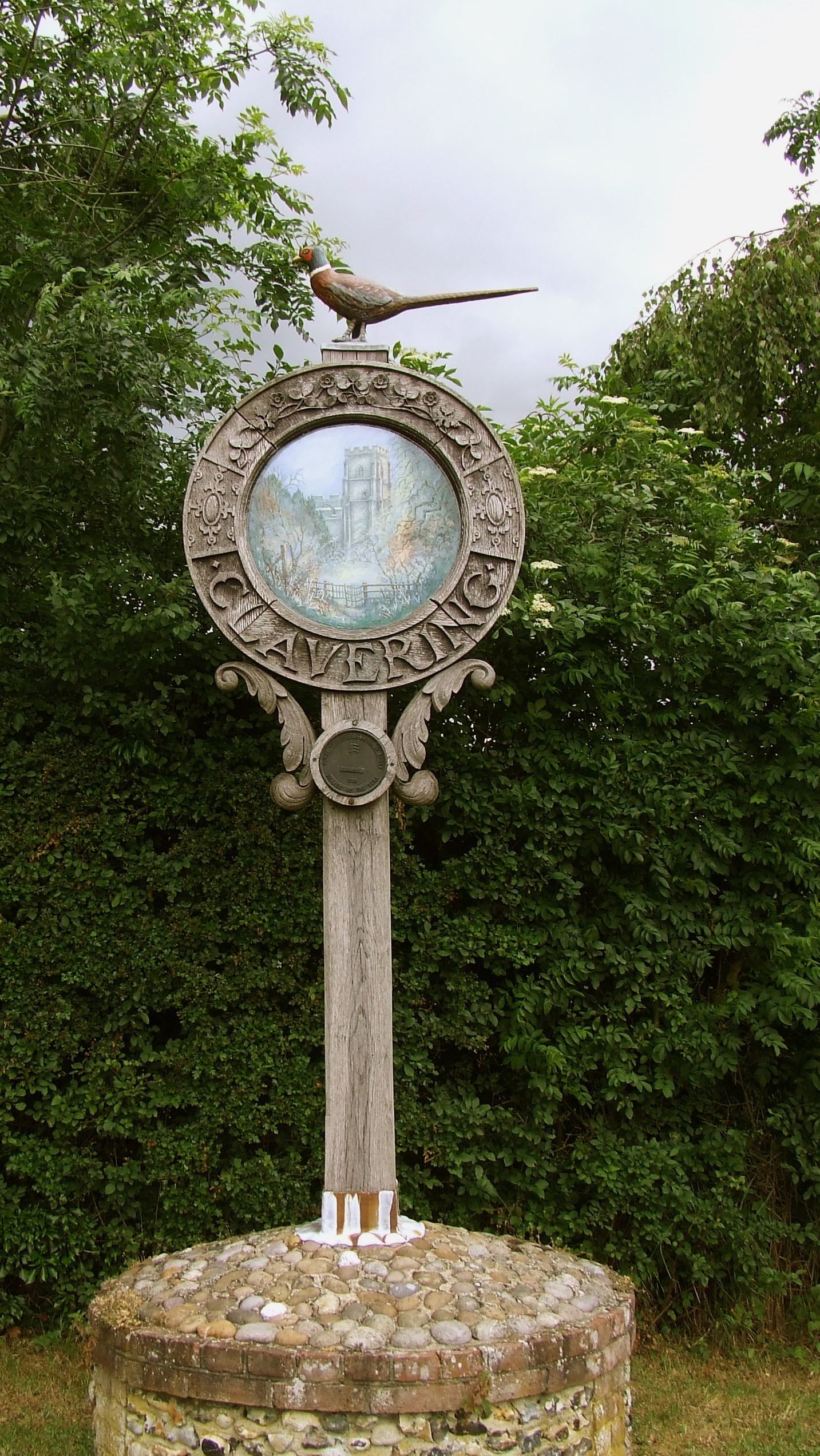
Clavering, Essex

Clavering is a village and also a parish in north-west Essex in England. It is about 20 miles (32 km) from Cambridge and 50 miles (80 km) from Southend...

Clavering Castle

Clavering Castle remains are situated in the small parish village of Clavering in the county of Essex, England, 50m north of the church of St Mary and...

Arkesden

Arkesden is a village and civil parish in the Uttlesford district of Essex, England. The village is 4.3 miles (7 km) south-west from Saffron Walden, approximately...

Rickling, Essex

Rickling is a village and former civil parish, now in the parish of Quendon and Rickling, in the Uttlesford district of Essex, England. The village is...

Chapel of St Helen

Chapel of St Helen (also St Helen's Chapel) is an ancient religious building in Wicken Bonhunt, north-west Essex. It dates from around the 11th century...

Berden

Berden is a village and civil parish in Essex, England. Berden village is approximately 6 miles (10 km) north from Bishop's Stortford, Hertfordshire and...

Berden Priory

Berden Priory was a priory in Essex, England. This site now has a Grade II* listed late 16th-century timber-framed house, the centre of Berden Priory Farm...

Nearby Amenities

Located within 500m of 51.972058,0.156824
Post Box
Brand: Royal Mail
Brand Wikidata: Q638098
Brand Wikipedia: en:Royal Mail
Collection Times: Mo-Fr 09:00; Sa 07:00
Operator: Royal Mail
Operator Wikidata: Q638098
Post Box Type: wall
Ref: CB11 94
Royal Cypher: VR
Royal Cypher Wikidata: Q33102356
Source: survey
Lat/Long: 51.9701169/0.1533201
School
Heidi's Montessori Day Nursery
Lat/Long: 51.9697756/0.1552034
Bus Stop
Wicken Road
Bus: yes
Naptan AtcoCode: 150018003005
Naptan Bearing: S
Naptan BusStopType: CUS
Naptan CommonName: Wicken Road
Naptan Crossing: Wicken Road B1038
Naptan Indicator: Adj
Naptan Landmark: Wicken Road
Naptan NaptanCode: esxdatjg
Naptan Street: Clatterbury Lane
Naptan Verified: no
Public Transport: platform
Source: naptan_import
Lat/Long: 51.9723435/0.1554596
Bus Stop
Cricket Grounds
Bus: yes
Naptan AtcoCode: 150018003006
Naptan Bearing: SW
Naptan BusStopType: CUS
Naptan CommonName: Clatterbury Lane
Naptan Indicator: SW-bound
Naptan Landmark: Clatterbury Lane
Naptan NaptanCode: esxdatjm
Naptan Street: Clatterbury Lane
Naptan Verified: no
Public Transport: platform
Source: naptan_import
Lat/Long: 51.9702865/0.1538839
Bus Stop
Hill Green
Bus: yes
Naptan AtcoCode: 150018003016
Naptan Bearing: SW
Naptan BusStopType: CUS
Naptan CommonName: Hill Green
Naptan Indicator: S-bound
Naptan Landmark: Hill Green
Naptan NaptanCode: esxdawda
Naptan Street: Clatterbury Lane
Naptan Verified: no
Public Transport: platform
Source: naptan_import
Lat/Long: 51.9749679/0.1565401
Bus Stop
Cricket Grounds
Bus: yes
Naptan AtcoCode: 150018003017
Naptan Bearing: NE
Naptan BusStopType: CUS
Naptan CommonName: Clatterbury Lane
Naptan Indicator: NE-bound
Naptan Landmark: Clatterbury Lane
Naptan NaptanCode: esxdawaw
Naptan Street: Clatterbury Lane
Naptan Verified: no
Public Transport: platform
Source: naptan_import
Lat/Long: 51.9698866/0.1526417
Bus Stop
Hill Green
Bus: yes
Naptan AtcoCode: 1500180030Y6
Naptan Bearing: NE
Naptan BusStopType: CUS
Naptan CommonName: Hill Green
Naptan Indicator: N-bound
Naptan Landmark: Hill Green
Naptan NaptanCode: esxgtgpm
Naptan Street: Clatterbury Lane
Naptan Verified: no
Public Transport: platform
Source: naptan_import
Lat/Long: 51.9749872/0.1564682
Bus Stop
Stickling Green Road
Bus: yes
Naptan AtcoCode: 150018003Y04
Naptan Bearing: N
Naptan BusStopType: CUS
Naptan CommonName: Stickling Green Road
Naptan Crossing: Wicken Road B1038
Naptan Indicator: Adj
Naptan Landmark: Stickling Green Road
Naptan NaptanCode: esxgwtma
Naptan Street: Clatterbury Lane
Naptan Verified: no
Public Transport: platform
Source: naptan_import
Lat/Long: 51.9735489/0.1556219
Bus Stop
Wicken Road
Bus: yes
Naptan AtcoCode: 150018003Y05
Naptan Bearing: N
Naptan BusStopType: CUS
Naptan CommonName: Wicken Road
Naptan Crossing: Wicken Road B1038
Naptan Indicator: Opp
Naptan Landmark: Wicken Road
Naptan NaptanCode: esxgwtmd
Naptan Street: Clatterbury Lane
Naptan Verified: no
Public Transport: platform
Source: naptan_import
Lat/Long: 51.9723055/0.1553188
Bus Stop
The Cricketers
Bus: yes
Naptan AtcoCode: 1500IM1778
Naptan Bearing: E
Naptan BusStopType: CUS
Naptan CommonName: The Cricketers
Naptan Crossing: Clatterbury Lane
Naptan Indicator: o/s
Naptan Landmark: The Cricketers
Naptan NaptanCode: esxadmgd
Naptan Street: Wicken Road
Naptan Verified: no
Public Transport: platform
Source: naptan_import
Lat/Long: 51.9727322/0.1558649
Bus Stop
The Cricketers
Bus: yes
Naptan AtcoCode: 1500IM1778A
Naptan Bearing: W
Naptan BusStopType: CUS
Naptan CommonName: The Cricketers
Naptan Crossing: Clatterbury Lane
Naptan Indicator: Opp
Naptan Landmark: The Cricketers
Naptan NaptanCode: esxgpdpm
Naptan Street: Wicken Road
Naptan Verified: no
Public Transport: platform
Source: naptan_import
Lat/Long: 51.9726767/0.1559496
Description: Public Footpath
Information: guidepost
Source: GPS;photograph
Tourism: information
Lat/Long: 51.9732087/0.158379
Description: Public Footpath
Information: guidepost
Source: GPS;photograph
Tourism: information
Lat/Long: 51.9736652/0.1501589
Description: Public Footpath
Information: guidepost
Source: GPS;photograph
Tourism: information
Lat/Long: 51.9740591/0.1599344
Barrier: stile
Foot: no
Lat/Long: 51.9745748/0.1591057
Barrier: stile
Foot: no
Lat/Long: 51.9749056/0.1586101
Description: Public Footpath
Information: guidepost
Source: GPS;photograph
Lat/Long: 51.9749296/0.1564237
Barrier: stile
Foot: no
Lat/Long: 51.9753786/0.1575077
Pub
The Cricketers Clavering
Lat/Long: 51.9729041/0.1557476
The Cricketers
Tourism: guest_house
Lat/Long: 51.9728744/0.1561258
Post Box
Brand: Royal Mail
Brand Wikidata: Q638098
Brand Wikipedia: en:Royal Mail
Collection Times: Mo-Fr 16:30; Sa 11:15
Operator: Royal Mail
Operator Wikidata: Q638098
Post Box Type: lamp
Ref: CB11 91
Royal Cypher: GVIR
Royal Cypher Wikidata: Q33102169
Source: survey
Lat/Long: 51.9727764/0.1554272
Telephone
Booth: K6
Covered: booth
Listed Status: Grade II
Phone: +44 1799 550211
Wikidata: Q26558094
Lat/Long: 51.972621/0.1553965
Fixme: 2013-09-01 footpath needs survey
Lat/Long: 51.9698686/0.1525446
Crossing
Lat/Long: 51.9701097/0.1533267
Defibrillator
Defibrillator Location: outside Clavering Village Hall
Emergency: defibrillator
Indoor: no
Ref GB The Circuit: 6CAEEB97-1F72-41AF-9DAA-AE2C014A83AD
Lat/Long: 51.9709072/0.1543978
Crossing
Crossing: unmarked
Crossing Island: yes
Crossing Markings: no
Tactile Paving: yes
Lat/Long: 51.9732948/0.1554099
Crossing
Crossing: unmarked
Crossing Island: yes
Crossing Markings: no
Tactile Paving: yes
Lat/Long: 51.9732425/0.1555941
Hill Green
Place: locality
Lat/Long: 51.9732707/0.1555104
The data included in this document is from www.openstreetmap.org. The data is made available under ODbL.

Have you been to Hill Green?

Leave your review of Hill Green below (or comments, questions and feedback).