Bencallen

Hill, Mountain in Ayrshire

Scotland

Bencallen

Slope descending towards Corrn Roy Corrn Roy is an unusual name for a stream; it flows below the hill slope to meet and join the greater watercourse, Balloch Burn.
Haggis Hill is sunlit at the left side of the image; Larg Hill is wooded, at its centre.
Slope descending towards Corrn Roy Credit: Trevor Littlewood

Bencallen is a prominent hill located in Ayrshire, Scotland. It sits within the Galloway Forest Park, which is renowned for its picturesque landscapes and diverse flora and fauna. Rising to an elevation of approximately 521 meters (1,709 feet), Bencallen offers captivating views of the surrounding countryside and is a popular destination for nature enthusiasts, hikers, and climbers.

The hill is characterized by its conical shape and its rugged terrain, featuring steep slopes and rocky outcrops. It is predominantly composed of granite, which gives it a distinctive appearance. The hill is covered in heather and grasses, creating a colorful tapestry that changes with the seasons.

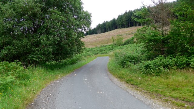
Bencallen is accessible via various walking routes, providing visitors with opportunities to explore the surrounding natural beauty. The ascent to the summit can be challenging, but the reward is well worth it, as on a clear day, one can enjoy breathtaking panoramic views of the Ayrshire coast, hills, and neighboring mountain ranges.

The hill is also home to a variety of wildlife, including red deer, mountain hares, and various bird species, making it a haven for wildlife enthusiasts and birdwatchers. Additionally, Bencallen is part of the Galloway Dark Sky Park, designated as one of the best places in Europe for stargazing, offering visitors the chance to witness the wonders of the night sky.

Overall, Bencallen is a captivating hill in Ayrshire, offering visitors an opportunity to immerse themselves in the natural beauty and tranquility of the Scottish countryside.

If you have any feedback on the listing, please let us know in the comments section below.

Bencallen Images

Images are sourced within 2km of 55.219835/-4.6073657 or Grid Reference NX3494. Thanks to Geograph Open Source API. All images are credited.

Slope descending towards Corrn Roy Corrn Roy is an unusual name for a stream; it flows below the hill slope to meet and join the greater watercourse, Balloch Burn.
Haggis Hill is sunlit at the left side of the image; Larg Hill is wooded, at its centre.
Slope descending towards Corrn Roy
Corrn Roy is an unusual name for a stream; it flows below the hill slope to meet and join the greater watercourse, Balloch Burn. Haggis Hill is sunlit at the left side of the image; Larg Hill is wooded, at its centre.
Farmhouse at Pinvalley The farmhouse and some of the barns at the farm of Pinvalley close to the River Stinchar.
Farmhouse at Pinvalley
The farmhouse and some of the barns at the farm of Pinvalley close to the River Stinchar.
Forest road crossing the Balloch Burn From the image it's not immediately apparent that there's a stream to be crossed or even that there's a bridge, but the Balloch Burn is there.
Forest road crossing the Balloch Burn
From the image it's not immediately apparent that there's a stream to be crossed or even that there's a bridge, but the Balloch Burn is there.
Warning notices beside forest road The road is passing through coniferous plantations above the Balloch Burn.
Warning notices beside forest road
The road is passing through coniferous plantations above the Balloch Burn.
Meandering of Balloch Burn The Balloch Burn winds its way across the foot of the scene joining another stream, the unusually named Corrn Roy, which drains the valley ahead.
Pinbreck Hill is the main hill in view with the shadowed flank of Glengap Hill rising at the right side of the image.
Meandering of Balloch Burn
The Balloch Burn winds its way across the foot of the scene joining another stream, the unusually named Corrn Roy, which drains the valley ahead. Pinbreck Hill is the main hill in view with the shadowed flank of Glengap Hill rising at the right side of the image.
High voltage power lines on hill slope The electricity transmission lines are on a northern slope above the valley of the Balloch Burn. 
The distant hill is Pinbreck Hill.
High voltage power lines on hill slope
The electricity transmission lines are on a northern slope above the valley of the Balloch Burn. The distant hill is Pinbreck Hill.
The road descending the Nick of the Balloch This lovely narrow moorland road has a surface which has deteriorated badly.  The stream below is the Corrn Roy (no mis-spelling, note!).
The road descending the Nick of the Balloch
This lovely narrow moorland road has a surface which has deteriorated badly. The stream below is the Corrn Roy (no mis-spelling, note!).
Poor surface on the road descending the Nick of the Balloch This is also part of Cycle Route 7 - 547.2 miles long from Sunderland in the northeast of England to Inverness.
Poor surface on the road descending the Nick of the Balloch
This is also part of Cycle Route 7 - 547.2 miles long from Sunderland in the northeast of England to Inverness.
The Nick of the Balloch road This is also part of Cycle Route 7 - 547.2 miles long from Sunderland in the northeast of England to Inverness.
The Nick of the Balloch road
This is also part of Cycle Route 7 - 547.2 miles long from Sunderland in the northeast of England to Inverness.
South Balloch Bridge The buildings of the farm at South Balloch beyond.
South Balloch Bridge
The buildings of the farm at South Balloch beyond.
North Balloch view A summer evening view looking into the Stinchar Valley from Dalwyne with Glengap Hill on the skyline.
North Balloch view
A summer evening view looking into the Stinchar Valley from Dalwyne with Glengap Hill on the skyline.
Balloch Burn near confluence with Corrn Roy
Road to Crosshill at South Balloch
Farmland at South Balloch
Road to Glentrool at South Balloch
Road to Barr at South Balloch
South Balloch Junction
Road to Barr at South Balloch
Show me another place!

Bencallen is located at Grid Ref: NX3494 (Lat: 55.219835, Lng: -4.6073657)

Unitary Authority: South Ayrshire

Police Authority: Ayrshire

What 3 Words

///utter.defeat.overnight. Near Girvan, South Ayrshire

Nearby Locations

Bencallen

Related Wikis

Stinchar Falls

Stinchar Falls is a waterfall of Scotland. It is located on the Stinchar Burn, east of Barr in Ayrshire. == See also == Waterfalls of Scotland == References ==

Barr, Ayrshire

Barr is a village in the South West of Ayrshire, Scotland, approximately 8 miles (13 km) from the town of Girvan. There are various opinions as to the...

Shalloch on Minnoch

Shalloch on Minnoch is a hill in the Range of the Awful Hand, a sub-range of the Galloway Hills range, part of the Southern Uplands of Scotland. It is...

Hadyard Hill Wind Farm

Hadyard Hill Wind Farm is located in Carrick district of South Ayrshire. Costing £85 million, the wind farm consists of 52 three-bladed Siemens wind turbines...

Nearby Amenities

Located within 500m of 55.219835,-4.6073657
The data included in this document is from www.openstreetmap.org. The data is made available under ODbL.

Have you been to Bencallen?

Leave your review of Bencallen below (or comments, questions and feedback).