Black Hill of Garleffin
Hill, Mountain in Ayrshire
Scotland
Black Hill of Garleffin

Black Hill of Garleffin is a prominent hill located in Ayrshire, Scotland. Situated near the small village of Garleffin, it stands at a height of approximately 282 meters (925 feet). This hill is a part of the Southern Uplands, a range of hills that stretch across southern Scotland.
The Black Hill of Garleffin is characterized by its distinctive dark color, which is a result of the underlying basalt rock formation. The hill offers breathtaking panoramic views of the surrounding countryside, including the nearby villages of Barrhill and Pinwherry, as well as the picturesque valleys and rolling hills of Ayrshire.
The hill is a popular destination for hikers and nature enthusiasts, with several paths and trails leading to its summit. Along the way, visitors can enjoy the diverse flora and fauna of the area, including heather, gorse, and various species of birds.
One of the notable features of the Black Hill of Garleffin is its historical significance. It is believed that there may have been an ancient fort or settlement on the hill, although no conclusive evidence has been found. Nonetheless, the hill's strategic location and commanding views suggest that it may have played a role in the region's past.
Overall, the Black Hill of Garleffin is a stunning natural landmark that offers both natural beauty and historical intrigue. Whether it's for a leisurely walk or a challenging hike, this hill is a must-visit destination for those exploring the Ayrshire countryside.
If you have any feedback on the listing, please let us know in the comments section below.
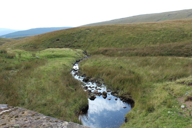
Black Hill of Garleffin Images
Images are sourced within 2km of 55.261486/-4.6134787 or Grid Reference NX3499. Thanks to Geograph Open Source API. All images are credited.


Black Hill of Garleffin is located at Grid Ref: NX3499 (Lat: 55.261486, Lng: -4.6134787)
Unitary Authority: South Ayrshire
Police Authority: Ayrshire
What 3 Words
///tungsten.diet.tamed. Near Maybole, South Ayrshire
Nearby Locations
Related Wikis

Ayr, Carrick and Cumnock (UK Parliament constituency)
Ayr, Carrick and Cumnock is a county constituency represented in the House of Commons of the Parliament of the United Kingdom. It was created for the 2005...

Stinchar Falls
Stinchar Falls is a waterfall of Scotland. It is located on the Stinchar Burn, east of Barr in Ayrshire. == See also == Waterfalls of Scotland == References ==

Kilkerran House
Kilkerran House is an 18th-century private house near Maybole, Ayrshire, Scotland. It is a category A listed building set within grounds included in the...

South Ayrshire
South Ayrshire (Scots: Sooth Ayrshire; Scottish Gaelic: Siorrachd Àir a Deas, pronounced [ˈʃirˠəxk aːɾʲ ə ˈtʲes̪]) is one of thirty-two council areas of...
Nearby Amenities
Located within 500m of 55.261486,-4.6134787Have you been to Black Hill of Garleffin?
Leave your review of Black Hill of Garleffin below (or comments, questions and feedback).