Brown Hill

Hill, Mountain in Ayrshire

Scotland

Brown Hill

Flattened area by the Route 7 cycle route Perhaps for timber stacks?
Flattened area by the Route 7 cycle route Credit: Gordon Brown

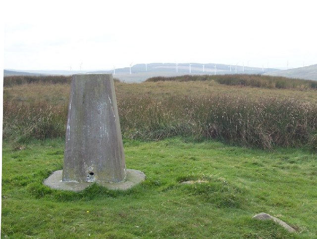
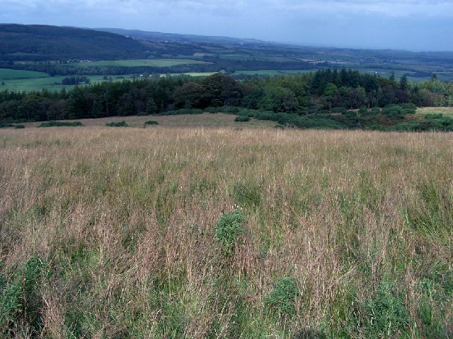
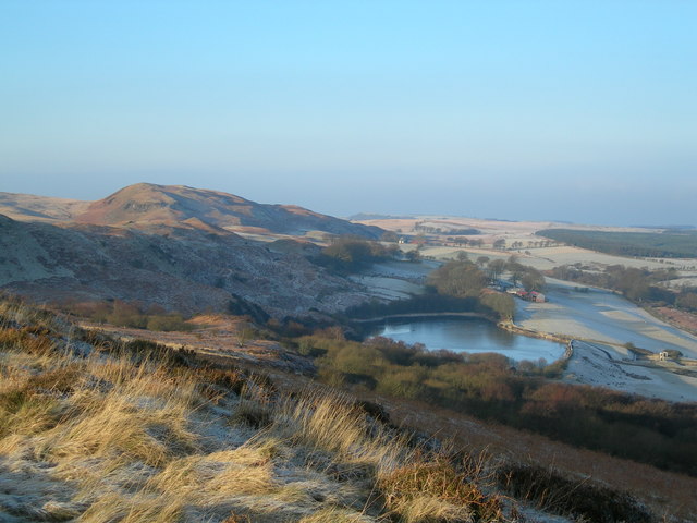
Brown Hill is a prominent hill located in the region of Ayrshire, Scotland. Standing at an elevation of approximately 218 meters (715 feet), it is a notable landmark in the area and offers scenic views of the surrounding countryside. Situated near the town of Ayr, Brown Hill is easily accessible and attracts both locals and tourists alike.

The hill itself consists of rolling grassy slopes, which are relatively easy to traverse, making it a popular destination for outdoor enthusiasts and hikers. The terrain is generally gentle, with no steep inclines or challenging obstacles, making it suitable for all ages and fitness levels. As a result, it is a common choice for individuals seeking a leisurely walk or a peaceful picnic spot.

Covered in patches of heather and scattered with low-lying shrubs, Brown Hill provides a haven for a variety of wildlife. Birdwatchers will be delighted to spot various species, including kestrels, buzzards, and pheasants, among others. The hill's diverse flora and fauna further enhance its natural beauty and contribute to its ecological significance.

With its close proximity to Ayr, visitors can easily combine a visit to Brown Hill with a trip to the town's attractions, such as Ayr Beach or the Robert Burns Birthplace Museum. Additionally, the hill's location on the outskirts of Ayrshire means that it is within reach of other notable landmarks in the region, such as Culzean Castle and the Ayrshire Coastal Path.

Overall, Brown Hill is a picturesque and accessible hill in Ayrshire, offering visitors a chance to enjoy the great outdoors and experience the region's natural beauty.

If you have any feedback on the listing, please let us know in the comments section below.

Brown Hill Images

Images are sourced within 2km of 55.283709/-4.639666 or Grid Reference NS3202. Thanks to Geograph Open Source API. All images are credited.

Flattened area by the Route 7 cycle route Perhaps for timber stacks?
Flattened area by the Route 7 cycle route
Perhaps for timber stacks?
Fully loaded timber lorry north of Palmullan Bridge
Road approaching the Diel's Elbow The upper slopes of Claughrie Hill ahead have been scalped - all timber extracted. This road is also part of Cycle Route 7 - 547.2 miles long from Sunderland in the northeast of England to Inverness.
Road approaching the Diel's Elbow
The upper slopes of Claughrie Hill ahead have been scalped - all timber extracted. This road is also part of Cycle Route 7 - 547.2 miles long from Sunderland in the northeast of England to Inverness.
Buildings near Cullochknowes
Barony Hill Trig point on Barony Hill, looking south west towards new wind turbines on Hadyard Hill.
Barony Hill
Trig point on Barony Hill, looking south west towards new wind turbines on Hadyard Hill.
Rough Grazing above Kilkerran Rough grazing viewed from track leading from quarries below Barony Hill to Glengee Wood
Rough Grazing above Kilkerran
Rough grazing viewed from track leading from quarries below Barony Hill to Glengee Wood
Auchalton Meadow A wildlife reserve managed by the Scottish Wildlife Trust.
Auchalton Meadow
A wildlife reserve managed by the Scottish Wildlife Trust.
Clear fell A clear fell area in Glenalla Forest, with Clauchrie Hill in the background.
Clear fell
A clear fell area in Glenalla Forest, with Clauchrie Hill in the background.
Recent Clear Fell Current timber extraction from Glenalla Forest.
Recent Clear Fell
Current timber extraction from Glenalla Forest.
Towards Shawsknowe Looking towards Shawsknowe Farm from the hill road.  Many of the old roadside beech trees have had to be cut back after this year's winter storm damage.
Towards Shawsknowe
Looking towards Shawsknowe Farm from the hill road. Many of the old roadside beech trees have had to be cut back after this year's winter storm damage.
Forest and Moor Trees of various ages and stages in Glenalla Forest.
Forest and Moor
Trees of various ages and stages in Glenalla Forest.
Forest edge The edge of the Galloway Forest Park. To see the difference after clear-felling, look at <a href="https://www.geograph.org.uk/photo/4489420">NS3400 : Clear fell edge at Glenalla</a>, taken 8 years later.
Forest edge
The edge of the Galloway Forest Park. To see the difference after clear-felling, look at NS3400 : Clear fell edge at Glenalla, taken 8 years later.
Edge of The Pilot Rocky crags on the northern slopes of The Pilot, viewed on a fine March afternoon.
Edge of The Pilot
Rocky crags on the northern slopes of The Pilot, viewed on a fine March afternoon.
Coming Up The Hill Road The Hill Road from Crosshill to the Stinchar Valley is a popular tourist route.
Coming Up The Hill Road
The Hill Road from Crosshill to the Stinchar Valley is a popular tourist route.
Cottages at Cullochknowes
New life This part of Glenalla Forest was replanted very quickly after the clear fell.
New life
This part of Glenalla Forest was replanted very quickly after the clear fell.
Moorland view
Moorland view
Show me another place!

Brown Hill is located at Grid Ref: NS3202 (Lat: 55.283709, Lng: -4.639666)

Unitary Authority: South Ayrshire

Police Authority: Ayrshire

What 3 Words

///headsets.hoped.deduced. Near Maybole, South Ayrshire

Related Wikis

Kilkerran House

Kilkerran House is an 18th-century private house near Maybole, Ayrshire, Scotland. It is a category A listed building set within grounds included in the...

Ayr, Carrick and Cumnock (UK Parliament constituency)

Ayr, Carrick, and Cumnock is a county constituency represented in the House of Commons of the Parliament of the United Kingdom. It was created for the...

Kilkerran railway station

Kilkerran railway station served an area of rural Ayrshire, Scotland from 1860 to 1965 on the Maybole and Girvan Railway. == History == The station opened...

South Ayrshire

South Ayrshire (Scots: Sooth Ayrshire; Scottish Gaelic: Siorrachd Àir a Deas, pronounced [ˈʃirˠəxk aːɾʲ ə ˈtʲes̪]) is one of thirty-two council areas of...

Crosshill, South Ayrshire

Crosshill is a small village in South Ayrshire, Scotland.Crosshill has a primary school. == References ==

Lochspouts

Lochspouts Loch (NS 2885 0586) or Lochspouts was situated in a hollow, surrounded by hilly ground on three sides and bounded by a narrow trap dyke to the...

Blairquhan Castle

Blairquhan ( blair-WHAHN, Scots: Blairwhan) is a Regency era castle near Maybole in South Ayrshire, Scotland. It was the historic home of the Hunter-Blair...

Dalquharran Castle

Dalquharran Castle is a category A listed building in South Ayrshire, Scotland, designed by Robert Adam and completed around 1790. The first recorded lord...

Nearby Amenities

Located within 500m of 55.283709,-4.639666
Power: pole
Lat/Long: 55.279361/-4.6377245
Power: pole
Lat/Long: 55.2814637/-4.6333317
Power: pole
Lat/Long: 55.2808288/-4.6346582
Power: pole
Lat/Long: 55.280567/-4.6352052
Power: pole
Lat/Long: 55.2800003/-4.6363889
Power: pole
Lat/Long: 55.2875895/-4.6370784
Power: pole
Lat/Long: 55.2873542/-4.6381148
Power: pole
Lat/Long: 55.2871189/-4.6391512
Power: pole
Lat/Long: 55.2876836/-4.6397816
The data included in this document is from www.openstreetmap.org. The data is made available under ODbL.

Have you been to Brown Hill?

Leave your review of Brown Hill below (or comments, questions and feedback).