Carreglefain

Hill, Mountain in Caernarfonshire

Wales

Carreglefain

Derelict hotel next to Pistyll Farm
Derelict hotel next to Pistyll Farm Credit: Dave Spicer

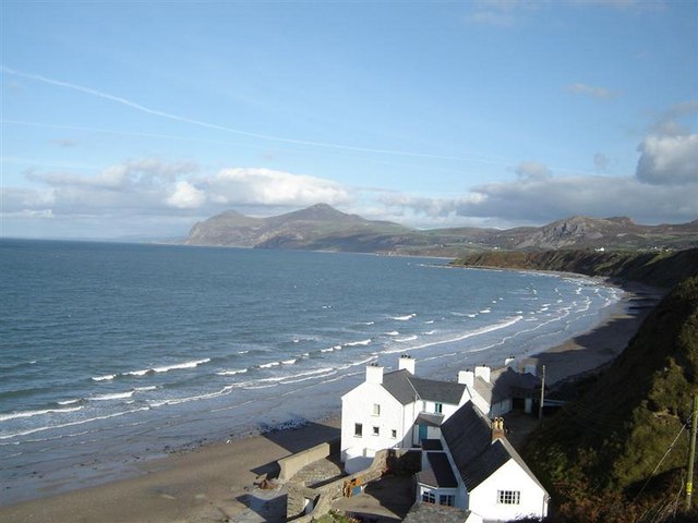
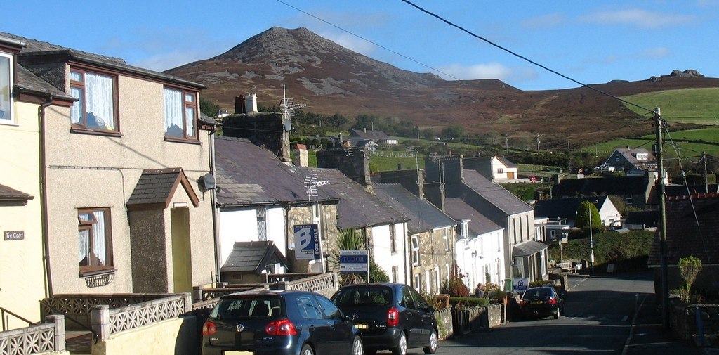
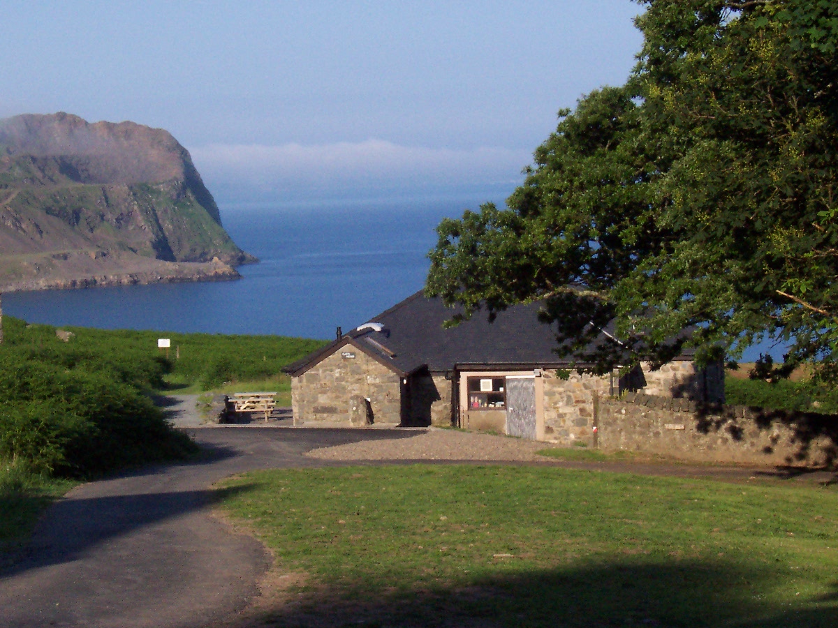
Carreglefain is a prominent hill located in the county of Caernarfonshire, in northwestern Wales. Rising to an elevation of 1,667 feet (508 meters), it is often referred to as a mountain due to its size and steep slopes. Situated near the village of Llanwnda, Carreglefain offers breathtaking panoramic views of the surrounding countryside and the nearby coastline of the Irish Sea.

The hill is composed mainly of sedimentary rocks, including sandstone and shale, which were formed millions of years ago during the geological process. These rocks provide a diverse range of colors and textures, giving Carreglefain a distinct and picturesque appearance.

Carreglefain is a popular destination for hikers and nature enthusiasts, attracting visitors from both near and far. Several well-marked trails traverse its slopes, offering various levels of difficulty to cater to different hiking abilities. The routes provide an opportunity to explore the diverse flora and fauna of the area, including heather, gorse, and various species of birds.

The hill is also of historical significance, with evidence of ancient settlements and burial sites found in the vicinity. Archaeologists have uncovered remnants of stone tools, pottery, and other artifacts, providing insights into the lives of early inhabitants of the region.

Overall, Carreglefain is a remarkable natural landmark, blending scenic beauty, geological wonders, and historical significance. Its accessibility and diverse offerings make it a must-visit destination for those seeking outdoor adventures and an appreciation for the rich heritage of Caernarfonshire.

If you have any feedback on the listing, please let us know in the comments section below.
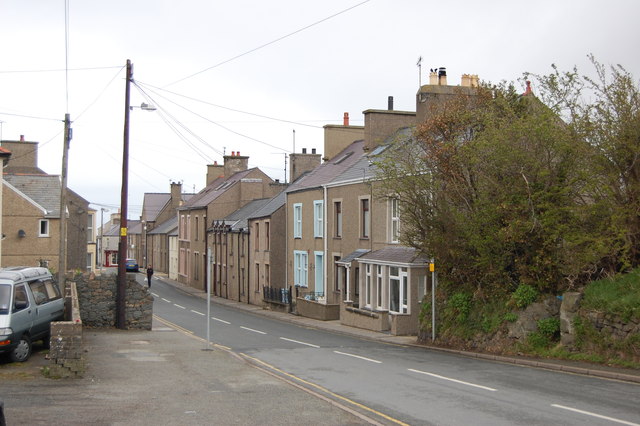
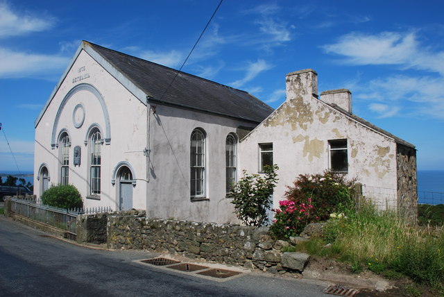
Carreglefain Images

Images are sourced within 2km of 52.940643/-4.4952205 or Grid Reference SH3241. Thanks to Geograph Open Source API. All images are credited.

Derelict hotel next to Pistyll Farm
B4417 at Pistyll Looking west from near the chapel.
B4417 at Pistyll
Looking west from near the chapel.
Pistyll Hotel Great location for a hotel - but it's derelict.
Pistyll Hotel
Great location for a hotel - but it's derelict.
A497 entering Nefyn Taken from the car park of the Spar store.
A497 entering Nefyn
Taken from the car park of the Spar store.
View towards Penrhyn Bodeilas from Wern
Llwybr Arfordir Llŷn/Lleyn Coastal Path (Pistyll) Hen walydd sych ar Lwybr Arfordir Llŷn ger Pistyll.

Old stone walls on Lleyn Coastal Path near Pistyll
Llwybr Arfordir Llŷn/Lleyn Coastal Path (Pistyll)
Hen walydd sych ar Lwybr Arfordir Llŷn ger Pistyll. Old stone walls on Lleyn Coastal Path near Pistyll
Bethania chapel in Pistyll Dated 1875.
Bethania chapel in Pistyll
Dated 1875.
Bethania chapel, Pistyll The frontage is well weathered, as you might expect with a coastal location.
Bethania chapel, Pistyll
The frontage is well weathered, as you might expect with a coastal location.
Coastal view at Pistyll An interesting coastal view, incorporating a large, long derelict old hotel.
Coastal view at Pistyll
An interesting coastal view, incorporating a large, long derelict old hotel.
Derelict old hotel near Pistyll I hear there may be plans afoot to refurb this old place. Great.
Derelict old hotel near Pistyll
I hear there may be plans afoot to refurb this old place. Great.
Capel Bethania, Pistyll With the attached manse or schoolroom it would make a sizeable house.

The plaque commemorates an old minister here I believe, Tom Nefyn Williams (1895-1958).
Capel Bethania, Pistyll
With the attached manse or schoolroom it would make a sizeable house. The plaque commemorates an old minister here I believe, Tom Nefyn Williams (1895-1958).
Fresh landslide After a notoriously wet Summer, water-saturated ground has collapsed just a matter of days prior to this visit by the North Wales Geology Association. Bramble bushes are still fresh and green at the toe of the slip, and wave action has not carried away a significant amount of fine material, while a large boulder (<a href="https://www.geograph.org.uk/photo/3175721">SH3040 : Erratic boulder</a>) stands on end where it has come to rest.
Fresh landslide
After a notoriously wet Summer, water-saturated ground has collapsed just a matter of days prior to this visit by the North Wales Geology Association. Bramble bushes are still fresh and green at the toe of the slip, and wave action has not carried away a significant amount of fine material, while a large boulder (SH3040 : Erratic boulder) stands on end where it has come to rest.
Erratic boulder This fine erratic boulder has just fallen onto the beach as part of a landslide (<a href="https://www.geograph.org.uk/photo/3175708">SH3040 : Fresh landslide</a>). It is made of Carboniferous Limestone, and may only have travelled from Anglesey, but although it is very angular and fresh, one side has been rubbed vigorously on bedrock and flattened. This surface carries a record of its transit and abrasion in the form of dense and (mostly) parallel striations. Sadly, these features are soon lost as the limestone dissolves in the rain. A pencil gives a scale.
Erratic boulder
This fine erratic boulder has just fallen onto the beach as part of a landslide (SH3040 : Fresh landslide). It is made of Carboniferous Limestone, and may only have travelled from Anglesey, but although it is very angular and fresh, one side has been rubbed vigorously on bedrock and flattened. This surface carries a record of its transit and abrasion in the form of dense and (mostly) parallel striations. Sadly, these features are soon lost as the limestone dissolves in the rain. A pencil gives a scale.
Nanhoron Arms Hotel
Nanhoron Arms Hotel
Capel Pistyll
Capel Pistyll
Gwylwyr Carreglefain Climbed from track to east allowed a direct ascent to the rocky outcrop. Property owner doesn't mind use of track for access and stated that plans afoot to improve walking routes around here this year.
Name: Gwylwyr Carreglefain
Hill number: 5146
Height: 261m / 856ft
Area: 30A: Anglesey and the Lleyn Peninsula
Class: Hu
Grid ref: SH 32426 41058
Summit feature: tiny cairn on rock outcrop
Drop: 129m
Col: 132m  SH317398
Gwylwyr Carreglefain
Climbed from track to east allowed a direct ascent to the rocky outcrop. Property owner doesn't mind use of track for access and stated that plans afoot to improve walking routes around here this year. Name: Gwylwyr Carreglefain Hill number: 5146 Height: 261m / 856ft Area: 30A: Anglesey and the Lleyn Peninsula Class: Hu Grid ref: SH 32426 41058 Summit feature: tiny cairn on rock outcrop Drop: 129m Col: 132m SH317398
B4417 near Pistyll
B4417 near Pistyll
B4417 at Pistyll
B4417 at Pistyll
Show me another place!

Carreglefain is located at Grid Ref: SH3241 (Lat: 52.940643, Lng: -4.4952205)

Unitary Authority: Gwynedd

Police Authority: North Wales

What 3 Words

///grad.outlast.published. Near Nefyn, Gwynedd

Nearby Locations

Carreglefain Pistyll

Related Wikis

Pistyll

Pistyll is a village and community in the Welsh county of Gwynedd, located on the Llŷn Peninsula midway between Nefyn and Llanaelhaearn. The larger village...

Nefyn

Nefyn (Welsh pronunciation: [ˈnɛvɨn], archaically anglicised as Nevin) is both a small town and a community on the northwest coast of the Llŷn Peninsula...

Garn Boduan

Garn Boduan is an Iron Age hillfort and hill near Nefyn, on the Llŷn Peninsula in Wales. In a survey in the 1950s the traces of over 170 round houses were...

Boduan

Boduan is a village in Gwynedd, Wales, about 4 miles from Pwllheli. It is in the historic county of Caernarfonshire. It was due to host the National Eisteddfod...

Buan, Gwynedd

Buan is a community in the Welsh county of Gwynedd, located on the Llŷn Peninsula. It includes the villages of Boduan and Rhydyclafdy, and has a population...

Morfa Nefyn

Morfa Nefyn is a village on the northern coast of the Llŷn Peninsula in Gwynedd, Wales. It lies on the crossroads of the B4417 and B4412. The village has...

Llithfaen

Llithfaen is a village on the northern coast of the Llŷn Peninsula in Gwynedd, Wales, in the historic county of Caernarfonshire. It is within the community...

Nant Gwrtheyrn

Nant Gwrtheyrn is a Welsh Language and Heritage Centre, located near the village of Llithfaen on the northern coast of the Llŷn Peninsula, Gwynedd, in...

Nearby Amenities

Located within 500m of 52.940643,-4.4952205
Mynydd Nefyn
Ele: 256
Natural: peak
Source: NPE
Lat/Long: 52.9367652/-4.4931974
Carreglefain
Alt Name: Carreg Lefain
Ele: 261
Natural: peak
Lat/Long: 52.9409189/-4.49509
Gwylwyr
Ele: 237
Natural: peak
Lat/Long: 52.9423526/-4.5014576
Tourism: viewpoint
Lat/Long: 52.9423747/-4.5014379
Fixme: continue
Lat/Long: 52.9396481/-4.494693
Barrier: kissing_gate
Lat/Long: 52.9375314/-4.5003815
The data included in this document is from www.openstreetmap.org. The data is made available under ODbL.

Have you been to Carreglefain?

Leave your review of Carreglefain below (or comments, questions and feedback).