Mynydd Nefyn

Hill, Mountain in Caernarfonshire

Wales

Mynydd Nefyn

B4354 west of Frochas
B4354 west of Frochas Credit: Alpin Stewart

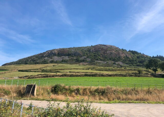
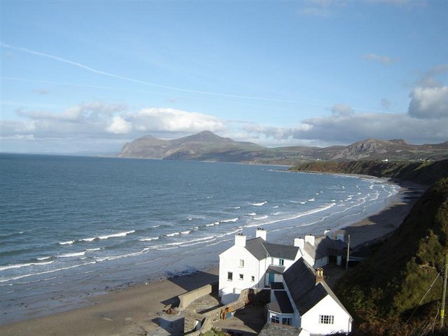
Mynydd Nefyn, located in Caernarfonshire, Wales, is a prominent hill and mountainous area with a rich historical and cultural significance. Standing at an elevation of approximately 1,150 feet (350 meters), it offers breathtaking panoramic views of the surrounding landscape and the Irish Sea.

The hill is characterized by its rugged terrain, covered in heather and grasses, and dotted with rocky outcrops. It is a popular destination for hikers and nature enthusiasts, who are drawn to its diverse flora and fauna, including rare species such as the chough bird.

Mynydd Nefyn is also renowned for its archaeological importance. The hill contains several ancient burial chambers, known as cromlechs, which date back to the Neolithic period. These stone structures provide fascinating insight into the region's prehistoric past and attract history buffs from far and wide.

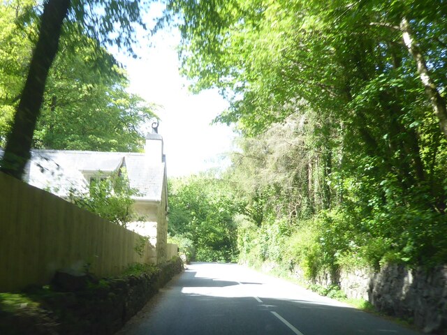
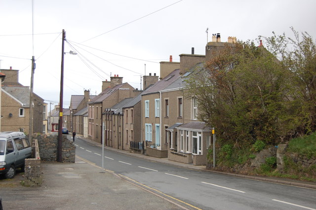
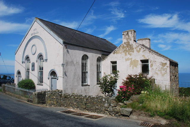
In addition to its natural and historical attractions, Mynydd Nefyn is surrounded by charming villages and towns, such as Nefyn and Pwllheli, which offer visitors a taste of traditional Welsh culture. The area is known for its warm and welcoming locals, who take pride in their heritage and are often eager to share stories and traditions with visitors.

Whether it's exploring the rugged landscape, discovering ancient burial chambers, or immersing oneself in Welsh culture, Mynydd Nefyn is a captivating destination that offers a unique blend of natural beauty and historical significance.

If you have any feedback on the listing, please let us know in the comments section below.

Mynydd Nefyn Images

Images are sourced within 2km of 52.931497/-4.5004232 or Grid Reference SH3240. Thanks to Geograph Open Source API. All images are credited.

B4354 west of Frochas
B4354 at Gorphwysfa
B4354 at Gorphwysfa
Garn Boduan This hill is the site of an Iron Age hillfort
Garn Boduan
This hill is the site of an Iron Age hillfort
Frochas farm
Frochas farm
Beach at Porth Nefyn View north-east along the coast to the conical peaks of Yr Eifl. Fine sandy beach here, reached via the lane on the right which gives way to a small car park.
Beach at Porth Nefyn
View north-east along the coast to the conical peaks of Yr Eifl. Fine sandy beach here, reached via the lane on the right which gives way to a small car park.
Canolfan Nefyn The old <a href="https://www.geograph.org.uk/photo/681878">SH3040 : Y Ganolfan. Nefyn's Community Centre</a> is now a memory, having been replaced by a larger, more up-to-date building
Canolfan Nefyn
The old SH3040 : Y Ganolfan. Nefyn's Community Centre is now a memory, having been replaced by a larger, more up-to-date building
Canolfan Nefyn Another view of <a href="https://www.geograph.org.uk/photo/2767137">SH3040 : Canolfan Nefyn</a>
Canolfan Nefyn
Another view of SH3040 : Canolfan Nefyn
B4417 at Pistyll Looking west from near the chapel.
B4417 at Pistyll
Looking west from near the chapel.
A497 entering Nefyn Taken from the car park of the Spar store.
A497 entering Nefyn
Taken from the car park of the Spar store.
View towards Penrhyn Bodeilas from Wern
New rock armour The notoriously unstable cliffs are protected here by newly-placed rock armour. This provides two functions, weighting the toe of a potential slip and reduction of wave energy and erosion. It is not obvious whether this is a private initiative or part of a more systematic scheme. See <a href="https://www.geograph.org.uk/photo/3175708">SH3040 : Fresh landslide</a> for context.
New rock armour
The notoriously unstable cliffs are protected here by newly-placed rock armour. This provides two functions, weighting the toe of a potential slip and reduction of wave energy and erosion. It is not obvious whether this is a private initiative or part of a more systematic scheme. See SH3040 : Fresh landslide for context.
Fresh landslide After a notoriously wet Summer, water-saturated ground has collapsed just a matter of days prior to this visit by the North Wales Geology Association. Bramble bushes are still fresh and green at the toe of the slip, and wave action has not carried away a significant amount of fine material, while a large boulder (<a href="https://www.geograph.org.uk/photo/3175721">SH3040 : Erratic boulder</a>) stands on end where it has come to rest.
Fresh landslide
After a notoriously wet Summer, water-saturated ground has collapsed just a matter of days prior to this visit by the North Wales Geology Association. Bramble bushes are still fresh and green at the toe of the slip, and wave action has not carried away a significant amount of fine material, while a large boulder (SH3040 : Erratic boulder) stands on end where it has come to rest.
Erratic boulder This fine erratic boulder has just fallen onto the beach as part of a landslide (<a href="https://www.geograph.org.uk/photo/3175708">SH3040 : Fresh landslide</a>). It is made of Carboniferous Limestone, and may only have travelled from Anglesey, but although it is very angular and fresh, one side has been rubbed vigorously on bedrock and flattened. This surface carries a record of its transit and abrasion in the form of dense and (mostly) parallel striations. Sadly, these features are soon lost as the limestone dissolves in the rain. A pencil gives a scale.
Erratic boulder
This fine erratic boulder has just fallen onto the beach as part of a landslide (SH3040 : Fresh landslide). It is made of Carboniferous Limestone, and may only have travelled from Anglesey, but although it is very angular and fresh, one side has been rubbed vigorously on bedrock and flattened. This surface carries a record of its transit and abrasion in the form of dense and (mostly) parallel striations. Sadly, these features are soon lost as the limestone dissolves in the rain. A pencil gives a scale.
Cemented gravels This material at the base of the cliff resembles poor-quality concrete, but is natural. Gravelly horizons within the glacial material are conduits for water. In these deposits a great deal of calcium carbonate is present in the form of limestone debris which has been ground down from bedrock of various ages within the Irish Sea Basin, which was dry during the glaciation of the area. Subsequent dissolution and re-precipitation by percolating groundwater has resulted in hardening of the gravel to a rock-like consistency. It is a curious anomaly that this area also suffers hard drinking water from local boreholes.
Cemented gravels
This material at the base of the cliff resembles poor-quality concrete, but is natural. Gravelly horizons within the glacial material are conduits for water. In these deposits a great deal of calcium carbonate is present in the form of limestone debris which has been ground down from bedrock of various ages within the Irish Sea Basin, which was dry during the glaciation of the area. Subsequent dissolution and re-precipitation by percolating groundwater has resulted in hardening of the gravel to a rock-like consistency. It is a curious anomaly that this area also suffers hard drinking water from local boreholes.
Nanhoron Arms Hotel
Nanhoron Arms Hotel
Gwylwyr Carreglefain Climbed from track to east allowed a direct ascent to the rocky outcrop. Property owner doesn't mind use of track for access and stated that plans afoot to improve walking routes around here this year.
Name: Gwylwyr Carreglefain
Hill number: 5146
Height: 261m / 856ft
Area: 30A: Anglesey and the Lleyn Peninsula
Class: Hu
Grid ref: SH 32426 41058
Summit feature: tiny cairn on rock outcrop
Drop: 129m
Col: 132m  SH317398
Gwylwyr Carreglefain
Climbed from track to east allowed a direct ascent to the rocky outcrop. Property owner doesn't mind use of track for access and stated that plans afoot to improve walking routes around here this year. Name: Gwylwyr Carreglefain Hill number: 5146 Height: 261m / 856ft Area: 30A: Anglesey and the Lleyn Peninsula Class: Hu Grid ref: SH 32426 41058 Summit feature: tiny cairn on rock outcrop Drop: 129m Col: 132m SH317398
Premier shop, Nefyn
Premier shop, Nefyn
Nefyn on a dull damp day Glorious on a summer's day but here on St David's Day it's a pretty bleak view towards the Seven Sisters.
Nefyn on a dull damp day
Glorious on a summer's day but here on St David's Day it's a pretty bleak view towards the Seven Sisters.
Show me another place!

Mynydd Nefyn is located at Grid Ref: SH3240 (Lat: 52.931497, Lng: -4.5004232)

Unitary Authority: Gwynedd

Police Authority: North Wales

What 3 Words

///skillet.kingdom.treetop. Near Nefyn, Gwynedd

Related Wikis

Garn Boduan

Garn Boduan is an Iron Age hillfort and hill near Nefyn, on the Llŷn Peninsula in Wales. In a survey in the 1950s the traces of over 170 round houses were...

Nefyn

Nefyn (Welsh pronunciation: [ˈnɛvɨn], archaically anglicised as Nevin) is both a small town and a community on the northwest coast of the Llŷn Peninsula...

Boduan

Boduan is a village in Gwynedd, Wales, about 4 miles from Pwllheli. It is in the historic county of Caernarfonshire. It was due to host the National Eisteddfod...

Buan, Gwynedd

Buan is a community in the Welsh county of Gwynedd, located on the Llŷn Peninsula. It includes the villages of Boduan and Rhydyclafdy, and has a population...

Pistyll

Pistyll is a village and community in the Welsh county of Gwynedd, located on the Llŷn Peninsula midway between Nefyn and Llanaelhaearn. The larger village...

Morfa Nefyn

Morfa Nefyn is a village on the northern coast of the Llŷn Peninsula in Gwynedd, Wales. It lies on the crossroads of the B4417 and B4412. The village has...

Ceidio

Ceidio is a former civil parish in the Welsh county of Gwynedd. It was abolished in 1934, and incorporated into Buan. == References ==

Cors Geirch National Nature Reserve

Cors Geirch National Nature Reserve is an extensive wetland site on the Llŷn Peninsula, in the central part of the valley that runs between Nefyn and Pwllheli...

Nearby Amenities

Located within 500m of 52.931497,-4.5004232
Power: pole
Lat/Long: 52.9292095/-4.5065564
Power: pole
Lat/Long: 52.928629/-4.5052046
Power: pole
Lat/Long: 52.9282361/-4.5046225
Power: pole
Lat/Long: 52.9277203/-4.5038742
Direction: 195
Generator Method: photovoltaic
Generator Output Electricity: yes
Generator Solar Modules: 9
Generator Source: solar
Generator Type: solar_photovoltaic_panel
Location: roof
Power: generator
Lat/Long: 52.9276346/-4.496946
Power: pole
Lat/Long: 52.9330606/-4.5054889
The data included in this document is from www.openstreetmap.org. The data is made available under ODbL.

Have you been to Mynydd Nefyn?

Leave your review of Mynydd Nefyn below (or comments, questions and feedback).