Glenward Hill

Hill, Mountain in Renfrewshire

Scotland

Glenward Hill

Larches above Heathfield Larches in a rather exposed location just west of Heathfield.
Larches above Heathfield Credit: Mark Nightingale

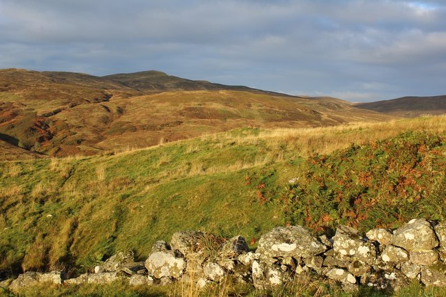
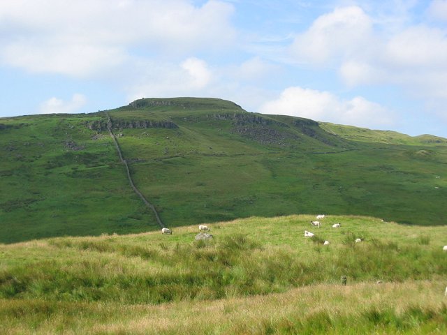
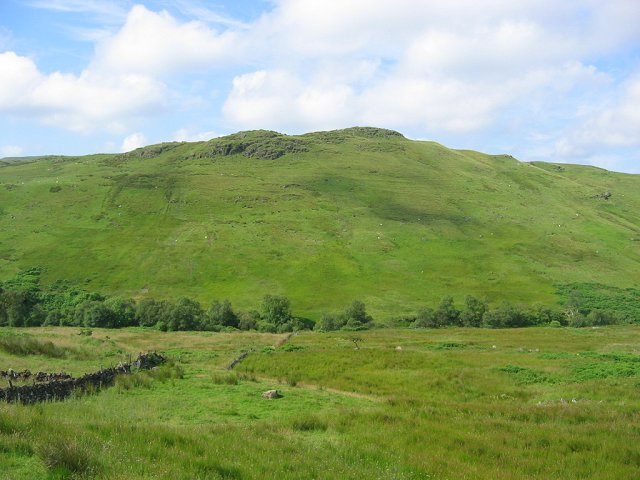
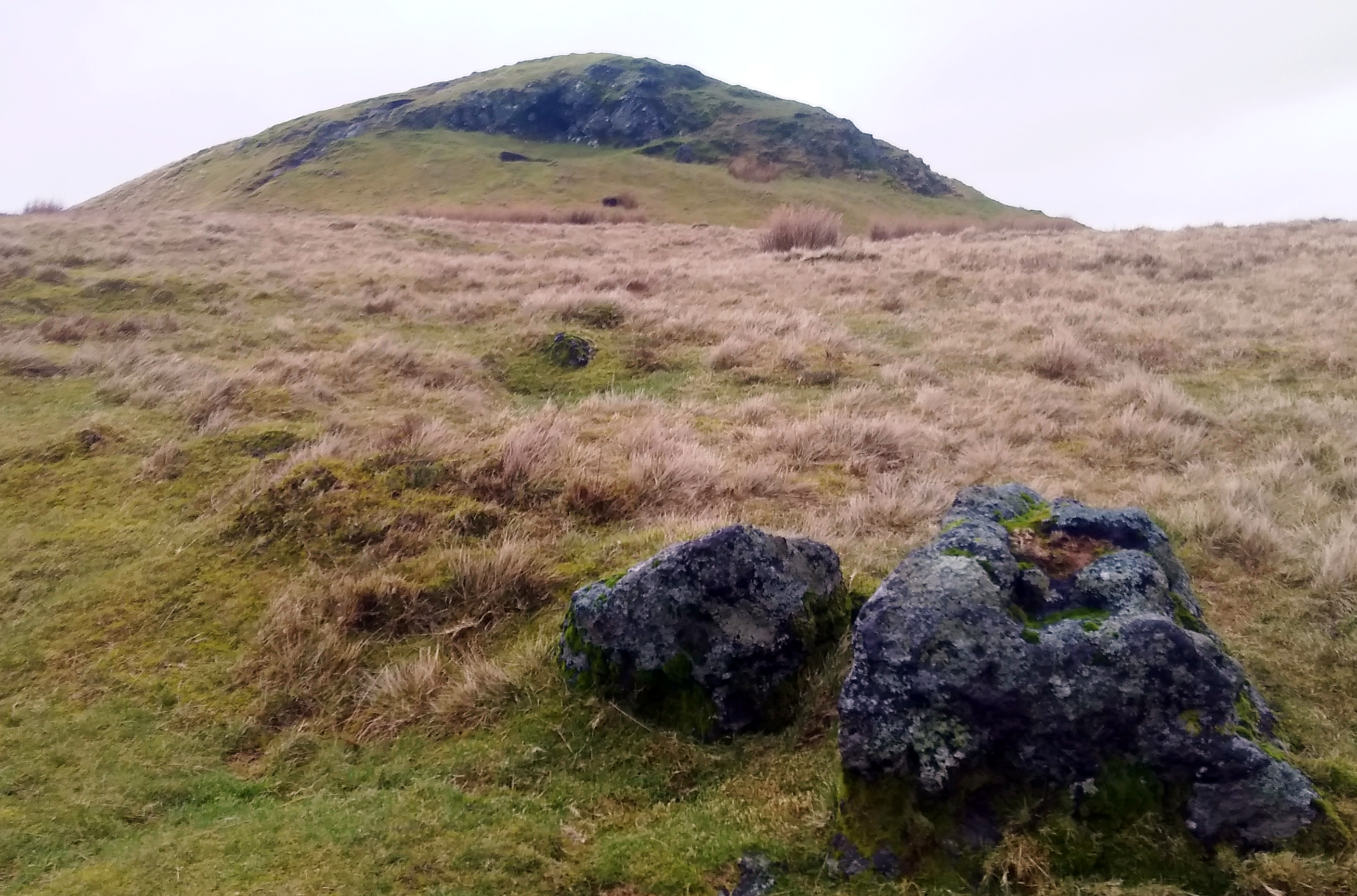
Glenward Hill is a prominent geographical feature located in Renfrewshire, Scotland. It is classified as a hill or mountain, depending on the definition used. Standing at an elevation of approximately 423 meters (1,388 feet), it offers picturesque views of the surrounding landscape.

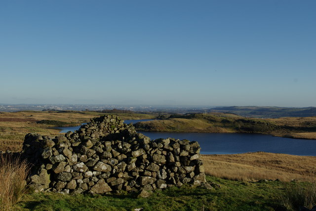
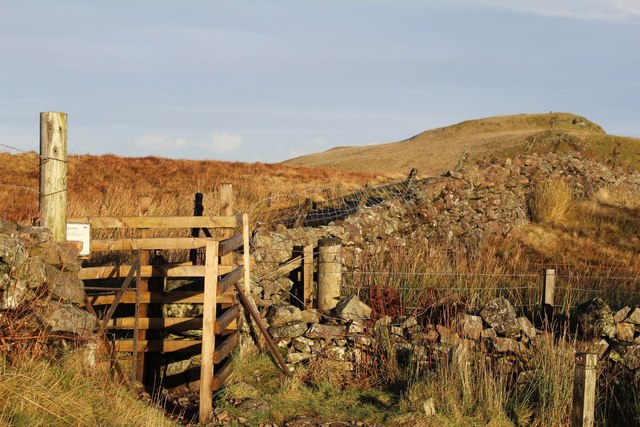
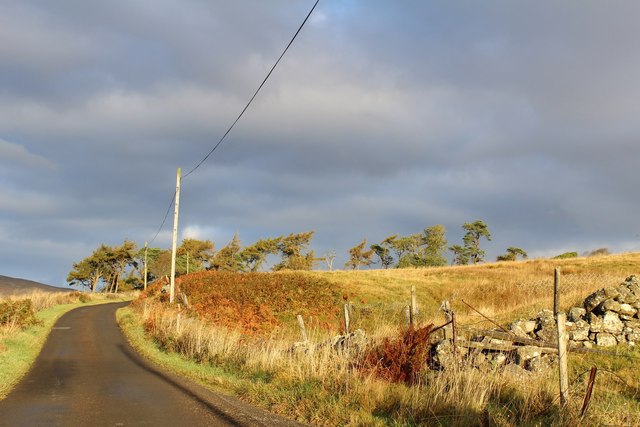
Situated in the southern part of Renfrewshire, Glenward Hill is part of the wider Clyde Muirshiel Regional Park, which covers an area of 108 square kilometers (42 square miles). The hill is characterized by its rolling slopes and rugged terrain, making it a popular destination for outdoor enthusiasts and hikers.

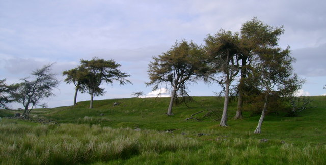
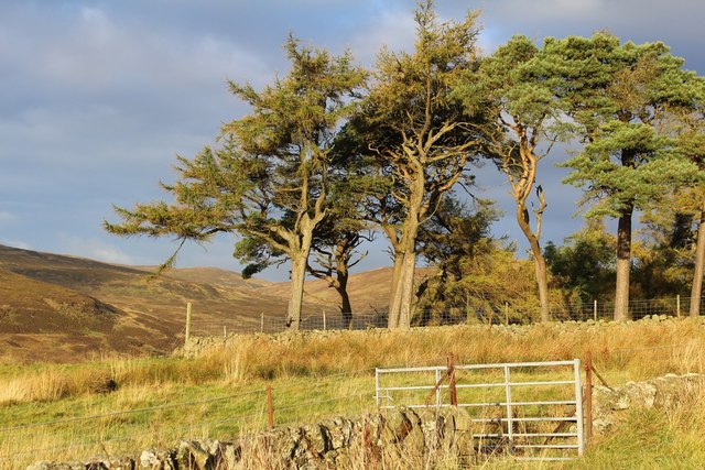
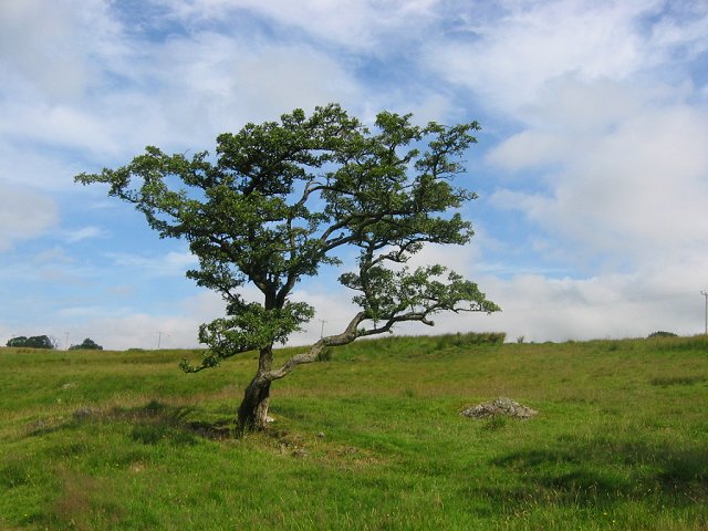
The hill is covered in a mix of vegetation, including heather, grasses, and scattered trees, adding to its natural beauty. The presence of diverse flora and fauna makes Glenward Hill an important ecological site within the region. Visitors can often spot various bird species, such as golden eagles and red kites, soaring above.

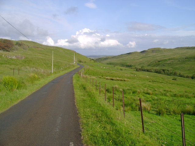
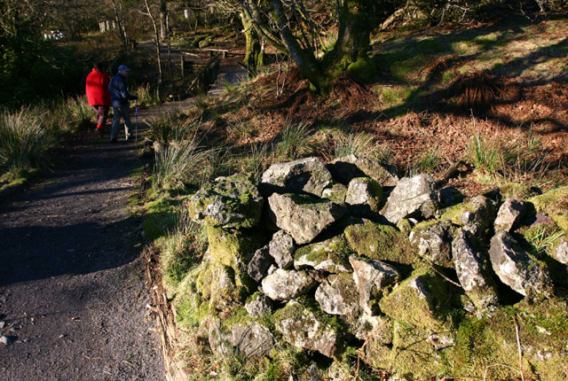
Access to Glenward Hill is facilitated by a network of well-maintained trails and paths, ensuring a safe and enjoyable experience for those venturing to the summit. The hill's location within the Clyde Muirshiel Regional Park also provides opportunities for other recreational activities, such as cycling, horseback riding, and wildlife observation.

Overall, Glenward Hill offers a stunning natural landscape, diverse flora and fauna, and a range of recreational opportunities. Whether one is seeking a challenging hike or a peaceful retreat into nature, Glenward Hill in Renfrewshire is a destination worth exploring.

If you have any feedback on the listing, please let us know in the comments section below.

Glenward Hill Images

Images are sourced within 2km of 55.818733/-4.6835243 or Grid Reference NS3161. Thanks to Geograph Open Source API. All images are credited.

Larches above Heathfield Larches in a rather exposed location just west of Heathfield.
Larches above Heathfield
Larches in a rather exposed location just west of Heathfield.
Road below Heathfield Looking along the road down the Calder Valley from below Heathfield.
Road below Heathfield
Looking along the road down the Calder Valley from below Heathfield.
Ruin west of Kaim Dam Although marked on the map as a sheepfold, the dimensions and gable would suggest it may have originally been a dwelling
Ruin west of Kaim Dam
Although marked on the map as a sheepfold, the dimensions and gable would suggest it may have originally been a dwelling
Avro Anson Remains Near Lairdside Hill A shot of the remains of the Anson.  In the distance, the Garnock valley can be noted.
Avro Anson Remains Near Lairdside Hill
A shot of the remains of the Anson. In the distance, the Garnock valley can be noted.
Armstrong Siddeley Cheetah Engine One of two Cheetahs remaining at the Anson crash site near Lairdside Hill.
Armstrong Siddeley Cheetah Engine
One of two Cheetahs remaining at the Anson crash site near Lairdside Hill.
Avro Anson Undercarriage Remains Undercarriage remains with an Armstrong Siddeley Cheetah engine visible to the right in the middle distance.
Avro Anson Undercarriage Remains
Undercarriage remains with an Armstrong Siddeley Cheetah engine visible to the right in the middle distance.
Garpel Burn and Lairdside Hill
Grave & Monument to Lord Francis Nathaniel Conyngham Born 24 September 1832. Died 14 September 1880. Member of Parliament for County Clare.
Grave & Monument to Lord Francis Nathaniel Conyngham
Born 24 September 1832. Died 14 September 1880. Member of Parliament for County Clare.
Path leading to Windy Hill
Minor road near Heathfield
View towards Misty Law
Woodland south of Heathfield
In Muirshiel Country Park
Turnave Hill Looking across the Calder to this craggy trap hill on the other side of the square.
Turnave Hill
Looking across the Calder to this craggy trap hill on the other side of the square.
Glenward Hill The line of trees marks the course of the Calder. Beyond rough grazing for sheep on volcanic rock.
Glenward Hill
The line of trees marks the course of the Calder. Beyond rough grazing for sheep on volcanic rock.
Grown out hedge. A familiar sight in Wales, replicated here in Renfrewshire. The remains of an old hawthorn hedge, now grown out and just a line of old trees. This is near the upper limits of enclosed farmland in the Calder Glen, but the farm, Heathfield is now a ruin, the land grazed from elsewhere.
Grown out hedge.
A familiar sight in Wales, replicated here in Renfrewshire. The remains of an old hawthorn hedge, now grown out and just a line of old trees. This is near the upper limits of enclosed farmland in the Calder Glen, but the farm, Heathfield is now a ruin, the land grazed from elsewhere.
Path, Muirsheil Country Park Muirsheil was the second country park to open in Scotland (1970) Rather remote on the site of an old lodge in a sporting estate. The horse chestnuts in the photo probably date to tree planting programme early in the life of the park.
A lovely place for a day out with helpful and friendly staff.
Path, Muirsheil Country Park
Muirsheil was the second country park to open in Scotland (1970) Rather remote on the site of an old lodge in a sporting estate. The horse chestnuts in the photo probably date to tree planting programme early in the life of the park. A lovely place for a day out with helpful and friendly staff.
Raith Burn Cut into the plateau in a small gorge that provides enough inaccessible places for a few trees to grow.
Raith Burn
Cut into the plateau in a small gorge that provides enough inaccessible places for a few trees to grow.
Show me another place!

Glenward Hill is located at Grid Ref: NS3161 (Lat: 55.818733, Lng: -4.6835243)

Unitary Authority: Renfrewshire

Police Authority: Renfrewshire and Inverclyde

What 3 Words

///registers.poem.barefoot. Near Lochwinnoch, Renfrewshire

Nearby Locations

Glenward Hill

Related Wikis

Windy Hill, Renfrewshire

Windy Hill is a 316 metres (1.037 feet) high hill in Renfrewshire, Scotland. It is one of the TuMPs of the Lowlands. == Geography == The hill is located...
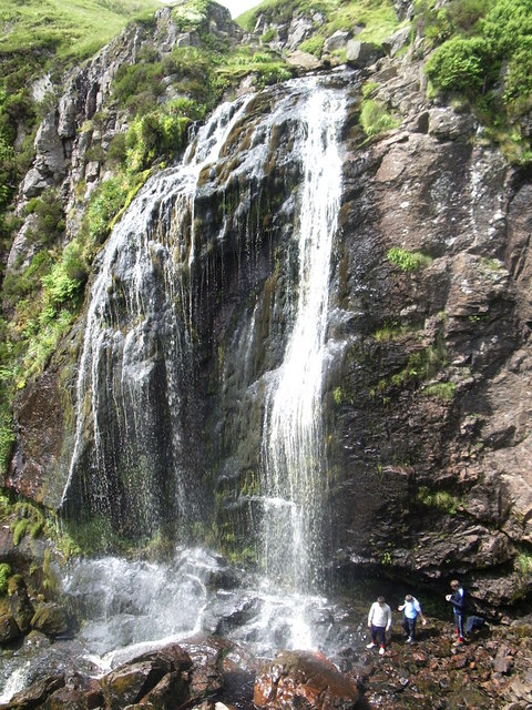
Spout of Garnock

The Spout of Garnock (or Garnock Spout) is a waterfall in Ayrshire, Scotland. At approximately 60–70 ft high, it is the county's highest waterfall. It...

Nether Mill

Nether Mill or the Nethermiln of Kilbirnie was originally the Barony of Kilbirnie corn mill and later became a meal mill as well, located in the Parish...

Barony of Ladyland

The Barony of Ladyland was in the old feudal Baillerie of Cunninghame, near Kilbirnie in what is now North Ayrshire, Scotland. == The history of the... ==

St John's Kirk, Lochwinnoch

St John's Kirk, also known as St Winnock's Church and, colloquially, Auld Simon (Old Simon), is a former church building in Lochwinnoch, Renfrewshire,...

Glengarnock Castle

Glengarnock Castle is one of the ancient ruined fortifications of Ayrshire. Its keep is located on a remote rocky promontory overlooking the River Garnock...
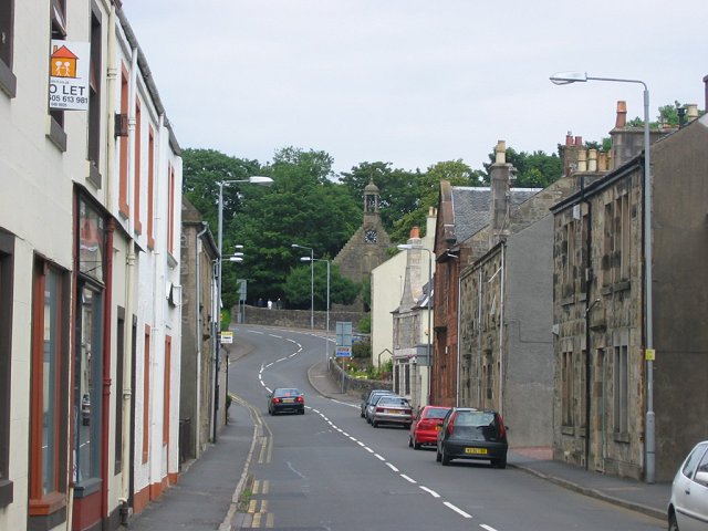
Lochwinnoch

Lochwinnoch (; Scots: Lochineuch, Scottish Gaelic: Loch Uinneach) is a village in the council area and historic county of Renfrewshire in the west central...

Lochwinnoch (loop) railway station

Lochwinnoch railway station was a railway station serving the village of Lochwinnoch, Renfrewshire, Scotland. The station was part of the Dalry and North...

Have you been to Glenward Hill?

Leave your review of Glenward Hill below (or comments, questions and feedback).