A' Chèir Ghorm

Hill, Mountain in Sutherland

Scotland

A' Chèir Ghorm

Foinaven, from the summit of Meall an Ceirileach Foinaven is just over 10km away.
Foinaven, from the summit of Meall an Ceirileach Credit: Michael Earnshaw

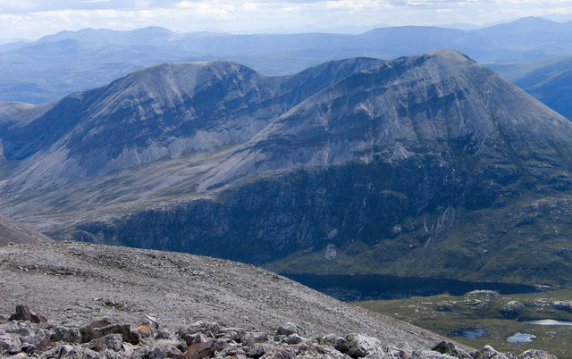
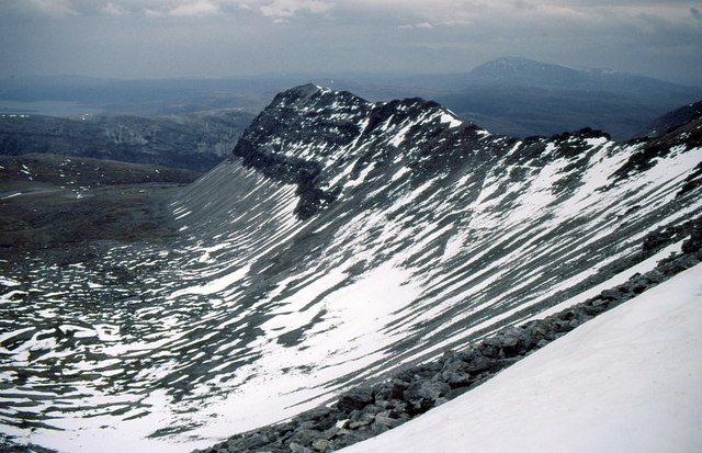
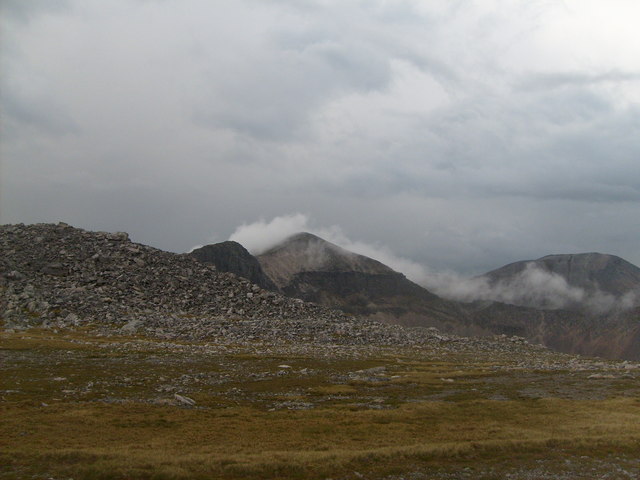
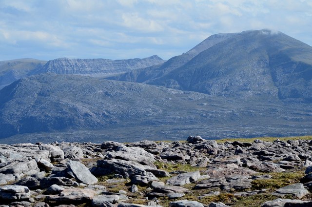
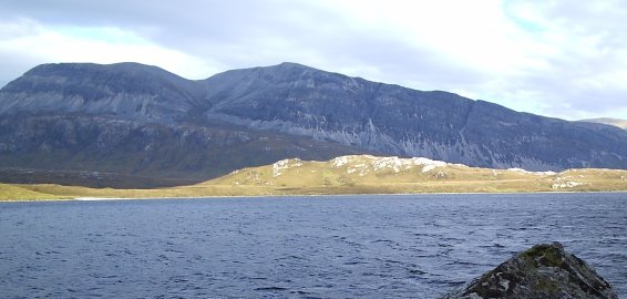
A' Chèir Ghorm is a prominent hill located in the Sutherland region of Scotland. Standing at an elevation of 891 meters (2,923 feet), it is classified as a Corbett, a term used to describe a Scottish hill between 2,500 and 3,000 feet in height. The hill is situated within the Assynt range, known for its rugged and picturesque landscapes.

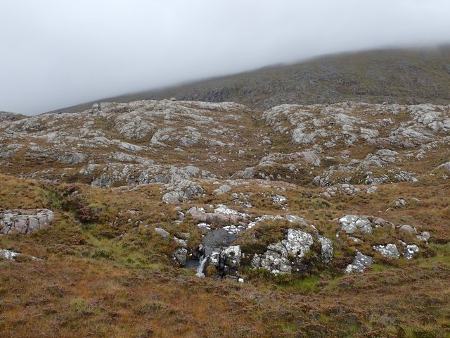
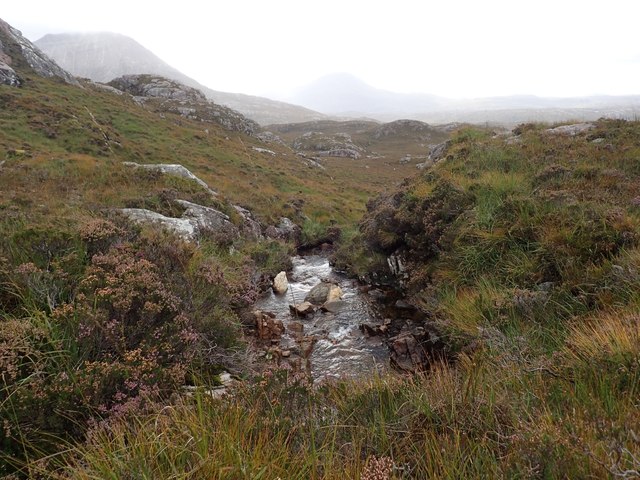
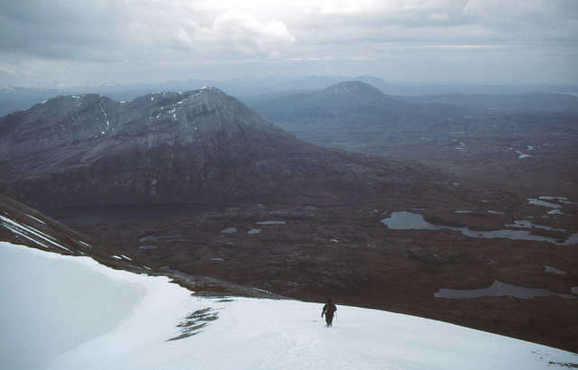
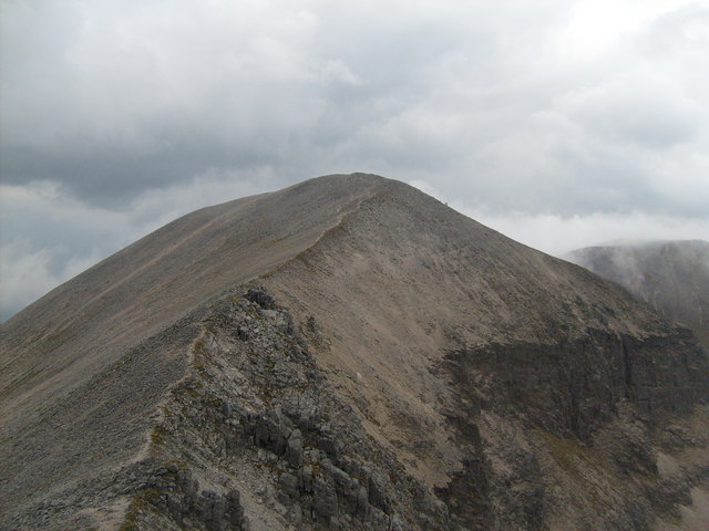
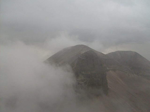
A' Chèir Ghorm is characterized by its distinctive pyramid-shaped peak, which offers breathtaking views of the surrounding countryside. It is composed primarily of Torridonian sandstone, a type of rock formed around 800 million years ago. The hill is also home to a diverse range of flora and fauna, including heather, mosses, and wildflowers, as well as various bird species such as golden eagles and peregrine falcons.

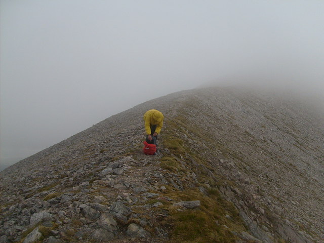
The ascent of A' Chèir Ghorm can be challenging, with steep and rocky terrain to navigate. However, the effort is rewarded by the stunning vistas from the summit, which encompass the nearby peaks of Ben More Assynt and Conival, as well as the vast expanse of Loch Assynt. The hill is a popular destination for hikers and mountaineers, who can access it via various routes, including those starting from the nearby village of Inchnadamph.

In addition to its natural beauty, A' Chèir Ghorm also holds historical significance. It is believed to have been a site of pagan rituals in ancient times, with evidence of Bronze Age settlements found in the vicinity.

Overall, A' Chèir Ghorm offers a challenging yet rewarding experience for outdoor enthusiasts, combining stunning natural scenery with a touch of ancient history.

If you have any feedback on the listing, please let us know in the comments section below.

A' Chèir Ghorm Images

Images are sourced within 2km of 58.400919/-4.8783541 or Grid Reference NC3149. Thanks to Geograph Open Source API. All images are credited.

Foinaven, from the summit of Meall an Ceirileach Foinaven is just over 10km away.
Foinaven, from the summit of Meall an Ceirileach
Foinaven is just over 10km away.
Foinaven from the southwest
Boulders on east slope of Ganu Mòr Ganu Mòr, the summit of Foinaven, rises to the right out of the image. The striking mountain face beyond is   A' Ch'eir Ghorm, another part of Foinaven.
Boulders on east slope of Ganu Mòr
Ganu Mòr, the summit of Foinaven, rises to the right out of the image. The striking mountain face beyond is A' Ch'eir Ghorm, another part of Foinaven.
Grey, bouldery slope of Ganu Mòr Ganu Mòr is the highest summit of Foinaven. Beyond the boulders and the intervening glen is Arkle.
Grey, bouldery slope of Ganu Mòr
Ganu Mòr is the highest summit of Foinaven. Beyond the boulders and the intervening glen is Arkle.
Small Waterfall on the Lower Western Slopes of Foinaven This was a very rough area, with many rocks and cliffs and grass and heather moorland in between.
Small Waterfall on the Lower Western Slopes of Foinaven
This was a very rough area, with many rocks and cliffs and grass and heather moorland in between.
Stream West of Foinaven This is the main stream feeding Loch Cul Uidh an Tuim. Arkle and Ben Stack in the mist in the distance.
Stream West of Foinaven
This is the main stream feeding Loch Cul Uidh an Tuim. Arkle and Ben Stack in the mist in the distance.
Foinaven and Arkle in Evening Light Seen from the road to Oldshoremore. The moon is rising above the left end of Foinaven.
Foinaven and Arkle in Evening Light
Seen from the road to Oldshoremore. The moon is rising above the left end of Foinaven.
North western slopes of A' Ch'eir Ghorm From the main ridge of Foinaven with Ben Hope on the horizon. Location identified by Nigel Brown through Speculative Upload.
North western slopes of A' Ch'eir Ghorm
From the main ridge of Foinaven with Ben Hope on the horizon. Location identified by Nigel Brown through Speculative Upload.
Descending into wilderness On the main Foinaven ridge south of Ganu Mòr heading for bealach before point 869. Arkle ahead with Loch na Tuadh at its foot and Ben Stack beyond.
Descending into wilderness
On the main Foinaven ridge south of Ganu Mòr heading for bealach before point 869. Arkle ahead with Loch na Tuadh at its foot and Ben Stack beyond.
Cadha na Beucaich A low point on the Foinaven ridge between points 869 and 808. Ganu Mòr is the high point on the right and A' Ch'eir Ghorm the flat topped ridge in front of it. The screes are all falling into Coire na Lurgainn.
Cadha na Beucaich
A low point on the Foinaven ridge between points 869 and 808. Ganu Mòr is the high point on the right and A' Ch'eir Ghorm the flat topped ridge in front of it. The screes are all falling into Coire na Lurgainn.
Leaving Ganu Mor 2 Heading South along the ridge
Leaving Ganu Mor 2
Heading South along the ridge
Approaching  Cadha na Beucaich The toughest part of the ridge,  we got caught in a thunderstorm accompanied by hailstones and heavy gusts of wind. So no pics of this part, staying on the ridge was more important.
Approaching Cadha na Beucaich
The toughest part of the ridge, we got caught in a thunderstorm accompanied by hailstones and heavy gusts of wind. So no pics of this part, staying on the ridge was more important.
Ridge from A' Cheir Ghorm Ganu Mor shrouded in cloud behind
Ridge from A' Cheir Ghorm
Ganu Mor shrouded in cloud behind
The Cadha na Beucaich saddle (in mist),  Ganu Mor   & A' Cheir Ghorm The thunderstorm, hailstones and heavy gusts of wind pass by as we reached the plateau at 808m. Phew!!! what a ride that was.
The Cadha na Beucaich saddle (in mist), Ganu Mor & A' Cheir Ghorm
The thunderstorm, hailstones and heavy gusts of wind pass by as we reached the plateau at 808m. Phew!!! what a ride that was.
The storm leaving Foinaven
Foinaven from Farrmheall The northern side of Foinaven, showing Ceann Garbh (R) with the distinctive long steep-sided spur of A' Ch'eir Gorm to the left.
Foinaven from Farrmheall
The northern side of Foinaven, showing Ceann Garbh (R) with the distinctive long steep-sided spur of A' Ch'eir Gorm to the left.
Stony descent to An t-Sàil Mhòr
Screes of Cadha na Beucaich
Show me another place!

A' Chèir Ghorm is located at Grid Ref: NC3149 (Lat: 58.400919, Lng: -4.8783541)

Unitary Authority: Highland

Police Authority: Highlands and Islands

What 3 Words

///handyman.events.quoted. Near Oldshoremore, Highland

Nearby Locations

A' Chèir Ghorm

Related Wikis

Foinaven

Foinaven (Scottish Gaelic: Foinne Bheinn) is a mountain in Scotland, situated in the far northwest corner of the Scottish Highlands. Like many of the monolithic...

Loch Dionard

Loch Dionard is a medium-sized loch in the Durness Parish, in Sutherland, Highland Council Area, Northern Scotland. It is in the North-Western Highlands...

North West Sutherland National Scenic Area

North West Sutherland is a national scenic area (NSA) covering the mountains and coastal scenery of the northwestern part of the county of Sutherland...

Arkle (Sutherland)

Arkle (Scottish Gaelic: Airceil) is a mountain in Sutherland, in the far north-west corner of the Scottish Highlands. Like its sister Foinaven, the mountain...

Nearby Amenities

Located within 500m of 58.400919,-4.8783541
Ele: 865
Natural: peak
Source: OS7
Lat/Long: 58.4009227/-4.8785044
The data included in this document is from www.openstreetmap.org. The data is made available under ODbL.

Have you been to A' Chèir Ghorm?

Leave your review of A' Chèir Ghorm below (or comments, questions and feedback).