Brockly Hill

Hill, Mountain in Ayrshire

Scotland

Brockly Hill

Tower Crane, Kilbirnie Situated in the W.& J. Knox Ltd. yard. Used for handling fishing nets that are manufactured and repaired here.
Tower Crane, Kilbirnie Credit: wfmillar

Brockly Hill is a prominent geographical feature located in Ayrshire, Scotland. It is classified as a hill rather than a mountain, standing at an elevation of approximately 150 meters (492 feet) above sea level. This hill is situated about 5 kilometers (3 miles) northwest of the town of Stewarton.

Brockly Hill is characterized by its gently sloping terrain, covered in lush green vegetation and scattered with a variety of trees and shrubs. The hill offers breathtaking panoramic views of the surrounding countryside, with glimpses of neighboring hills and valleys in the distance. On clear days, it is said that one can even catch a glimpse of the Ayrshire coast.

The hill is a favorite destination for nature enthusiasts and hikers, who enjoy exploring its gentle slopes and taking in the peaceful ambiance. Several walking trails traverse the area, providing opportunities for outdoor activities such as walking, jogging, and picnicking. The relatively low elevation makes it accessible to people of various fitness levels and ages.

Brockly Hill is also known for its historical significance. It is believed to have been a site of human activity dating back thousands of years, with evidence of ancient settlements found in the surrounding area. The hill has witnessed the passage of time and continues to be a place of tranquility and natural beauty in the heart of Ayrshire.

If you have any feedback on the listing, please let us know in the comments section below.
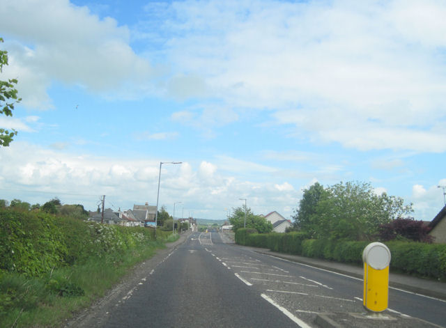
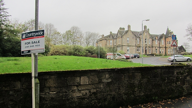
Brockly Hill Images

Images are sourced within 2km of 55.769839/-4.6919455 or Grid Reference NS3156. Thanks to Geograph Open Source API. All images are credited.

Tower Crane, Kilbirnie Situated in the W.& J. Knox Ltd. yard. Used for handling fishing nets that are manufactured and repaired here.
Tower Crane, Kilbirnie
Situated in the W.& J. Knox Ltd. yard. Used for handling fishing nets that are manufactured and repaired here.
Entering Kilbirnie on the Largs road From the west on the A760
Entering Kilbirnie on the Largs road
From the west on the A760
Masonic temple Home of Lodge Royal Blues No. 399.
Masonic temple
Home of Lodge Royal Blues No. 399.
Dipple Road Looking north up tree lined Dipple Road.
Dipple Road
Looking north up tree lined Dipple Road.
Windburned trees Trees suffering from windburn after an unusual May storm, creating a misleadingly autumnal scene.
Windburned trees
Trees suffering from windburn after an unusual May storm, creating a misleadingly autumnal scene.
Fields, High Glengarth Wet today after months of rainfall. The land is grazed by cattle.
Fields, High Glengarth
Wet today after months of rainfall. The land is grazed by cattle.
High Glengarth A gap in a grown out hedge, raining as usual.
High Glengarth
A gap in a grown out hedge, raining as usual.
Grass in Glengarnock Grazing for cattle, an electricity pole awaits erection.
Grass in Glengarnock
Grazing for cattle, an electricity pole awaits erection.
Redheugh The large building looks like a residential home and is not the property for sale. The sale board refrers to a terraced house at £139,995 fixed price.
Redheugh
The large building looks like a residential home and is not the property for sale. The sale board refrers to a terraced house at £139,995 fixed price.
Dipple Road Leaving Kilbirnie for an area of scattered livestock farms.
Dipple Road
Leaving Kilbirnie for an area of scattered livestock farms.
Knox's Mill The mill buildings seen from the Tesco car park.
Knox's Mill
The mill buildings seen from the Tesco car park.
Sunset Trees Near Nervelstone Farm.
Sunset Trees
Near Nervelstone Farm.
Maich Water, near Langstilly Farm Langstilly Farm in the distance.
Maich Water, near Langstilly Farm
Langstilly Farm in the distance.
Nervelstone Farm Rough grazing here.
Nervelstone Farm
Rough grazing here.
Mossy Tree Unnamed Burn flowing towards Maigh Water through wooded glen.
Mossy Tree
Unnamed Burn flowing towards Maigh Water through wooded glen.
Tree Decay Surprised to see this tree still standing after the recent gales.
Tree Decay
Surprised to see this tree still standing after the recent gales.
Woods near Nervelstone Evening sun lights the wood.
Woods near Nervelstone
Evening sun lights the wood.
Trees near Nervelstone Mainly Beech trees.
Trees near Nervelstone
Mainly Beech trees.
Show me another place!

Brockly Hill is located at Grid Ref: NS3156 (Lat: 55.769839, Lng: -4.6919455)

Unitary Authority: North Ayrshire

Police Authority: Ayrshire

What 3 Words

///thighs.ferrying.expansion. Near Kilbirnie, North Ayrshire

Nearby Locations

Brockly Hill

Related Wikis

Glengarnock Castle

Glengarnock Castle is one of the ancient ruined fortifications of Ayrshire. Its keep is located on a remote rocky promontory overlooking the River Garnock...

Kilbirnie South railway station

Kilbirnie South railway station was a railway station serving the town of Kilbirnie, North Ayrshire, Scotland as part of the Lanarkshire and Ayrshire Railway...

Kilbirnie

Kilbirnie (Scottish Gaelic: Cill Bhraonaigh) is a small town of 7,280 (as of 2001) inhabitants situated in the Garnock Valley area of North Ayrshire, on...

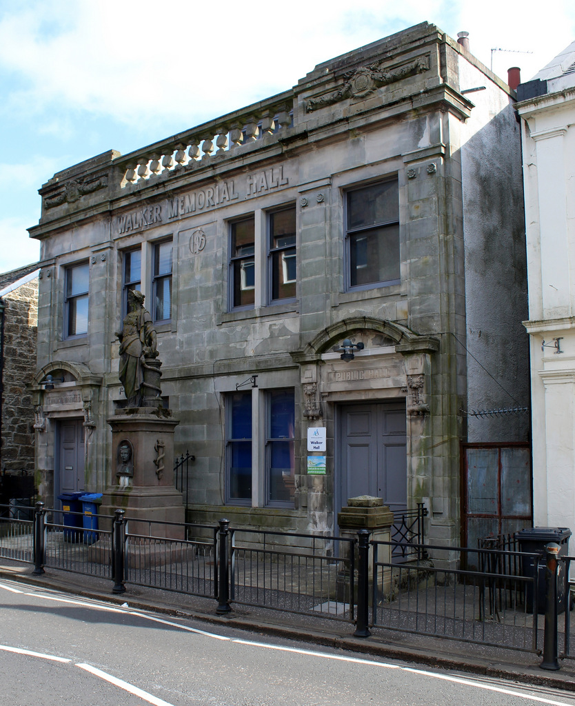
Walker Memorial Hall, Kilbirnie

The Walker Memorial Hall is a municipal building in Main Street, Kilbirnie, North Ayrshire, Scotland. The structure is currently used as the offices for...

Nearby Amenities

Located within 500m of 55.769839,-4.6919455
Power: tower
Source: Bing
Lat/Long: 55.7659469/-4.6901197
Power: tower
Source: Bing
Lat/Long: 55.7682441/-4.6852238
Power: pole
Lat/Long: 55.7695725/-4.6993958
Power: pole
Lat/Long: 55.7695174/-4.6957898
Power: pole
Lat/Long: 55.769296/-4.6970751
Power: pole
Lat/Long: 55.770592/-4.6995479
Power: pole
Lat/Long: 55.7709681/-4.6988354
Power: pole
Lat/Long: 55.7714615/-4.6978938
Power: pole
Lat/Long: 55.7719853/-4.696921
Power: pole
Lat/Long: 55.772454/-4.6963085
Power: pole
Lat/Long: 55.7729332/-4.6956856
Power: pole
Lat/Long: 55.773573/-4.6948461
Power: pole
Lat/Long: 55.7730351/-4.6974001
Power: pole
Lat/Long: 55.7725161/-4.6971772
Power: pole
Lat/Long: 55.7711123/-4.6965168
Power: pole
Lat/Long: 55.7709283/-4.6964377
Power: pole
Lat/Long: 55.7700823/-4.6960627
Power: pole
Lat/Long: 55.7688026/-4.695494
Power: pole
Lat/Long: 55.7680573/-4.6951857
Power: pole
Lat/Long: 55.7674221/-4.6949211
Power: pole
Lat/Long: 55.766692/-4.6946191
Power: pole
Lat/Long: 55.766031/-4.6943545
Power: pole
Lat/Long: 55.7672475/-4.6856759
Power: pole
Lat/Long: 55.7670119/-4.6871841
Power: pole
Lat/Long: 55.7668022/-4.6885945
Power: pole
Lat/Long: 55.7665877/-4.6899714
Power: pole
Lat/Long: 55.7663768/-4.6912964
Power: pole
Lat/Long: 55.7658025/-4.6920963
Power: pole
Lat/Long: 55.7735273/-4.6944232
Power: pole
Lat/Long: 55.7734605/-4.6937066
Power: pole
Lat/Long: 55.7733878/-4.6929192
The data included in this document is from www.openstreetmap.org. The data is made available under ODbL.

Have you been to Brockly Hill?

Leave your review of Brockly Hill below (or comments, questions and feedback).