Auld Hill
Hill, Mountain in Wigtownshire
Scotland
Auld Hill

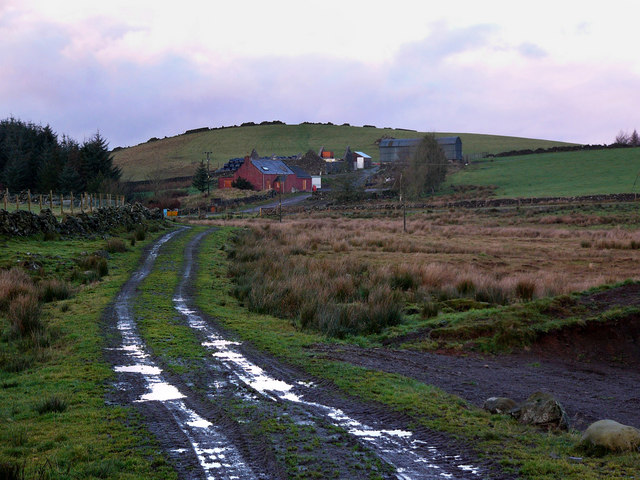
Auld Hill is a prominent landmark located in Wigtownshire, a region in southwest Scotland. Standing at an elevation of approximately 373 meters (1,224 feet), it is classified as a hill rather than a mountain. Auld Hill is situated near the small village of Auchenmalg, just south of the larger town of Glenluce.
The hill is characterized by its distinctive conical shape, which is a result of its volcanic origin. Composed primarily of basalt, Auld Hill was formed millions of years ago during volcanic activity in the region. Over time, erosion and weathering have shaped the hill's slopes, creating a picturesque landscape.
Auld Hill offers stunning panoramic views of the surrounding countryside, including the rolling fields of Wigtownshire and the nearby coastline. On clear days, visitors can even catch a glimpse of the Irish Sea in the distance. The hill is a popular destination for hikers and nature enthusiasts, who can enjoy the peaceful and serene atmosphere while exploring its trails.
The area surrounding Auld Hill is also rich in biodiversity. The hill is home to a variety of plant and animal species, including heather, gorse, and various birds of prey. The diverse flora and fauna make Auld Hill an important site for conservation efforts in the region.
Overall, Auld Hill is a natural treasure in Wigtownshire, offering visitors the opportunity to connect with nature and enjoy breathtaking views of the Scottish countryside.
If you have any feedback on the listing, please let us know in the comments section below.
Auld Hill Images
Images are sourced within 2km of 54.958691/-4.6389065 or Grid Reference NX3165. Thanks to Geograph Open Source API. All images are credited.


Auld Hill is located at Grid Ref: NX3165 (Lat: 54.958691, Lng: -4.6389065)
Unitary Authority: Dumfries and Galloway
Police Authority: Dumfries and Galloway
What 3 Words
///forecast.unfilled.decency. Near Newton Stewart, Dumfries & Galloway
Nearby Locations
Related Wikis

Kirkcowan railway station
Kirkcowan railway station served the village of Kirkcowan, Dumfries and Galloway, Scotland from 1861 to 1965 on the Portpatrick and Wigtownshire Joint...

Kirkcowan
Kirkcowan is an area about 15 miles in length, and from nearly two to nearly seven miles in breadth, comprising 30,580 acres, of which 7000 are arable...

Tarf Water, Wigtownshire
The Tarf Water is a river in the former county of Wigtownshire in south-west Scotland. It rises on the Ayrshire border (55.0048°N 4.7815°W / 55.0048;...

Barhapple Loch
Barhapple Loch is a small semicircular freshwater loch located in Wigtownshire, Dumfries and Galloway in Scotland. Barhapple Loch is principally known...
Wood of Cree
Wood of Cree is a nature reserve in Dumfries and Galloway, Scotland. Located approximately 4 miles (6.4 km) north north-west of Newton Stewart, it is managed...

Newton Stewart F.C.
Newton Stewart Football Club are a football club from the town of Newton Stewart in the Dumfries and Galloway area of Scotland. Formed in 1880, as Newton...

Newton Stewart
Newton Stewart (Gd: Baile Ùr nan Stiùbhartach) is a former burgh town in the historical county of Wigtownshire in Dumfries and Galloway, southwest Scotland...

Newton Stewart Hospital
Newton Stewart Hospital is a health facility in Newton Stewart, Dumfries and Galloway, Scotland. It is managed by NHS Dumfries and Galloway. == History... ==
Nearby Amenities
Located within 500m of 54.958691,-4.6389065Have you been to Auld Hill?
Leave your review of Auld Hill below (or comments, questions and feedback).