Hardridge Hill

Hill, Mountain in Renfrewshire

Scotland

Hardridge Hill

North side of Knock More High rise flats in Clydebank can be spotted in the distance.
North side of Knock More Credit: wfmillar

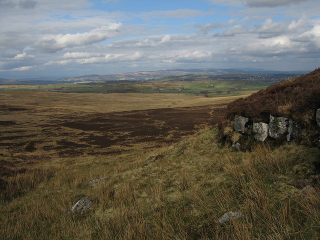
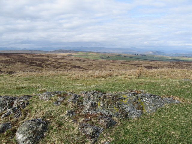
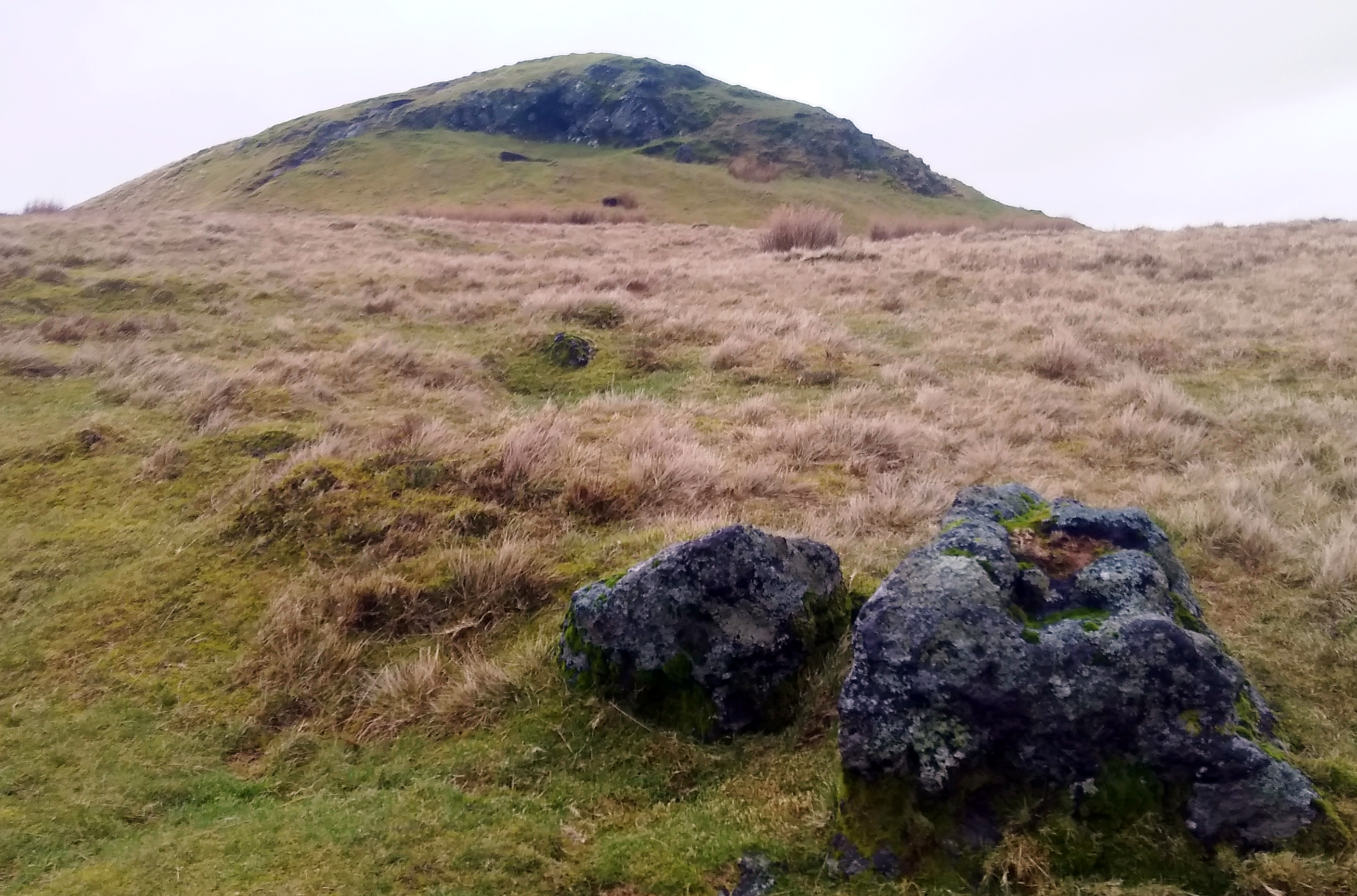
Hardridge Hill is a prominent geographic feature located in Renfrewshire, Scotland. Rising to an elevation of approximately 230 meters (750 feet), it is commonly referred to as a hill rather than a mountain due to its relatively moderate height. The hill is situated in the southwestern part of Renfrewshire, close to the town of Kilbarchan.

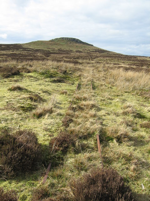
Hardridge Hill is known for its distinctive shape, characterized by a gently sloping profile and a wide, rounded summit. The hill is composed mainly of sedimentary rocks, including sandstone and shale, which have been shaped by millions of years of geological processes.

The hill is covered in a mixture of grasses, heather, and scattered shrubs, providing habitat for a variety of wildlife. Several species of birds, such as pheasants and red grouse, can be observed in the area, along with small mammals like rabbits and hares.

Due to its relatively accessible location, Hardridge Hill attracts outdoor enthusiasts and hikers who enjoy exploring its scenic trails. The summit offers panoramic views of the surrounding countryside, including the Kilpatrick Hills to the west and the Clyde Estuary to the south. On a clear day, it is even possible to catch a glimpse of the distant peaks of the Scottish Highlands.

Overall, Hardridge Hill provides a picturesque and tranquil setting for nature lovers and offers a moderate hiking challenge for those seeking outdoor adventure in Renfrewshire.

If you have any feedback on the listing, please let us know in the comments section below.

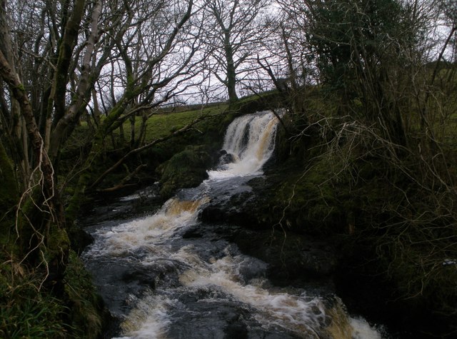
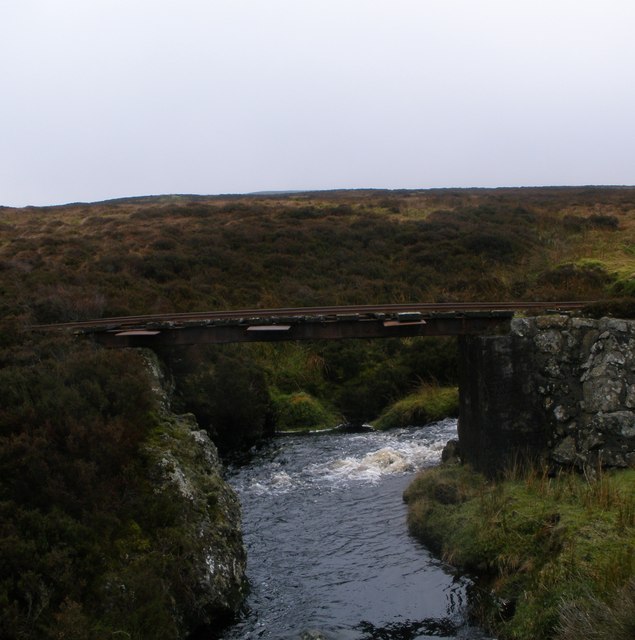
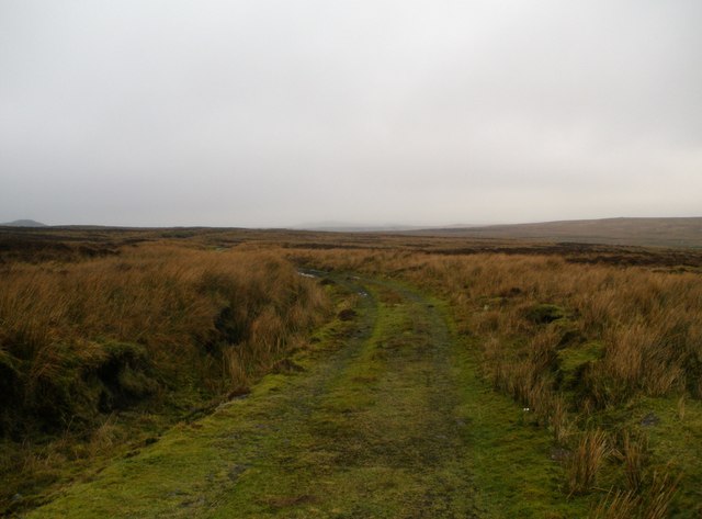
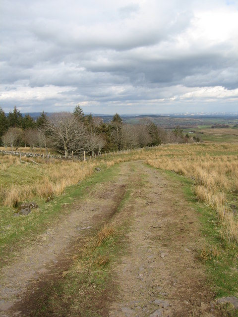
Hardridge Hill Images

Images are sourced within 2km of 55.874752/-4.7080146 or Grid Reference NS3067. Thanks to Geograph Open Source API. All images are credited.

North side of Knock More High rise flats in Clydebank can be spotted in the distance.
North side of Knock More
High rise flats in Clydebank can be spotted in the distance.
View from Knock Hill, Duchal Moor The farm in the distance is Hillside.
View from Knock Hill, Duchal Moor
The farm in the distance is Hillside.
Knock More Hill
Knock More Hill
Remains on Dunnairbuck Hill
Farm Track Farm Track under snow with gate in the near background on Duchal Moor. 4th April 2010 1.50pm.
Farm Track
Farm Track under snow with gate in the near background on Duchal Moor. 4th April 2010 1.50pm.
Kilmacolm Lower Reservoir
Waterfall on Blacketty Water
Disused narrow gauge railway bridge over Blacketty Water Narrow gauge railway used to carry grouse shooters on to Duchal Moor
Disused narrow gauge railway bridge over Blacketty Water
Narrow gauge railway used to carry grouse shooters on to Duchal Moor
Landrover track on Duchal Moor
Hill Track A rarely used track which runs west from Dippany. Cairncurran Hill is in the background.
Hill Track
A rarely used track which runs west from Dippany. Cairncurran Hill is in the background.
Ruin on the road to Dippany Well established trees suggest that this has been a ruin for a long time.
Ruin on the road to Dippany
Well established trees suggest that this has been a ruin for a long time.
Old Farm Machinery Close to the track west of Dippany. I don't know what it is , but it was made by Wm. Dickie of East Kilbride, Glasgow.
Old Farm Machinery
Close to the track west of Dippany. I don't know what it is , but it was made by Wm. Dickie of East Kilbride, Glasgow.
Kilmacolm High Dam Craig Minnan is the hill dead centre.
Kilmacolm High Dam
Craig Minnan is the hill dead centre.
Plantation Track near High Kilmacolm Dam looking towards Glasgow.
Plantation
Track near High Kilmacolm Dam looking towards Glasgow.
Primroses and daffodils Track to Hardridge Cottage.
Primroses and daffodils
Track to Hardridge Cottage.
Points Old narrow gauge railway line on Duchal Moor. This was used in a bygone age for transporting people to shoot on the moor for grouse. This is the old train shed now used for farm storage. The extensive railway can still be found over the moor.
Points
Old narrow gauge railway line on Duchal Moor. This was used in a bygone age for transporting people to shoot on the moor for grouse. This is the old train shed now used for farm storage. The extensive railway can still be found over the moor.
Duchal Moor Narrow Gauge Railway
Duchal Moor Narrow Gauge Railway Handy for crossing boggy bits.
Duchal Moor Narrow Gauge Railway
Handy for crossing boggy bits.
Show me another place!

Hardridge Hill is located at Grid Ref: NS3067 (Lat: 55.874752, Lng: -4.7080146)

Unitary Authority: Inverclyde

Police Authority: Renfrewshire and Inverclyde

What 3 Words

///durations.pulled.keep. Near Kilmacolm, Inverclyde

Nearby Locations

Hardridge Hill

Related Wikis

Inverclyde

Inverclyde (Scots: Inerclyde, Scottish Gaelic: Inbhir Chluaidh, pronounced [iɲiɾʲˈxl̪ˠuəj], "mouth of the Clyde") is one of 32 council areas used for local...

Inverclyde (UK Parliament constituency)

Inverclyde is a parliamentary constituency of the House of Commons of the Parliament of the United Kingdom. It replaced Greenock and Inverclyde and the...

Windy Hill, Renfrewshire

Windy Hill is a 316 metres (1.037 feet) high hill in Renfrewshire, Scotland. It is one of the TuMPs of the Lowlands. == Geography == The hill is located...

Gryffe Reservoirs

The Gryffe Reservoirs, also spelled 'Gryfe', take their name from the River Gryffe, name deriving from the Gaelic garbh meaning "rough stream". are two...

Nearby Amenities

Located within 500m of 55.874752,-4.7080146
The data included in this document is from www.openstreetmap.org. The data is made available under ODbL.

Have you been to Hardridge Hill?

Leave your review of Hardridge Hill below (or comments, questions and feedback).