Carneddol

Hill, Mountain in Caernarfonshire

Wales

Carneddol

Saethon Bach Cottage north of Mynytho
Saethon Bach Credit: Eirian Evans

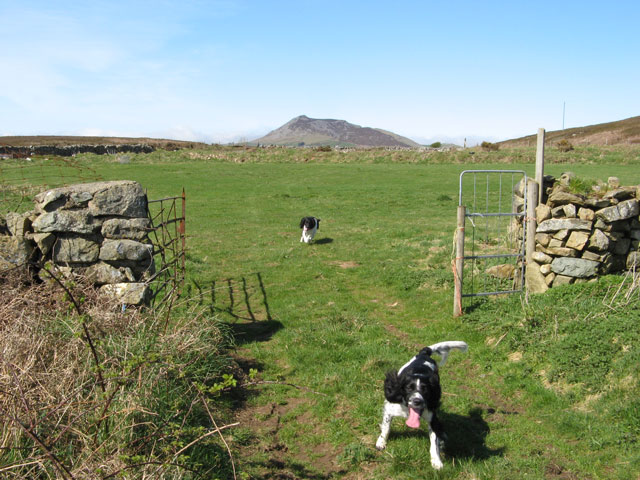
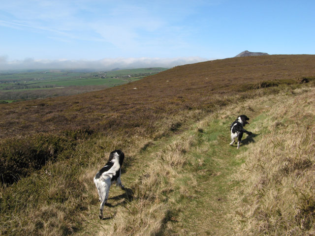
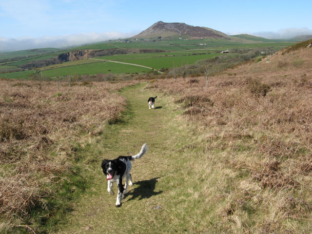
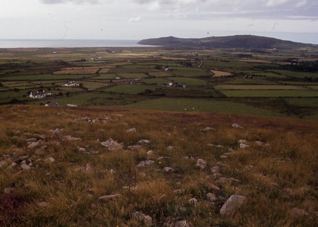
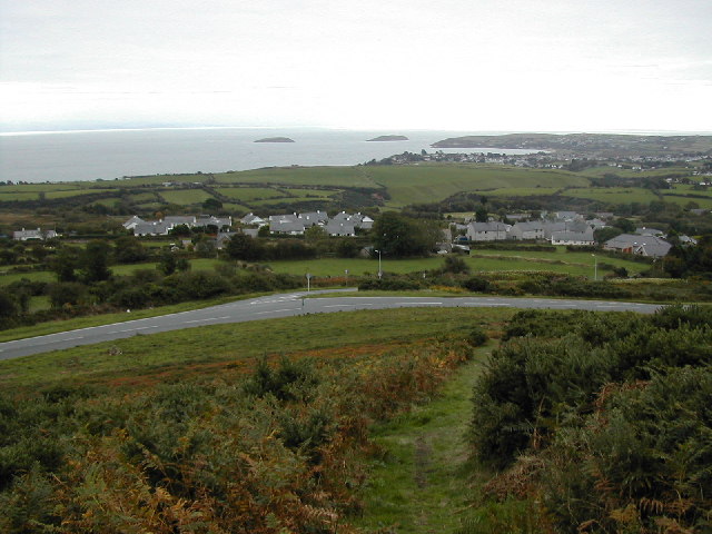
Carneddol is a prominent hill located in the county of Caernarfonshire, Wales. It is part of the larger Carneddau mountain range within Snowdonia National Park. Standing at an elevation of approximately 1,535 feet (468 meters), Carneddol offers breathtaking panoramic views of the surrounding landscape.

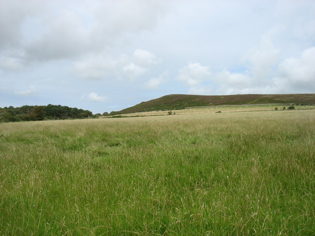
The hill is characterized by its rugged and rocky terrain, with steep slopes and a distinct peak. Its location within Snowdonia National Park provides ample opportunities for outdoor enthusiasts, including hikers and mountaineers, to explore the natural beauty of the area. The hill is often included in various hiking routes and trails, offering a challenging yet rewarding experience for those seeking adventure.

Carneddol is blessed with an abundance of flora and fauna, showcasing the diverse ecosystem of the region. The hillside is adorned with heather, grasses, and wildflowers, creating a colorful tapestry during the warmer months. Wildlife such as red grouse, mountain goats, and birds of prey can often be spotted in the area.

The hill holds historical and cultural significance as well. It is believed that Carneddol was once a Bronze Age burial site, with ancient cairns and burial mounds still visible today. The surrounding area is also dotted with remnants of old settlements and farms, providing a glimpse into the region's rich history.

Overall, Carneddol is a captivating and majestic hill in Caernarfonshire, offering a blend of natural beauty, outdoor adventure, and historical intrigue for visitors to explore and appreciate.

If you have any feedback on the listing, please let us know in the comments section below.
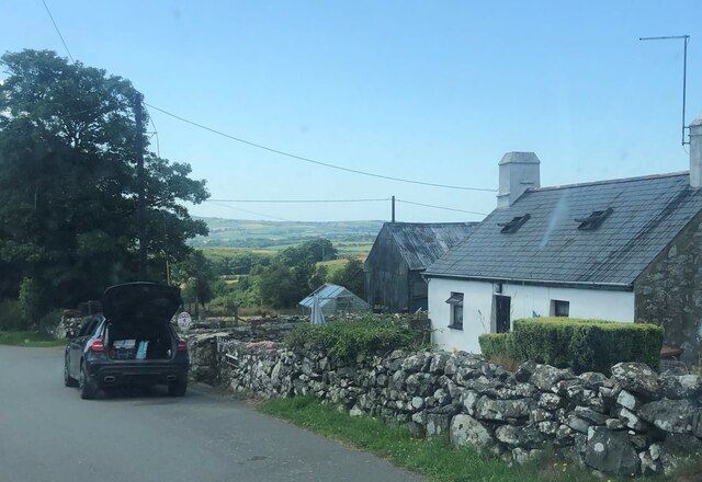
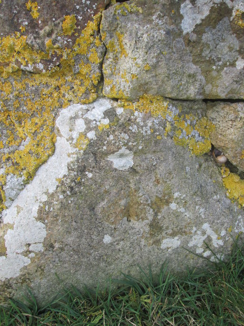
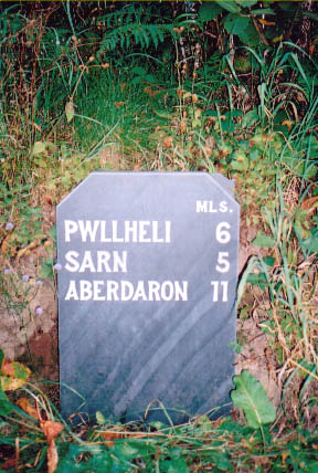
Carneddol Images

Images are sourced within 2km of 52.868424/-4.525322 or Grid Reference SH3033. Thanks to Geograph Open Source API. All images are credited.

Saethon Bach Cottage north of Mynytho
Saethon Bach
Cottage north of Mynytho
Fields below Mynytho Common
Ordnance Survey Cut Mark This OS cut mark can be found at the road junction on the NE facing wall. It marks a point 156.101m above mean sea level.
Ordnance Survey Cut Mark
This OS cut mark can be found at the road junction on the NE facing wall. It marks a point 156.101m above mean sea level.
Modern Milestone by the B4415, Nant Saethon Stone post by the B4415, in parish of Llanengan (Gwynedd District), Nant Saethon, East side of road, North of Inkerman Bridge and West of Carn Saethon hillfort. Modern replica of a Caernarvon chamfered milestone.

Inscription reads:-
.......MLS.
PWLLHELI 6
SARN 5
ABERDARON 11

To be surveyed

Milestone Society National ID: CAE_PWAD06
Modern Milestone by the B4415, Nant Saethon
Stone post by the B4415, in parish of Llanengan (Gwynedd District), Nant Saethon, East side of road, North of Inkerman Bridge and West of Carn Saethon hillfort. Modern replica of a Caernarvon chamfered milestone. Inscription reads:- .......MLS. PWLLHELI 6 SARN 5 ABERDARON 11 To be surveyed Milestone Society National ID: CAE_PWAD06
Neuadd Mynytho Village Hall
Bales of hay near Mynytho On the horizon is the ruined windmill atop Foel Fawr
Bales of hay near Mynytho
On the horizon is the ruined windmill atop Foel Fawr
B4413 in Mynytho
B4413 in Mynytho
Fields on the common Not marked on the map at 1:50,000 are these fields which make an enclosure within the common, and in need of investigation as they were unoccupied at the time of our visit. The peak of Carn Fadryn <a href="https://www.geograph.org.uk/gridref/SH2735">SH2735</a> looms over the local horizon.
Fields on the common
Not marked on the map at 1:50,000 are these fields which make an enclosure within the common, and in need of investigation as they were unoccupied at the time of our visit. The peak of Carn Fadryn SH2735 looms over the local horizon.
Track and heath Informal tracks encircle the enclosure in the northern common. The low vegetation comprises heath and gorse, both very dead-looking at this time of year. In the distance can be seen the ever-present summit of Carn Fadryn and the northern coastal hills which are covered in a sea fog.
Track and heath
Informal tracks encircle the enclosure in the northern common. The low vegetation comprises heath and gorse, both very dead-looking at this time of year. In the distance can be seen the ever-present summit of Carn Fadryn and the northern coastal hills which are covered in a sea fog.
Footpath and Carn Fadryn A footpath runs in a northwesterly direction over the common, leading down to the unclassified road in the valley. It appears as if another track leads to Nanhoron Quarry <a href="https://www.geograph.org.uk/photo/1857842">SH2832 : Nanhoron Quarry</a> but this is an illusion since another, deep valley intervenes. In the distance the summit of Carn Fadryn looms <a href="https://www.geograph.org.uk/gridref/SH2735">SH2735</a>.
Footpath and Carn Fadryn
A footpath runs in a northwesterly direction over the common, leading down to the unclassified road in the valley. It appears as if another track leads to Nanhoron Quarry SH2832 : Nanhoron Quarry but this is an illusion since another, deep valley intervenes. In the distance the summit of Carn Fadryn looms SH2735.
Mynytho Common
Mynytho Common
Access road for Caerau Uchaf The quite lengthy access road to the farm at Caerau Uchaf leaves a minor road from which the image was recorded. The cloud-shadowed hill in the distance is Moel Caerau.
Access road for Caerau Uchaf
The quite lengthy access road to the farm at Caerau Uchaf leaves a minor road from which the image was recorded. The cloud-shadowed hill in the distance is Moel Caerau.
Field at Penbodlas Penbodlas is a small settlement to the south of two hills of the Lleyn Peninsula; those hills are seen in the image: Carn Fadryn and Garn Bach.
Field at Penbodlas
Penbodlas is a small settlement to the south of two hills of the Lleyn Peninsula; those hills are seen in the image: Carn Fadryn and Garn Bach.
Mynytho Common Parked on the minor road to the east, up the track then used footpath to head south and east of summit and then corkscrew route over rocks and gorse to gain the least prickly route to the summit with Paul Webster.
Name: Mynytho Common
Hill number: 14753
Height: 194m / 636ft
Parent (Ma/M): 1958  Carneddol
Section: 30A: Anglesey and the Lleyn Peninsula
County/UA: Gwynedd (CoU)
Class: Tump (100-199m)
Grid ref: SH 29866 31932
Summit feature: rock outcrop amid heather & gorse
Drop: 43m
Col: 151m  SH305326
Mynytho Common
Parked on the minor road to the east, up the track then used footpath to head south and east of summit and then corkscrew route over rocks and gorse to gain the least prickly route to the summit with Paul Webster. Name: Mynytho Common Hill number: 14753 Height: 194m / 636ft Parent (Ma/M): 1958 Carneddol Section: 30A: Anglesey and the Lleyn Peninsula County/UA: Gwynedd (CoU) Class: Tump (100-199m) Grid ref: SH 29866 31932 Summit feature: rock outcrop amid heather & gorse Drop: 43m Col: 151m SH305326
Possible Holiday Cottage A lovely holiday cottage to the NE of Mynytho Common which is accessed by a track from the east.
Possible Holiday Cottage
A lovely holiday cottage to the NE of Mynytho Common which is accessed by a track from the east.
Tracks on the common An afternoon exploring the tracks radiating out across Mynytho Common with its characteristic heath and gorse vegetation showing dark, dead colours in the Spring sunshine.
Tracks on the common
An afternoon exploring the tracks radiating out across Mynytho Common with its characteristic heath and gorse vegetation showing dark, dead colours in the Spring sunshine.
Road junction near Garnfadryn Both roads lead to Botwnnog, the one on the right via Garnfadryn.
Road junction near Garnfadryn
Both roads lead to Botwnnog, the one on the right via Garnfadryn.
Talfor, Mynytho This is a typical 19thC house.
Talfor, Mynytho
This is a typical 19thC house.
Show me another place!

Carneddol is located at Grid Ref: SH3033 (Lat: 52.868424, Lng: -4.525322)

Unitary Authority: Gwynedd

Police Authority: North Wales

What 3 Words

///beaten.heats.harps. Near Nefyn, Gwynedd

Nearby Locations

Carneddol

Related Wikis

Llanfihangel Bachellaeth

Llanfihangel Bachellaeth is a former civil parish in the Welsh county of Gwynedd. It was abolished in 1934, and incorporated into Buan. == References ==

Mynytho

Mynytho is a small village in the parish of Llanengan near the southern coast of the Llŷn Peninsula in northwestern Wales. It consists of a few houses...

Capel Newydd, Nanhoron

Capel Newydd in Nanhoron, near Llanengan, Gwynedd, is probably the oldest surviving Nonconformist chapel in North Wales. The chapel dates from 1770–1772...

Llanbedrog

Llanbedrog is a village and community on the Llŷn peninsula of Gwynedd in Wales. It is situated on the south side of the peninsula on the A499 between...

Nearby Amenities

Located within 500m of 52.868424,-4.525322
Carneddol
Ele: 235
Natural: peak
Lat/Long: 52.8685598/-4.524653
The data included in this document is from www.openstreetmap.org. The data is made available under ODbL.

Have you been to Carneddol?

Leave your review of Carneddol below (or comments, questions and feedback).