Barskeoch Fell
Hill, Mountain in Wigtownshire
Scotland
Barskeoch Fell

Barskeoch Fell is a prominent hill located in Wigtownshire, a region known for its picturesque landscapes in southwest Scotland. Rising to an elevation of 612 meters (2,008 feet), it is considered a notable mountain within the region. Barskeoch Fell is situated in the Galloway Forest Park, which is renowned for its natural beauty and abundant wildlife.
The hill offers breathtaking panoramic views of the surrounding countryside, including the Galloway Hills and the Ayrshire coast. Its location within the forest park ensures a tranquil and serene atmosphere, making it a popular destination for outdoor enthusiasts and nature lovers.
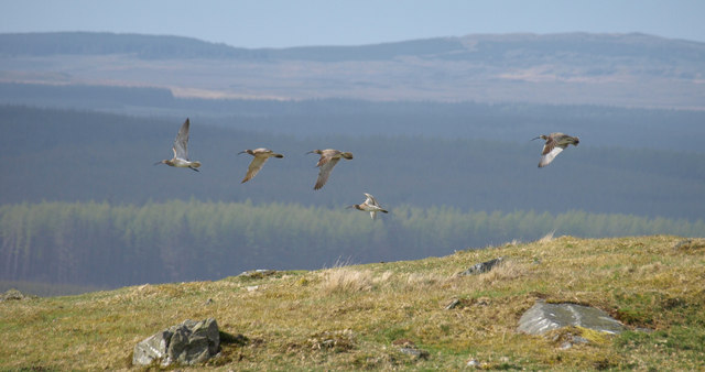
The terrain of Barskeoch Fell is characterized by steep slopes and rocky outcrops, providing a challenging yet rewarding climb for hikers and mountaineers. Its diverse range of flora and fauna adds to the allure of the hill, with heather, grasses, and mosses covering the lower slopes, and hardy mountain plants thriving at higher elevations.
The summit of Barskeoch Fell rewards visitors with spectacular vistas that stretch for miles, offering a glimpse of the stunning Scottish landscape. On a clear day, one can see as far as the Isle of Arran and the mountains of the Lake District.
Hikers and climbers are advised to come prepared with appropriate gear and clothing, as the weather conditions on Barskeoch Fell can change quickly, with strong winds and misty conditions often prevailing. Overall, Barskeoch Fell is a captivating natural landmark, inviting adventurers to explore its rugged beauty and experience the magic of Scotland's countryside.
If you have any feedback on the listing, please let us know in the comments section below.
Barskeoch Fell Images
Images are sourced within 2km of 54.931669/-4.659944 or Grid Reference NX2962. Thanks to Geograph Open Source API. All images are credited.


Barskeoch Fell is located at Grid Ref: NX2962 (Lat: 54.931669, Lng: -4.659944)
Unitary Authority: Dumfries and Galloway
Police Authority: Dumfries and Galloway
What 3 Words
///dislikes.caveman.brave. Near Newton Stewart, Dumfries & Galloway
Nearby Locations
Related Wikis

Kirkcowan railway station
Kirkcowan railway station served the village of Kirkcowan, Dumfries and Galloway, Scotland from 1861 to 1965 on the Portpatrick and Wigtownshire Joint...

Kirkcowan
Kirkcowan is an area about 15 miles in length, and from nearly two to nearly seven miles in breadth, comprising 30,580 acres, of which 7000 are arable...

Tarf Water, Wigtownshire
The Tarf Water is a river in the former county of Wigtownshire in south-west Scotland. It rises on the Ayrshire border (55.0048°N 4.7815°W / 55.0048;...

Barhapple Loch
Barhapple Loch is a small semicircular freshwater loch located in Wigtownshire, Dumfries and Galloway in Scotland. Barhapple Loch is principally known...

Castle Loch, Dumfries and Galloway
Castle Loch is a large, shallow, freshwater loch in Dumfries and Galloway, in the Southern Uplands of south-west Scotland. It lies to the west of Mochrum...
Castle Loch
Castle Loch is a shallow eutrophic loch covering an area of around 100 hectares in the town of Lochmaben in Dumfries and Galloway, Scotland. It lies to...

Mochrum Loch
Mochrum Loch is a large, irregular shaped, shallow, freshwater loch in Dumfries and Galloway, in the Southern Uplands of south-west Scotland. It lies approximately...
Related Videos
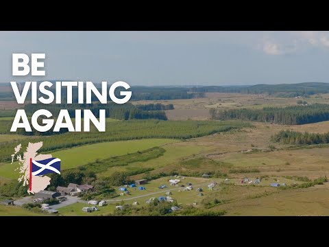
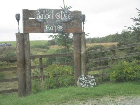
Wander to Balloch O' Dee
Wander to Balloch O' Dee 3 excellent days spent only 17 miles from home at Balloch O' Dee camp site. As it says on sign at the ...
Nearby Amenities
Located within 500m of 54.931669,-4.659944Have you been to Barskeoch Fell?
Leave your review of Barskeoch Fell below (or comments, questions and feedback).