Dunnairbuck Hill

Hill, Mountain in Renfrewshire

Scotland

Dunnairbuck Hill

Pylons, Queenside Muir Powerlines crossing the plateau from Inverkip powerstation (now disused or mothballed due to high oil prices).
Pylons, Queenside Muir Credit: Richard Webb

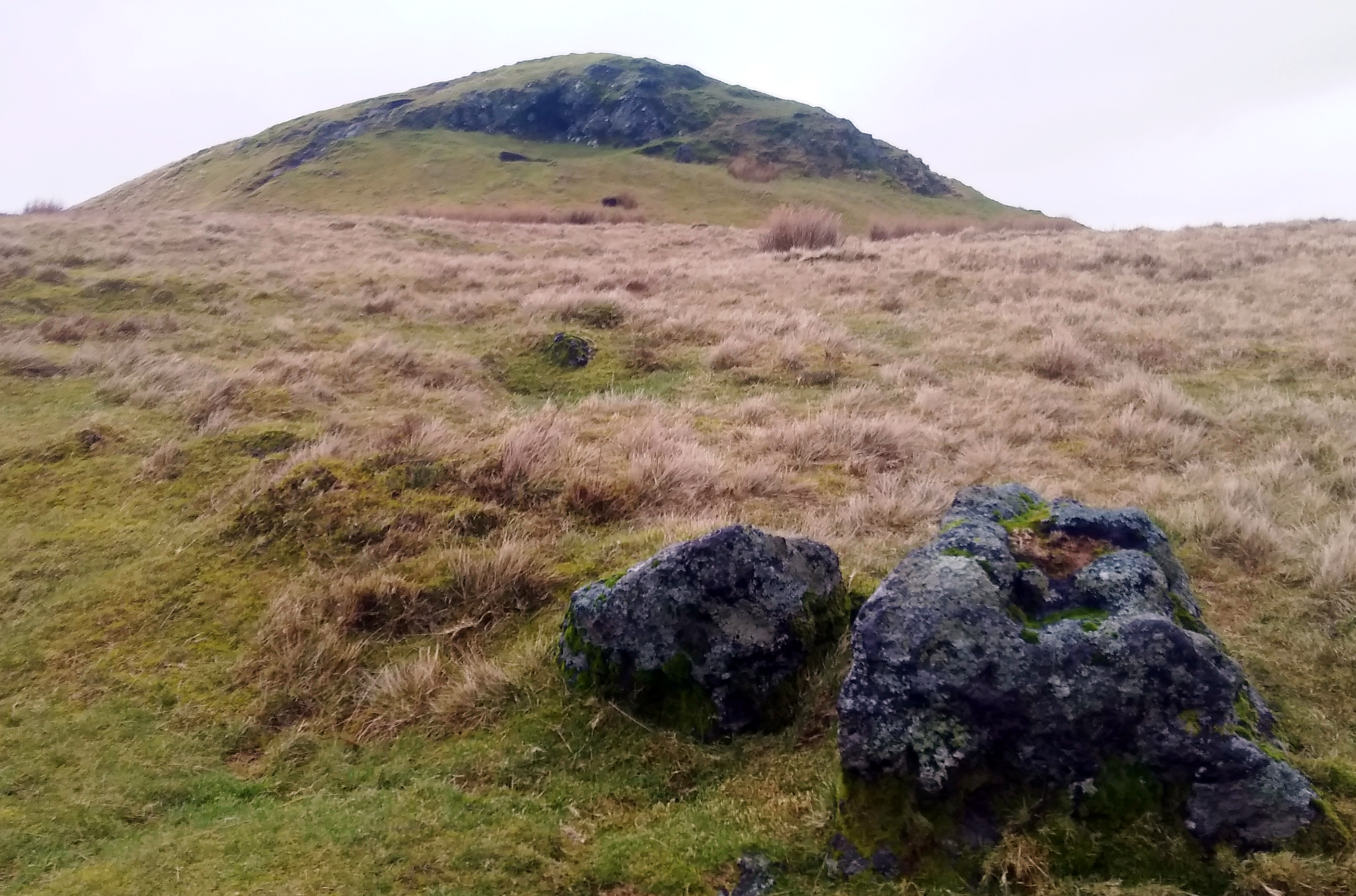
Dunnairbuck Hill is a prominent natural feature located in Renfrewshire, Scotland. Standing at an elevation of approximately 305 meters (1,001 feet), it is classified as a hill rather than a mountain. The hill is situated in the southwestern part of the county, near the village of Kilbarchan.

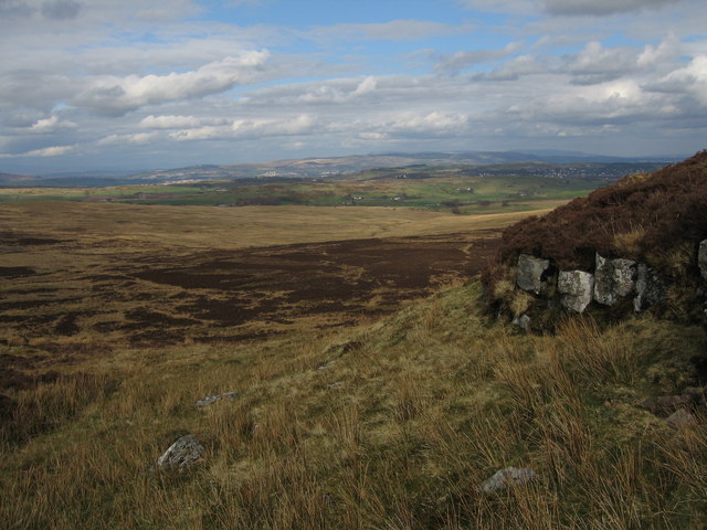
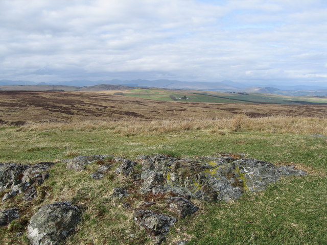
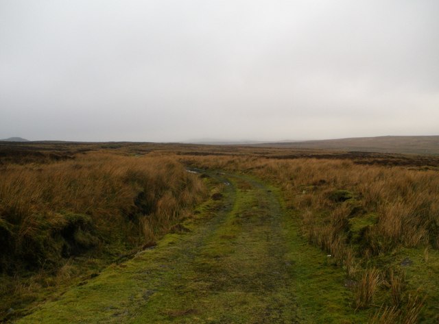
Dunnairbuck Hill is composed mainly of sandstone, a common rock formation in the region. Its slopes are covered in a variety of vegetation, including grasses, heather, and scattered patches of woodland. The hill offers stunning panoramic views of the surrounding countryside and is a popular destination for hikers and nature enthusiasts.

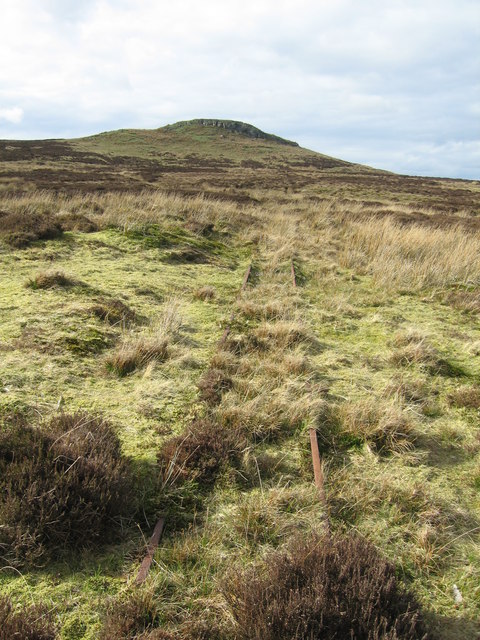
The ascent to the summit of Dunnairbuck Hill is relatively moderate, making it accessible to people of various fitness levels. There are several well-marked trails and footpaths that lead to the top, allowing visitors to explore the area at their own pace. Along the way, walkers may encounter various wildlife species, such as rabbits, foxes, and a variety of bird species.

At the summit of Dunnairbuck Hill, visitors are rewarded with breathtaking vistas of the surrounding landscape, including the rolling hills of Renfrewshire, the Clyde Valley, and the distant peaks of the Scottish Highlands. On clear days, it is even possible to see as far as the Isle of Arran in the Firth of Clyde.

Overall, Dunnairbuck Hill offers a picturesque and accessible natural escape for those looking to enjoy Scotland's scenic beauty and outdoor pursuits.

If you have any feedback on the listing, please let us know in the comments section below.

Dunnairbuck Hill Images

Images are sourced within 2km of 55.863294/-4.7314801 or Grid Reference NS2966. Thanks to Geograph Open Source API. All images are credited.

Pylons, Queenside Muir Powerlines crossing the plateau from Inverkip powerstation (now disused or mothballed due to high oil prices).
Pylons, Queenside Muir
Powerlines crossing the plateau from Inverkip powerstation (now disused or mothballed due to high oil prices).
Calder Water. The young Calder Water on Queenside Muir, just below the mine.
Calder Water.
The young Calder Water on Queenside Muir, just below the mine.
Queenside Muir Powerline from Inverkip crossing the Muir along the course of the Calder Water.  There was once a reservoir in the centre of this view, and the square. Muirsheil estate was brought into public ownership for water supply purposes. Was there a plan to build a larger dam on the Calder?
Queenside Muir
Powerline from Inverkip crossing the Muir along the course of the Calder Water. There was once a reservoir in the centre of this view, and the square. Muirsheil estate was brought into public ownership for water supply purposes. Was there a plan to build a larger dam on the Calder?
North side of Knock More High rise flats in Clydebank can be spotted in the distance.
North side of Knock More
High rise flats in Clydebank can be spotted in the distance.
View from Knock Hill, Duchal Moor The farm in the distance is Hillside.
View from Knock Hill, Duchal Moor
The farm in the distance is Hillside.
Knock More Hill
Knock More Hill
Calder Water
Calder Water
Hyndal Hill
Hyndal Hill
Knockdal Ring
Knockdal Ring
Remains on Dunnairbuck Hill
Muirshiel mines in the winter The mines at Muirsheil country park in the winter
Muirshiel mines in the winter
The mines at Muirsheil country park in the winter
Farm Track Farm Track under snow with gate in the near background on Duchal Moor. 4th April 2010 1.50pm.
Farm Track
Farm Track under snow with gate in the near background on Duchal Moor. 4th April 2010 1.50pm.
Disused rail line Some remains of the narrow gauge "Grouse" railway on Duchal moor. Almost entirely obliterated by the undergrowth this collapsed bridging section over a small burn remains exposed.
Disused rail line
Some remains of the narrow gauge "Grouse" railway on Duchal moor. Almost entirely obliterated by the undergrowth this collapsed bridging section over a small burn remains exposed.
Disused narrow gauge railway bridge over Blacketty Water Narrow gauge railway used to carry grouse shooters on to Duchal Moor
Disused narrow gauge railway bridge over Blacketty Water
Narrow gauge railway used to carry grouse shooters on to Duchal Moor
Landrover track on Duchal Moor
Muirshiel Country Park Looking over very rough sheep grazing to Copile Hill.
Muirshiel Country Park
Looking over very rough sheep grazing to Copile Hill.
Blacketty Water Narrow gauge railway bridge on Duchal Moor.
Blacketty Water
Narrow gauge railway bridge on Duchal Moor.
Lochan, Smeath Hill, Muirshiel Country Park. A small unnamed burn feeds from here into Blacketty Water.
Lochan, Smeath Hill, Muirshiel Country Park.
A small unnamed burn feeds from here into Blacketty Water.
Show me another place!

Dunnairbuck Hill is located at Grid Ref: NS2966 (Lat: 55.863294, Lng: -4.7314801)

Unitary Authority: Inverclyde

Police Authority: Renfrewshire and Inverclyde

What 3 Words

///whisker.plodded.sides. Near Kilmacolm, Inverclyde

Nearby Locations

Dunnairbuck Hill

Related Wikis

Windy Hill, Renfrewshire

Windy Hill is a 316 metres (1.037 feet) high hill in Renfrewshire, Scotland. It is one of the TuMPs of the Lowlands. == Geography == The hill is located...

Inverclyde

Inverclyde (Scots: Inerclyde, Scottish Gaelic: Inbhir Chluaidh, pronounced [iɲiɾʲˈxl̪ˠuəj], "mouth of the Clyde") is one of 32 council areas used for local...

Inverclyde (UK Parliament constituency)

Inverclyde is a parliamentary constituency of the House of Commons of the Parliament of the United Kingdom. It replaced Greenock and Inverclyde and the...

Gryffe Reservoirs

The Gryffe Reservoirs, also spelled 'Gryfe', take their name from the River Gryffe, name deriving from the Gaelic garbh meaning "rough stream". are two...

Have you been to Dunnairbuck Hill?

Leave your review of Dunnairbuck Hill below (or comments, questions and feedback).