Brown Carrick Hill

Hill, Mountain in Ayrshire

Scotland

Brown Carrick Hill

Brown Carrick Hill Road up to the masts
Brown Carrick Hill Credit: Richard Webb

Brown Carrick Hill is a prominent geographical feature located in Ayrshire, Scotland. It is classified as a hill, rather than a mountain, with an elevation of approximately 404 meters (1,325 feet). The hill is situated within the Carrick Forest, which is part of the larger Galloway Forest Park.

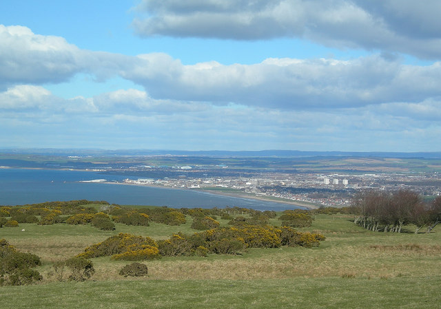
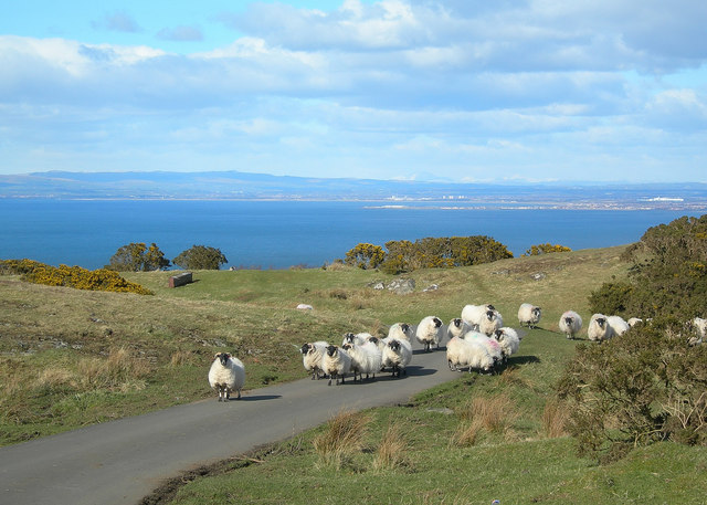
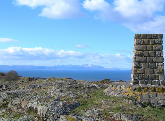
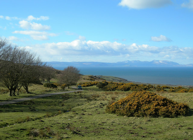
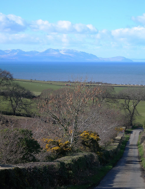
Brown Carrick Hill offers breathtaking panoramic views of the surrounding landscape, including the Firth of Clyde and the Isle of Arran. It is a popular destination for outdoor enthusiasts, such as hikers and nature lovers, seeking to explore the natural beauty of the area.

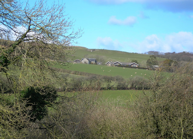
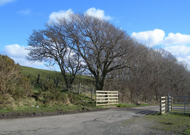
The hill is characterized by its rolling green slopes, covered in heather and grasses. The terrain is relatively gentle, making it accessible to a wide range of abilities. There are several well-marked trails that lead to the summit, offering visitors the opportunity to enjoy a variety of scenic walks.

At the top of Brown Carrick Hill, there is a trig point, which is a marker used in surveying to precisely determine the hill's height. This serves as a landmark and provides a sense of accomplishment for those who reach the summit.

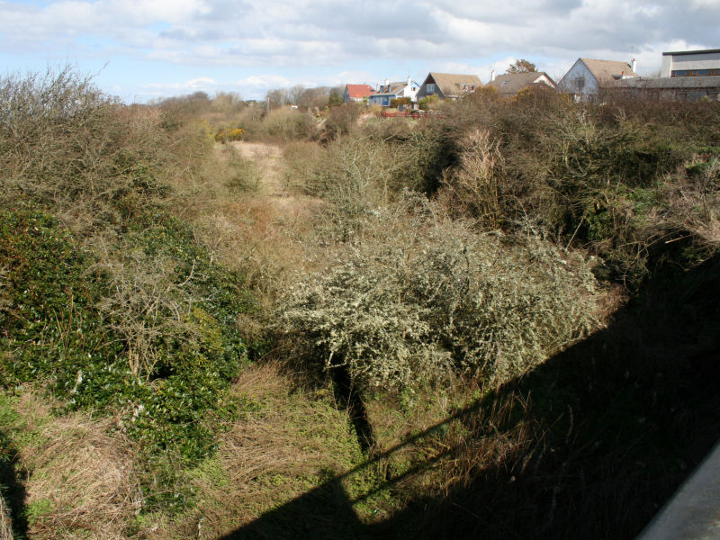
The hill is also home to a diverse range of flora and fauna, including various species of birds, mammals, and plant life. It provides an important habitat for wildlife and contributes to the overall biodiversity of the region.

Overall, Brown Carrick Hill in Ayrshire offers a stunning natural environment, with its picturesque views, accessible trails, and abundant wildlife, making it a must-visit destination for nature enthusiasts and those seeking a peaceful escape in the Scottish countryside.

If you have any feedback on the listing, please let us know in the comments section below.

Brown Carrick Hill Images

Images are sourced within 2km of 55.407485/-4.7108279 or Grid Reference NS2815. Thanks to Geograph Open Source API. All images are credited.

Brown Carrick Hill Road up to the masts
Brown Carrick Hill
Road up to the masts
Brown Carrick Hill Summit.
Brown Carrick Hill
Summit.
Communications Mast at Fisherton This large mast is a prominent local landmark.
Communications Mast at Fisherton
This large mast is a prominent local landmark.
Dunduff Castle Dunduff Castle, viewed from the ancient Earthwork.  The three communication masts on Brown Carrick Hill are visible on the skyline.
Dunduff Castle
Dunduff Castle, viewed from the ancient Earthwork. The three communication masts on Brown Carrick Hill are visible on the skyline.
Fisherton Farm
Fisherton Farm
Fields and Caravans Looking along the edge of the old railway line, south of the Heads of Ayr.
Fields and Caravans
Looking along the edge of the old railway line, south of the Heads of Ayr.
Beoch A winter view, taken on a fine March afternoon.
Beoch
A winter view, taken on a fine March afternoon.
Sauchrie Glen Looking up Sauchrie Glen from the Hill Road.  The three Police Radio Masts in the background are a prominent local landmark.
Sauchrie Glen
Looking up Sauchrie Glen from the Hill Road. The three Police Radio Masts in the background are a prominent local landmark.
At the Cattle Grid One of several cattle grids on the Brown Carrick Hill Road.
At the Cattle Grid
One of several cattle grids on the Brown Carrick Hill Road.
Brown Carrick Hill Road National Cycle Route number 7 follows this road.
Brown Carrick Hill Road
National Cycle Route number 7 follows this road.
Sheep by Sauchrie Glen The narrow part of Sauchrie glen is visible beyond the sheep.  Extra care is needed when walking on hill grazing at this time of year (March), before the lambing has taken place.
Sheep by Sauchrie Glen
The narrow part of Sauchrie glen is visible beyond the sheep. Extra care is needed when walking on hill grazing at this time of year (March), before the lambing has taken place.
Moorland View The Brown Carrick Hill Road is just out of sight, behind the rocky outcrop.
Moorland View
The Brown Carrick Hill Road is just out of sight, behind the rocky outcrop.
Ayr from Brown Carrick Hill A fine view of Ayr on a clear March afternoon.  Prominent features include, from the left: Ayr Harbour, the Pavilion, the Low Green, Ayr Beach, the 3 blocks of flats at Riverside Place.  Prestwick Airport is visible in the middle distance. For a wintry view, see <a href="https://www.geograph.org.uk/photo/6046946">NS3016 : Towards Ayr</a>
Ayr from Brown Carrick Hill
A fine view of Ayr on a clear March afternoon. Prominent features include, from the left: Ayr Harbour, the Pavilion, the Low Green, Ayr Beach, the 3 blocks of flats at Riverside Place. Prestwick Airport is visible in the middle distance. For a wintry view, see NS3016 : Towards Ayr
Hill Country The gate leads to a large sheepfold.
Hill Country
The gate leads to a large sheepfold.
Sheep on the Road Black-faced sheep on the Brown Carrick Hill Road.  The first promontory in the spectacular view is Troon Harbour, with Irvine behind.  Ben Lomond and the Trossachs are visible on the skyline. The paper mill at Irvine is on the far right.
Sheep on the Road
Black-faced sheep on the Brown Carrick Hill Road. The first promontory in the spectacular view is Troon Harbour, with Irvine behind. Ben Lomond and the Trossachs are visible on the skyline. The paper mill at Irvine is on the far right.
Brown Carrick Hill Viewpoint A fine view of Arran and the Firth of Clyde on a beautiful March afternoon. For a wintry view, see <a href="https://www.geograph.org.uk/photo/6046928">NS2916 : At The Brown Carrick Viewpoint</a>
Brown Carrick Hill Viewpoint
A fine view of Arran and the Firth of Clyde on a beautiful March afternoon. For a wintry view, see NS2916 : At The Brown Carrick Viewpoint
Arran View Looking across the Firth of Clyde to Arran from the Brown Carrick Hill viewpoint on a glorious March afternoon. For a wintry view, see <a href="https://www.geograph.org.uk/photo/6046923">NS2916 : Park Here For The Viewpoint</a>
Arran View
Looking across the Firth of Clyde to Arran from the Brown Carrick Hill viewpoint on a glorious March afternoon. For a wintry view, see NS2916 : Park Here For The Viewpoint
Goat Fell View Looking across the Firth of Clyde towards Goat Fell from the Brown Carrick Hill Road on a glorious March afternoon.
Goat Fell View
Looking across the Firth of Clyde towards Goat Fell from the Brown Carrick Hill Road on a glorious March afternoon.
Show me another place!

Brown Carrick Hill is located at Grid Ref: NS2815 (Lat: 55.407485, Lng: -4.7108279)

Unitary Authority: South Ayrshire

Police Authority: Ayrshire

What 3 Words

///redeeming.intelligible.delivers. Near Maybole, South Ayrshire

Related Wikis

Heads of Ayr railway station

Heads of Ayr railway station was a railway station serving the Heads of Ayr, South Ayrshire, Scotland. The station was part of the Maidens and Dunure Light...

Dunure railway station

Dunure railway station was a railway station serving the village of Dunure, South Ayrshire, Scotland. The station was part of the Maidens and Dunure Light...
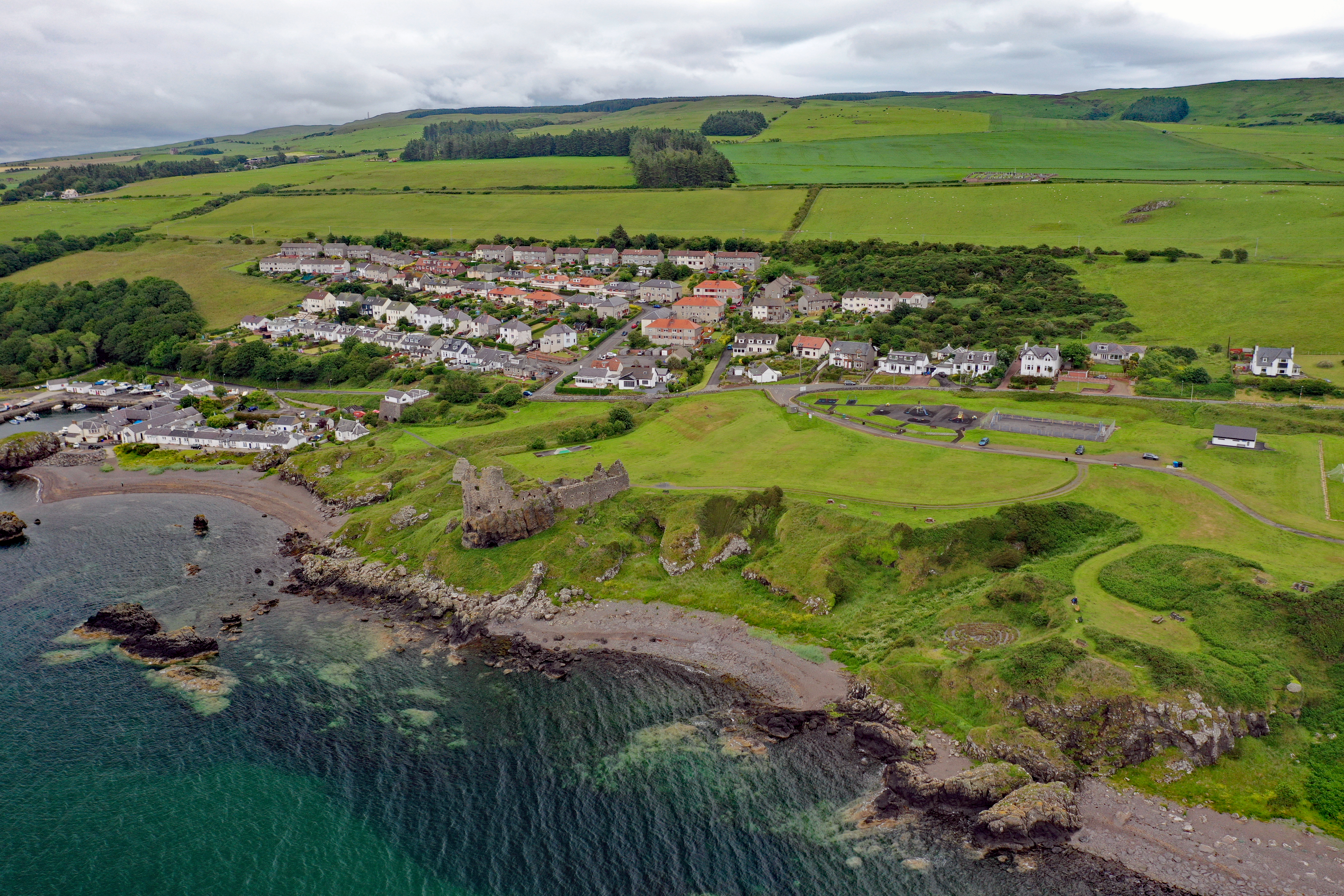
Dunure

Dunure (Scottish Gaelic: Dùn Iùbhair, meaning Yew Hill) is a small village in the South Ayrshire area of Scotland about five miles (eight kilometres) from...

Heads of Ayr Holiday Camp railway station

Heads of Ayr Holiday Camp railway station was a railway station serving the holiday camp and hotel at Heads of Ayr, South Ayrshire, Scotland. The station...

Nearby Amenities

Located within 500m of 55.407485,-4.7108279
Brown Carrick Hill
Corbett: no
Ele: 287
Graham: no
Loc Name: Fisherton Hill
Marilyn: yes
Munro: no
Natural: peak
Prominence: 228
Lat/Long: 55.4076782/-4.7096374
Ele: 287
Man Made: survey_point
Prominence: 228
Lat/Long: 55.4074815/-4.7123476
Barrier: stile
Lat/Long: 55.4078536/-4.7111334
Barrier: stile
Lat/Long: 55.4088984/-4.7034505
The data included in this document is from www.openstreetmap.org. The data is made available under ODbL.

Have you been to Brown Carrick Hill?

Leave your review of Brown Carrick Hill below (or comments, questions and feedback).