Little Hill

Hill, Mountain in Ayrshire

Scotland

Little Hill

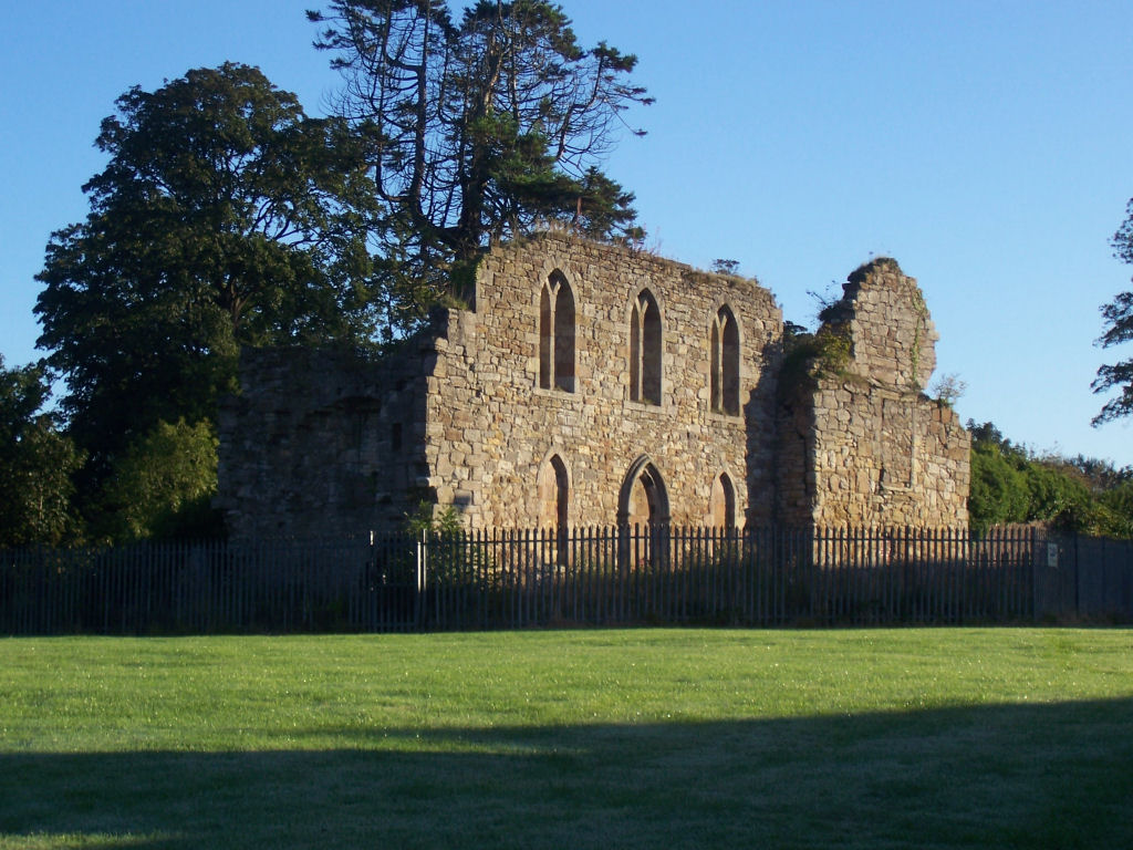
Kilwinning Abbey ruins and detached church tower
Kilwinning Abbey ruins and detached church tower Credit: Colin Park

Little Hill is a prominent hill located in the region of Ayrshire, Scotland. It forms part of the Southern Uplands, a picturesque range of hills and mountains that stretch across the south of the country. Rising to an elevation of approximately 1,037 feet (316 meters), Little Hill offers stunning panoramic views of the surrounding countryside.

Situated near the town of Ayr, Little Hill is easily accessible and attracts both locals and tourists alike. The hill is characterized by its gentle slopes and lush greenery, making it a popular destination for hiking and outdoor activities. Its well-maintained trails provide a pleasant and scenic route to the summit, enabling visitors to fully immerse themselves in the beauty of the Ayrshire landscape.

At the top of Little Hill, one can enjoy breathtaking vistas of the rolling hills, valleys, and distant sea views of the Ayrshire coast. On clear days, the Isle of Arran can be seen in the distance, adding to the natural charm of the area.

Little Hill is also home to a diverse range of flora and fauna, including heather, gorse, and various bird species. Nature enthusiasts can observe the local wildlife and appreciate the tranquility of the surroundings.

Overall, Little Hill is a captivating destination that offers outdoor enthusiasts and nature lovers a chance to experience the beauty and serenity of the Ayrshire countryside. Its accessibility and stunning views make it a must-visit location for those seeking a memorable and invigorating outdoor adventure.

If you have any feedback on the listing, please let us know in the comments section below.

Little Hill Images

Images are sourced within 2km of 55.651209/-4.7292443 or Grid Reference NS2843. Thanks to Geograph Open Source API. All images are credited.

Kilwinning Abbey ruins and detached church tower
Detached church tower at Kilwinning Abbey
Kilwinning viewed from number 11 bus
Lauchlan Way junction off Howgate
Kilwinning Orange Halls Almswall Road
Nethermains Road looking south From Shavian Terrace
Nethermains Road looking south
From Shavian Terrace
The path to Erskine Church, Kilwinning Erskine church dates from 1838 with later additions of 1883.
The path to Erskine Church, Kilwinning
Erskine church dates from 1838 with later additions of 1883.
Victoria Bar, Howgate, Kilwinning
District 48 Orange Hall & Social Club, Kilwinning
Kilwinning Abbey Category A-listed. Founded c1162 by Richard de Morville on the site of a church built by Irish St Wynnin.
Kilwinning Abbey
Category A-listed. Founded c1162 by Richard de Morville on the site of a church built by Irish St Wynnin.
East Processional Doorway, Kilwinning Abbey Category A-listed. Founded c1162 by Richard de Morville on the site of a church built by Irish St Wynnin.
East Processional Doorway, Kilwinning Abbey
Category A-listed. Founded c1162 by Richard de Morville on the site of a church built by Irish St Wynnin.
Kilwinning Kirk
Kilwinning Kirk
Kilwinning Kirk
Kilwinning Kirk
Kilwinning War Memorial Bearing an image of St. Winning, to whom Kilwinning Abbey was dedicated.
Kilwinning War Memorial
Bearing an image of St. Winning, to whom Kilwinning Abbey was dedicated.
Kilwinning Abbey ruins What survives of the south transept gable of the abbey church.
Kilwinning Abbey ruins
What survives of the south transept gable of the abbey church.
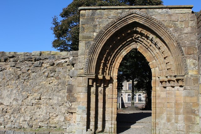
Ruined doorway, Kilwinning Abbey
Ruined doorway, Kilwinning Abbey This is the same doorway seen here <a title="https://www.geograph.org.uk/photo/3705377" href="https://www.geograph.org.uk/photo/3705377">Link</a> , viewed from the other side.
Ruined doorway, Kilwinning Abbey
This is the same doorway seen here Link , viewed from the other side.
Processional doorway, Kilwinning Abbey
Show me another place!

Little Hill is located at Grid Ref: NS2843 (Lat: 55.651209, Lng: -4.7292443)

Unitary Authority: North Ayrshire

Police Authority: Ayrshire

What 3 Words

///blindfold.retailing.lightly. Near Kilwinning, North Ayrshire

Related Wikis

Kilwinning railway station

Kilwinning railway station is a railway station serving the town of Kilwinning, North Ayrshire, Scotland. The station is managed by ScotRail and is on...

Lands of Ashgrove

The Lands of Ashgrove, previously known as Ashenyards, formed a small estate in the Parish of Kilwinning, North Ayrshire, lying between Kilwinning and...

Kerelaw Castle

Kerelaw Castle is a castle ruin. It is situated on the coast of North Ayrshire, Scotland in the town of Stevenston. == History == This castle, variously...

Piperheugh

Piperheugh, Piper's-Heugh, or even Piperhaugh was a hamlet in North Ayrshire, Parish of Stevenston, Scotland. The inhabitants were recorded as famous manufacturers...

Related Videos

Kilwinning Abbey With Music On History Visit To North Ayrshire Scotland

Tour Scotland short 4K travel video clip, with Scottish music, of the ruined Kilwinning Abbey on ancestry, genealogy, family history ...

Mysterious blue big foot caught

Out camping when spotted a blue big foot.

Nearby Amenities

Located within 500m of 55.651209,-4.7292443
Traffic Signals
Lat/Long: 55.6503653/-4.7225781
Mini Roundabout
Lat/Long: 55.6502404/-4.7233374
Crossing
Crossing: traffic_signals
Kerb: lowered
Lat/Long: 55.6473101/-4.7331585
Crossing
Lat/Long: 55.649856/-4.7232107
Power: pole
Lat/Long: 55.6556945/-4.7298354
Power: pole
Lat/Long: 55.6550128/-4.7300062
Power: pole
Lat/Long: 55.6542019/-4.7299771
Power: pole
Lat/Long: 55.6533991/-4.7299542
Power: pole
Lat/Long: 55.6525728/-4.7299
Power: pole
Lat/Long: 55.6517654/-4.7298563
Power: pole
Lat/Long: 55.6509626/-4.72985
Power: pole
Lat/Long: 55.6503267/-4.7295917
Power: pole
Lat/Long: 55.6512329/-4.7313082
Power: pole
Lat/Long: 55.6496955/-4.7293563
Power: pole
Lat/Long: 55.6490701/-4.7291438
Power: pole
Lat/Long: 55.6485929/-4.7293459
Power: pole
Lat/Long: 55.6474691/-4.7298604
Noexit: yes
Lat/Long: 55.6483365/-4.7332205
Noexit: yes
Lat/Long: 55.6482366/-4.7332647
Generator Method: photovoltaic
Generator Output Electricity: yes
Generator Source: solar
Generator Type: solar_photovoltaic_panel
Power: generator
Lat/Long: 55.6539111/-4.7237308
Generator Method: photovoltaic
Generator Output Electricity: yes
Generator Source: solar
Generator Type: solar_photovoltaic_panel
Power: generator
Lat/Long: 55.6539015/-4.7236589
Generator Method: photovoltaic
Generator Output Electricity: yes
Generator Source: solar
Generator Type: solar_photovoltaic_panel
Power: generator
Lat/Long: 55.6514367/-4.7233964
Generator Method: photovoltaic
Generator Output Electricity: yes
Generator Source: solar
Generator Type: solar_photovoltaic_panel
Power: generator
Lat/Long: 55.6525409/-4.7218565
Crossing
Crossing: traffic_signals
Lat/Long: 55.650483/-4.7226188
Crossing
Crossing: traffic_signals
Lat/Long: 55.6503409/-4.7227265
Crossing
Crossing: traffic_signals
Lat/Long: 55.650396/-4.7222828
The data included in this document is from www.openstreetmap.org. The data is made available under ODbL.

Have you been to Little Hill?

Leave your review of Little Hill below (or comments, questions and feedback).