Cnoc Eilid Mhathain

Hill, Mountain in Sutherland

Scotland

Cnoc Eilid Mhathain

Allt nam Uamh View downstream in the Assynt limestone country.
Allt nam Uamh Credit: Richard Webb

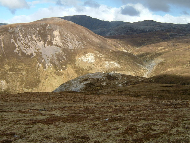
Cnoc Eilid Mhathain, also known as Ben Hope, is the most northerly Munro, a Scottish mountain over 3,000 feet (914 meters) in height, located in the county of Sutherland in the Scottish Highlands. It stands isolated in the remote area of Strathmore, approximately 30 miles southwest of Thurso.

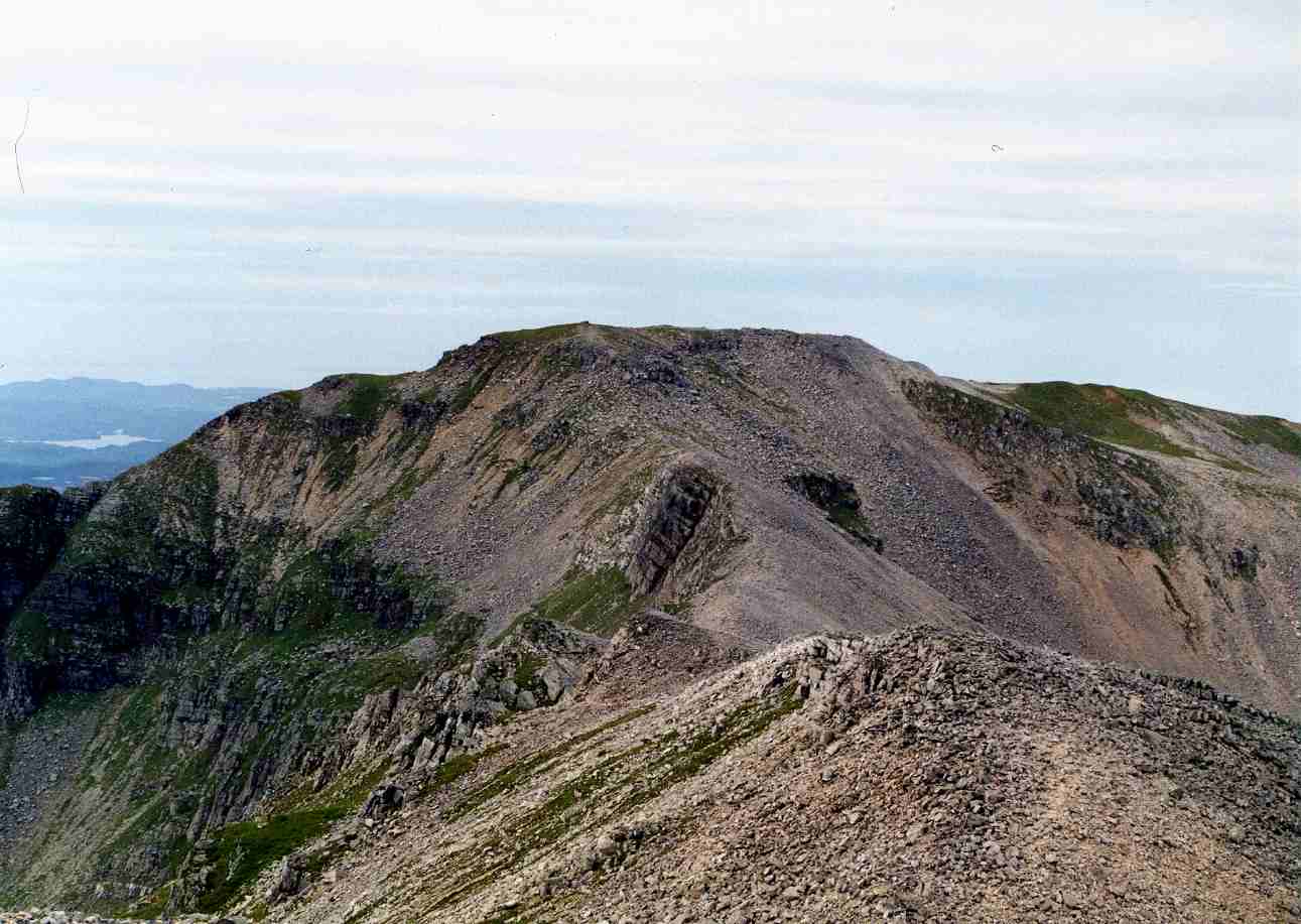
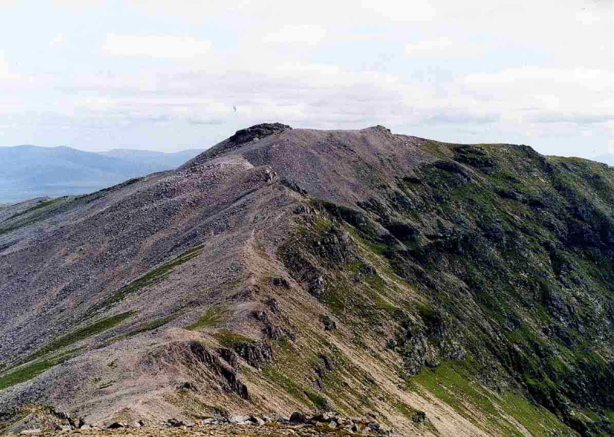
With a height of 927 meters (3,041 feet), Cnoc Eilid Mhathain offers breathtaking panoramic views of the surrounding landscape. Its distinctive conical shape and rocky slopes make it easily recognizable from a distance. The mountain is composed mostly of quartzite, giving it a rugged and weathered appearance.

The ascent of Cnoc Eilid Mhathain is considered moderate to challenging, depending on the chosen route. The most popular approach is from the west, starting at a car park in Alltnacaillich. From there, hikers follow a well-marked path that gradually steepens as it reaches the summit ridge. The final section involves some scrambling over rocky terrain, adding an element of adventure to the climb.

Reaching the summit of Cnoc Eilid Mhathain rewards climbers with stunning views across the vast expanse of Sutherland, encompassing the wild moorlands and lochs that characterize the region. On clear days, it is even possible to see the Orkney Islands to the north.

Due to its remote location, Cnoc Eilid Mhathain offers a sense of solitude and tranquility, attracting outdoor enthusiasts and nature lovers. It is a popular destination for hillwalkers, mountaineers, and photographers seeking a challenging yet rewarding experience in the rugged beauty of the Scottish Highlands.

If you have any feedback on the listing, please let us know in the comments section below.

Cnoc Eilid Mhathain Images

Images are sourced within 2km of 58.120134/-4.9250399 or Grid Reference NC2718. Thanks to Geograph Open Source API. All images are credited.

Allt nam Uamh View downstream in the Assynt limestone country.
Allt nam Uamh
View downstream in the Assynt limestone country.
Allt nan Uamh Upstream view taken on an ascent of Breabag. The burn bed is usually dry here with the water running through a cave system.
Allt nan Uamh
Upstream view taken on an ascent of Breabag. The burn bed is usually dry here with the water running through a cave system.
Moorland on Breabag View down the Allt nan Uamh with Canisp in the background.
Moorland on Breabag
View down the Allt nan Uamh with Canisp in the background.
Fuaran Allt nan Uamh The spring, Fuaran Allt nan Uamh, issues from the mountainside as a substantial flow of water soon to enter the main valley river, the Allt nan Uamh. The image was recorded from close to the confluence of the two streams.
Fuaran Allt nan Uamh
The spring, Fuaran Allt nan Uamh, issues from the mountainside as a substantial flow of water soon to enter the main valley river, the Allt nan Uamh. The image was recorded from close to the confluence of the two streams.
Un-named lochan on northern slope of Breabag The view across the lochan in dull weather is near to north-west where the brightly hazed mountain seen centrally is Beinn Rèidh.
Un-named lochan on northern slope of Breabag
The view across the lochan in dull weather is near to north-west where the brightly hazed mountain seen centrally is Beinn Rèidh.
View towards Breabag from the summit of Conival
Active sink hole with recent fracture Not one to jump up and down on.

Breabag in the background under thick cloud.
Active sink hole with recent fracture
Not one to jump up and down on. Breabag in the background under thick cloud.
Path near the bone caves Path near the bone caves, stunning place
Path near the bone caves
Path near the bone caves, stunning place
Rocky slopes of Breabag Rocky slopes on the descent from Breabag. Cul Mor and Cul Beag are visible in the distance.
Rocky slopes of Breabag
Rocky slopes on the descent from Breabag. Cul Mor and Cul Beag are visible in the distance.
Slopes of Breabag The slopes of Breabag looking across to Conival (hidden in the cloud)
Slopes of Breabag
The slopes of Breabag looking across to Conival (hidden in the cloud)
Looking out of cavemouth
Resurgence of the Allt nan Uamh The 'stream of the caves' emerges here from its passage through the hillside to join the dry streambed. The Bone Caves are in the crag in the middle distance.
Resurgence of the Allt nan Uamh
The 'stream of the caves' emerges here from its passage through the hillside to join the dry streambed. The Bone Caves are in the crag in the middle distance.
Dry streambed, Allt nan Uamh Most of the water has taken an alternative route underground to emerge at the spring, Fuaran Allt nan Uamh, near the W edge of the square.
Dry streambed, Allt nan Uamh
Most of the water has taken an alternative route underground to emerge at the spring, Fuaran Allt nan Uamh, near the W edge of the square.
Dry streambed seen from the Bone Caves The course of the Allt nan Uamh is dry here, with the water reappearing further west. Beyond the heather the hillside rises to the ridge N of Breabag, with a sprinkling of snow in this view on a chilly May morning.
Dry streambed seen from the Bone Caves
The course of the Allt nan Uamh is dry here, with the water reappearing further west. Beyond the heather the hillside rises to the ridge N of Breabag, with a sprinkling of snow in this view on a chilly May morning.
View west from the Bone Caves, Inchnadamph A view from the cave entrances back down the dry valley of the Allt nan Uamh. The water emerges at a spring below the scree in the middle distance.
View west from the Bone Caves, Inchnadamph
A view from the cave entrances back down the dry valley of the Allt nan Uamh. The water emerges at a spring below the scree in the middle distance.
Dry streambed above the Fuaran Allt nan Uamh A view down the glen towards the location of the spring from which the water issues.
Dry streambed above the Fuaran Allt nan Uamh
A view down the glen towards the location of the spring from which the water issues.
Dry river bed Due to the geology of the area not the dry weather recently.
Dry river bed
Due to the geology of the area not the dry weather recently.
The Bone Caves One of the Bone Caves two or three miles south of Inchnadamph
The Bone Caves
One of the Bone Caves two or three miles south of Inchnadamph
Show me another place!

Cnoc Eilid Mhathain is located at Grid Ref: NC2718 (Lat: 58.120134, Lng: -4.9250399)

Unitary Authority: Highland

Police Authority: Highlands and Islands

What 3 Words

///prelude.frowns.professed. Near Inchnadamph, Highland

Nearby Locations

Cnoc Eilid Mhathain

Related Wikis

Uamh an Claonaite

Uamh an Claonaite (Scottish Gaelic: Cave of the sloping rock) is the longest cave in Scotland. It consists of a series of dry passages and a series of...

Breabag

Breabag (815 m) is a mountain in the Northwest Highlands of Scotland, in the Assynt area of Sutherland. A flat-topped summit, it is usually climbed from...

Conival

Conival (Scottish Gaelic: Cona Mheall) is a Scottish mountain situated in Assynt in the Sutherland area of the Highland Council Area, thirty kilometres...

Ben More Assynt

Ben More Assynt (Scottish Gaelic: Beinn Mhòr Asaint) is a mountain in Assynt in the far northwest of Scotland, 30 kilometres (19 miles) north-northeast...

Have you been to Cnoc Eilid Mhathain?

Leave your review of Cnoc Eilid Mhathain below (or comments, questions and feedback).