Highsted

Settlement in Kent Swale

England

Highsted

Slough Road There is quite a tangle of lanes here, in the main not going anywhere important. This could be said to be a way to Erriottwood.
Slough Road Credit: Robin Webster

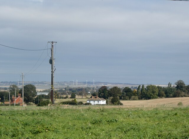
Highsted is a small village located in the county of Kent, in southeastern England. Situated just northeast of the town of Sittingbourne, Highsted is nestled in a picturesque rural setting, surrounded by beautiful countryside and farmland. The village is part of the Swale district and falls within the civil parish of Bapchild.

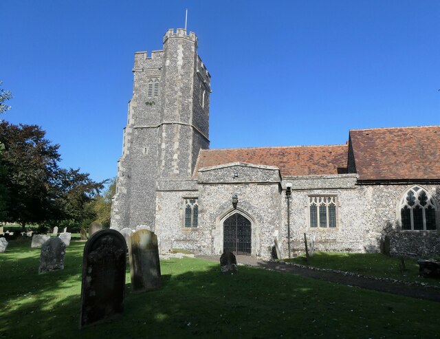
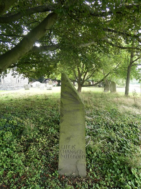
Despite its small size, Highsted boasts a rich history that dates back centuries. The village is home to several notable landmarks, including the Grade I listed St. Laurence Church, a stunning medieval church that showcases both Norman and Gothic architectural styles. This historic church is believed to have been built in the 12th century and has remained a focal point of the village ever since.

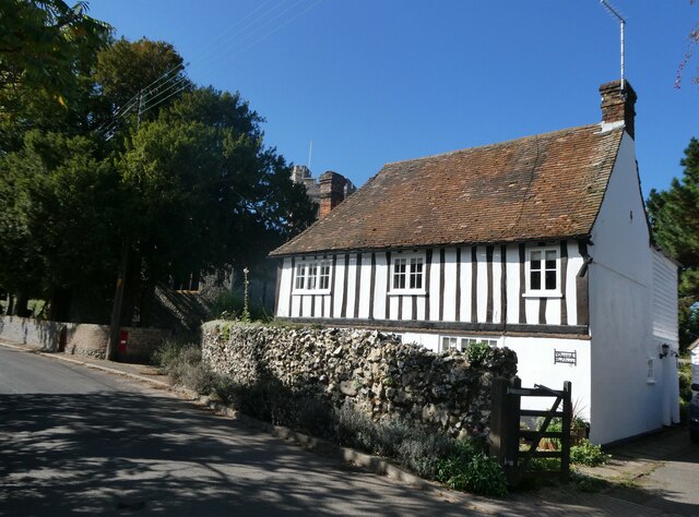
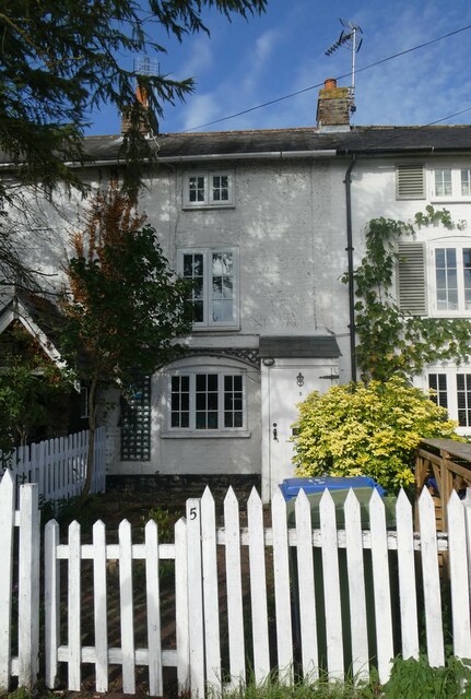
Highsted is primarily a residential area, with a close-knit community that values its peaceful and idyllic surroundings. The village offers a tranquil and serene environment for its residents, away from the hustle and bustle of urban life. The surrounding countryside provides ample opportunities for outdoor activities, such as walking, cycling, and exploring nature trails.

Although Highsted does not have its own amenities, the nearby town of Sittingbourne offers a range of facilities including shops, supermarkets, schools, and healthcare services. The village benefits from good transport links, with easy access to major roads and public transportation connecting it to other towns and cities in the region.

Overall, Highsted is a charming village that offers a sense of tranquility and a connection to its rich historical past. Its picturesque setting, combined with its close proximity to amenities, makes it an attractive place to live for those seeking a quiet and rural lifestyle.

If you have any feedback on the listing, please let us know in the comments section below.
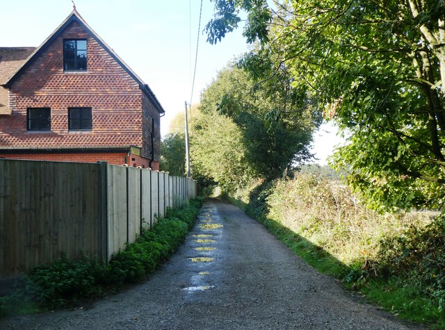
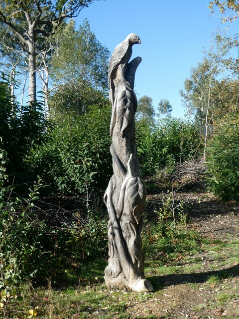
Highsted Images

Images are sourced within 2km of 51.319036/0.74197 or Grid Reference TQ9161. Thanks to Geograph Open Source API. All images are credited.

Slough Road There is quite a tangle of lanes here, in the main not going anywhere important. This could be said to be a way to Erriottwood.
Slough Road
There is quite a tangle of lanes here, in the main not going anywhere important. This could be said to be a way to Erriottwood.
View across Bapchild and The Swale to the Isle of Sheppey From a footpath running between Dully Road and Church Street, Rodmersham.
View across Bapchild and The Swale to the Isle of Sheppey
From a footpath running between Dully Road and Church Street, Rodmersham.
Rodmersham, near Sittingbourne View from a footpath with the tower of St. Nicholas's church on the left.
Rodmersham, near Sittingbourne
View from a footpath with the tower of St. Nicholas's church on the left.
The Church of St. Nicholas, Rodmersham A Grade I listed building with a 13th century chancel, a 14th century nave and a 15th century tower which was restored 1875-93.
The Church of St. Nicholas, Rodmersham
A Grade I listed building with a 13th century chancel, a 14th century nave and a 15th century tower which was restored 1875-93.
Tomb in the churchyard, St. Nicholas Church, Rodmersham The grave of Helen, wife of Robert Mercer, died Oct. 1906, aged 68 years.  erected by Robert Mercer "In Loving Memory 1907". According to the 1881 census, he was a hop grower and farmer of 180 acres, employing 56 men, 14 boys and 12 women, which suggests he was wealthy enough to erect such an expensive marble tomb.  He died in 1917. The carved dog seems to be a later addition.
Tomb in the churchyard, St. Nicholas Church, Rodmersham
The grave of Helen, wife of Robert Mercer, died Oct. 1906, aged 68 years. erected by Robert Mercer "In Loving Memory 1907". According to the 1881 census, he was a hop grower and farmer of 180 acres, employing 56 men, 14 boys and 12 women, which suggests he was wealthy enough to erect such an expensive marble tomb. He died in 1917. The carved dog seems to be a later addition.
Church Cottage, Rodmersham Church Street. A 16th century Grade II listed building.
Church Cottage, Rodmersham
Church Street. A 16th century Grade II listed building.
Edward Ardizzone's grave, Rodmersham The grave, near burials of other members of his family, is in St. Nicholas' churchyard. Edward Ardizzone, CBE RA (16 October 1900 – 8 November 1979), was an English painter, print-maker and war artist, and the author and illustrator of books, many of them for children. For Tim All Alone, which he wrote and illustrated, Ardizzone won the inaugural Kate Greenaway Medal for the year's best children's book illustration by a British subject
Edward Ardizzone's grave, Rodmersham
The grave, near burials of other members of his family, is in St. Nicholas' churchyard. Edward Ardizzone, CBE RA (16 October 1900 – 8 November 1979), was an English painter, print-maker and war artist, and the author and illustrator of books, many of them for children. For Tim All Alone, which he wrote and illustrated, Ardizzone won the inaugural Kate Greenaway Medal for the year's best children's book illustration by a British subject
Nicholas Ardizzone's grave, Rodmersham churchyard The grave, near burials of other members of his family, is in St. Nicholas' churchyard. His father, Edward Ardizzone, CBE RA (16 October 1900 – 8 November 1979), was an English painter, print-maker and war artist, and the author and illustrator of books, many of them for children. Nicholas, a cinematographer, catalogued his father's work as war artist and also published a detailed catalogue of his prints and lithographs. Edward's grave is hidden behind Nicholas's.
Nicholas Ardizzone's grave, Rodmersham churchyard
The grave, near burials of other members of his family, is in St. Nicholas' churchyard. His father, Edward Ardizzone, CBE RA (16 October 1900 – 8 November 1979), was an English painter, print-maker and war artist, and the author and illustrator of books, many of them for children. Nicholas, a cinematographer, catalogued his father's work as war artist and also published a detailed catalogue of his prints and lithographs. Edward's grave is hidden behind Nicholas's.
Nicholas Ardizzone's grave, Rodmersham churchyard Looking eastwards towards Church Street. The grave, near burials of other members of his family including his father, Edward, is in St. Nicholas' churchyard.  Edward Ardizzone, CBE RA (16 October 1900 – 8 November 1979), was an English painter, print-maker and war artist, and the author and illustrator of books, many of them for children. Nicholas, a cinematographer, catalogued his father's work as war artist and also published a detailed catalogue of his prints and lithographs.
Nicholas Ardizzone's grave, Rodmersham churchyard
Looking eastwards towards Church Street. The grave, near burials of other members of his family including his father, Edward, is in St. Nicholas' churchyard. Edward Ardizzone, CBE RA (16 October 1900 – 8 November 1979), was an English painter, print-maker and war artist, and the author and illustrator of books, many of them for children. Nicholas, a cinematographer, catalogued his father's work as war artist and also published a detailed catalogue of his prints and lithographs.
Rodmersham village From a footpath running between Church Street and Rodmersham Green. St. Nicholas's church tower is on the left and is in Church Street. Rodmersham Court Farm orchard is beyond the field.
Rodmersham village
From a footpath running between Church Street and Rodmersham Green. St. Nicholas's church tower is on the left and is in Church Street. Rodmersham Court Farm orchard is beyond the field.
No. 5 Vine Cottages, Rodmersham Green No blue plaque to indicate that Edward Ardizzone lived here until his death in 1979. He is buried in St. Nicholas's Church, Rodmersham. Edward Ardizzone, CBE RA (16 October 1900 – 8 November 1979), was an English painter, print-maker and war artist, and the author and illustrator of books, many of them for children.
No. 5 Vine Cottages, Rodmersham Green
No blue plaque to indicate that Edward Ardizzone lived here until his death in 1979. He is buried in St. Nicholas's Church, Rodmersham. Edward Ardizzone, CBE RA (16 October 1900 – 8 November 1979), was an English painter, print-maker and war artist, and the author and illustrator of books, many of them for children.
Pond at Rodmersham Green Bottles Lane can be seen through the trees.
Pond at Rodmersham Green
Bottles Lane can be seen through the trees.
Village sign, Green Lane, Rodmersham Green With The Fruiterers Arms in the background in Bottles Lane.
Village sign, Green Lane, Rodmersham Green
With The Fruiterers Arms in the background in Bottles Lane.
Entrance to Cromer's Wood, near Sittingbourne This 28 hectare ancient semi-natural woodland sits on the southeast side of a dry slope valley. It was donated by Shell Research Ltd. to Kent Trust for Nature Conservation, now known as Kent Wildlife Trust, in 1996.
Entrance to Cromer's Wood, near Sittingbourne
This 28 hectare ancient semi-natural woodland sits on the southeast side of a dry slope valley. It was donated by Shell Research Ltd. to Kent Trust for Nature Conservation, now known as Kent Wildlife Trust, in 1996.
Path between Cromer's Wood and Broadoak Road With Shooting Box Cottage on the left. Cromer's Wood is a 28 hectare ancient semi-natural woodland that sits on the southeast side of a dry slope valley. It was donated by Shell Research Ltd. to Kent Trust for Nature Conservation, now known as Kent Wildlife Trust, in 1996.
Path between Cromer's Wood and Broadoak Road
With Shooting Box Cottage on the left. Cromer's Wood is a 28 hectare ancient semi-natural woodland that sits on the southeast side of a dry slope valley. It was donated by Shell Research Ltd. to Kent Trust for Nature Conservation, now known as Kent Wildlife Trust, in 1996.
Metal plaque, Cromer's Wood, near Sittingbourne Cromer's Wood is a 28 hectare ancient semi-natural woodland that sits on the southeast side of a dry slope valley. It was donated by Shell Research Ltd. to Kent Trust for Nature Conservation, now known as Kent Wildlife Trust, in 1996, as this plaque informs the public.
Metal plaque, Cromer's Wood, near Sittingbourne
Cromer's Wood is a 28 hectare ancient semi-natural woodland that sits on the southeast side of a dry slope valley. It was donated by Shell Research Ltd. to Kent Trust for Nature Conservation, now known as Kent Wildlife Trust, in 1996, as this plaque informs the public.
Wood carving, Cromer's Wood, near Sittingbourne At the picnic area.  Cromer's Wood is a 28 hectare ancient semi-natural woodland that sits on the southeast side of a dry slope valley. It was donated by Shell Research Ltd. to Kent Trust for Nature Conservation, now known as Kent Wildlife Trust, in 1996.
Wood carving, Cromer's Wood, near Sittingbourne
At the picnic area. Cromer's Wood is a 28 hectare ancient semi-natural woodland that sits on the southeast side of a dry slope valley. It was donated by Shell Research Ltd. to Kent Trust for Nature Conservation, now known as Kent Wildlife Trust, in 1996.
Wood carving, Cromer's Wood, near Sittingbourne Detail of a carving in the picnic area.  Cromer's Wood is a 28 hectare ancient semi-natural woodland that sits on the southeast side of a dry slope valley. It was donated by Shell Research Ltd. to Kent Trust for Nature Conservation, now known as Kent Wildlife Trust, in 1996.
Wood carving, Cromer's Wood, near Sittingbourne
Detail of a carving in the picnic area. Cromer's Wood is a 28 hectare ancient semi-natural woodland that sits on the southeast side of a dry slope valley. It was donated by Shell Research Ltd. to Kent Trust for Nature Conservation, now known as Kent Wildlife Trust, in 1996.
Show me another place!

Highsted is located at Grid Ref: TQ9161 (Lat: 51.319036, Lng: 0.74197)

Administrative County: Kent

District: Swale

Police Authority: Kent

What 3 Words

///ended.play.beam. Near Sittingbourne, Kent

Nearby Locations

Rodmersham Green Highsted

Related Wikis

Highsted

Highsted is a village near Sittingbourne in Kent, England. It is in the civil parish of Rodmersham. Most of the village is on Highsted Valley road leading...

Sittingbourne Community F.C.

Sittingbourne Community F.C. is an English football club located in Sittingbourne, in Kent. The club plays in the Kent County Football League Division...

Woodstock Sports F.C.

Woodstock Sports Football Club was an English football team based in Sittingbourne, Kent, last played in the Southern Counties East League. During the...
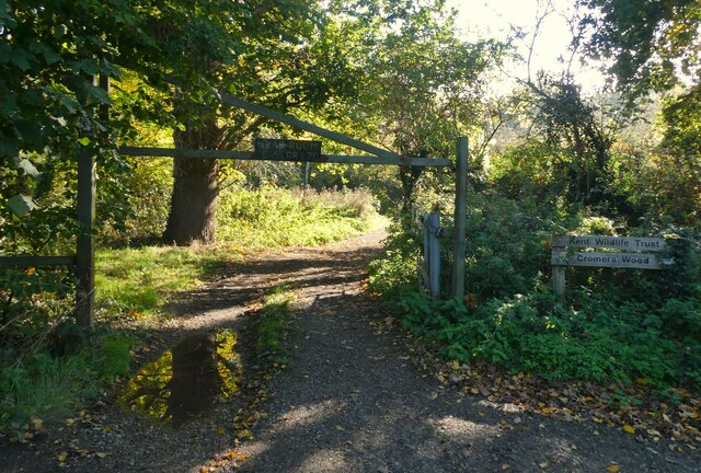
Cromers Wood

Cromers Wood is a 28-hectare (69-acre) nature reserve between Milstead and Sittingbourne in Kent. It is managed by Kent Wildlife Trust.This ancient semi...

Nearby Amenities

Located within 500m of 51.319036,0.74197
Curve Geometry: yes
Lat/Long: 51.315805/0.7393121
Curve Geometry: yes
Lat/Long: 51.3169342/0.7392733
Curve Geometry: yes
Lat/Long: 51.3218429/0.7386468
Curve Geometry: yes
Lat/Long: 51.3204568/0.7396274
Curve Geometry: yes
Lat/Long: 51.3192584/0.7408731
Bus Stop
Fruiterers Arms
Bench: no
Bin: yes
Flag: no
Lit: yes
Naptan AtcoCode: 2400A010720A
Naptan Bearing: W
Naptan BusStopType: CUS
Naptan CommonName: Fruiterers Arms
Naptan Indicator: adj
Naptan Landmark: Green Ln
Naptan NaptanCode: kntamjda
Naptan Street: Bottles Ln
Naptan Verified: no
Public Transport: platform
Shelter: no
Source: naptan_import
Tactile Paving: no
Lat/Long: 51.3180963/0.7473138
Bus Stop
Stockers Hill
Flag: no
Naptan AtcoCode: 2400A010730A
Naptan Bearing: W
Naptan BusStopType: CUS
Naptan CommonName: Stockers Hill
Naptan Indicator: W-bound
Naptan Landmark: Stockers Brow
Naptan NaptanCode: kntamjdg
Naptan Street: Stockers Hill
Naptan Verified: no
Public Transport: platform
Shelter: no
Source: naptan_import
Lat/Long: 51.3190517/0.7418592
Bus Stop
Cromers Road
Flag: no
Naptan AtcoCode: 2400A010740A
Naptan Bearing: SE
Naptan BusStopType: CUS
Naptan CommonName: Cromers Road
Naptan Indicator: SE-bound
Naptan Landmark: Highsted Rd
Naptan NaptanCode: kntamjdj
Naptan Street: Cromers Rd
Naptan Verified: no
Public Transport: platform
Source: naptan_import
Lat/Long: 51.3211362/0.7384955
Bus Stop
Highsted Posting Box
Flag: no
Naptan AtcoCode: 2400A038340A
Naptan Bearing: S
Naptan BusStopType: CUS
Naptan CommonName: Highsted Posting Box
Naptan Indicator: S-bound
Naptan Landmark: Post Box
Naptan NaptanCode: kntdpgdj
Naptan Street: Highsted Road
Naptan Verified: no
Note: this is not a post box, it is a naptan import of what might be a bus stop - but there is not much to indicate there is a bus stop on the ground
Public Transport: platform
Source: naptan_import
Lat/Long: 51.3192284/0.7388619
Post Box
Brand: Royal Mail
Brand Wikidata: Q638098
Brand Wikipedia: en:Royal Mail
Collection Times: Mo-Fr 15:00; Sa 09:30; Su off
Operator: Royal Mail
Operator Wikidata: Q638098
Post Box Mounting: pier
Post Box Type: lamp
Postal Code: ME9
Ref: ME9 76
Royal Cypher: EIIR
Royal Cypher Wikidata: Q33102113
Source: survey;streetlevel imagery;aerial imagery;local knowledge
Lat/Long: 51.3184116/0.7476205
Curve Geometry: yes
Lat/Long: 51.3193735/0.7404232
Curve Geometry: yes
Lat/Long: 51.3202367/0.7398146
Curve Geometry: yes
Lat/Long: 51.3207584/0.7392209
Curve Geometry: yes
Lat/Long: 51.3229078/0.7384577
Curve Geometry: yes
Lat/Long: 51.3180697/0.7389583
Curve Geometry: yes
Lat/Long: 51.3206248/0.7386674
Curve Geometry: yes
Lat/Long: 51.319791/0.7400534
Curve Geometry: yes
Lat/Long: 51.3192396/0.7411616
Curve Geometry: yes
Lat/Long: 51.3193157/0.7405722
Curve Geometry: yes
Lat/Long: 51.3198768/0.7387022
Curve Geometry: yes
Lat/Long: 51.3204609/0.7386319
Rodmersham Green
Place: village
Lat/Long: 51.3192093/0.7477328
Curve Geometry: yes
Lat/Long: 51.3211062/0.738726
Curve Geometry: yes
Lat/Long: 51.32113/0.7386044
Curve Geometry: yes
Lat/Long: 51.3211759/0.7384576
Curve Geometry: yes
Lat/Long: 51.3208857/0.7389523
Curve Geometry: yes
Lat/Long: 51.3208302/0.7390941
Communication Mobile Phone: yes
Communication Tv: yes
Man Made: mast
Tower Type: communication
Lat/Long: 51.319867/0.7413167
Hiking: yes
Information: guidepost
Tourism: information
Lat/Long: 51.3193197/0.7388653
Post Box
Brand: Royal Mail
Brand Wikidata: Q638098
Brand Wikipedia: en:Royal Mail
Collection Times: Mo-Fr 17:15; Sa 09:30; Su off
Note: this is reinstatement of post box added to map by paulbiv in 2016, but deleted by PAL3001 in Changeset #85384963 in 2020 - maybe not understanding the difference between a bus stop named after a post box and the post box itself
Operator: Royal Mail
Operator Wikidata: Q638098
Post Box Design: type_b
Post Box Mounting: brick_pillar
Post Box Type: wall
Ref: ME10 20
Royal Cypher: GR
Royal Cypher Wikidata: Q33102273
Source: survey;streetlevel imagery;aerial imagery
Lat/Long: 51.3192787/0.7388673
Generator Method: photovoltaic
Generator Output Electricity: yes
Generator Source: solar
Generator Type: solar_photovoltaic_panel
Location: roof
Power: generator
Lat/Long: 51.3191579/0.7401314
Generator Method: photovoltaic
Generator Output Electricity: yes
Generator Source: solar
Generator Type: solar_photovoltaic_panel
Location: roof
Power: generator
Lat/Long: 51.3191218/0.7401784
Generator Method: photovoltaic
Generator Output Electricity: yes
Generator Source: solar
Generator Type: solar_photovoltaic_panel
Location: roof
Power: generator
Lat/Long: 51.3199181/0.7389888
Generator Method: photovoltaic
Generator Output Electricity: yes
Generator Source: solar
Generator Type: solar_photovoltaic_panel
Location: roof
Power: generator
Lat/Long: 51.3187681/0.7422155
The data included in this document is from www.openstreetmap.org. The data is made available under ODbL.

Have you been to Highsted?

Leave your review of Highsted below (or comments, questions and feedback).