Black Hill

Hill, Mountain in Wigtownshire

Scotland

Black Hill

Road to Blairderry
Road to Blairderry Credit: David Baird

Black Hill is a prominent hill located in Wigtownshire, Scotland. It forms part of the Galloway Hills range and is situated near the village of Bargrennan. Standing at an elevation of approximately 751 meters (2,464 feet), it is one of the highest peaks in the area.

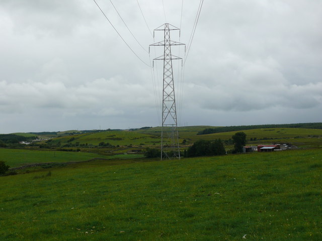
The hill is characterized by its rugged and steep slopes, covered in heather and grasses. Its summit offers breathtaking panoramic views over the surrounding countryside, including the nearby Merrick, which is the highest peak in southern Scotland. On a clear day, it is possible to see as far as the Irish Sea and even the Isle of Man.

Black Hill is a popular destination for hikers and outdoor enthusiasts due to its accessibility and stunning natural beauty. Several walking routes and trails traverse the hill, catering to different levels of difficulty and providing opportunities to explore the diverse flora and fauna of the region.

The hill also holds historical significance, as it was once used as a site for illicit whisky distillation during the 18th and 19th centuries. Remnants of these activities, such as abandoned stills and smuggler's caves, can still be found scattered across the hillside, adding an element of intrigue and mystique to the area.

Overall, Black Hill in Wigtownshire offers a captivating blend of natural beauty, recreational opportunities, and historical intrigue, making it an enticing destination for both locals and visitors alike.

If you have any feedback on the listing, please let us know in the comments section below.

Black Hill Images

Images are sourced within 2km of 54.907829/-4.6986246 or Grid Reference NX2760. Thanks to Geograph Open Source API. All images are credited.

Road to Blairderry
Road to Blairderry
Blairderry Farm from the slopes of Barwhil Looking to Blairderry (Blar doire - the field of the oak wood) over an area of clearfell from Barwhil (Barr chuill - hill of the hazels)
Blairderry Farm from the slopes of Barwhil
Looking to Blairderry (Blar doire - the field of the oak wood) over an area of clearfell from Barwhil (Barr chuill - hill of the hazels)
The Tarf Water from Barwhil
Barlae Bridge The bridge carries the A75 over the Water of Tarf. Barlae comes from the gaelic barr laegh - the calves' hill.
Barlae Bridge
The bridge carries the A75 over the Water of Tarf. Barlae comes from the gaelic barr laegh - the calves' hill.
Water of Tarf from Barlae Bridge Looking south.
Water of Tarf from Barlae Bridge
Looking south.
Water of Tarf from Barlae Bridge Looking north
Water of Tarf from Barlae Bridge
Looking north
Muil farm and the A75 The work taking place behind the farm is in connection with a new water mains being run across the breadth of the county.
Muil farm and the A75
The work taking place behind the farm is in connection with a new water mains being run across the breadth of the county.
Field gate, moor and forestry near Muil farm
Knockbreck View from this hill, which is one of the highest in this grid, towards Barmore Farm.
Knockbreck
View from this hill, which is one of the highest in this grid, towards Barmore Farm.
Knockbreck View south from this hill across the A75 centre of picture towards Mark of Luce Moss on the horizon and Mark of Luce Farm left of the Moss.
Knockbreck
View south from this hill across the A75 centre of picture towards Mark of Luce Moss on the horizon and Mark of Luce Farm left of the Moss.
Knockbreck View west from this hill across open countryside, Barmore Farm can be seen left of picture.
Knockbreck
View west from this hill across open countryside, Barmore Farm can be seen left of picture.
Knockbreck View across the A75 towards the Galloway Hills.
Knockbreck
View across the A75 towards the Galloway Hills.
Knockbreck View across towards Muil Plantation.
Knockbreck
View across towards Muil Plantation.
Knockbreck View across to Barmore Hill and Mark of Luce Moss.
Knockbreck
View across to Barmore Hill and Mark of Luce Moss.
Barmore Farm View of the farm from Knockbreck Hill.
Barmore Farm
View of the farm from Knockbreck Hill.
Knockbreck View north west across open farm land to Artfield Fell Wind Farm with its 15 wind turbines.
Knockbreck
View north west across open farm land to Artfield Fell Wind Farm with its 15 wind turbines.
Pylons View west from underneath these electricity pylons past Barmore Farm right of picture.
Pylons
View west from underneath these electricity pylons past Barmore Farm right of picture.
Artfield Fell Wind Farm View of this wind farm from Knockbreck Hill. The turbines cover 4 grid squares, NX2266, NX2366, NX2267 and NX2367.
Artfield Fell Wind Farm
View of this wind farm from Knockbreck Hill. The turbines cover 4 grid squares, NX2266, NX2366, NX2267 and NX2367.
Show me another place!

Black Hill is located at Grid Ref: NX2760 (Lat: 54.907829, Lng: -4.6986246)

Unitary Authority: Dumfries and Galloway

Police Authority: Dumfries and Galloway

What 3 Words

///argued.meanest.mouse. Near Newton Stewart, Dumfries & Galloway

Related Wikis

Barhapple Loch

Barhapple Loch is a small semicircular freshwater loch located in Wigtownshire, Dumfries and Galloway in Scotland. Barhapple Loch is principally known...

Tarf Water, Wigtownshire

The Tarf Water is a river in the former county of Wigtownshire in south-west Scotland. It rises on the Ayrshire border (55.0048°N 4.7815°W / 55.0048;...

Kirkcowan railway station

Kirkcowan railway station served the village of Kirkcowan, Dumfries and Galloway, Scotland from 1861 to 1965 on the Portpatrick and Wigtownshire Joint...

Kirkcowan

Kirkcowan is an area about 15 miles in length, and from nearly two to nearly seven miles in breadth, comprising 30,580 acres, of which 7000 are arable...

Nearby Amenities

Located within 500m of 54.907829,-4.6986246
Power: tower
Lat/Long: 54.9087156/-4.6996032
Power: tower
Lat/Long: 54.9099392/-4.6952949
Power: tower
Lat/Long: 54.9076765/-4.7032619
Power: pole
Lat/Long: 54.9098932/-4.6923396
Power: pole
Lat/Long: 54.9094599/-4.6938443
Power: pole
Lat/Long: 54.9090945/-4.6951881
Power: pole
Lat/Long: 54.9086812/-4.6966419
Power: pole
Lat/Long: 54.9083034/-4.6979776
Power: pole
Lat/Long: 54.9080274/-4.6989727
Power: pole
Lat/Long: 54.9076697/-4.7002146
Power: pole
Lat/Long: 54.9073104/-4.7014779
Power: pole
Lat/Long: 54.9069527/-4.7027546
Power: pole
Lat/Long: 54.9065995/-4.7040421
Power: pole
Lat/Long: 54.906248/-4.7052705
The data included in this document is from www.openstreetmap.org. The data is made available under ODbL.

Have you been to Black Hill?

Leave your review of Black Hill below (or comments, questions and feedback).