Garvock Hill
Hill, Mountain in Renfrewshire
Scotland
Garvock Hill
Garvock Hill is a prominent hill located in the county of Renfrewshire, Scotland. Situated near the village of Kilmacolm, it is part of the scenic Clyde Muirshiel Regional Park. With its elevation reaching 300 meters (984 feet) above sea level, Garvock Hill is a notable landmark in the area, offering stunning panoramic views of the surrounding countryside.
The hill is characterized by its gentle slopes and lush greenery, covered predominantly by grass and heather. It is home to a variety of flora and fauna, making it a popular destination for nature enthusiasts and walkers. The hill's diverse ecosystem supports various plant species, including wildflowers and ferns, while birds such as buzzards and kestrels can often be spotted soaring above.
A network of well-marked paths and trails traverse Garvock Hill, providing opportunities for hikers and walkers to explore its natural beauty. One of the most popular routes is the Garvock Hill Circular Walk, which takes visitors on a scenic journey around the hill, offering breathtaking views of the surrounding countryside.
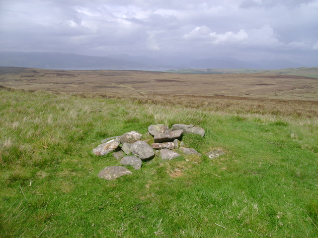
Aside from its natural beauty, Garvock Hill also holds historical significance. On its summit lies the remains of an Iron Age hill fort, believed to have been constructed around 2,000 years ago. This archaeological site attracts history enthusiasts who are fascinated by the region's ancient past.
Overall, Garvock Hill is a picturesque and historically rich destination, inviting visitors to immerse themselves in its natural wonders and explore its intriguing past.
If you have any feedback on the listing, please let us know in the comments section below.
Garvock Hill Images
Images are sourced within 2km of 55.88561/-4.7845303 or Grid Reference NS2569. Thanks to Geograph Open Source API. All images are credited.


Garvock Hill is located at Grid Ref: NS2569 (Lat: 55.88561, Lng: -4.7845303)
Unitary Authority: Inverclyde
Police Authority: Renfrewshire and Inverclyde
What 3 Words
///connected.happy.offices. Near Inverkip, Inverclyde
Nearby Locations
Related Wikis

Inverclyde
Inverclyde (Scots: Inerclyde, Scottish Gaelic: Inbhir Chluaidh, pronounced [iɲiɾʲˈxl̪ˠuəj], "mouth of the Clyde") is one of 32 council areas used for local...

Inverclyde (UK Parliament constituency)
Inverclyde is a parliamentary constituency of the House of Commons of the Parliament of the United Kingdom. It replaced Greenock and Inverclyde and the...

Loch Thom
Loch Thom is a reservoir which since 1827 has provided a water supply to the town of Greenock in Inverclyde, Scotland. It is named after the civil engineer...

Gryffe Reservoirs
The Gryffe Reservoirs, also spelled 'Gryfe', take their name from the River Gryffe, name deriving from the Gaelic garbh meaning "rough stream". are two...
Nearby Amenities
Located within 500m of 55.88561,-4.7845303Have you been to Garvock Hill?
Leave your review of Garvock Hill below (or comments, questions and feedback).