Colaouse Hill
Hill, Mountain in Renfrewshire
Scotland
Colaouse Hill

The requested URL returned error: 429 Too Many Requests
If you have any feedback on the listing, please let us know in the comments section below.
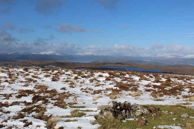
Colaouse Hill Images
Images are sourced within 2km of 55.894362/-4.7854775 or Grid Reference NS2570. Thanks to Geograph Open Source API. All images are credited.


Colaouse Hill is located at Grid Ref: NS2570 (Lat: 55.894362, Lng: -4.7854775)
Unitary Authority: Inverclyde
Police Authority: Renfrewshire and Inverclyde
What 3 Words
///submerged.undertook.flip. Near Inverkip, Inverclyde
Nearby Locations
Related Wikis

Loch Thom
Loch Thom is a reservoir which since 1827 has provided a water supply to the town of Greenock in Inverclyde, Scotland. It is named after the civil engineer...

Inverclyde (UK Parliament constituency)
Inverclyde is a parliamentary constituency of the House of Commons of the Parliament of the United Kingdom. It replaced Greenock and Inverclyde and the...

Inverclyde
Inverclyde (Scots: Inerclyde, Scottish Gaelic: Inbhir Chluaidh, pronounced [iɲiɾʲˈxl̪ˠuəj], "mouth of the Clyde") is one of 32 council areas used for local...

Gryffe Reservoirs
The Gryffe Reservoirs, also spelled 'Gryfe', take their name from the River Gryffe, name deriving from the Gaelic garbh meaning "rough stream". are two...
Nearby Amenities
Located within 500m of 55.894362,-4.7854775Have you been to Colaouse Hill?
Leave your review of Colaouse Hill below (or comments, questions and feedback).