Braid Hill

Hill, Mountain in Wigtownshire

Scotland

Braid Hill

Road to Blairderry
Road to Blairderry Credit: David Baird

Braid Hill, located in Wigtownshire, is a small hill situated in southwestern Scotland. It is part of the larger Galloway Hills range and stands at an elevation of approximately 573 meters (1,880 feet). The hill is known for its picturesque landscape and stunning panoramic views of the surrounding countryside.

Braid Hill is characterized by its gentle slopes and green, grassy terrain, making it a popular destination for hikers and nature enthusiasts. It offers a relatively easy ascent, with well-defined paths leading to the summit. Along the way, visitors can enjoy the beauty of the Scottish countryside, with rolling hills, scattered woodlands, and meandering streams.

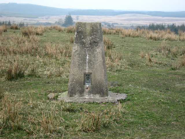
Upon reaching the top of Braid Hill, visitors are rewarded with breathtaking views that stretch for miles. On clear days, it is possible to see the nearby Loch Ryan and the Irish Sea, as well as the neighboring Galloway Forest Park and Isle of Man. The summit also provides an ideal vantage point for birdwatching, with several species of birds, including peregrine falcons and kestrels, often spotted in the area.

Braid Hill is a peaceful and tranquil location, offering visitors a chance to escape the hustle and bustle of everyday life. It provides an opportunity to connect with nature and enjoy the beauty of the Scottish landscape. Whether it is for a leisurely stroll or a challenging hike, Braid Hill offers a rewarding experience for all who venture to its summit.

If you have any feedback on the listing, please let us know in the comments section below.

Braid Hill Images

Images are sourced within 2km of 54.904434/-4.717025 or Grid Reference NX2560. Thanks to Geograph Open Source API. All images are credited.

Road to Blairderry
Road to Blairderry
Barlae Bridge The bridge carries the A75 over the Water of Tarf. Barlae comes from the gaelic barr laegh - the calves' hill.
Barlae Bridge
The bridge carries the A75 over the Water of Tarf. Barlae comes from the gaelic barr laegh - the calves' hill.
Water of Tarf from Barlae Bridge Looking south.
Water of Tarf from Barlae Bridge
Looking south.
Water of Tarf from Barlae Bridge Looking north
Water of Tarf from Barlae Bridge
Looking north
Trig Pillar S8224 - Blairderry Moss Open grazing top. Tertiary station pillar completed 4th December 1954 costing £15.10s.0d, and still in good condition. Spider has replacement OS centre cap with raised small narrow letters. Flush bracket faces 212° SSW. Vented through sight hole on NNE face. Almost full 360° panorama over surrounding conifers.
Trig Pillar S8224 - Blairderry Moss
Open grazing top. Tertiary station pillar completed 4th December 1954 costing £15.10s.0d, and still in good condition. Spider has replacement OS centre cap with raised small narrow letters. Flush bracket faces 212° SSW. Vented through sight hole on NNE face. Almost full 360° panorama over surrounding conifers.
Bridge of Barlae Burn View along the A75 past the bridge to Barlae Farm.
Bridge of Barlae Burn
View along the A75 past the bridge to Barlae Farm.
Cairntop to Barlae This new section of the A75 between Barlae and Cairntop is about one and a half miles (depending on who you listen to), cost £6.5 million and opened on 15th October 2010 two months ahead of schedule. A new dual carriageway has been built alongside the old A75 to improve overtaking opportunities and safety.
Cairntop to Barlae
This new section of the A75 between Barlae and Cairntop is about one and a half miles (depending on who you listen to), cost £6.5 million and opened on 15th October 2010 two months ahead of schedule. A new dual carriageway has been built alongside the old A75 to improve overtaking opportunities and safety.
Bridge of Barlae Burn View of Barlae Burn which runs into Tarf Water about 150 yards from the bridge.
Bridge of Barlae Burn
View of Barlae Burn which runs into Tarf Water about 150 yards from the bridge.
Barlae Bridge on the A75 Note the poor dead badger by the side of the road.
Barlae Bridge on the A75
Note the poor dead badger by the side of the road.
Approaching a dual carriageway on the A75
The beginning of a dual carriageway on the A75
Old Military Road View across to Barlae Hill with transmitter mast and the Galloway Hills on the horizon.
Old Military Road
View across to Barlae Hill with transmitter mast and the Galloway Hills on the horizon.
Old Military Road The track of the old road runs ahead with a new build gravel track to the right.
Old Military Road
The track of the old road runs ahead with a new build gravel track to the right.
Old Military Road At this point the old road runs pretty much along the side of the much more recently built A75 to the right of picture.
Old Military Road
At this point the old road runs pretty much along the side of the much more recently built A75 to the right of picture.
Track to Blairderry View past Derhagie Hill left of picture to Blairderry Hill also left on the horizon with Blairderry Moss wood to the right.
Track to Blairderry
View past Derhagie Hill left of picture to Blairderry Hill also left on the horizon with Blairderry Moss wood to the right.
Track to the A75 This track to Blairderry leads in this direction down to a new dualled section of the A75.
Track to the A75
This track to Blairderry leads in this direction down to a new dualled section of the A75.
Cross roads Straight ahead is the track to Blairderry and to the right and left is the old military road.
Cross roads
Straight ahead is the track to Blairderry and to the right and left is the old military road.
Name that road Somewhere amongst this quagmire is an old military road, but I think I'll leave the search for another day.
Name that road
Somewhere amongst this quagmire is an old military road, but I think I'll leave the search for another day.
Show me another place!

Braid Hill is located at Grid Ref: NX2560 (Lat: 54.904434, Lng: -4.717025)

Unitary Authority: Dumfries and Galloway

Police Authority: Dumfries and Galloway

What 3 Words

///subsystem.stiletto.spurted. Near Newton Stewart, Dumfries & Galloway

Related Wikis

Barhapple Loch

Barhapple Loch is a small semicircular freshwater loch located in Wigtownshire, Dumfries and Galloway in Scotland. Barhapple Loch is principally known...

Tarf Water, Wigtownshire

The Tarf Water is a river in the former county of Wigtownshire in south-west Scotland. It rises on the Ayrshire border (55.0048°N 4.7815°W / 55.0048;...

Kirkcowan railway station

Kirkcowan railway station served the village of Kirkcowan, Dumfries and Galloway, Scotland from 1861 to 1965 on the Portpatrick and Wigtownshire Joint...

Glenluce railway station

Glenluce station was a station open in 1862 on the former Port Road that was constructed on the Portpatrick and Wigtownshire Joint Railway. It served the...

Nearby Amenities

Located within 500m of 54.904434,-4.717025
Power: tower
Lat/Long: 54.9033426/-4.720919
Power: tower
Lat/Long: 54.9047542/-4.7147761
Power: tower
Lat/Long: 54.9042153/-4.7171209
Power: pole
Lat/Long: 54.9049264/-4.7105545
Power: pole
Lat/Long: 54.9046442/-4.7119305
Power: pole
Lat/Long: 54.9043759/-4.7132018
Power: pole
Lat/Long: 54.9040196/-4.7148004
Power: pole
Lat/Long: 54.9037652/-4.7159618
Power: pole
Lat/Long: 54.9034645/-4.7173485
Power: pole
Lat/Long: 54.9031792/-4.7187433
Power: pole
Lat/Long: 54.9028831/-4.7200817
Power: pole
Lat/Long: 54.9025901/-4.7214147
Power: pole
Lat/Long: 54.9023356/-4.7226673
The data included in this document is from www.openstreetmap.org. The data is made available under ODbL.

Have you been to Braid Hill?

Leave your review of Braid Hill below (or comments, questions and feedback).