South Burnt Hill

Hill, Mountain in Ayrshire

Scotland

South Burnt Hill

Cattle in Brisbane Glen Near the top of the Glen, with Noddsdale Water in the background.
Cattle in Brisbane Glen Credit: Thomas Nugent

South Burnt Hill, located in Ayrshire, is a prominent hill that forms part of the Scottish Lowlands. Rising to an elevation of around 260 meters (853 feet), it offers stunning panoramic views of the surrounding countryside. The hill is characterized by its gentle slopes and undulating terrain, making it a popular destination for outdoor enthusiasts and hikers.

South Burnt Hill is situated in close proximity to the village of Ochiltree, providing easy access for visitors. The hill is predominantly covered in heather and grass, with scattered patches of woodland adding to its natural beauty. The varied vegetation supports a diverse range of wildlife, including birds, small mammals, and insects.

The summit of South Burnt Hill is marked by a cairn, which serves as a point of interest for visitors. From here, one can enjoy breathtaking views of the Ayrshire countryside, with rolling hills and fertile farmland stretching as far as the eye can see. On clear days, it is even possible to catch a glimpse of the Ailsa Craig, a volcanic island located off the Ayrshire coast.

South Burnt Hill is a peaceful and tranquil location, offering visitors a chance to escape the hustle and bustle of everyday life. Whether it be a leisurely stroll or a more challenging hike, this hill provides a refreshing outdoor experience for nature lovers and adventurers alike.

If you have any feedback on the listing, please let us know in the comments section below.

South Burnt Hill Images

Images are sourced within 2km of 55.847164/-4.7873709 or Grid Reference NS2565. Thanks to Geograph Open Source API. All images are credited.

Cattle in Brisbane Glen Near the top of the Glen, with Noddsdale Water in the background.
Cattle in Brisbane Glen
Near the top of the Glen, with Noddsdale Water in the background.
North Burnt Hill Approaching the summit of North Burnt Hill.
North Burnt Hill
Approaching the summit of North Burnt Hill.
Trig point on Burnt Hill
Boggy terrain on Burnt Hill
South Burnt Hill The top of South Burnt Hill.
South Burnt Hill
The top of South Burnt Hill.
North Burnt Hill Looking towards Creuch Hill from the top of North Burnt Hill.
North Burnt Hill
Looking towards Creuch Hill from the top of North Burnt Hill.
Craigie Linn One of several water cut scars on the hillside on the east side of Brisbane Glen Road, approaching the top of the glen.
Craigie Linn
One of several water cut scars on the hillside on the east side of Brisbane Glen Road, approaching the top of the glen.
Queenside Muir Moorland north of Hill of Stake. Looking North.
Queenside Muir
Moorland north of Hill of Stake. Looking North.
South Black Burn One of the many burns flowing into Noddsdale Water.
South Black Burn
One of the many burns flowing into Noddsdale Water.
North Black Burn Flows into Noddsdale Water in Brisbane Glen.
Taken from the Old Largs Road.
North Black Burn
Flows into Noddsdale Water in Brisbane Glen. Taken from the Old Largs Road.
Hill of Stake The highest hill in Muirshiel Regional Park.
Hill of Stake
The highest hill in Muirshiel Regional Park.
Pile of Stones The weather can change very quickly in these moors. Looking towards the Firth of Clyde.
Pile of Stones
The weather can change very quickly in these moors. Looking towards the Firth of Clyde.
Burnt Hill Firth of Clyde in the distance.
Burnt Hill
Firth of Clyde in the distance.
Heading Towards Tourgill Glen Lairdside Hill to the left. Firth of Clyde beyond. Light was going very fast.
Heading Towards Tourgill Glen
Lairdside Hill to the left. Firth of Clyde beyond. Light was going very fast.
Fallen Mast
Fallen Mast
Left to Rot! I don't suppose these will ever be removed from the moor.
Left to Rot!
I don't suppose these will ever be removed from the moor.
Peat Hill Looking over the moor towards Burnt Hill.
Peat Hill
Looking over the moor towards Burnt Hill.
Burn on North Burnt Hill One of several small burns on the west side of the hill, overlooking the Old Largs Road from Greenock.
Burn on North Burnt Hill
One of several small burns on the west side of the hill, overlooking the Old Largs Road from Greenock.
Show me another place!

South Burnt Hill is located at Grid Ref: NS2565 (Lat: 55.847164, Lng: -4.7873709)

Unitary Authority: North Ayrshire

Police Authority: Ayrshire

What 3 Words

///firming.glaze.state. Near Skelmorlie, North Ayrshire

Nearby Locations

South Burnt Hill

Related Wikis

Hill of Stake

Hill of Stake is a hill on the boundary between North Ayrshire and Renfrewshire, Scotland. == Geography == The hill is 522 metres (1,713 feet) high and...

British European Airways Flight S200P

British European Airways Flight S200P was a short-haul flight from London-Northolt Airport to Glasgow-Renfrew Airport, Scotland. On 21 April 1948, while...
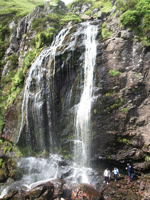
Spout of Garnock

The Spout of Garnock (or Garnock Spout) is a waterfall in Ayrshire, Scotland. At approximately 60–70 ft high, it is the county's highest waterfall. It...

Irish Law (mountain)

Irish Law is a mountain located in North Ayrshire, Scotland near the town of Largs. It has an elevation of 484 metres (1,588 ft) and a prominence of 80...

Nearby Amenities

Located within 500m of 55.847164,-4.7873709
South Burnt Hill
Corbett: no
Ele: 455
Graham: no
Marilyn: no
Munro: no
Natural: peak
Lat/Long: 55.8476581/-4.7878873
The data included in this document is from www.openstreetmap.org. The data is made available under ODbL.

Have you been to South Burnt Hill?

Leave your review of South Burnt Hill below (or comments, questions and feedback).