Bents Hill
Hill, Mountain in Ayrshire
Scotland
Bents Hill

Bents Hill, located in Ayrshire, Scotland, is a prominent hill that offers stunning views and recreational opportunities for visitors. Rising to an elevation of approximately 230 meters (750 feet), it is a popular destination for hikers and nature enthusiasts.
Situated near the town of Troon, Bents Hill is easily accessible and attracts both locals and tourists alike. The hill is known for its distinctive shape, with a gradual incline that makes it suitable for people of all fitness levels. Its slopes are covered in lush green vegetation, providing a picturesque backdrop for outdoor activities.
At the summit of Bents Hill, visitors are rewarded with breathtaking panoramic views of the surrounding countryside, including the nearby Firth of Clyde and the Isle of Arran. On clear days, it is even possible to see as far as the mountains of Northern Ireland.
The hill is also home to a variety of wildlife, making it an ideal spot for birdwatching and nature photography. Visitors may encounter species such as red grouse, skylarks, and meadow pipits during their explorations.
There are several well-marked trails that lead to the summit of Bents Hill, allowing visitors to choose the route that suits their preferences and abilities. Additionally, the hill is equipped with amenities such as parking areas and picnic spots, making it a family-friendly destination.
Overall, Bents Hill in Ayrshire is a natural gem that offers a rewarding experience for outdoor enthusiasts, providing breathtaking views, diverse wildlife, and a tranquil escape from the bustling city life.
If you have any feedback on the listing, please let us know in the comments section below.
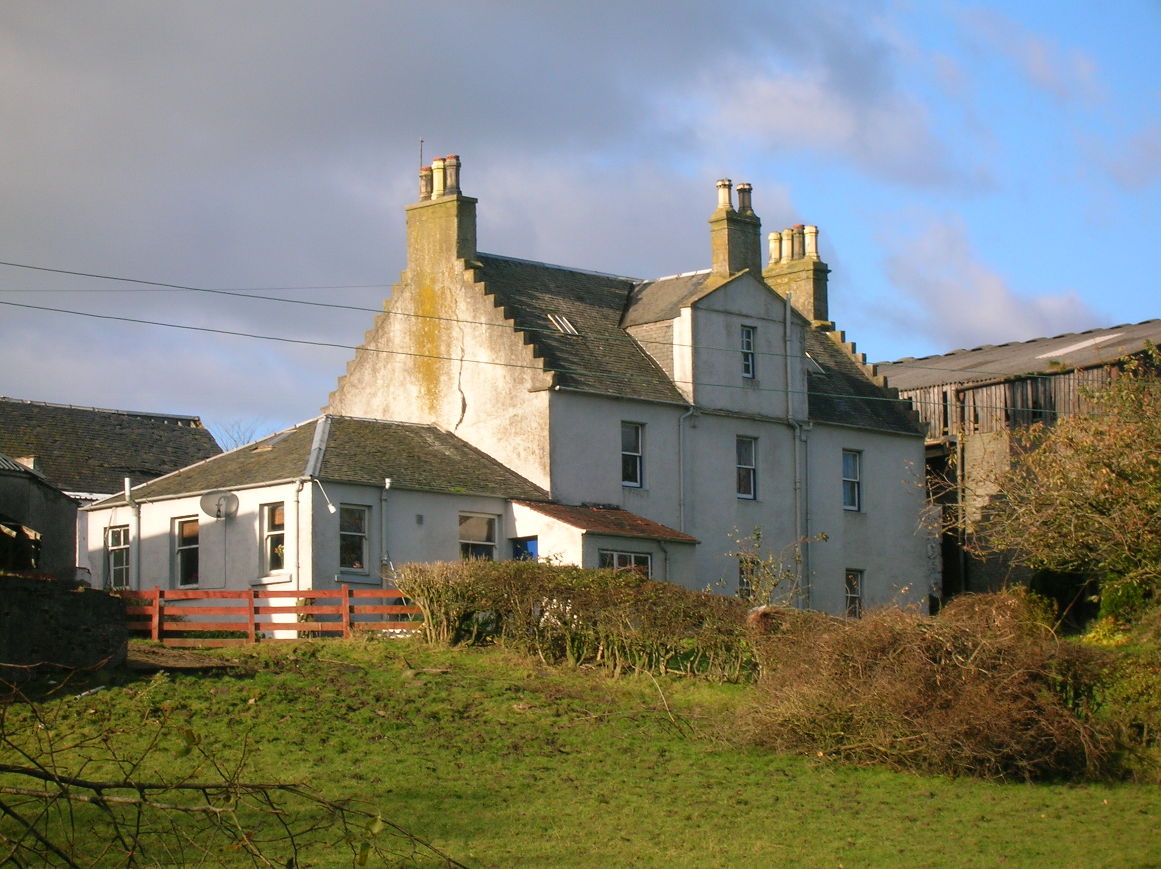
Bents Hill Images
Images are sourced within 2km of 55.722598/-4.7852531 or Grid Reference NS2551. Thanks to Geograph Open Source API. All images are credited.


Bents Hill is located at Grid Ref: NS2551 (Lat: 55.722598, Lng: -4.7852531)
Unitary Authority: North Ayrshire
Police Authority: Ayrshire
What 3 Words
///reports.season.fidelity. Near Dalry, North Ayrshire
Nearby Locations
Related Wikis
Giffordland
Giffordland is in North Ayrshire, Parish of Dalry (Cunninghame) in the former Region of Strathclyde, Scotland. == Background == Giffordland was a small...

Knockewart Loch
Knockewart Loch or Loch Jargon was situated in a hollow lying area beneath Knockewart Hill in the Parish of Ardrossan, North Ayrshire, Scotland. The old...

Drakemyre, North Ayrshire
Drakemyre or Drakemire was once a distinct village on the Rye Water in North Ayrshire, Parish of Dalry, Scotland. The settlement on the B780 road to Kilbirnie...
Dalry, North Ayrshire
Dalry () is a small town in the Garnock Valley in Ayrshire, Scotland. Drakemyre is a northern suburb. == History == Dalry (from Scottish Gaelic: Dail Ruighe...
Related Videos
Lynn Falls | Dalry
A walk around the Lynn Glen in Dalry.
High-Power Rocket launch (Level1), with onboard camera
Backwards-facing camera shot of my Certification flight to High Power Rocketry certification level-1. The rocket was a 130cm ...
Nearby Amenities
Located within 500m of 55.722598,-4.7852531Have you been to Bents Hill?
Leave your review of Bents Hill below (or comments, questions and feedback).