An Coileachan

Hill, Mountain in Ross-shire

Scotland

An Coileachan

Boggy path towards Meallan Buidhe
Boggy path towards Meallan Buidhe Credit: Steven Brown

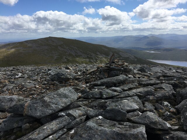
An Coileachan is a prominent hill located in Ross-shire, Scotland. It is part of the Torridon range, which is known for its rugged beauty and stunning landscapes. An Coileachan stands at an elevation of 923 meters (3,028 feet) and is often climbed by hiking enthusiasts and nature lovers.

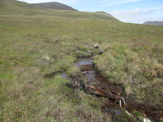
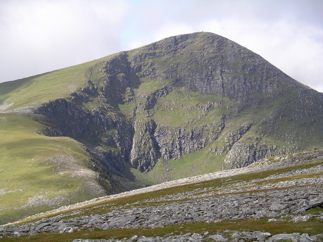
The hill is characterized by its distinctive shape, with a steep and rocky summit. It offers breathtaking views of the surrounding area, including the nearby Loch a' Bhraoin and the surrounding mountains of Beinn Dearg and Beinn an Eoin. The hike to the summit of An Coileachan is challenging, with sections of steep inclines and uneven terrain, but the rewarding vistas make it well worth the effort.

An Coileachan is also home to a variety of flora and fauna, making it a haven for wildlife enthusiasts. The hillside is covered in heather, moss, and grasses, providing a habitat for many species of birds, insects, and small mammals. It is not uncommon to spot golden eagles soaring overhead or catch a glimpse of red deer grazing in the lower slopes.

For those wishing to explore the area further, An Coileachan is often climbed in conjunction with other nearby peaks, such as Maol Chean-dearg or Beinn Liath Mhor. These mountains offer additional opportunities to immerse oneself in the natural beauty of the Torridon range.

Overall, An Coileachan is a stunning and challenging hill that showcases the breathtaking landscapes and rich biodiversity of Ross-shire, making it a must-visit destination for outdoor enthusiasts.

If you have any feedback on the listing, please let us know in the comments section below.

An Coileachan Images

Images are sourced within 2km of 57.667603/-4.9493155 or Grid Reference NH2468. Thanks to Geograph Open Source API. All images are credited.

Boggy path towards Meallan Buidhe
Rough path towards Loch Gorm
Near the summit of An Coileachan
Summit cairn of An Coileachan
Path at Bealach Ban
Path at Bealach Ban
Cairn near the 922m top of Meall Gorm
Bealach Bàn Between Meall Gorm and An Coileachan.
Bealach Bàn
Between Meall Gorm and An Coileachan.
Bealach Bàn Looking towards Meall Gorm.
Bealach Bàn
Looking towards Meall Gorm.
The way down An Coileachan Heading back to the bike at Fannich Lodge, which is amongst the lefthand plantation of the shore of Loch Fannich. the pale strip around Loch Fannich shows it to be a reservoir for a hydroelectric plant with the water levels down a bit after a dry period. See <a href="https://www.geograph.org.uk/photo/35534">NH3162 : Grudie Bridge Power Station</a>.
The way down An Coileachan
Heading back to the bike at Fannich Lodge, which is amongst the lefthand plantation of the shore of Loch Fannich. the pale strip around Loch Fannich shows it to be a reservoir for a hydroelectric plant with the water levels down a bit after a dry period. See NH3162 : Grudie Bridge Power Station.
Female Ptarmigan on An Coileachan I had just disturbed her brood, which despite only being a few days old flew off in one direction. The female then feigned to have an injured wing to lure me (a supposed predator, though I was actually doing a bird survey) away. It stayed with me for a couple of minutes before hiding, it would then return to its chicks once I was far enough away that she wouldn't draw my attention to them.
Female Ptarmigan on An Coileachan
I had just disturbed her brood, which despite only being a few days old flew off in one direction. The female then feigned to have an injured wing to lure me (a supposed predator, though I was actually doing a bird survey) away. It stayed with me for a couple of minutes before hiding, it would then return to its chicks once I was far enough away that she wouldn't draw my attention to them.
Flanks of An Coileachan Large areas of scree, excellent Ptarmigan country. Also every chance of turning an ankle.
Flanks of An Coileachan
Large areas of scree, excellent Ptarmigan country. Also every chance of turning an ankle.
Creag a' Choire Riabhaich Small valley north of Loch Fannich.
Creag a' Choire Riabhaich
Small valley north of Loch Fannich.
An Eigin Looking down from An Coileachan.
An Eigin
Looking down from An Coileachan.
The way down An Coileachan Approaching Fannich Lodge, where the bike is.
The way down An Coileachan
Approaching Fannich Lodge, where the bike is.
Tree remains On the flank of An Coileachan.
Tree remains
On the flank of An Coileachan.
Broad ridge near Meall Gorm Very easy walking. Too wide to concentrate walkers enough to create a path.
Broad ridge near Meall Gorm
Very easy walking. Too wide to concentrate walkers enough to create a path.
Approaching the summit of An Coileachan
Bealach Bàn Looking over the col between Meall Gorm and An Coilleachan towards Sgùrr nan Clach Geala and Sgùrr Mòr in the Fannich group of hills.
Bealach Bàn
Looking over the col between Meall Gorm and An Coilleachan towards Sgùrr nan Clach Geala and Sgùrr Mòr in the Fannich group of hills.
Show me another place!

An Coileachan is located at Grid Ref: NH2468 (Lat: 57.667603, Lng: -4.9493155)

Unitary Authority: Highland

Police Authority: Highlands and Islands

What 3 Words

///twin.bloomers.lobby. Near Achnasheen, Highland

Nearby Locations

An Coileachan

Related Wikis

Ross and Cromarty

Ross and Cromarty (Scottish Gaelic: Ros agus Cromba), also referred to as Ross-shire and Cromartyshire, is a variously defined area in the Highlands and...

Loch Fannich

Loch Fannich is a remote loch in Ross-shire, in Scotland. The loch is located 19 kilometres (12 mi) west of Strathpeffer. == Etymology == The name Fannich...

Sgùrr Mòr (Fannichs)

Sgùrr Mòr is the highest of the nine Munros in the mountain range known as the Fannichs in northern Scotland. This range is located between Loch Fannich...

Fannichs

The Fannichs are a range of mountains located in Highland, Scotland. It lies between Loch Fannich in the southeast and Loch Broom in the northwest. According...

Nearby Amenities

Located within 500m of 57.667603,-4.9493155
An Coileachan
Description: The little cock
Ele: 923
Munro: yes
Munro Number: M266
Natural: peak
Source: NPE
Wikidata: Q13125497
Lat/Long: 57.667665/-4.94975
The data included in this document is from www.openstreetmap.org. The data is made available under ODbL.

Have you been to An Coileachan?

Leave your review of An Coileachan below (or comments, questions and feedback).