South Hill

Hill, Mountain in Ayrshire

Scotland

South Hill

Entrance to the Ardrossan Wind Farm This 24MW wind farm is made up of twelve 2 MW Danish-designed Vestas V80 turbines.
Entrance to the Ardrossan Wind Farm Credit: Gordon Brown

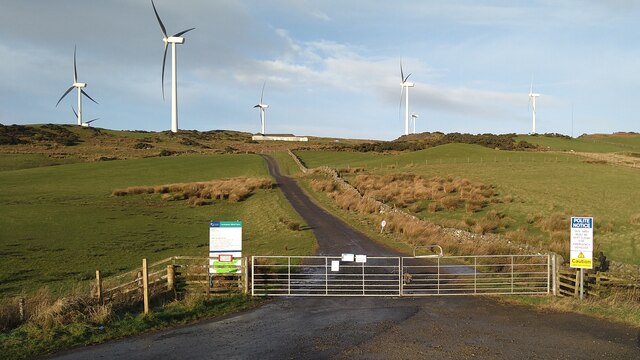
South Hill is a prominent hill located in the region of Ayrshire, Scotland. Standing at an elevation of approximately 320 meters (1,050 feet), it dominates the surrounding landscape and offers breathtaking panoramic views of the countryside.

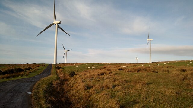
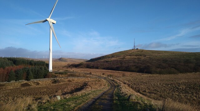
Situated just south of the town of Ayr, South Hill boasts a distinctive conical shape, making it easily recognizable from a distance. The hill is covered in lush green vegetation, providing a haven for a variety of plant and animal species. It is particularly renowned for its heather-covered slopes, which create a beautiful purple hue during the blooming season.

Accessing the summit of South Hill can be achieved via a well-maintained footpath, ensuring a pleasant and accessible hiking experience for all skill levels. The ascent is relatively moderate, and the reward upon reaching the top is well worth the effort. On a clear day, one can see as far as the Isle of Arran and the Mull of Kintyre, adding to the allure of this natural landmark.

South Hill is not only a popular destination for outdoor enthusiasts and nature lovers, but it also holds historical significance. It is said that the hill was once the site of an ancient fortification, with traces of earthworks still visible today.

Overall, South Hill in Ayrshire is a captivating and culturally significant natural feature that offers both recreational opportunities and a glimpse into the region's rich history.

If you have any feedback on the listing, please let us know in the comments section below.
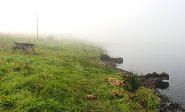
South Hill Images

Images are sourced within 2km of 55.690297/-4.7988678 or Grid Reference NS2447. Thanks to Geograph Open Source API. All images are credited.

Entrance to the Ardrossan Wind Farm This 24MW wind farm is made up of twelve 2 MW Danish-designed Vestas V80 turbines.
Entrance to the Ardrossan Wind Farm
This 24MW wind farm is made up of twelve 2 MW Danish-designed Vestas V80 turbines.
Entrance to Busbie Muir Reservoir
In the Ardrossan Wind Farm Showing four of the twelve 2 MW Danish-designed Vestas V80 turbines.
In the Ardrossan Wind Farm
Showing four of the twelve 2 MW Danish-designed Vestas V80 turbines.
In the Ardrossan Wind Farm Showing two of the twelve 2 MW Danish-designed Vestas V80 turbines.
In the Ardrossan Wind Farm
Showing two of the twelve 2 MW Danish-designed Vestas V80 turbines.
In the Ardrossan Wind Farm In the distance the mast of the North Hill Wireless Station.
In the Ardrossan Wind Farm
In the distance the mast of the North Hill Wireless Station.
Grassy path approaching Blackshaw Hill Blackshaw Hill itself in the distance.
Grassy path approaching Blackshaw Hill
Blackshaw Hill itself in the distance.
Blackshaw Hill cup and ring-marked stone
The track to Blackshaw Farm
View to North Hill Wireless Station, over the un-named lochan There has been a lot of preparation for new tree planting in this area - these are support stakes but seedling trees not yet present.
View to North Hill Wireless Station, over the un-named lochan
There has been a lot of preparation for new tree planting in this area - these are support stakes but seedling trees not yet present.
Busbie Muir Reservoir in morning mist
Wind Farm above Ardrossan Very visible from all over the Firth of Clyde is this a visual intrusion ?  Three more turbines were added in 2008, making the total now 15.
Wind Farm above Ardrossan
Very visible from all over the Firth of Clyde is this a visual intrusion ? Three more turbines were added in 2008, making the total now 15.
Wind farm north of Ardrossan The view west from the B780 is dominated by the wind farm on Hapuland Muir.  It came into operation in August 2004
Wind farm north of Ardrossan
The view west from the B780 is dominated by the wind farm on Hapuland Muir. It came into operation in August 2004
Dykehead Farm One of the activities signposted for this farm is clay pigeon shooting
Dykehead Farm
One of the activities signposted for this farm is clay pigeon shooting
Munnoch Reservoir The windfarm above the town of Ardrossan can be seen along the ridgeline of the hills in this photo, and the reservoir itself is supposed to be good for birdwatching.
Munnoch Reservoir
The windfarm above the town of Ardrossan can be seen along the ridgeline of the hills in this photo, and the reservoir itself is supposed to be good for birdwatching.
Knockewart Farm This photo doesn't really show that this farm is perched on a steep slope. If you look at my photo of <a href="https://www.geograph.org.uk/photo/167664">NS2547 : Munnoch Reservoir</a> you will get a better idea of how steep the slope is, as it can be seen on the right side in that image.
Knockewart Farm
This photo doesn't really show that this farm is perched on a steep slope. If you look at my photo of NS2547 : Munnoch Reservoir you will get a better idea of how steep the slope is, as it can be seen on the right side in that image.
Caddell Farm Caddell Farm with Meikle Ittington farm behind it to the right and Knockwart Farm on the hill in the distance with the Communications Tower on Knockewart Hills above it.
Caddell Farm
Caddell Farm with Meikle Ittington farm behind it to the right and Knockwart Farm on the hill in the distance with the Communications Tower on Knockewart Hills above it.
West Kilbride - Dalry Moor Road, Blackshaw Farm
West Kilbride - Dalry Moor Road, Gill Farm
Show me another place!

South Hill is located at Grid Ref: NS2447 (Lat: 55.690297, Lng: -4.7988678)

Unitary Authority: North Ayrshire

Police Authority: Ayrshire

What 3 Words

///speaker.stuns.kilt. Near West Kilbride, North Ayrshire

Nearby Locations

South Hill Coal Hill

Related Wikis

Knockewart Loch

Knockewart Loch or Loch Jargon was situated in a hollow lying area beneath Knockewart Hill in the Parish of Ardrossan, North Ayrshire, Scotland. The old...
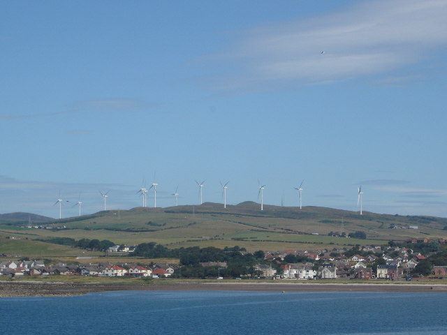
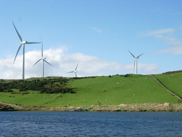
Ardrossan Wind Farm

The 24 megawatt (MW) Ardrossan Wind Farm in Ardrossan, North Ayrshire, Scotland was officially opened on 10 August 2004. The Vestas factory in Argyll,...

Law Hill

Law Hill is a hill in the North Ayrshire town of West Kilbride, overlooking the Firth of Clyde and the hills of Arran beyond. The summit rises above the...

North Ayrshire

North Ayrshire (Scottish Gaelic: Siorrachd Àir a Tuath, pronounced [ˈʃirˠəxk aːɾʲ ə ˈt̪ʰuə]) is one of 32 council areas in Scotland. The council area borders...

Nearby Amenities

Located within 500m of 55.690297,-4.7988678
Generator Method: wind_turbine
Generator Output Electricity: 2.0 MW
Generator Source: wind
Generator Type: horizontal_axis
Power: generator
Lat/Long: 55.6906122/-4.8049348
Power: pole
Lat/Long: 55.6932484/-4.7931061
Power: pole
Lat/Long: 55.6924676/-4.7928291
Power: pole
Lat/Long: 55.6916622/-4.7925416
Power: pole
Lat/Long: 55.6915964/-4.7917667
Power: pole
Lat/Long: 55.6946316/-4.800716
Power: pole
Lat/Long: 55.6942899/-4.8021597
The data included in this document is from www.openstreetmap.org. The data is made available under ODbL.

Have you been to South Hill?

Leave your review of South Hill below (or comments, questions and feedback).