Highfields

Settlement in Staffordshire Stafford

England

Highfields

Brunswick House, Brunswick Terrace, Stafford, under construction Brunswick House is part of a housing development on the south-east side of  Brunswick Terrace. The builders were David Wilson Homes. Owing to the nature of the ground all properties were built on concrete piles driven into the ground.
Brunswick House, Brunswick Terrace, Stafford, under construction Credit: Rod Grealish

Highfields is a small town located in the county of Staffordshire, England. Situated approximately 3 miles north of the county town, Stafford, it is nestled within the picturesque countryside of the West Midlands region. With a population of around 5,000 residents, Highfields has a close-knit and friendly community.

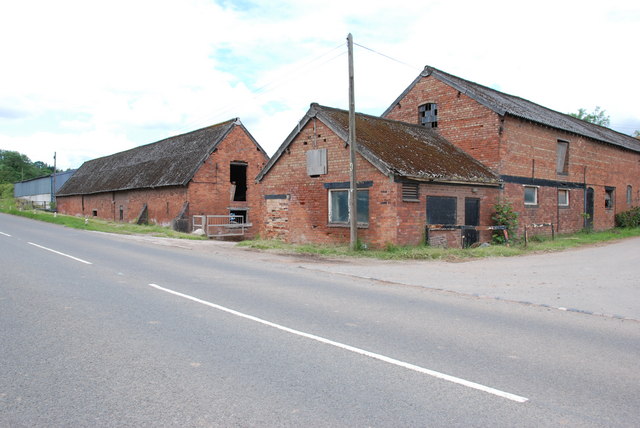
The town is known for its charming and well-preserved historic buildings, showcasing a mix of architectural styles from different eras. Highfields is home to a number of traditional pubs, cafes, and local shops, which add to its quaint and inviting atmosphere. The town also boasts a beautiful parish church, St. Mary's, dating back to the 13th century, which is a prominent landmark in the area.

Nature lovers and outdoor enthusiasts are drawn to Highfields for its stunning surroundings and ample green spaces. The town is surrounded by rolling hills, verdant fields, and scenic woodlands, offering countless opportunities for walking, hiking, and exploring the countryside. Additionally, the nearby Cannock Chase, an Area of Outstanding Natural Beauty, provides further opportunities for outdoor activities and wildlife spotting.

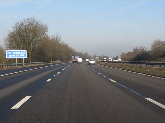
Highfields benefits from excellent transport links, with the M6 motorway passing nearby, connecting the town to major cities such as Birmingham and Manchester. The town also has a railway station, ensuring easy access to other parts of the country.

Overall, Highfields is a picturesque and idyllic town, perfect for those seeking a peaceful and close community atmosphere, alongside the beauty of the Staffordshire countryside.

If you have any feedback on the listing, please let us know in the comments section below.
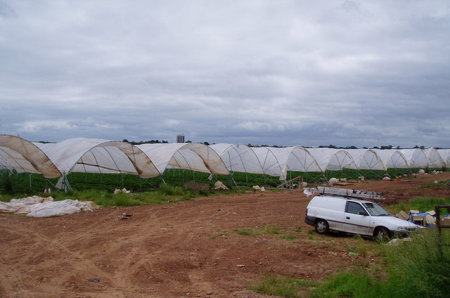
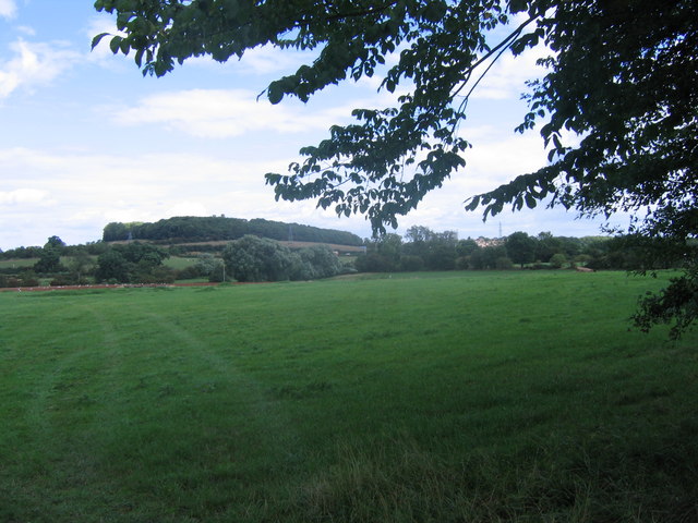
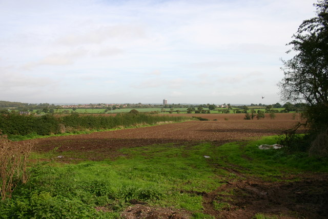
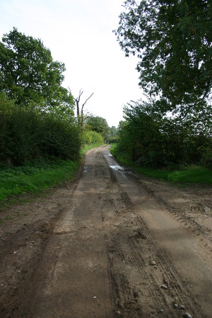
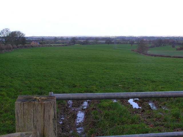
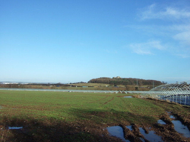
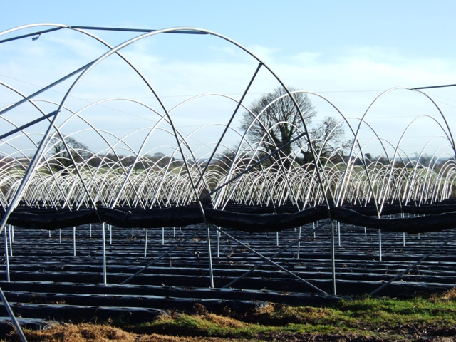
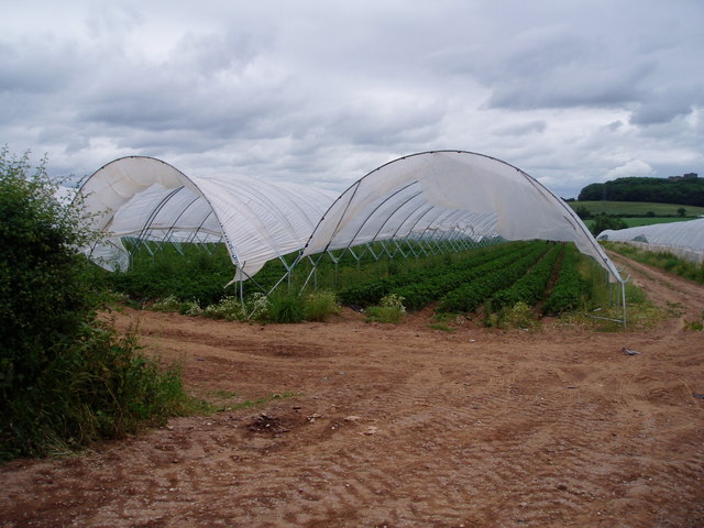
Highfields Images

Images are sourced within 2km of 52.790071/-2.13491 or Grid Reference SJ9121. Thanks to Geograph Open Source API. All images are credited.

Brunswick House, Brunswick Terrace, Stafford, under construction Brunswick House is part of a housing development on the south-east side of  Brunswick Terrace. The builders were David Wilson Homes. Owing to the nature of the ground all properties were built on concrete piles driven into the ground.
Brunswick House, Brunswick Terrace, Stafford, under construction
Brunswick House is part of a housing development on the south-east side of Brunswick Terrace. The builders were David Wilson Homes. Owing to the nature of the ground all properties were built on concrete piles driven into the ground.
Show homes on Hollins Drive off Brunswick Terrace, Stafford The nearest two houses on Hollins Drive were the show homes for the two-storey houses on the development. The nearest house was the entrance to a reception area with staff day accommodation. An arched opening in the party wall led to the second house which was fully furnished and the actual show home.
Show homes on Hollins Drive off Brunswick Terrace, Stafford
The nearest two houses on Hollins Drive were the show homes for the two-storey houses on the development. The nearest house was the entrance to a reception area with staff day accommodation. An arched opening in the party wall led to the second house which was fully furnished and the actual show home.
New build terrace along south-east side of Brunswick Terrace The far houses are occupied according to house prices on Rightmove. The turf has been laid. The nearer houses are awaiting final completion, the rubble removing and the turf laid. The silver birch trees have already been planted. The development was built by David Wilson Homes and advertised in sales-speak as "Brunswick Mews". They are designed to match the external features of the Victorian houses on the other side of the road which are grade II listed
New build terrace along south-east side of Brunswick Terrace
The far houses are occupied according to house prices on Rightmove. The turf has been laid. The nearer houses are awaiting final completion, the rubble removing and the turf laid. The silver birch trees have already been planted. The development was built by David Wilson Homes and advertised in sales-speak as "Brunswick Mews". They are designed to match the external features of the Victorian houses on the other side of the road which are grade II listed
View along Horton Drive to Victorian houses on Brunswick Terrace Houses on Horton Drive under construction.  When completed the houses on the left will be three-storey townhouses. They are designed to match the external features of the Victorian houses on Brunswick Terrace which are grade II listed. The development is by David Wilson Homes.
View along Horton Drive to Victorian houses on Brunswick Terrace
Houses on Horton Drive under construction. When completed the houses on the left will be three-storey townhouses. They are designed to match the external features of the Victorian houses on Brunswick Terrace which are grade II listed. The development is by David Wilson Homes.
Strawberry fields forever! Giant polytunnels housing strawberry plants, just ready for harvesting.
Strawberry fields forever!
Giant polytunnels housing strawberry plants, just ready for harvesting.
Grassy Field Looking across fields near Derrington, across the M6 ,which is this side of the pylon line to Stafford Castle, just poking above the trees.
Grassy Field
Looking across fields near Derrington, across the M6 ,which is this side of the pylon line to Stafford Castle, just poking above the trees.
Fields off Billington Bank, Stafford A view of fields from an unnamed lane off the brow of Billington bank near Stafford. On the horizon in the distance is 'The Keep', a block of flats on the Highfields Estate in Stafford. There used to be a second block but that was brought down and new housing built.
Fields off Billington Bank, Stafford
A view of fields from an unnamed lane off the brow of Billington bank near Stafford. On the horizon in the distance is 'The Keep', a block of flats on the Highfields Estate in Stafford. There used to be a second block but that was brought down and new housing built.
Unnamed Lane to Leese Farm At the end of this unnamed lane is a public footpath and Leese Farm which can just be seen (the two white features are the windows!).
Unnamed Lane to Leese Farm
At the end of this unnamed lane is a public footpath and Leese Farm which can just be seen (the two white features are the windows!).
Leese Farm from Thorneyfields Lane
Farmland near Stafford Castle Looking across fields towards the M6 motorway with Stafford castle sat high on its hill and motte in the distance. 
The large white buildings to the left are the industrial units of Primepoint 14 by Junction 14.
The polytunnels are a part of a strawberry farm that attracts droves of eastern European fruitpickers each summer.
Farmland near Stafford Castle
Looking across fields towards the M6 motorway with Stafford castle sat high on its hill and motte in the distance. The large white buildings to the left are the industrial units of Primepoint 14 by Junction 14. The polytunnels are a part of a strawberry farm that attracts droves of eastern European fruitpickers each summer.
Polytunnels near Stafford Protected cropping for strawberries. The crops are picked by a crowd of eastern European workers during the season.
Polytunnels near Stafford
Protected cropping for strawberries. The crops are picked by a crowd of eastern European workers during the season.
Polytunnels full of strawberries Just west of Stafford.
Polytunnels full of strawberries
Just west of Stafford.
A518 looking west
A518 looking west
M6 Motorway at the power lines The view as the M6 passes underneath the lines.
M6 Motorway at the power lines
The view as the M6 passes underneath the lines.
M6 Motorway near Derrington
Sheep and lambs near Derrington The lambs are growing up rapidly but the mothers were still looking protective.
Sheep and lambs near Derrington
The lambs are growing up rapidly but the mothers were still looking protective.
The A518 A518 looking back to M6 Motorway and Stafford.
The A518
A518 looking back to M6 Motorway and Stafford.
Billington Farm, A518 This farm has seen better days, it looks prime barn conversion property.
Billington Farm, A518
This farm has seen better days, it looks prime barn conversion property.
Show me another place!

Highfields is located at Grid Ref: SJ9121 (Lat: 52.790071, Lng: -2.13491)

Administrative County: Staffordshire

District: Stafford

Police Authority: Staffordshire

What 3 Words

///provoking.fishery.hill. Near Stafford, Staffordshire

Nearby Locations

Rowley Park Highfields

Related Wikis

King Edward VI High School, Stafford

King Edward VI High School is a coeducational secondary school and sixth form located in the Highfields area of Stafford, England. The school's sixth form...

Stafford Town F.C.

Stafford Town Football Club is an English football club based in Stafford. The club's senior men's team play in the North West Counties League Division...

Stafford Grammar School

Stafford Grammar School is a mixed independent day school at Burton Manor, located on the outskirts of Stafford, the county town of Staffordshire. Founded...

Stafford Castle

Stafford Castle is an ancient Grade II listed castle situated two miles west of the town of Stafford in Staffordshire, England. From the time of the Norman...

Nearby Amenities

Located within 500m of 52.790071,-2.13491
Traffic Calming: hump
Lat/Long: 52.7936416/-2.1310417
Traffic Calming: table
Lat/Long: 52.7907315/-2.1299071
Mini Roundabout
Direction: clockwise
Lat/Long: 52.7888974/-2.1315975
Traffic Calming: table
Lat/Long: 52.7920265/-2.1287167
Bus Stop
Auden Way
Bus: yes
Naptan AtcoCode: 3800C710301
Naptan Bearing: SE
Naptan CommonName: Auden Way
Naptan Indicator: Adj
Naptan Landmark: Auden Way
Naptan PlusbusZoneRef: STAFFRD
Naptan Street: Wordsworth Avenue
Naptan Verified: no
Public Transport: platform
Source: naptan_import
Lat/Long: 52.7941693/-2.1335179
Bus Stop
Carisbrooke Drive
Bus: yes
Naptan AtcoCode: 3800C712100
Naptan Bearing: SE
Naptan CommonName: Carisbrooke Drive
Naptan Indicator: Opp
Naptan Landmark: Carisbrooke Drive
Naptan PlusbusZoneRef: STAFFRD
Naptan Street: Sundown Drive
Naptan Verified: no
Public Transport: platform
Source: naptan_import
Lat/Long: 52.7904843/-2.1406543
Bus Stop
Oak Tree Close
Bus: yes
Naptan AtcoCode: 3800C712101
Naptan Bearing: NW
Naptan CommonName: Oak Tree Close
Naptan Indicator: Opp
Naptan Landmark: Oak Tree Close
Naptan Street: Sundown Drive
Naptan Verified: no
Public Transport: platform
Source: naptan_import
Lat/Long: 52.7904107/-2.1420183
Bus Stop
Somerset Road
Bus: yes
Naptan AtcoCode: 3800C718401
Naptan Bearing: SE
Naptan BusStopType: CUS
Naptan CommonName: Somerset Road
Naptan Indicator: Adj
Naptan Landmark: Somerset Road
Naptan PlusbusZoneRef: STAFFRD
Naptan Street: Tennyson Road
Naptan Verified: no
Public Transport: platform
Source: naptan_import
Lat/Long: 52.7905379/-2.1301643
Bus Stop
Oxleathers Court
Bus: yes
Naptan AtcoCode: 3800C727101
Naptan Bearing: SE
Naptan CommonName: Oxleathers Court
Naptan Indicator: Adj
Naptan Landmark: Oxleathers Court
Naptan PlusbusZoneRef: STAFFRD
Naptan Street: Sundown Drive
Naptan Verified: no
Public Transport: platform
Source: naptan_import
Lat/Long: 52.790072/-2.1395704
Bus Stop
Oxleathers Court
Bus: yes
Naptan AtcoCode: 3800C727102
Naptan Bearing: NW
Naptan CommonName: Oxleathers Court
Naptan Indicator: Opp
Naptan Landmark: Oxleathers Court
Naptan PlusbusZoneRef: STAFFRD
Naptan Street: Sundown Drive
Naptan Verified: no
Public Transport: platform
Source: naptan_import
Lat/Long: 52.7897578/-2.139258
Bus Stop
Lilleshall Way
Bus: yes
Naptan AtcoCode: 3800C727301
Naptan Bearing: NW
Naptan CommonName: Lilleshall Way
Naptan Indicator: Opp
Naptan Landmark: Lilleshall Way
Naptan PlusbusZoneRef: STAFFRD
Naptan Street: Sundown Drive
Naptan Verified: no
Public Transport: platform
Source: naptan_import
Lat/Long: 52.7891424/-2.1349706
Bus Stop
Cape Avenue
Bus: yes
Naptan AtcoCode: 3800C727302
Naptan Bearing: SE
Naptan CommonName: Cape Avenue
Naptan Indicator: Opp
Naptan Landmark: Cape Avenue
Naptan PlusbusZoneRef: STAFFRD
Naptan Street: Sundown Drive
Naptan Verified: no
Public Transport: platform
Source: naptan_import
Lat/Long: 52.7896896/-2.1360251
Bus Stop
Stevenson Drive
Bus: yes
Naptan AtcoCode: 3800C727501
Naptan Bearing: SW
Naptan CommonName: Stevenson Drive
Naptan Indicator: Opp
Naptan Landmark: Stevenson Drive
Naptan PlusbusZoneRef: STAFFRD
Naptan Street: Somerset Road
Naptan Verified: no
Public Transport: platform
Source: naptan_import
Lat/Long: 52.7885256/-2.1318695
Bus Stop
Thackeray Walk
Bus: yes
Naptan AtcoCode: 3800C727601
Naptan Bearing: NE
Naptan CommonName: Thackeray Walk
Naptan Indicator: Adj
Naptan Landmark: Thackeray Walk
Naptan PlusbusZoneRef: STAFFRD
Naptan Street: Somerset Road
Naptan Verified: no
Public Transport: platform
Source: naptan_import
Lat/Long: 52.7895404/-2.13121
Bus Stop
West Way
Bus: yes
Naptan AtcoCode: 3800C727801
Naptan Bearing: NE
Naptan CommonName: West Way
Naptan Indicator: Adj
Naptan Landmark: West Way
Naptan PlusbusZoneRef: STAFFRD
Naptan Street: Somerset Road
Naptan Verified: no
Public Transport: platform
Source: naptan_import
Lat/Long: 52.7918748/-2.1289176
Bus Stop
Norfolk Way
Bus: yes
Naptan AtcoCode: 3800C728201
Naptan Bearing: NW
Naptan CommonName: Norfolk Way
Naptan Indicator: Adj
Naptan Landmark: Norfolk Way
Naptan PlusbusZoneRef: STAFFRD
Naptan Street: Barnes Road
Naptan Verified: no
Public Transport: platform
Source: naptan_import
Lat/Long: 52.7878363/-2.1292576
Bus Stop
Coleridge Drive
Bus: yes
Naptan AtcoCode: 3800C728501
Naptan Bearing: SE
Naptan CommonName: Coleridge Drive
Naptan Indicator: Adj
Naptan Landmark: Coleridge Drive
Naptan PlusbusZoneRef: STAFFRD
Naptan Street: Tennyson Road
Naptan Verified: no
Public Transport: platform
Source: naptan_import
Lat/Long: 52.7920841/-2.1331556
Bus Stop
Landor Way
Bus: yes
Naptan AtcoCode: 3800C728801
Naptan Bearing: SW
Naptan CommonName: Landor Way
Naptan Indicator: Adj
Naptan Landmark: Flats
Naptan PlusbusZoneRef: STAFFRD
Naptan Street: Milton Grove
Naptan Verified: no
Public Transport: platform
Source: naptan_import
Lat/Long: 52.7916145/-2.1350375
Bus Stop
Landor Way
Bus: yes
Naptan AtcoCode: 3800C728802
Naptan Bearing: NE
Naptan CommonName: Landor Way
Naptan Indicator: Opp
Naptan Landmark: Flats
Naptan PlusbusZoneRef: STAFFRD
Naptan Street: Milton Grove
Naptan Verified: no
Public Transport: platform
Source: naptan_import
Lat/Long: 52.7915423/-2.1353487
Bus Stop
Sundown Road
Bus: yes
Naptan AtcoCode: 3800C728901
Naptan Bearing: N
Naptan CommonName: Sundown Road
Naptan Indicator: Adj
Naptan Landmark: Sundown Road
Naptan PlusbusZoneRef: STAFFRD
Naptan Street: Milton Grove
Naptan Verified: no
Public Transport: platform
Source: naptan_import
Lat/Long: 52.7902457/-2.1371538
Bus Stop
Sycamore Lane
Bus: yes
Naptan AtcoCode: 3800C729001
Naptan Bearing: N
Naptan CommonName: Sycamore Lane
Naptan Indicator: Adj
Naptan Landmark: Sycamore Lane
Naptan PlusbusZoneRef: STAFFRD
Naptan Street: Whittingham Drive
Naptan Verified: no
Public Transport: platform
Source: naptan_import
Lat/Long: 52.7912077/-2.1369937
Bus Stop
Sycamore Lane
Bus: yes
Naptan AtcoCode: 3800C729002
Naptan Bearing: S
Naptan CommonName: Sycamore Lane
Naptan Indicator: Opp
Naptan Landmark: Sycamore Lane
Naptan PlusbusZoneRef: STAFFRD
Naptan Street: Whittingham Dr
Naptan Verified: no
Public Transport: platform
Source: naptan_import
Lat/Long: 52.7915225/-2.1369354
Bus Stop
Torridge Drive
Bus: yes
Naptan AtcoCode: 3800C729101
Naptan Bearing: NW
Naptan CommonName: Torridge Drive
Naptan Indicator: Adj
Naptan Landmark: Torridge Drive
Naptan PlusbusZoneRef: STAFFRD
Naptan Street: Whittingham Drive
Naptan Verified: no
Public Transport: platform
Source: naptan_import
Lat/Long: 52.792384/-2.138169
Bus Stop
Burlington Drive
Bus: yes
Naptan AtcoCode: 3800C729102
Naptan Bearing: SE
Naptan CommonName: Burlington Drive
Naptan Indicator: Adj
Naptan Landmark: Burlington Dr
Naptan PlusbusZoneRef: STAFFRD
Naptan Street: Whittingham Dr
Naptan Verified: no
Public Transport: platform
Source: naptan_import
Lat/Long: 52.7931564/-2.1388091
Bus Stop
Clarendon Drive
Bus: yes
Naptan AtcoCode: 3800C729201
Naptan Bearing: SW
Naptan CommonName: Clarendon Drive
Naptan Indicator: Opp
Naptan Landmark: Clarendon Dr
Naptan PlusbusZoneRef: STAFFRD
Naptan Street: Whittingham Dr
Naptan Verified: no
Public Transport: platform
Source: naptan_import
Lat/Long: 52.7931548/-2.140218
Bus Stop
Orwell Drive
Bus: yes
Naptan AtcoCode: 3800C729301
Naptan Bearing: SW
Naptan CommonName: Orwell Drive
Naptan Indicator: Adj
Naptan Landmark: Orwell Drive
Naptan PlusbusZoneRef: STAFFRD
Naptan Street: Whittingham Drive
Naptan Verified: no
Public Transport: platform
Source: naptan_import
Lat/Long: 52.7924617/-2.1409572
Bus Stop
Somerset Road
Bus: yes
Naptan AtcoCode: 3800C742501
Naptan Bearing: NW
Naptan CommonName: Somerset Road
Naptan Indicator: Adj
Naptan Landmark: Somerset Road
Naptan PlusbusZoneRef: STAFFRD
Naptan Street: West Way
Naptan Verified: no
Public Transport: platform
Source: naptan_import
Lat/Long: 52.7918677/-2.1285109
Bus Stop
Somerset Road
Bus: yes
Naptan AtcoCode: 3800C742502
Naptan Bearing: SE
Naptan CommonName: Somerset Road
Naptan Indicator: Opp
Naptan Landmark: Somerset Road
Naptan PlusbusZoneRef: STAFFRD
Naptan Street: West Way
Naptan Verified: no
Public Transport: platform
Source: naptan_import
Lat/Long: 52.7918271/-2.1281963
Bus Stop
Swinburne Close
Bus: yes
Naptan AtcoCode: 3800C742701
Naptan Bearing: NW
Naptan CommonName: Swinburne Close
Naptan Indicator: Opp
Naptan Landmark: Swinburne Close
Naptan PlusbusZoneRef: STAFFRD
Naptan Street: West Way
Naptan Verified: no
Public Transport: platform
Source: naptan_import
Lat/Long: 52.7939826/-2.1316635
Bus Stop
Lovelace Close
Bus: yes
Naptan AtcoCode: 3800C742702
Naptan Bearing: SE
Naptan CommonName: Lovelace Close
Naptan Indicator: Adj
Naptan Landmark: Lovelace Close
Naptan PlusbusZoneRef: STAFFRD
Naptan Street: West Way
Naptan Verified: no
Public Transport: platform
Source: naptan_import
Lat/Long: 52.7932102/-2.1303885
Bus Stop
Attlee Crescent
Bus: yes
Naptan AtcoCode: 3800C792600
Naptan Bearing: SE
Naptan CommonName: Attlee Crescent
Naptan Indicator: Adj
Naptan Landmark: Attlee Crescent
Naptan PlusbusZoneRef: STAFFRD
Naptan Street: Bagots Oak
Naptan Verified: no
Public Transport: platform
Source: naptan_import
Lat/Long: 52.7888618/-2.1286379
Turning Circle
Lat/Long: 52.7911756/-2.1408378
Barrier: bollard
Lat/Long: 52.7912178/-2.1365922
Turning Circle
Lat/Long: 52.7900082/-2.1344295
Turning Circle
Lat/Long: 52.7903776/-2.1339071
Turning Circle
Lat/Long: 52.7901821/-2.1364492
Turning Circle
Lat/Long: 52.7896891/-2.1352747
Barrier: bollard
Lat/Long: 52.790953/-2.1332263
Turning Circle
Lat/Long: 52.7900261/-2.1321531
Turning Circle
Lat/Long: 52.7897076/-2.1282676
Source: survey
Lat/Long: 52.7912594/-2.1349051
Turning Circle
Lat/Long: 52.7890826/-2.1301422
Source: survey
Lat/Long: 52.7911556/-2.1347135
Turning Circle
Lat/Long: 52.7941047/-2.1349237
Turning Circle
Lat/Long: 52.7920461/-2.1302445
Barrier: bollard
Lat/Long: 52.7923785/-2.131842
Turning Circle
Lat/Long: 52.7928935/-2.133278
Traffic Calming: table
Lat/Long: 52.7900451/-2.1305426
Post Box
Post Box Type: pillar
Royal Cypher: EIIR
Royal Cypher Wikidata: Q33102113
Lat/Long: 52.7917414/-2.1290271
Generator Method: photovoltaic
Generator Output Electricity: yes
Generator Source: solar
Generator Type: solar_photovoltaic_panel
Location: roof
Power: generator
Lat/Long: 52.7880709/-2.1367228
Generator Method: photovoltaic
Generator Output Electricity: yes
Generator Source: solar
Generator Type: solar_photovoltaic_panel
Location: roof
Power: generator
Lat/Long: 52.7884796/-2.1376482
Generator Method: photovoltaic
Generator Output Electricity: yes
Generator Source: solar
Generator Type: solar_photovoltaic_panel
Location: roof
Power: generator
Lat/Long: 52.7889906/-2.134856
Generator Method: photovoltaic
Generator Output Electricity: yes
Generator Source: solar
Generator Type: solar_photovoltaic_panel
Location: roof
Power: generator
Lat/Long: 52.7872144/-2.1331018
Generator Method: photovoltaic
Generator Output Electricity: yes
Generator Source: solar
Generator Type: solar_photovoltaic_panel
Location: roof
Power: generator
Lat/Long: 52.7871544/-2.1327236
Generator Method: photovoltaic
Generator Output Electricity: yes
Generator Source: solar
Generator Type: solar_photovoltaic_panel
Location: roof
Power: generator
Lat/Long: 52.7872014/-2.1329033
Generator Method: photovoltaic
Generator Output Electricity: yes
Generator Source: solar
Generator Type: solar_photovoltaic_panel
Location: roof
Power: generator
Lat/Long: 52.7873296/-2.1336705
Generator Method: photovoltaic
Generator Output Electricity: yes
Generator Source: solar
Generator Type: solar_photovoltaic_panel
Location: roof
Power: generator
Lat/Long: 52.7874901/-2.1339387
Generator Method: photovoltaic
Generator Output Electricity: yes
Generator Source: solar
Generator Type: solar_photovoltaic_panel
Location: roof
Power: generator
Lat/Long: 52.7874593/-2.1338394
Generator Method: photovoltaic
Generator Output Electricity: yes
Generator Source: solar
Generator Type: solar_photovoltaic_panel
Location: roof
Power: generator
Lat/Long: 52.7874431/-2.1337724
Generator Method: photovoltaic
Generator Output Electricity: yes
Generator Source: solar
Generator Type: solar_photovoltaic_panel
Location: roof
Power: generator
Lat/Long: 52.7874058/-2.1336785
Generator Method: photovoltaic
Generator Output Electricity: yes
Generator Source: solar
Generator Type: solar_photovoltaic_panel
Location: roof
Power: generator
Lat/Long: 52.7879573/-2.1352074
Generator Method: photovoltaic
Generator Output Electricity: yes
Generator Source: solar
Generator Type: solar_photovoltaic_panel
Location: roof
Power: generator
Lat/Long: 52.7879168/-2.135143
Give Way
Direction: forward
Lat/Long: 52.7907501/-2.1299557
Give Way
Direction: backward
Lat/Long: 52.7907157/-2.1298537
Give Way
Direction: forward
Lat/Long: 52.790065/-2.1306009
Give Way
Direction: backward
Lat/Long: 52.7900301/-2.1304933
Traffic Calming: hump
Lat/Long: 52.792804/-2.1299182
Generator Method: photovoltaic
Generator Output Electricity: yes
Generator Source: solar
Generator Type: solar_photovoltaic_panel
Location: roof
Power: generator
Lat/Long: 52.7899963/-2.1278313
Generator Method: photovoltaic
Generator Output Electricity: yes
Generator Source: solar
Generator Type: solar_photovoltaic_panel
Location: roof
Power: generator
Lat/Long: 52.7866385/-2.1310794
Generator Method: photovoltaic
Generator Output Electricity: yes
Generator Source: solar
Generator Type: solar_photovoltaic_panel
Location: roof
Power: generator
Lat/Long: 52.786671/-2.1303177
Generator Method: photovoltaic
Generator Output Electricity: yes
Generator Source: solar
Generator Type: solar_photovoltaic_panel
Location: roof
Power: generator
Lat/Long: 52.7866158/-2.1302158
Generator Method: photovoltaic
Generator Output Electricity: yes
Generator Source: solar
Generator Type: solar_photovoltaic_panel
Location: roof
Power: generator
Lat/Long: 52.7873312/-2.1292287
Generator Method: photovoltaic
Generator Output Electricity: yes
Generator Source: solar
Generator Type: solar_photovoltaic_panel
Location: roof
Power: generator
Lat/Long: 52.7878827/-2.1302667
Generator Method: photovoltaic
Generator Output Electricity: yes
Generator Source: solar
Generator Type: solar_photovoltaic_panel
Location: roof
Power: generator
Lat/Long: 52.7876994/-2.1303445
Generator Method: photovoltaic
Generator Output Electricity: yes
Generator Source: solar
Generator Type: solar_photovoltaic_panel
Location: roof
Power: generator
Lat/Long: 52.7878259/-2.1311331
Generator Method: photovoltaic
Generator Output Electricity: yes
Generator Source: solar
Generator Type: solar_photovoltaic_panel
Location: roof
Power: generator
Lat/Long: 52.7881293/-2.1309507
Generator Method: photovoltaic
Generator Output Electricity: yes
Generator Source: solar
Generator Type: solar_photovoltaic_panel
Location: roof
Power: generator
Lat/Long: 52.7880271/-2.1310231
Generator Method: photovoltaic
Generator Output Electricity: yes
Generator Source: solar
Generator Type: solar_photovoltaic_panel
Location: roof
Power: generator
Lat/Long: 52.7879362/-2.1311116
Generator Method: photovoltaic
Generator Output Electricity: yes
Generator Source: solar
Generator Type: solar_photovoltaic_panel
Location: roof
Power: generator
Lat/Long: 52.7874317/-2.1310499
Barrier: fence
Lat/Long: 52.7911322/-2.1394888
The data included in this document is from www.openstreetmap.org. The data is made available under ODbL.

Have you been to Highfields?

Leave your review of Highfields below (or comments, questions and feedback).