Highfield

Settlement in Hertfordshire Dacorum

England

Highfield

Houses in Cupid Green Lane Being very close to the edge of the development they were intended to look like barn conversions.
Houses in Cupid Green Lane Credit: Jack Hill

Highfield is a small village located in the county of Hertfordshire, England. Situated approximately 30 miles north of London, it is part of the district of St Albans. The village is known for its picturesque landscapes, charming architecture, and tranquil surroundings.

Highfield is primarily a residential area, with a population of around 1,500 residents. The village offers a peaceful and family-friendly environment, attracting those seeking a quieter lifestyle while still remaining within commuting distance of the capital.

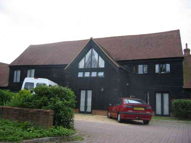
The village is characterized by its mix of traditional and modern houses, ranging from quaint cottages to more contemporary properties. Highfield benefits from a strong sense of community, with various community events and activities organized throughout the year.

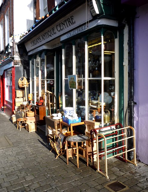
Residents of Highfield enjoy access to several amenities and services. The village has a small local shop for everyday essentials, while a wider range of shopping facilities can be found in nearby St Albans. There are also a number of schools in the surrounding area, providing educational opportunities for families with children.

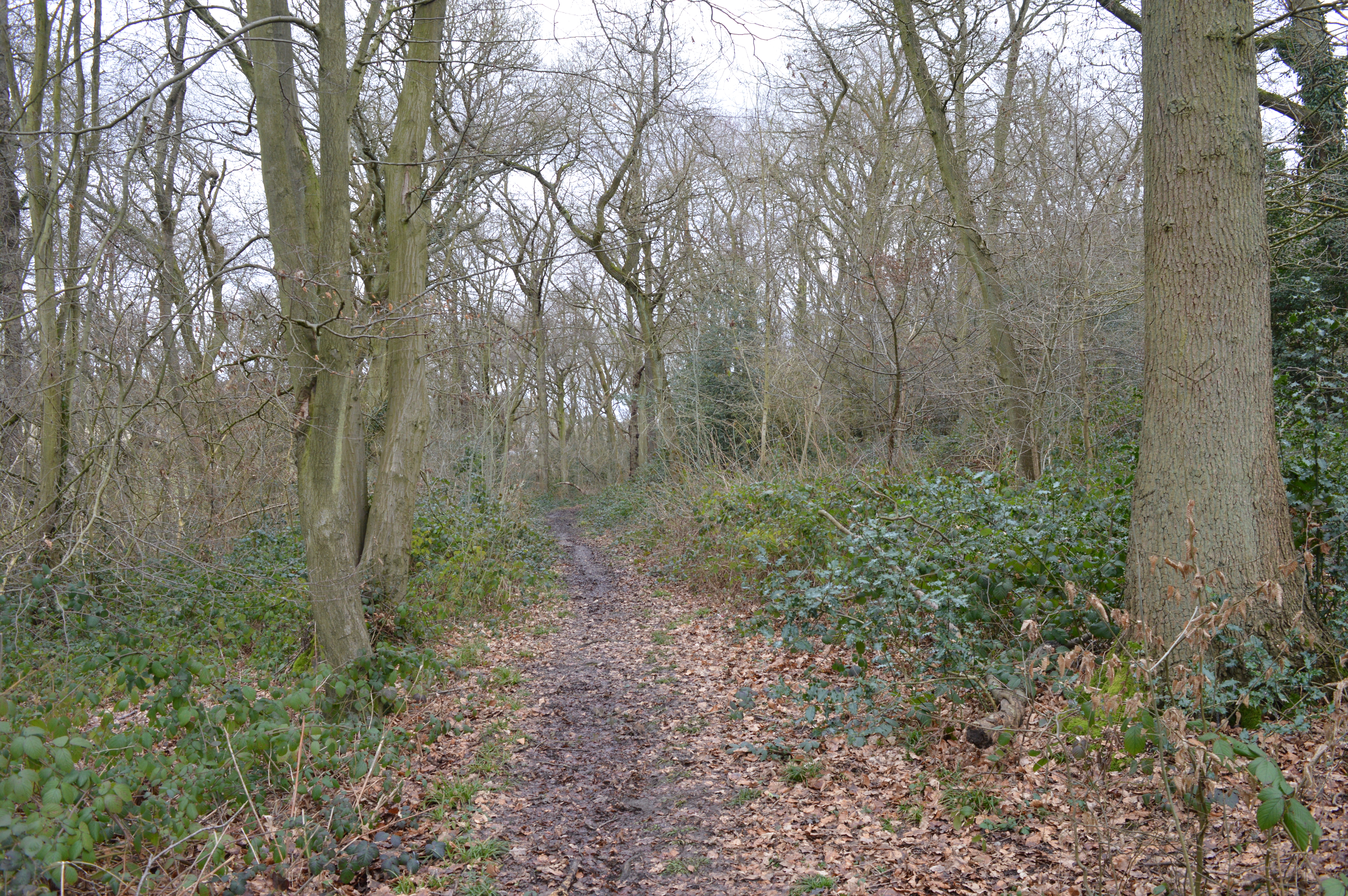
For outdoor enthusiasts, Highfield offers beautiful countryside views and ample opportunities for walking, cycling, and exploring nature. The village is surrounded by green spaces and parks, including the nearby Verulamium Park, which features a lake, Roman ruins, and extensive sports facilities.

Highfield benefits from excellent transport links, with easy access to major road networks, including the M1 and M25 motorways. The village is served by regular bus services, connecting residents to nearby towns and cities. The nearest railway station is in St Albans, providing frequent train services to London and other destinations.

Overall, Highfield is a charming village offering a peaceful and scenic lifestyle, ideal for those seeking a close-knit community and easy access to both nature and urban amenities.

If you have any feedback on the listing, please let us know in the comments section below.

Highfield Images

Images are sourced within 2km of 51.763245/-0.460354 or Grid Reference TL0608. Thanks to Geograph Open Source API. All images are credited.

Houses in Cupid Green Lane Being very close to the edge of the development they were intended to look like barn conversions.
Houses in Cupid Green Lane
Being very close to the edge of the development they were intended to look like barn conversions.
St Barnabas Church, Adeyfield: Interior view The inside of St Barnabas church, seen from the gallery at the west end.
St Barnabas Church, Adeyfield: Interior view
The inside of St Barnabas church, seen from the gallery at the west end.
Part of Hemel Hempstead town centre in Marlowes Near the b&m bargains store.
Part of Hemel Hempstead town centre in Marlowes
Near the b&m bargains store.
Part of Hemel Hempstead town centre in Marlowes Nice.
Part of Hemel Hempstead town centre in Marlowes
Nice.
Hemel Hempstead - High Street Street view, old town of Hemel Hempstead.
Hemel Hempstead - High Street
Street view, old town of Hemel Hempstead.
Hemel Hempstead - Antique shop Jordan's Antique Centre, High Street, Old Town, Hemel Hempstead.
Hemel Hempstead - Antique shop
Jordan's Antique Centre, High Street, Old Town, Hemel Hempstead.
Post office depot on Maylands Avenue, Hemel Hempstead
Screwfix on Maylands Avenue, Hemel Hempstead
Houses on Redbourn Road, Cupid Green
The River Gade through Riverside Centre, Hemel Hempstead A notable addition to the shopping area of Hemel in environmental terms, restoring a section of river channel to a "natural" state and allowing plenty of extra space for peak flows.  If it never sees otters or water voles, it at least represents a move away from the standard approach to treating small rivers at the time Hemel Hempstead New Town was built, which was to confine them in hard-surfaced channels or hide them altogether in culverts.
The River Gade through Riverside Centre, Hemel Hempstead
A notable addition to the shopping area of Hemel in environmental terms, restoring a section of river channel to a "natural" state and allowing plenty of extra space for peak flows. If it never sees otters or water voles, it at least represents a move away from the standard approach to treating small rivers at the time Hemel Hempstead New Town was built, which was to confine them in hard-surfaced channels or hide them altogether in culverts.
Liberty Tea Rooms and Community Hub, Waterhouse Street
Hemel Hempstead Water Gardens The River Gade was well-landscaped as part of the development of Hemel Hempstead New Town, with paths, seating and frequent bridges.
Hemel Hempstead Water Gardens
The River Gade was well-landscaped as part of the development of Hemel Hempstead New Town, with paths, seating and frequent bridges.
Hemel Hempstead:  River Gade and Water Gardens Looking downstream.  The River Gade was well-landscaped as part of the development of Hemel Hempstead New Town, with paths, seating and frequent bridges.  To the right of the picture the dual-level car park, its low wall attractively creeper-covered, contains the scene and screens it from the busy Leighton Buzzard Road on the other side.
Hemel Hempstead: River Gade and Water Gardens
Looking downstream. The River Gade was well-landscaped as part of the development of Hemel Hempstead New Town, with paths, seating and frequent bridges. To the right of the picture the dual-level car park, its low wall attractively creeper-covered, contains the scene and screens it from the busy Leighton Buzzard Road on the other side.
Hemel Hempstead : Tesco By the petrol station with the car wash in view.
Hemel Hempstead : Tesco
By the petrol station with the car wash in view.
Former Practical Driving Test Centre, Hemel Hempstead Situated in Queensway (B487), this DTC opened on Thursday 18th August 2016 replacing the former DTC at Halfords in London Road, <a title="https://www.geograph.org.uk/photo/5050320" href="https://www.geograph.org.uk/photo/5050320">Link</a>. It is adjacent to the fire station and its postcode is HP2 5HA. Update: this DTC closed on Thursday 31st October 2019.
Former Practical Driving Test Centre, Hemel Hempstead
Situated in Queensway (B487), this DTC opened on Thursday 18th August 2016 replacing the former DTC at Halfords in London Road, Link. It is adjacent to the fire station and its postcode is HP2 5HA. Update: this DTC closed on Thursday 31st October 2019.
Notice at Entrance to former Driving Test Centre, Hemel Hempstead This notice is beside the entrance to the DTC in Queensway HP2 5HA. It says the following:
  
 DVSA Driving test candidates entrance.

 Press bell and wait.

 Update: this DTC closed on Thursday 31st October 2019.

 The bell itself is to the left of the notice.
Notice at Entrance to former Driving Test Centre, Hemel Hempstead
This notice is beside the entrance to the DTC in Queensway HP2 5HA. It says the following: DVSA Driving test candidates entrance. Press bell and wait. Update: this DTC closed on Thursday 31st October 2019. The bell itself is to the left of the notice.
Notice outside former Driving Test Centre, Hemel Hempstead This notice is fixed above a metal railing outside the DTC in Queensway HP2 5HA. It says the following:

 Driving Test Candidates permitted entry.
 Park in DVSA marked bays, 10 minutes
 before test only.
 No practicing at any time.

 The notice has the word "practicing" in the last line, but I believe that spelling is incorrect. It should perhaps instead be the word "practising". However, I stand to be corrected if I am wrong. Update: I have now discovered that the word "practicing" is the American equivalent of "practising". Update: this DTC closed on Thursday 31st October 2019.
Notice outside former Driving Test Centre, Hemel Hempstead
This notice is fixed above a metal railing outside the DTC in Queensway HP2 5HA. It says the following: Driving Test Candidates permitted entry. Park in DVSA marked bays, 10 minutes before test only. No practicing at any time. The notice has the word "practicing" in the last line, but I believe that spelling is incorrect. It should perhaps instead be the word "practising". However, I stand to be corrected if I am wrong. Update: I have now discovered that the word "practicing" is the American equivalent of "practising". Update: this DTC closed on Thursday 31st October 2019.
Hemel Hempstead : Hemel Gateway The Travelodge seen here on Hemel Gateway.
Hemel Hempstead : Hemel Gateway
The Travelodge seen here on Hemel Gateway.
Show me another place!

Highfield is located at Grid Ref: TL0608 (Lat: 51.763245, Lng: -0.460354)

Administrative County: Hertfordshire

District: Dacorum

Police Authority: Hertfordshire

What 3 Words

///patch.each.rail. Near Hemel Hempstead, Hertfordshire

Nearby Locations

Highfield Yewtree Wood

Related Wikis

Highfield, Hertfordshire

Highfield is a neighbourhood district in Hemel Hempstead, Hertfordshire, United Kingdom. It was constructed on a green field site as part of the construction...

Howe Grove Wood

Howe Grove Wood is an 8.5 hectare Local Nature Reserve (LNR) in Hemel Hempstead in Hertfordshire. It was declared an LNR in 1997 by Dacorum Borough Council...

Pennine Way Stadium

The Pennine Way Stadium is a multi-use sports facility in Hemel Hempstead, Hertfordshire, and home of Hemel Stags rugby league club. == History == Hemel...

Godwin's Halt railway station

Godwin's Halt railway station served the area of Highfield, Hertfordshire, England from 1905 to 1964 on the Nickey Line. == History == The station opened...

Nearby Amenities

Located within 500m of 51.763245,-0.460354
Mini Roundabout
Direction: clockwise
Lat/Long: 51.7653644/-0.4644801
Traffic Calming: table
Lat/Long: 51.7646747/-0.4599973
Post Office
Highfield Post Office
Addr Country: GB
Addr Postcode: HP2 5SB
Brand: Post Office
Brand Wikidata: Q1783168
Brand Wikipedia: en:Post Office Ltd
Contact Website: https://www.postoffice.co.uk/branch-finder/0671266/highfield
Ref Pol Id: 466
Lat/Long: 51.7654009/-0.4621628
Mini Roundabout
Lat/Long: 51.7632938/-0.4656617
Mini Roundabout
Direction: clockwise
Lat/Long: 51.759854/-0.4643597
Turning Circle
Lat/Long: 51.7630843/-0.4550373
Turning Circle
Lat/Long: 51.7626389/-0.454993
Crossing
Crossing: traffic_signals
Lat/Long: 51.7595233/-0.4630905
Highfield
Created By: Potlatch 0.10f
Is In Town: Hemel Hempstead
Place: suburb
Wikidata: Q5758485
Lat/Long: 51.763332/-0.4605886
Bus Stop
Westerdale
Bench: yes
Bus: yes
Naptan AtcoCode: 210021400720
Naptan Bearing: SW
Naptan CommonName: Westerdale
Naptan Crossing: Mendip Way
Naptan Indicator: opp
Naptan Landmark: Mendip Way
Naptan NaptanCode: hrtdmaga
Naptan PlusbusZoneRef: HEMLHMP
Naptan ShortCommonName: NA
Naptan Street: Cambrian Way
Naptan Verified: no
Public Transport: platform
Shelter: yes
Source: naptan_import
Lat/Long: 51.7653488/-0.4611285
Bus Stop
Saturn Way
Bus: yes
Naptan AtcoCode: 210021400780
Naptan Bearing: SW
Naptan CommonName: Saturn Way
Naptan Crossing: Jupiter Drive JMI School
Naptan Indicator: opp
Naptan Landmark: Jupiter Drive JMI School
Naptan NaptanCode: hrtdmagj
Naptan PlusbusZoneRef: HEMLHMP
Naptan ShortCommonName: NA
Naptan Street: Jupiter Drive
Naptan Verified: no
Public Transport: platform
Source: naptan_import
Lat/Long: 51.7644739/-0.4540717
Bus Stop
St Paul's Church
Bus: yes
Naptan AtcoCode: 210021400800
Naptan Bearing: W
Naptan CommonName: St Paul's Church
Naptan Crossing: Fletcher Way
Naptan Indicator: opp
Naptan Landmark: Fletcher Way
Naptan NaptanCode: hrtdmagm
Naptan PlusbusZoneRef: HEMLHMP
Naptan ShortCommonName: NA
Naptan Street: Solway
Naptan Verified: no
Public Transport: platform
Source: naptan_import
Lat/Long: 51.7645026/-0.4583168
Bus Stop
Bellgate Shops
Bus: yes
Naptan AtcoCode: 210021400820
Naptan Bearing: W
Naptan CommonName: Bellgate Shops
Naptan Crossing: Allandale
Naptan Indicator: opp
Naptan Landmark: Allandale
Naptan NaptanCode: hrtdmagt
Naptan PlusbusZoneRef: HEMLHMP
Naptan ShortCommonName: NA
Naptan Street: Fletcher Way
Naptan Verified: no
Public Transport: platform
Source: naptan_import
Lat/Long: 51.7651386/-0.4629326
Bus Stop
catsdell
Bench: no
Bus: yes
Naptan AtcoCode: 210021400960
Naptan Bearing: SW
Naptan CommonName: Bellgate Shops
Naptan Crossing: Fletcher Way
Naptan Indicator: S-bound
Naptan Landmark: Fletcher Way
Naptan NaptanCode: hrtdmajd
Naptan PlusbusZoneRef: HEMLHMP
Naptan ShortCommonName: NA
Naptan Street: Cattsdell
Naptan Verified: no
Public Transport: platform
Shelter: no
Source: naptan_import
Lat/Long: 51.7642625/-0.4614081
Bus Stop
Mercers
Bench: no
Bus: yes
Naptan AtcoCode: 210021400980
Naptan Bearing: S
Naptan CommonName: Mercers
Naptan Crossing: Thumpers
Naptan Indicator: opp
Naptan Landmark: Thumpers
Naptan NaptanCode: hrtdjwta
Naptan PlusbusZoneRef: HEMLHMP
Naptan ShortCommonName: NA
Naptan Street: Cattsdell
Naptan Verified: no
Public Transport: platform
Shelter: no
Source: naptan_import
Lat/Long: 51.7623896/-0.4627438
Bus Stop
Great Road
Bus: yes
Local Ref: NR
Naptan AtcoCode: 210021401040
Naptan Bearing: SW
Naptan CommonName: Great Road
Naptan Crossing: Great Road
Naptan Indicator: nr
Naptan Landmark: Great Road
Naptan NaptanCode: hrtdmada
Naptan PlusbusZoneRef: HEMLHMP
Naptan ShortCommonName: NA
Naptan Street: Queensway
Naptan Verified: no
Public Transport: platform
Source: naptan_import
Lat/Long: 51.7606524/-0.4568251
Bus Stop
Great Road
Bus: yes
Naptan AtcoCode: 210021411820
Naptan Bearing: NE
Naptan CommonName: Great Road
Naptan Crossing: Jupiter Drive
Naptan Indicator: opp
Naptan Landmark: Jupiter Drive
Naptan NaptanCode: hrtdgpap
Naptan PlusbusZoneRef: HEMLHMP
Naptan ShortCommonName: NA
Naptan Street: Queensway
Naptan Verified: no
Public Transport: platform
Source: naptan_import
Lat/Long: 51.7612113/-0.4562409
Bus Stop
Mercers
Bench: no
Bus: yes
Naptan AtcoCode: 210021411920
Naptan Bearing: N
Naptan CommonName: Mercers
Naptan Crossing: Randalls Ride
Naptan Indicator: adj
Naptan Landmark: Randalls Ride
Naptan NaptanCode: hrtdgpaw
Naptan PlusbusZoneRef: HEMLHMP
Naptan ShortCommonName: NA
Naptan Street: Cattsdell
Naptan Verified: no
Public Transport: platform
Shelter: no
Source: naptan_import
Lat/Long: 51.7618237/-0.4630983
Bus Stop
cattsdell
Bench: no
Bus: yes
Naptan AtcoCode: 210021411940
Naptan Bearing: NE
Naptan CommonName: Bellgate Shops
Naptan Crossing: Royal Stag PH
Naptan Indicator: N-bound
Naptan Landmark: Royal Stag PH
Naptan NaptanCode: hrtdgpda
Naptan PlusbusZoneRef: HEMLHMP
Naptan ShortCommonName: NA
Naptan Street: Cattsdell
Naptan Verified: no
Public Transport: platform
Shelter: no
Source: naptan_import
Lat/Long: 51.7644637/-0.4613157
Bus Stop
Randalls Ride
Bus: yes
Naptan AtcoCode: 210021412062
Naptan Bearing: NE
Naptan CommonName: Randalls Ride
Naptan Crossing: opp Randalls Ride
Naptan Indicator: opp
Naptan Landmark: opp Randalls Ride
Naptan NaptanCode: hrtgwpgj
Naptan PlusbusZoneRef: HEMLHMP
Naptan ShortCommonName: NA
Naptan Street: Allandale
Naptan Verified: no
Public Transport: platform
Source: naptan_import
Lat/Long: 51.7618719/-0.466091
Bus Stop
Randalls Ride
Bus: yes
Local Ref: NR
Naptan AtcoCode: 210021412063
Naptan Bearing: SW
Naptan BusStopType: CUS
Naptan CommonName: Randalls Ride
Naptan Crossing: Randalls Ride
Naptan Indicator: nr
Naptan Landmark: Randalls Ride
Naptan NaptanCode: hrtgwpgm
Naptan PlusbusZoneRef: HEMLHMP
Naptan ShortCommonName: NA
Naptan Street: Allandale
Naptan Verified: no
Public Transport: platform
Source: naptan_import
Lat/Long: 51.7617181/-0.4661064
Bus Stop
Bellgate Shops
Bus: yes
Naptan AtcoCode: 210021412100
Naptan Bearing: E
Naptan CommonName: Bellgate Shops
Naptan Crossing: Cambrian Way
Naptan Indicator: o/s
Naptan Landmark: Cambrian Way
Naptan NaptanCode: hrtdgpdm
Naptan PlusbusZoneRef: HEMLHMP
Naptan ShortCommonName: NA
Naptan Street: Fletcher Way
Naptan Verified: no
Public Transport: platform
Shelter: yes
Source: naptan_import
Lat/Long: 51.7651299/-0.4622663
Bus Stop
St Paul's Church
Bus: yes
Naptan AtcoCode: 210021412120
Naptan Bearing: E
Naptan CommonName: St Paul's Church
Naptan Crossing: Jupiter Drive
Naptan Indicator: o/s
Naptan Landmark: Jupiter Drive
Naptan NaptanCode: hrtdgpdp
Naptan PlusbusZoneRef: HEMLHMP
Naptan ShortCommonName: NA
Naptan Street: Solway
Naptan Verified: no
Public Transport: platform
Shelter: no
Source: naptan_import
Lat/Long: 51.764357/-0.4568147
Bus Stop
Saturn Way
Bus: yes
Naptan AtcoCode: 210021412140
Naptan Bearing: NE
Naptan CommonName: Saturn Way
Naptan Crossing: Community Centre
Naptan Indicator: adj
Naptan Landmark: Community Centre
Naptan NaptanCode: hrtdgpdt
Naptan PlusbusZoneRef: HEMLHMP
Naptan ShortCommonName: NA
Naptan Street: Jupiter Drive
Naptan Verified: no
Public Transport: platform
Shelter: no
Source: naptan_import
Lat/Long: 51.7646247/-0.4539217
Bus Stop
Westerdale
Bus: yes
Naptan AtcoCode: 210021412220
Naptan Bearing: NE
Naptan CommonName: Westerdale
Naptan Crossing: opp Mendip Way
Naptan Indicator: adj
Naptan Landmark: opp Mendip Way
Naptan NaptanCode: hrtdgmwa
Naptan PlusbusZoneRef: HEMLHMP
Naptan ShortCommonName: NA
Naptan Street: Cambrian Way
Naptan Verified: no
Public Transport: platform
Source: naptan_import
Lat/Long: 51.7654568/-0.4611393
Bus Stop
Wensleydale
Bench: no
Bus: yes
Local Ref: NR
Naptan AtcoCode: 210021412225
Naptan Bearing: NE
Naptan CommonName: Wensleydale
Naptan Crossing: opp Barmouth Row
Naptan Indicator: nr
Naptan Landmark: opp Barmouth Row
Naptan NaptanCode: hrtdgmwd
Naptan PlusbusZoneRef: HEMLHMP
Naptan ShortCommonName: NA
Naptan Street: Cambrian Way
Naptan Verified: no
Public Transport: platform
Shelter: no
Source: naptan_import
Lat/Long: 51.7664777/-0.4587568
Bus Stop
Queensway
Bench: no
Bus: yes
Description: No timetable available at stop.
Naptan AtcoCode: 210021460230
Naptan Bearing: N
Naptan BusStopType: CUS
Naptan CommonName: Queensway
Naptan Crossing: Queensway
Naptan Indicator: N-bound
Naptan Landmark: Queensway
Naptan NaptanCode: hrtdapgj
Naptan PlusbusZoneRef: HEMLHMP
Naptan ShortCommonName: NA
Naptan Street: Cattsdell
Naptan Verified: no
Public Transport: platform
Shelter: no
Source: naptan_import
Lat/Long: 51.7598334/-0.4622579
Bus Stop
Queensway
Bench: no
Bus: yes
Naptan AtcoCode: 210021460240
Naptan Bearing: S
Naptan CommonName: Queensway
Naptan Crossing: Queensway
Naptan Indicator: S-bound
Naptan Landmark: Queensway
Naptan NaptanCode: hrtdamwg
Naptan PlusbusZoneRef: HEMLHMP
Naptan ShortCommonName: NA
Naptan Street: Cattsdell
Naptan Verified: no
Public Transport: platform
Shelter: no
Source: naptan_import
Lat/Long: 51.7598046/-0.462114
Fast Food
Lemon Plaice
Cuisine: fish_and_chips
Lat/Long: 51.7652416/-0.4615622
Co-op Food
Brand: Co-op Food
Brand Wikidata: Q3277439
Brand Wikipedia: en:Co-op Food
Operator: The Co-operative Group
Operator Wikidata: Q117202
Shop: convenience
Lat/Long: 51.7653478/-0.4622057
Rogersons
Shop: greengrocer
Lat/Long: 51.7652914/-0.4618948
Hemel Trade and DIY
Shop: doityourself
Lat/Long: 51.7652814/-0.4617392
Traffic Calming: hump
Lat/Long: 51.7653328/-0.4639835
Post Box
Brand: Royal Mail
Brand Wikidata: Q638098
Brand Wikipedia: en:Royal Mail
Collection Times: Mo-Fr 09:00; Sa 07:00
Operator: Royal Mail
Operator Wikidata: Q638098
Post Box Type: lamp
Ref: HP2 75D
Royal Cypher: EIIR
Royal Cypher Wikidata: Q33102113
Source: survey
Survey Date: 2015-09-13
Lat/Long: 51.7622447/-0.4565806
Post Box
Brand: Royal Mail
Brand Wikidata: Q638098
Brand Wikipedia: en:Royal Mail
Collection Times: Mo-Fr 09:00; Sa 07:00
Operator: Royal Mail
Operator Wikidata: Q638098
Post Box Type: pillar
Ref: HP2 14D
Royal Cypher: EIIR
Royal Cypher Wikidata: Q33102113
Source: survey
Survey Date: 2015-09-13
Lat/Long: 51.7624262/-0.462644
Post Box
Brand: Royal Mail
Brand Wikidata: Q638098
Brand Wikipedia: en:Royal Mail
Collection Times: Mo-Fr 09:00; Sa 07:00
Operator: Royal Mail
Operator Wikidata: Q638098
Post Box Type: lamp
Ref: HP2 16D
Royal Cypher: EIIR
Royal Cypher Wikidata: Q33102113
Source: survey
Survey Date: 2015-09-13
Lat/Long: 51.7645654/-0.4590722
Mini Roundabout
Source: survey
Lat/Long: 51.7646189/-0.4585877
Post Box
Brand: Royal Mail
Brand Wikidata: Q638098
Brand Wikipedia: en:Royal Mail
Collection Times: Mo-Fr 18:00; Sa 12:00
Operator: Royal Mail
Operator Wikidata: Q638098
Post Box Type: pillar
Ref: HP2 18
Royal Cypher: EIIR
Royal Cypher Wikidata: Q33102113
Source: survey
Survey Date: 2015-09-13
Lat/Long: 51.764928/-0.4537964
Post Box
Brand: Royal Mail
Brand Wikidata: Q638098
Brand Wikipedia: en:Royal Mail
Collection Times: Mo-Fr 17:15; Sa 12:00
Operator: Royal Mail
Operator Wikidata: Q638098
Post Box Type: pillar
Ref: HP2 15
Royal Cypher: EIIR
Royal Cypher Wikidata: Q33102113
Source: survey
Survey Date: 2015-09-13
Lat/Long: 51.7653966/-0.46257
Speed Camera
Maxspeed: 40 mph
Lat/Long: 51.760507/-0.4571352
Speed Camera
Maxspeed: 30 mph
Lat/Long: 51.7627045/-0.4535589
Crossing
Crossing: unmarked
Crossing Island: no
Tactile Paving: yes
Lat/Long: 51.7596643/-0.4622016
Communication Mobile Phone: yes
Man Made: mast
Tower Type: communication
Lat/Long: 51.7653075/-0.4615561
Traffic Calming: hump
Lat/Long: 51.7647638/-0.4608376
Crossing
Crossing: marked
Lat/Long: 51.7604038/-0.4572779
Direction: 190
Generator Method: photovoltaic
Generator Output Electricity: yes
Generator Solar Modules: 12
Generator Source: solar
Generator Type: solar_photovoltaic_panel
Location: roof
Power: generator
Lat/Long: 51.7633333/-0.4576171
Barrier: bollard
Lat/Long: 51.765061/-0.4550306
Direction: 140
Generator Method: photovoltaic
Generator Output Electricity: yes
Generator Solar Modules: 12
Generator Source: solar
Generator Type: solar_photovoltaic_panel
Location: roof
Power: generator
Lat/Long: 51.7651603/-0.457045
Direction: 130
Generator Method: photovoltaic
Generator Output Electricity: yes
Generator Solar Modules: 10
Generator Source: solar
Generator Type: solar_photovoltaic_panel
Location: roof
Power: generator
Lat/Long: 51.7652287/-0.4569475
Direction: 240
Generator Method: photovoltaic
Generator Output Electricity: yes
Generator Solar Modules: 11
Generator Source: solar
Generator Type: solar_photovoltaic_panel
Location: roof
Power: generator
Lat/Long: 51.7656308/-0.4590677
Direction: 240
Generator Method: photovoltaic
Generator Output Electricity: yes
Generator Solar Modules: 27
Generator Source: solar
Generator Type: solar_photovoltaic_panel
Location: roof
Power: generator
Lat/Long: 51.7652713/-0.4606544
Barrier: bollard
Lat/Long: 51.7650896/-0.4606636
Barrier: bollard
Lat/Long: 51.7650702/-0.4606698
Barrier: bollard
Lat/Long: 51.7650532/-0.4606761
Barrier: bollard
Lat/Long: 51.7650378/-0.4606786
Barrier: bollard
Lat/Long: 51.76502/-0.4606886
Barrier: bollard
Lat/Long: 51.7650045/-0.4606948
Barrier: bollard
Lat/Long: 51.7649859/-0.4607011
Barrier: bollard
Lat/Long: 51.7649697/-0.4607086
Barrier: bollard
Lat/Long: 51.7649349/-0.4607098
Barrier: bollard
Lat/Long: 51.764921/-0.4606923
Barrier: bollard
Lat/Long: 51.764956/-0.4607145
Traffic Calming: table
Lat/Long: 51.7649975/-0.4619711
Traffic Calming: table
Lat/Long: 51.7648772/-0.4614186
Traffic Calming: hump
Lat/Long: 51.764653/-0.4591613
Direction: 240
Generator Method: photovoltaic
Generator Output Electricity: yes
Generator Solar Modules: 12
Generator Source: solar
Generator Type: solar_photovoltaic_panel
Location: roof
Power: generator
Lat/Long: 51.7654775/-0.4584767
Direction: 150
Generator Method: photovoltaic
Generator Output Electricity: yes
Generator Solar Modules: 14
Generator Source: solar
Generator Type: solar_photovoltaic_panel
Location: roof
Power: generator
Lat/Long: 51.765786/-0.4575183
Generator Method: photovoltaic
Generator Output Electricity: yes
Generator Solar Modules: 15
Generator Source: solar
Generator Type: solar_photovoltaic_panel
Location: roof
Power: generator
Tilted: no
Lat/Long: 51.7670955/-0.4589012
Traffic Calming: island
Lat/Long: 51.7633609/-0.4655312
Traffic Calming: island
Lat/Long: 51.7633075/-0.4658151
Traffic Calming: table
Lat/Long: 51.7651442/-0.462706
Traffic Calming: hump
Lat/Long: 51.7652535/-0.4633566
Direction: 200
Generator Method: photovoltaic
Generator Output Electricity: yes
Generator Solar Modules: 12
Generator Source: solar
Generator Type: solar_photovoltaic_panel
Location: roof
Power: generator
Lat/Long: 51.7625507/-0.4608399
Direction: 220
Generator Method: photovoltaic
Generator Output Electricity: yes
Generator Solar Modules: 10
Generator Source: solar
Generator Type: solar_photovoltaic_panel
Location: roof
Power: generator
Lat/Long: 51.7613746/-0.4649171
Barrier: bollard
Lat/Long: 51.7612474/-0.4650767
Parking
Parking: surface
Lat/Long: 51.7628884/-0.4632186
The data included in this document is from www.openstreetmap.org. The data is made available under ODbL.

Have you been to Highfield?

Leave your review of Highfield below (or comments, questions and feedback).