Cauldron Hill

Hill, Mountain in Renfrewshire

Scotland

Cauldron Hill

Dunrod Well - Shielhill Glen Dunrod Well
Dunrod Well - Shielhill Glen Credit: Raibeart MacAoidh

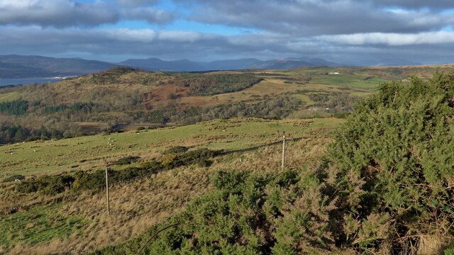
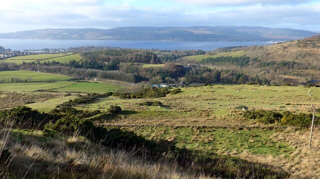
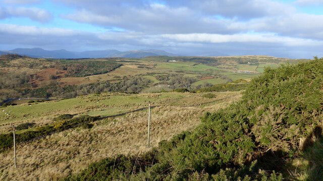
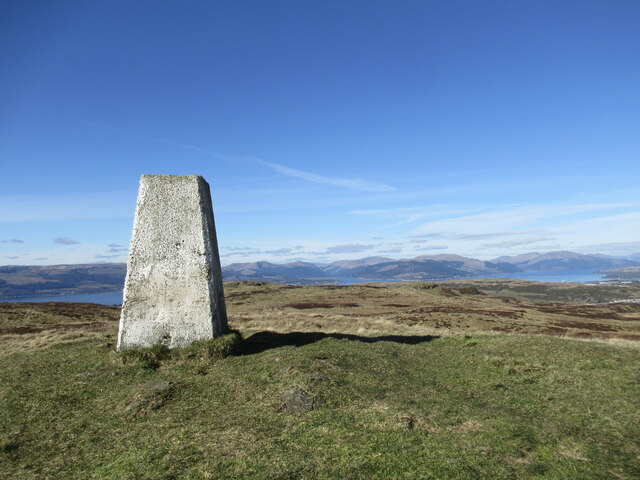
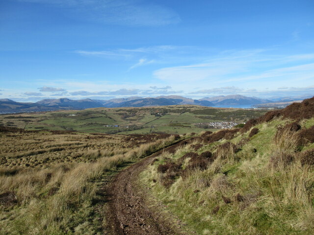
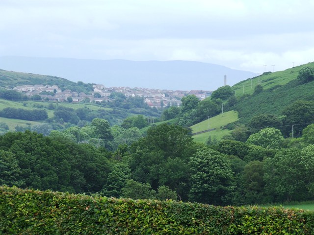
Cauldron Hill, located in Renfrewshire, Scotland, is a prominent geographical feature that stands at an elevation of approximately 260 meters (850 feet). Situated near the village of Lochwinnoch, it offers stunning panoramic views of the surrounding countryside, making it a popular destination for hikers and nature enthusiasts.

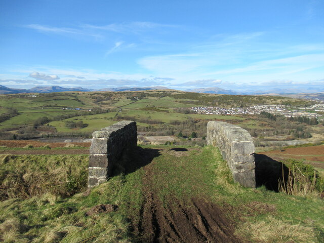
Covered in lush green vegetation, Cauldron Hill forms part of the larger Clyde Muirshiel Regional Park, which encompasses almost 108 square miles of diverse landscapes. The hill is composed mainly of sandstone, contributing to its distinctive reddish-brown hue.

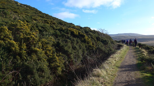
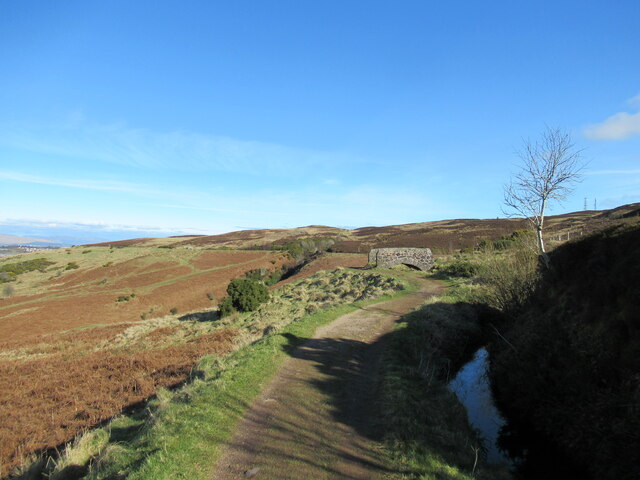
As visitors ascend Cauldron Hill, they are greeted with a variety of flora and fauna, including heather, ferns, and wildflowers. The hill is also home to several species of birds, such as buzzards and kestrels, which can be spotted soaring overhead.

At the summit of Cauldron Hill, walkers are rewarded with breathtaking views across Renfrewshire and the nearby Lochwinnoch Nature Reserve. On clear days, it is even possible to catch a glimpse of the distant hills of Argyllshire and Ayrshire.

Cauldron Hill offers a range of walking routes, catering to both experienced hikers and those seeking a more leisurely stroll. The paths are well-maintained, allowing visitors to navigate the hill with relative ease.

Overall, Cauldron Hill is a picturesque and accessible natural landmark, attracting visitors from near and far who seek to immerse themselves in the beauty of Scotland's countryside.

If you have any feedback on the listing, please let us know in the comments section below.

Cauldron Hill Images

Images are sourced within 2km of 55.917209/-4.8246198 or Grid Reference NS2372. Thanks to Geograph Open Source API. All images are credited.

Dunrod Well - Shielhill Glen Dunrod Well
Dunrod Well - Shielhill Glen
Dunrod Well
Land below the Greenock Cut Across the Firth of Clyde, housing in Dunoon just visible.
Land below the Greenock Cut
Across the Firth of Clyde, housing in Dunoon just visible.
Looking down on Dunrod from the Greenock Cut The Firth of Clyde showing in the distance.
Looking down on Dunrod from the Greenock Cut
The Firth of Clyde showing in the distance.
On the Greenock Cut path above Majeston
Looking down from the Greenock Cut
Bridge over Inverkip Road at Chrisswell The A78 runs for 42 miles between Greenock and Prestwick. For much of its route, it follows the northern section of the Ayrshire coast. Although it is classified as a primary road throughout its length, the standard varies. Much of the road is single carriageway, both for a short distance through Greenock and a 21-mile stretch between Inverkip and Ardrossan. The rest is dual carriageway; between the Eglinton and Warrix interchanges there are in fact 3 lanes in each direction, and the road is constructed to motorway standard (with full grade separation at junctions) except for a lack of hard shoulders.
Bridge over Inverkip Road at Chrisswell
The A78 runs for 42 miles between Greenock and Prestwick. For much of its route, it follows the northern section of the Ayrshire coast. Although it is classified as a primary road throughout its length, the standard varies. Much of the road is single carriageway, both for a short distance through Greenock and a 21-mile stretch between Inverkip and Ardrossan. The rest is dual carriageway; between the Eglinton and Warrix interchanges there are in fact 3 lanes in each direction, and the road is constructed to motorway standard (with full grade separation at junctions) except for a lack of hard shoulders.
Shielhill and Dunrod Hill A hill farm above the Firth of Clyde near Inverkip.
Shielhill and Dunrod Hill
A hill farm above the Firth of Clyde near Inverkip.
Wind turbine below Dunrod Hill A single turbine just east of Shielhill.
Wind turbine below Dunrod Hill
A single turbine just east of Shielhill.
The summit of Hillside Hill A view from the rather tautologically named Hillside Hill, with Loch Thom visible below.
The summit of Hillside Hill
A view from the rather tautologically named Hillside Hill, with Loch Thom visible below.
Trig pillar on Dunrod Hill A trig with a view across the Firth of Clyde to the hills of the Cowal Peninsula.
Trig pillar on Dunrod Hill
A trig with a view across the Firth of Clyde to the hills of the Cowal Peninsula.
Between Dunrod Hill and Cauldron Hill A small moorland hill with rock outcrops on the moorland plateau above the Firth of Clyde.
Between Dunrod Hill and Cauldron Hill
A small moorland hill with rock outcrops on the moorland plateau above the Firth of Clyde.
Bridge over aqueduct, Greenock Cut The Greenock Cut is a nineteenth-century aqueduct that once transported water from Loch Thom to the industries of Greenock. This is one of numerous small bridges over the aqueduct, with the derelict former IBM site visible below, and the outskirts of Greenock in the middle ground.
Bridge over aqueduct, Greenock Cut
The Greenock Cut is a nineteenth-century aqueduct that once transported water from Loch Thom to the industries of Greenock. This is one of numerous small bridges over the aqueduct, with the derelict former IBM site visible below, and the outskirts of Greenock in the middle ground.
Path by the Greenock Cut The Greenock Cut is a nineteenth-century aqueduct that once transported water from Loch Thom to the industries of Greenock. This path alongside is now a popular walk.
Path by the Greenock Cut
The Greenock Cut is a nineteenth-century aqueduct that once transported water from Loch Thom to the industries of Greenock. This path alongside is now a popular walk.
A glimpse of Greenock The south-western outskirts of Greenock are visible in this view towards the distant hills of the Cowal Peninsula.
A glimpse of Greenock
The south-western outskirts of Greenock are visible in this view towards the distant hills of the Cowal Peninsula.
Water-waster in sluice house, Greenock Cut A control mechanism for removing excess water from the Greenock Cut aqueduct.  For a fuller description, see <a href="https://www.geograph.org.uk/photo/1234617">NS2372 : Water-waster mechanism</a>.
Water-waster in sluice house, Greenock Cut
A control mechanism for removing excess water from the Greenock Cut aqueduct. For a fuller description, see NS2372 : Water-waster mechanism.
Dunrod Road Near the junction with the A78 Inverkip Road, looking towards the bridge over the Spango Burn. Note the water tap on the left, which is a recent addition. 

See also <a href="https://www.geograph.org.uk/photo/7567073">NS2273 : Water tap on Dunrod Road</a>.
Dunrod Road
Near the junction with the A78 Inverkip Road, looking towards the bridge over the Spango Burn. Note the water tap on the left, which is a recent addition. See also NS2273 : Water tap on Dunrod Road.
Auchness Bridge The high, stone arched bridge carries Dunrod Road high above the Spango Burn. Unfortunately it's a regular target for fly-tippers.
Auchness Bridge
The high, stone arched bridge carries Dunrod Road high above the Spango Burn. Unfortunately it's a regular target for fly-tippers.
The Spango Burn Looking downstream from Auchness Bridge.
The Spango Burn
Looking downstream from Auchness Bridge.
Show me another place!

Cauldron Hill is located at Grid Ref: NS2372 (Lat: 55.917209, Lng: -4.8246198)

Unitary Authority: Inverclyde

Police Authority: Renfrewshire and Inverclyde

What 3 Words

///upward.barrel.asking. Near Inverkip, Inverclyde

Related Wikis

IBM railway station

IBM railway station (formerly known as IBM Halt) is a currently disused railway station on the Inverclyde Line, 25+1⁄2 miles (41 km) west of Glasgow Central...

Spango Valley

Spango Valley is a steep sided valley to the south-west of Greenock, Scotland. It runs approximately south west to north east for around 2.4 km (1.5 mi...

Ravenscraig railway station

Ravenscraig railway station was a railway station located south west of the town of Greenock, Inverclyde, Scotland, originally as part of the Greenock...

Braeside, Greenock

Braeside is a neighbourhood situated on the far west side of Greenock, in Inverclyde, Scotland. It has one primary schools in its vicinity, Aileymill,...

Nearby Amenities

Located within 500m of 55.917209,-4.8246198
Ele: 285
Natural: peak
Lat/Long: 55.9173573/-4.824729
Power: pole
Lat/Long: 55.9149464/-4.8313786
Power: pole
Lat/Long: 55.9142006/-4.8297766
Power: pole
Lat/Long: 55.9138924/-4.8284683
Power: pole
Lat/Long: 55.9136402/-4.8273892
Power: pole
Lat/Long: 55.9133448/-4.8261518
Power: pole
Lat/Long: 55.9130985/-4.8250977
Power: pole
Lat/Long: 55.9128474/-4.8240124
The data included in this document is from www.openstreetmap.org. The data is made available under ODbL.

Have you been to Cauldron Hill?

Leave your review of Cauldron Hill below (or comments, questions and feedback).