Cnoc Breac

Hill, Mountain in Sutherland

Scotland

Cnoc Breac

Loch Assynt Taken from the A894.
Loch Assynt Credit: Peter Jeffery

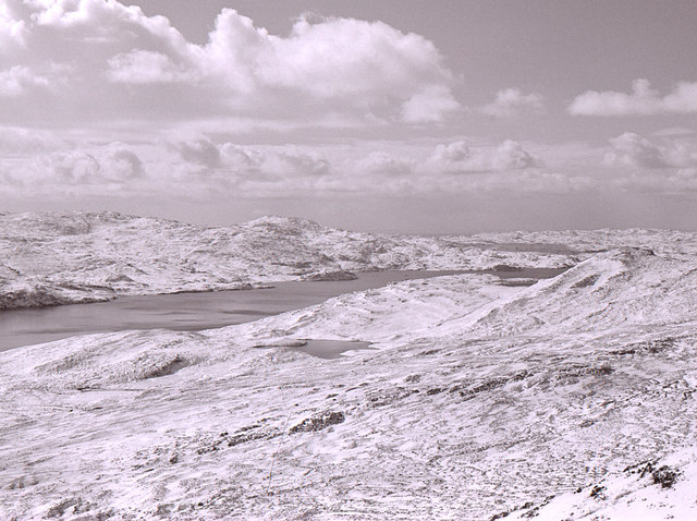
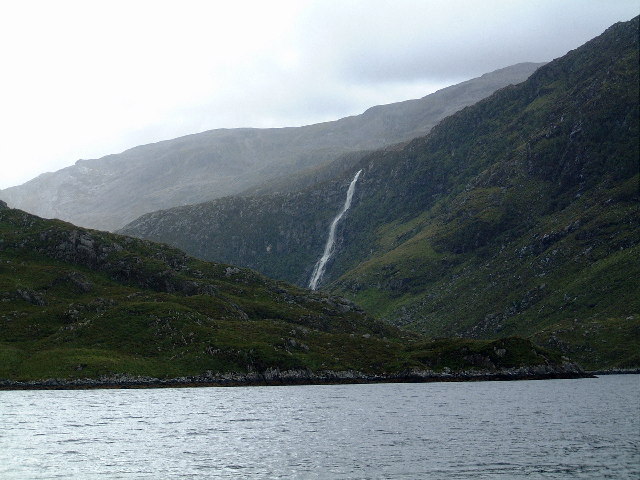
Cnoc Breac is a prominent hill located in the county of Sutherland, in the northern part of Scotland. With an elevation of approximately 687 meters (2,254 feet), it is classified as a hill rather than a mountain, but it still offers breathtaking views of the surrounding landscape.

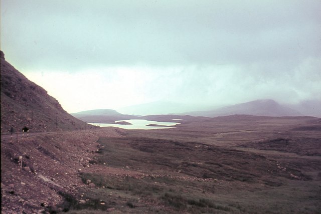
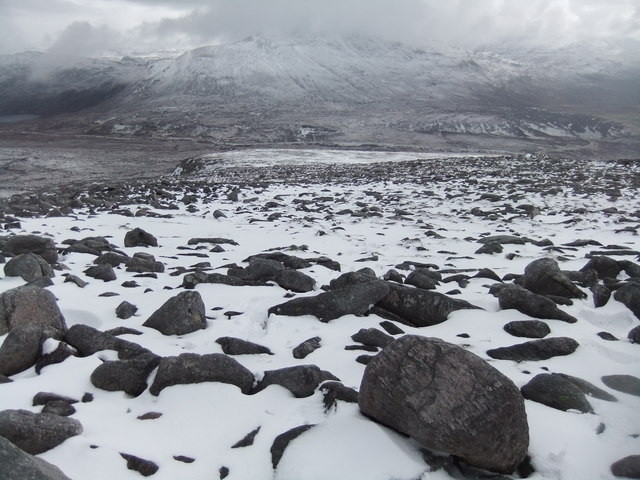
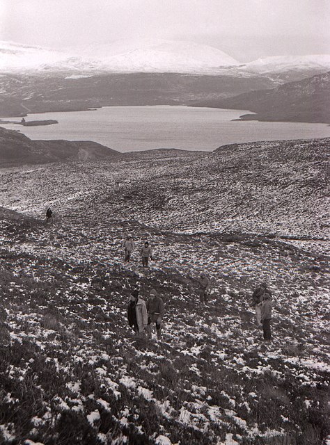
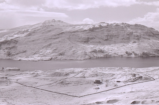
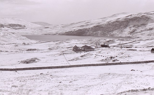
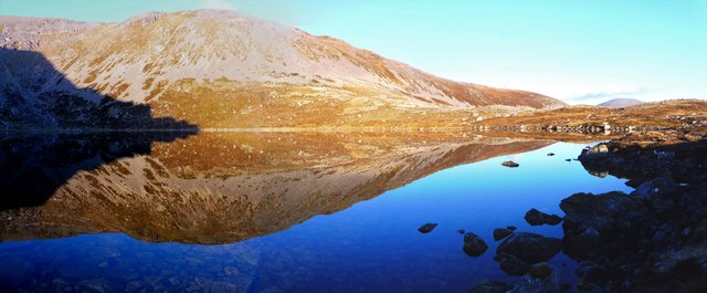
Situated within the vast and rugged Scottish Highlands, Cnoc Breac is part of a range of hills known for their wild and untamed beauty. Its summit is marked by a cairn, a man-made pile of stones used as a navigational aid or a memorial. From this vantage point, on a clear day, visitors can be rewarded with panoramic vistas of the surrounding countryside, including Loch Shin and the nearby Ben Klibreck mountain range.

Cnoc Breac is a popular destination for hikers and outdoor enthusiasts, who are drawn to its challenging yet rewarding trails. The ascent to the summit is relatively steep, but well-defined paths make it accessible to experienced walkers. The surrounding area offers a diverse range of flora and fauna, including heather, mosses, and various bird species, providing a rich and vibrant ecosystem.

Due to its remote location, Cnoc Breac provides a serene and peaceful atmosphere, away from the hustle and bustle of urban life. It is a place where visitors can immerse themselves in the natural beauty of the Scottish Highlands, taking in the grandeur of the landscape and experiencing a sense of tranquility amidst the rolling hills and moorlands.

If you have any feedback on the listing, please let us know in the comments section below.

Cnoc Breac Images

Images are sourced within 2km of 58.190683/-5.0060587 or Grid Reference NC2326. Thanks to Geograph Open Source API. All images are credited.

Loch Assynt Taken from the A894.
Loch Assynt
Taken from the A894.
Coire Dearg, Glas Bheinn The lower part of the coire with the NW ridge on the right.
Coire Dearg, Glas Bheinn
The lower part of the coire with the NW ridge on the right.
Sail Gharbh from Glas Bheinn From the slopes leading to the NW ridge from lower Coire Dearg.
Sail Gharbh from Glas Bheinn
From the slopes leading to the NW ridge from lower Coire Dearg.
Northwest ridge, Glas Bheinn Amongst the quartzite boulders on the ridge to this Corbett summit. Loch na Gainmhich is the nearest body of water with the sea loch of Loch a' Chairn Bhain more distant, dividing into Loch Glendhu and Loch Glencoul. Loch Unapool is in view on the moorland, upper left corner.
Northwest ridge, Glas Bheinn
Amongst the quartzite boulders on the ridge to this Corbett summit. Loch na Gainmhich is the nearest body of water with the sea loch of Loch a' Chairn Bhain more distant, dividing into Loch Glendhu and Loch Glencoul. Loch Unapool is in view on the moorland, upper left corner.
Cloud descending on Glas Bheinn A chance for some navigation practice on the way to the summit with cloud descending to about 600m.
Cloud descending on Glas Bheinn
A chance for some navigation practice on the way to the summit with cloud descending to about 600m.
Loch a' Choire Dheirg on Glas Bheinn One of several lochans on this quartzite mountain, seen from the NW ridge.
Loch a' Choire Dheirg on Glas Bheinn
One of several lochans on this quartzite mountain, seen from the NW ridge.
Spidean Coinich
Spidean Coinich
Below Spidean Coinich on the east side
Path to Quinag
Path to Quinag
Footbridge over upper Allt Sgiathaig A path leads from a car park beside the A894 to the bridge and beyond, over the moor towards Spidean Coinich, the central peak in the image and one of three Corbetts which are part of the small range of mountain tops known as Quinag.
Footbridge over upper Allt Sgiathaig
A path leads from a car park beside the A894 to the bridge and beyond, over the moor towards Spidean Coinich, the central peak in the image and one of three Corbetts which are part of the small range of mountain tops known as Quinag.
View towards Loch Assynt Ardvreck Castle can just be seen on the peninsula on the left
View towards Loch Assynt
Ardvreck Castle can just be seen on the peninsula on the left
Achmore Farm in the snow Seen from the lower slopes of Glas Bheinn. Loch Assynt is beyond, with Beinn Gharbh on the other side.
Achmore Farm in the snow
Seen from the lower slopes of Glas Bheinn. Loch Assynt is beyond, with Beinn Gharbh on the other side.
View towards Lochan Feòir in the snow Looking from the lower slopes of Glas Bheinn. Lochan Feòir is the small lochan in the middle, with Loch Assynt beyond.
View towards Lochan Feòir in the snow
Looking from the lower slopes of Glas Bheinn. Lochan Feòir is the small lochan in the middle, with Loch Assynt beyond.
Achmore Farm Loch Assynt is in the distance.
Achmore Farm
Loch Assynt is in the distance.
Bend in A894 at the top of Skiag
The A894 descends to Skiag Bridge The junction at Skiag Bridge is just visible right of centre. With Loch Assynt and Stronchrubie cliff in the background.
The A894 descends to Skiag Bridge
The junction at Skiag Bridge is just visible right of centre. With Loch Assynt and Stronchrubie cliff in the background.
The Marble Road Looking north near the summit of the Marble Road.
The Marble Road
Looking north near the summit of the Marble Road.
Loch a' Choire Dheirg The cirque, one of several beneath Glas Bheinn, has a floor of Scourian gneiss whilst its upper slopes are formed in the Basal Quartzite and overlying Pipe Rock, both of Cambrian age, the quartzite being separated from the gneiss by the Glencoul Thrust Fault.
Loch a' Choire Dheirg
The cirque, one of several beneath Glas Bheinn, has a floor of Scourian gneiss whilst its upper slopes are formed in the Basal Quartzite and overlying Pipe Rock, both of Cambrian age, the quartzite being separated from the gneiss by the Glencoul Thrust Fault.
Show me another place!

Cnoc Breac is located at Grid Ref: NC2326 (Lat: 58.190683, Lng: -5.0060587)

Unitary Authority: Highland

Police Authority: Highlands and Islands

What 3 Words

///sneezing.generals.gasping. Near Inchnadamph, Highland

Nearby Locations

Cnoc Breac

Related Wikis

Glas Bheinn (Assynt)

Glas Bheinn (776 m) is a mountain in the Northwest Highlands of Scotland. It lies in the Assynt area of Sutherland, in the far north of the country. A...

Loch Assynt

Loch Assynt (Scottish Gaelic: Loch Asaint) is a freshwater loch in Sutherland, Scotland, 8 kilometres (5.0 mi) north-east of Lochinver. Situated in a spectacular...
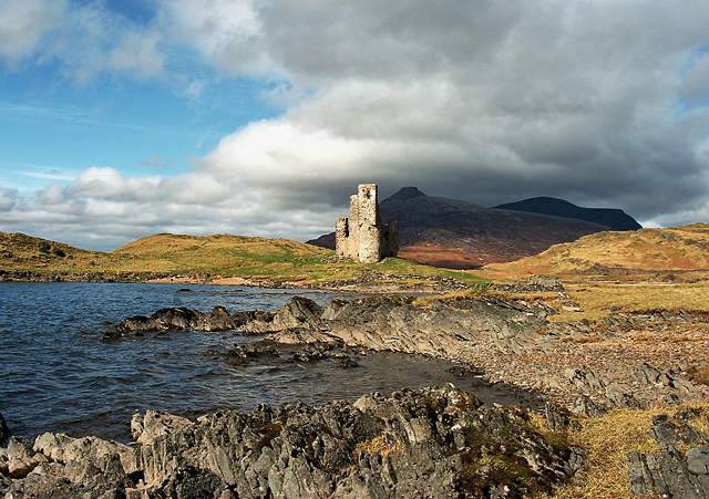
Ardvreck Castle

Ardvreck Castle is a castle, now ruinous, standing on a rocky promontory in Loch Assynt, Sutherland, Scotland, UK. The structure dates from about 1490...

Assynt

Assynt (Scottish Gaelic: Asainn [ˈas̪ɪɲ] or Asainte [ˈas̪ɪɲtʲə]) is a sparsely populated area in the south-west of Sutherland, lying north of Ullapool...

Quinag

Quinag (Scottish Gaelic: A’ Chuineag) is an 808 m high mountain range in Sutherland in the Scottish Highlands, with an undulating series of peaks along...

Assynt Castle

Assynt Castle was a castle, located on Eilean Assynt located in Loch Assynt, Highland in Scotland. == History == The Murray of Culbin family held lands...

Inchnadamph

Inchnadamph is a hamlet in Assynt, Sutherland, Scotland. The name is an anglicisation of the Gaelic name Innis nan Damh meaning 'meadow of the stags'....

Eas a' Chual Aluinn

Eas a' Chual Aluinn (grid reference NC281278) in the parish of Assynt, Sutherland, Highland, Scotland, is the tallest waterfall in the United Kingdom with...

Nearby Amenities

Located within 500m of 58.190683,-5.0060587
Parking
Source: Bing
Lat/Long: 58.1901412/-5.0144409
The data included in this document is from www.openstreetmap.org. The data is made available under ODbL.

Have you been to Cnoc Breac?

Leave your review of Cnoc Breac below (or comments, questions and feedback).