Benbrake Hill

Hill, Mountain in Wigtownshire

Scotland

Benbrake Hill

The Southern Upland Way near Craigairie
The Southern Upland Way near Craigairie Credit: Dave Kelly

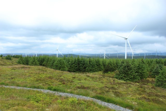
Benbrake Hill is a prominent hill located in Wigtownshire, Scotland. Standing at an elevation of 271 meters (889 feet), it offers stunning panoramic views of the surrounding countryside and coastline. The hill is a popular destination for hikers and nature enthusiasts, with a well-defined trail leading to the summit.

The terrain of Benbrake Hill is mainly grassy with scattered patches of heather and gorse. The hill is relatively easy to climb, making it suitable for hikers of all levels of experience. Along the way, visitors may encounter various wildlife species such as birds, rabbits, and deer.

At the summit of Benbrake Hill, hikers are rewarded with breathtaking views of the Irish Sea and the rolling hills of Wigtownshire. On a clear day, it is possible to see as far as the Isle of Man and the Mull of Galloway.

Overall, Benbrake Hill is a picturesque and tranquil spot that offers a peaceful escape from the hustle and bustle of everyday life. Whether you're looking for a challenging hike or simply a place to relax and enjoy nature, Benbrake Hill is sure to impress.

If you have any feedback on the listing, please let us know in the comments section below.

Benbrake Hill Images

Images are sourced within 2km of 55.035938/-4.7742112 or Grid Reference NX2274. Thanks to Geograph Open Source API. All images are credited.

The Southern Upland Way near Craigairie
The Southern Upland Way near Craig Airie Fell
Young trees in Kilgallioch Forest Some young naturally reseeded conifers in Kilgallioch Forest near Craig Airie Fell. The wind turbines in the background are part of the Kilgallioch Wind Farm.
Young trees in Kilgallioch Forest
Some young naturally reseeded conifers in Kilgallioch Forest near Craig Airie Fell. The wind turbines in the background are part of the Kilgallioch Wind Farm.
Footpath crossing Craig Airie Fell A footpath surfaced with loose stone crossing the top of Craig Airie Fell. The Fell top allows an extensive view to the west across Kilgallioch Forest and the wind farm which shares the same ground.
Footpath crossing Craig Airie Fell
A footpath surfaced with loose stone crossing the top of Craig Airie Fell. The Fell top allows an extensive view to the west across Kilgallioch Forest and the wind farm which shares the same ground.
Looking northeast from the top of Craig Airie Fell Looking in a north easterly direction from the top of Craig Airie Fell. An isolated picnic table can be seen beside the path. The wind turbines are all part of the large Kilgallioch Wind Farm which fills the view in most directions from the top of the hill.
Looking northeast from the top of Craig Airie Fell
Looking in a north easterly direction from the top of Craig Airie Fell. An isolated picnic table can be seen beside the path. The wind turbines are all part of the large Kilgallioch Wind Farm which fills the view in most directions from the top of the hill.
Looking to the northwest from the top of Craig Airie Fell Looking across a mix of trees and wind turbines in Kilgallioch Forest.
Looking to the northwest from the top of Craig Airie Fell
Looking across a mix of trees and wind turbines in Kilgallioch Forest.
Looking east from the top of Craig Airie Fell Looking east from Craig Airie Fell. Loch Derry can be seen in the distance amongst the forest of wind turbines of Kilgallioch Wind Farm.
Looking east from the top of Craig Airie Fell
Looking east from Craig Airie Fell. Loch Derry can be seen in the distance amongst the forest of wind turbines of Kilgallioch Wind Farm.
Path in Kilgallioch Forest A footpath in Kilgallioch Forest with a loose stone surface. One of the many wind turbines in the forest is visible in the distance through the gap in the trees.
Path in Kilgallioch Forest
A footpath in Kilgallioch Forest with a loose stone surface. One of the many wind turbines in the forest is visible in the distance through the gap in the trees.
Wind turbine near Craigairie One of the many wind turbines of Kilgallioch Wind Farm within Kilgallioch Forest.
Wind turbine near Craigairie
One of the many wind turbines of Kilgallioch Wind Farm within Kilgallioch Forest.
Forest Road Leading to Craig Airie Fell
Ward Hill Plantation
Quarry at Benbrake Hill
Forest Road at Benbrake Hill
Forest Road to Killgallioch
Forest Break on Darnarroch Fell
Show me another place!

Benbrake Hill is located at Grid Ref: NX2274 (Lat: 55.035938, Lng: -4.7742112)

Unitary Authority: Dumfries and Galloway

Police Authority: Dumfries and Galloway

What 3 Words

///panicking.secrets.argue. Near Cairnryan, Dumfries & Galloway

Nearby Locations

Benbrake Hill

Related Wikis

Kilgallioch

Kilgallioch Wind Farm is a 96 turbine wind farm in South Ayrshire, Scotland with a total capacity of up to 239 megawatts (MW). Consent granted by the Scottish...

Loch Dornal

Loch Dornal is an irregular shaped, shallow, freshwater loch in south Ayrshire, in the Southern Uplands of Scotland. It lies approximately eight miles...

Barrhill railway station

Barrhill railway station is a railway station serving the village of Barrhill, South Ayrshire, Scotland. The station is managed by ScotRail and is on the...

Glenwhilly railway station

Glenwhilly railway station served the area of Glenwhilly, Dumfries and Galloway, Scotland from 1887 to 1965 on the Girvan and Portpatrick Junction Railway...

Nearby Amenities

Located within 500m of 55.035938,-4.7742112
Generator Method: wind_turbine
Generator Source: wind
Generator Type: horizontal_axis
Power: generator
Lat/Long: 55.0337039/-4.7789669
Generator Method: wind_turbine
Generator Source: wind
Generator Type: horizontal_axis
Power: generator
Lat/Long: 55.0336055/-4.7678948
Benbrake Hill
Ele: 312
Natural: peak
Lat/Long: 55.0359533/-4.7741535
The data included in this document is from www.openstreetmap.org. The data is made available under ODbL.

Have you been to Benbrake Hill?

Leave your review of Benbrake Hill below (or comments, questions and feedback).