Barbae Hill

Hill, Mountain in Ayrshire

Scotland

Barbae Hill

Laggan Loch Below Troweir Hill, a small circle of clear water in a wetland
Laggan Loch Credit: Richard Webb

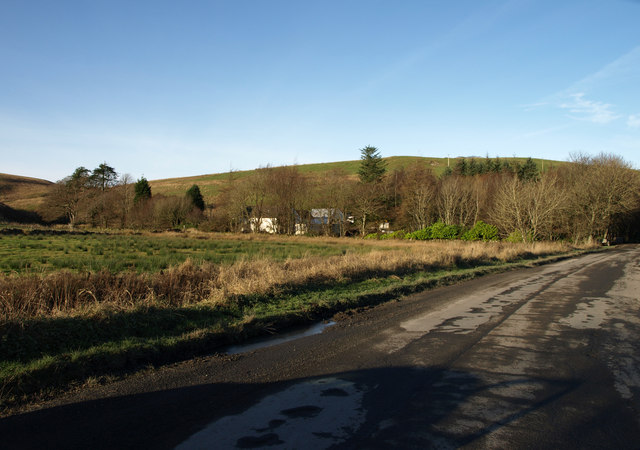
Barbae Hill is a prominent geographical feature located in Ayrshire, Scotland. It is classified as a hill due to its elevation, with a summit reaching approximately 176 meters (577 feet) above sea level. The hill is situated near the village of Barrhill, about 16 kilometers (10 miles) southeast of Girvan.

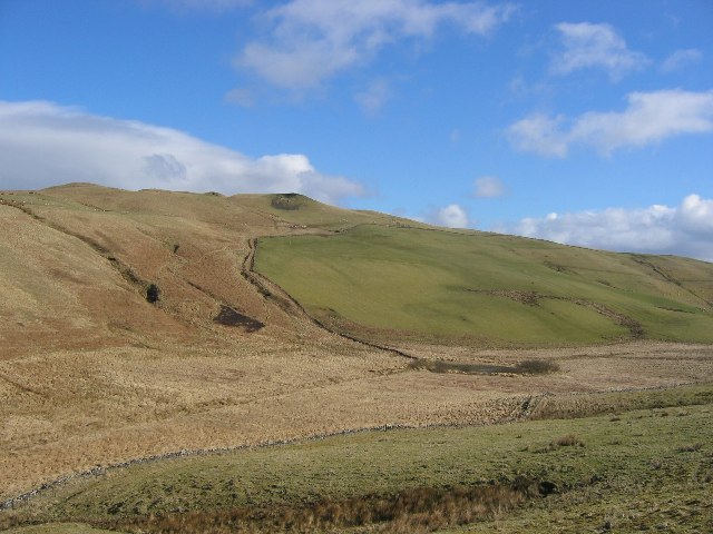
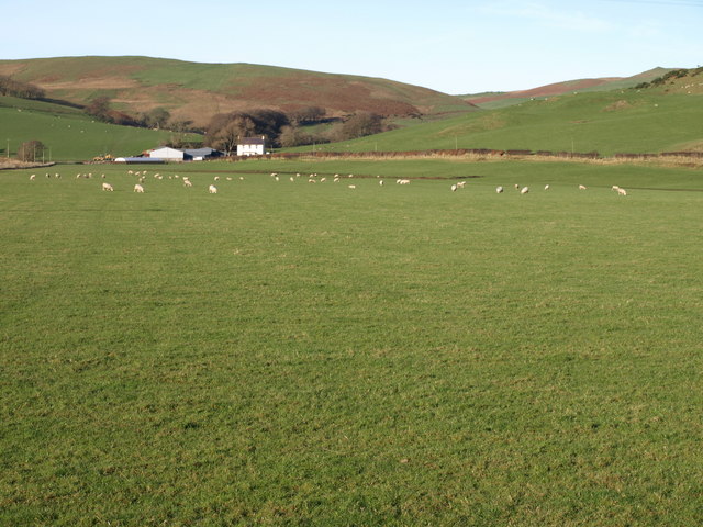
Barbae Hill is part of the Southern Uplands, a range of hills and mountains running parallel to the southwest coast of Scotland. It is known for its distinctive conical shape, offering panoramic views of the surrounding countryside and the Firth of Clyde to the west.

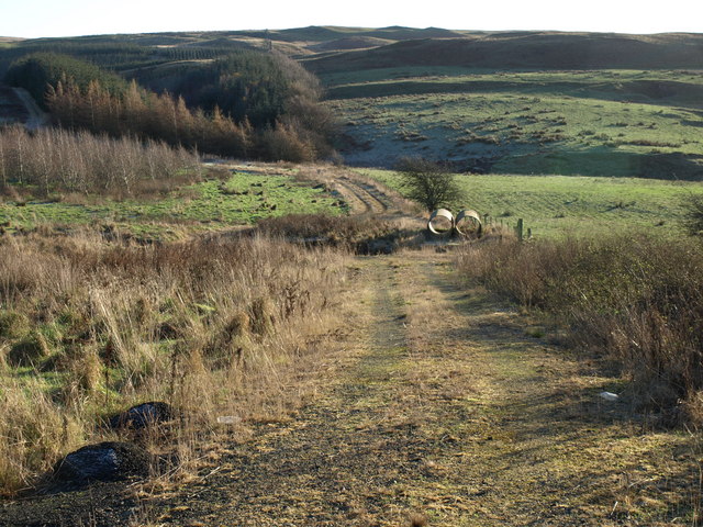
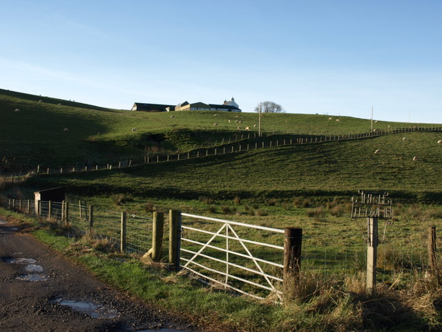
The hill is covered in heather and grasses, providing a habitat for various wildlife species, including birds, insects, and small mammals. It also features a number of walking trails and footpaths, making it a popular destination for hikers and nature enthusiasts.

Barbae Hill has historical significance as well, with traces of ancient settlements and burial cairns found in the surrounding area. These archaeological remains indicate that the hill has been inhabited since prehistoric times, adding to its cultural value.

Overall, Barbae Hill offers a combination of natural beauty, recreational opportunities, and historical interest. Whether you are seeking a leisurely hike, a chance to observe wildlife, or a glimpse into the past, this hill in Ayrshire provides a rewarding experience for visitors.

If you have any feedback on the listing, please let us know in the comments section below.
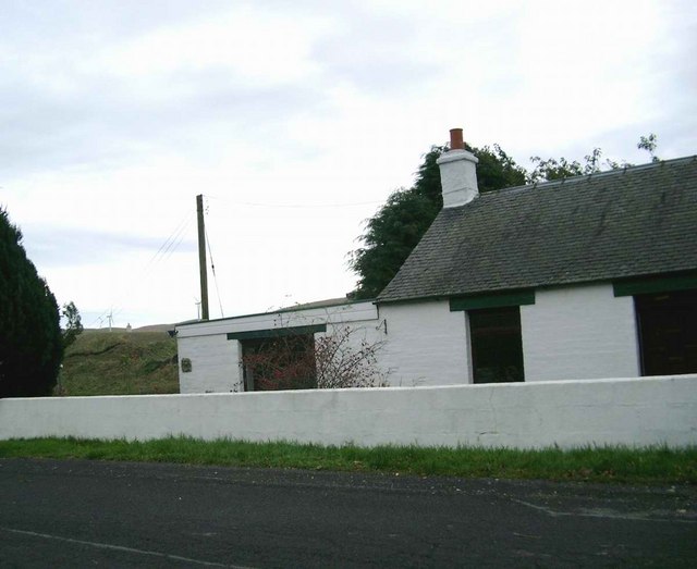
Barbae Hill Images

Images are sourced within 2km of 55.214972/-4.7944435 or Grid Reference NX2294. Thanks to Geograph Open Source API. All images are credited.

Laggan Loch Below Troweir Hill, a small circle of clear water in a wetland
Laggan Loch
Below Troweir Hill, a small circle of clear water in a wetland
Saughs Hill from Troweir Hill Saughs Hill and Troweir Hill are identical height summits either end of a moor.
Saughs Hill from Troweir Hill
Saughs Hill and Troweir Hill are identical height summits either end of a moor.
Tormitchell Quarry The wind turbines of Scottish & Southern Energy's Hadyard Hill are just visible in the distance
Tormitchell Quarry
The wind turbines of Scottish & Southern Energy's Hadyard Hill are just visible in the distance
Surplus equipment at Tormitchell Quarry
The Water of Assel at Tormitchell
Tormitchell Quarry
Tormitchell Quarry
The ruins of Pinmerry One of the Hadyard Hill wind turbines behind.  These are 2.3MW turbines, 52 in all, making this, at time of commissioning in early 2006, the UK's biggest wind farm
The ruins of Pinmerry
One of the Hadyard Hill wind turbines behind. These are 2.3MW turbines, 52 in all, making this, at time of commissioning in early 2006, the UK's biggest wind farm
Hadyard Hill Wind Farm 52 three-bladed Danish turbines, each capable of generating 2.3 MW of power, giving a total output of 120 MW, which made this Britain's most powerful wind farm when it was commissioned in March 2006.

The diameter of the blades is 80m (262 feet) and each turbine is mounted on tubular steel towers either 60m (197 feet) or 70m (229 feet) in height.
Hadyard Hill Wind Farm
52 three-bladed Danish turbines, each capable of generating 2.3 MW of power, giving a total output of 120 MW, which made this Britain's most powerful wind farm when it was commissioned in March 2006. The diameter of the blades is 80m (262 feet) and each turbine is mounted on tubular steel towers either 60m (197 feet) or 70m (229 feet) in height.
Wind turbine at Hadyard Hill 2.3MW turbine, one of 52 on this large wind farm
Wind turbine at Hadyard Hill
2.3MW turbine, one of 52 on this large wind farm
House south of Tormitchell
Valley of the Water of Assel
Water of Assel
Water of Assel
Small Bridge and Fields Looking over fields to Dalfask Hill
Small Bridge and Fields
Looking over fields to Dalfask Hill
Flat Field Dalfask Farm.
Flat Field
Dalfask Farm.
Upland Grazing
Upland Grazing
Track leading to forestry
High Troweir Farm
High Troweir Farm
Tralodden cottage
Tralodden cottage
Show me another place!

Barbae Hill is located at Grid Ref: NX2294 (Lat: 55.214972, Lng: -4.7944435)

Unitary Authority: South Ayrshire

Police Authority: Ayrshire

What 3 Words

///barmaid.lakeside.risking. Near Girvan, South Ayrshire

Nearby Locations

Smoody Glen Barbae Hill

Related Wikis

Pinmore railway station

Pinmore railway station served the hamlet of Pinmore, South Ayrshire, Scotland from 1877 to 1965 on the Girvan and Portpatrick Junction Railway. ��2�...
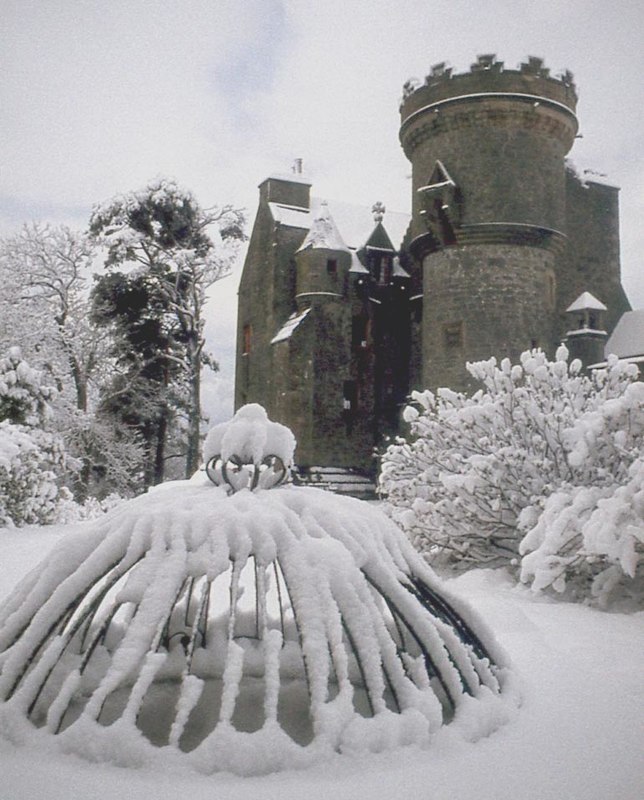
Penkill Castle

Penkill Castle is a 16th-century castle with later additions. It is around 1⁄2 mile (800 metres) south of Old Dailly, northeast of Girvan in south Ayrshire...

Old Dailly

Old Dailly is a hamlet in South Ayrshire, Scotland. It is located west of Dailly (or "New Dailly"). The Charter or Blue stones of Old Dailly in Ayrshire...
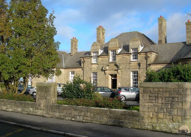
Davidson Hospital

The Davidson Hospital was a health facility in Girvan, South Ayrshire, Scotland. It was managed by NHS Ayrshire and Arran. It remains a Category B listed...

Nearby Amenities

Located within 500m of 55.214972,-4.7944435
Barbae
Place: hamlet
Lat/Long: 55.2129836/-4.7910211
The data included in this document is from www.openstreetmap.org. The data is made available under ODbL.

Have you been to Barbae Hill?

Leave your review of Barbae Hill below (or comments, questions and feedback).