Cronk ny Arrey

Hill, Mountain in Isle of Man

Scotland

Cronk ny Arrey

Maitland, number 11, at Port Erin A Beyer Peacock & Co built in 1905.
Named after one of the directors Dalrymple Maitland.
Recent history:-
The locomotive sports a brass safety valve bonnet mounted on the boiler (the others being painted) but this was originally carried by No. 13 Kissack until 1971. The locomotive last worked in 2007 and a new boiler from the Severn Valley Railway (New boiler 1). The frames were moved off site for restoration by Alan Keef in 2017. The loco was moved to the Statfold Barn Railway for reassembly and painting in 2020 and returned to the railway on 6 January 2022 for trials before re-entering service. 
Another test day today.
Maitland, number 11, at Port Erin Credit: Richard Hoare

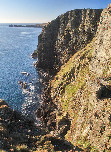
Cronk ny Arrey is a prominent hill located on the Isle of Man, in the Irish Sea. Standing at a height of 525 meters (1,722 feet) above sea level, it is one of the highest points on the island and offers stunning panoramic views of the surrounding landscape.

The hill is characterized by its rugged terrain, with steep slopes covered in grass and heather. It is a popular destination for hikers and outdoor enthusiasts looking to challenge themselves and enjoy the natural beauty of the Isle of Man.

Cronk ny Arrey is also known for its rich biodiversity, with a variety of plant and animal species thriving in the area. Birdwatchers may spot species such as kestrels, peregrine falcons, and ravens soaring overhead, while the hillside is home to a diverse range of flora including wildflowers and ferns.

Visitors to Cronk ny Arrey can explore the hill on foot, following established trails that wind their way to the summit. On a clear day, the views from the top stretch out across the island and beyond, making it a truly memorable experience for those who make the journey to the peak.

If you have any feedback on the listing, please let us know in the comments section below.

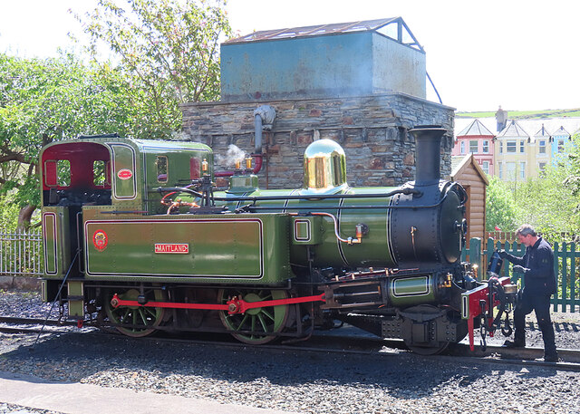
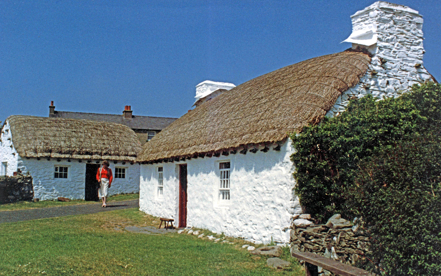
Cronk ny Arrey Images

Images are sourced within 2km of 54.067285/-4.7639003 or Grid Reference SC1967. Thanks to Geograph Open Source API. All images are credited.

Maitland, number 11, at Port Erin A Beyer Peacock & Co built in 1905.
Named after one of the directors Dalrymple Maitland.
Recent history:-
The locomotive sports a brass safety valve bonnet mounted on the boiler (the others being painted) but this was originally carried by No. 13 Kissack until 1971. The locomotive last worked in 2007 and a new boiler from the Severn Valley Railway (New boiler 1). The frames were moved off site for restoration by Alan Keef in 2017. The loco was moved to the Statfold Barn Railway for reassembly and painting in 2020 and returned to the railway on 6 January 2022 for trials before re-entering service. 
Another test day today.
Maitland, number 11, at Port Erin
A Beyer Peacock & Co built in 1905. Named after one of the directors Dalrymple Maitland. Recent history:- The locomotive sports a brass safety valve bonnet mounted on the boiler (the others being painted) but this was originally carried by No. 13 Kissack until 1971. The locomotive last worked in 2007 and a new boiler from the Severn Valley Railway (New boiler 1). The frames were moved off site for restoration by Alan Keef in 2017. The loco was moved to the Statfold Barn Railway for reassembly and painting in 2020 and returned to the railway on 6 January 2022 for trials before re-entering service. Another test day today.
Maitland at Port Erin Fresh from a test run.
A Beyer Peacock & Co built in 1905.
Named after one of the directors Dalrymple Maitland.
Recent history:-
The locomotive sports a brass safety valve bonnet mounted on the boiler (the others being painted) but this was originally carried by No. 13 Kissack until 1971. The locomotive last worked in 2007 and a new boiler from the Severn Valley Railway (New boiler 1). The frames were moved off site for restoration by Alan Keef in 2017. The loco was moved to the Statfold Barn Railway for reassembly and painting in 2020 and returned to the railway on 6 January 2022 for trials before re-entering service.
Maitland at Port Erin
Fresh from a test run. A Beyer Peacock & Co built in 1905. Named after one of the directors Dalrymple Maitland. Recent history:- The locomotive sports a brass safety valve bonnet mounted on the boiler (the others being painted) but this was originally carried by No. 13 Kissack until 1971. The locomotive last worked in 2007 and a new boiler from the Severn Valley Railway (New boiler 1). The frames were moved off site for restoration by Alan Keef in 2017. The loco was moved to the Statfold Barn Railway for reassembly and painting in 2020 and returned to the railway on 6 January 2022 for trials before re-entering service.
Mull Hill Like so many other places, Mull Hill is the site of Second World War military ruins.
Mull Hill
Like so many other places, Mull Hill is the site of Second World War military ruins.
Mull Hill Somewhere near the summit of Mull Hill, a mere 169 metres above sea level.
Mull Hill
Somewhere near the summit of Mull Hill, a mere 169 metres above sea level.
Meayll Chambered Cairn (2) The cairn is of a very unusual, if not unique, design, with six pairs of tombs, each pair separated by an entrance passageway, round the circumference of the circle. This is one of the tombs, made up of three stones set vertically. <a href="https://www.geograph.org.uk/photo/7493605">SC1867 : Meayll Chambered Cairn (3)</a>
Meayll Chambered Cairn (2)
The cairn is of a very unusual, if not unique, design, with six pairs of tombs, each pair separated by an entrance passageway, round the circumference of the circle. This is one of the tombs, made up of three stones set vertically. SC1867 : Meayll Chambered Cairn (3)
Meayll Chambered Cairn (3) The cairn is of a very unusual, if not unique, design, with six pairs of tombs, each pair separated by an entrance passageway, round the circumference of the circle. This is one of the pairs. Each tomb is made up of flattish stones set vertically, and the passage is marked by narrower upright stones. <a href="https://www.geograph.org.uk/photo/7493606">SC1867 : Meayll Chambered Cairn (4)</a>
Meayll Chambered Cairn (3)
The cairn is of a very unusual, if not unique, design, with six pairs of tombs, each pair separated by an entrance passageway, round the circumference of the circle. This is one of the pairs. Each tomb is made up of flattish stones set vertically, and the passage is marked by narrower upright stones. SC1867 : Meayll Chambered Cairn (4)
Meayll Chambered Cairn (4) The cairn is of a very unusual, if not unique, design, with six pairs of tombs, each pair separated by an entrance passageway, round the circumference of the circle. This is one of the pairs. Each tomb is made up of flattish stones set vertically though these ones have begun to sag, and the passage is marked by narrower upright stones. <a href="https://www.geograph.org.uk/photo/7493609">SC1867 : Meayll Chambered Cairn (5)</a>
Meayll Chambered Cairn (4)
The cairn is of a very unusual, if not unique, design, with six pairs of tombs, each pair separated by an entrance passageway, round the circumference of the circle. This is one of the pairs. Each tomb is made up of flattish stones set vertically though these ones have begun to sag, and the passage is marked by narrower upright stones. SC1867 : Meayll Chambered Cairn (5)
Meayll Chambered Cairn (5) The cairn is of a very unusual, if not unique, design, with six pairs of tombs, each pair separated by an entrance passageway, round the circumference of the circle. This is one of the pairs. Each tomb is made up of flattish stones set vertically, though the nearer one has become distorted. The passage is marked by narrower upright stones. <a href="https://www.geograph.org.uk/photo/7493611">SC1867 : Meayll Chambered Cairn (1)</a>
Meayll Chambered Cairn (5)
The cairn is of a very unusual, if not unique, design, with six pairs of tombs, each pair separated by an entrance passageway, round the circumference of the circle. This is one of the pairs. Each tomb is made up of flattish stones set vertically, though the nearer one has become distorted. The passage is marked by narrower upright stones. SC1867 : Meayll Chambered Cairn (1)
Meayll Chambered Cairn (1) The cairn is of a very unusual, if not unique, design, with six pairs of tombs, each pair separated by an entrance passageway, round the circumference of the circle. <a href="https://www.geograph.org.uk/photo/7493599">SC1867 : Meayll Chambered Cairn (2)</a>
Meayll Chambered Cairn (1)
The cairn is of a very unusual, if not unique, design, with six pairs of tombs, each pair separated by an entrance passageway, round the circumference of the circle. SC1867 : Meayll Chambered Cairn (2)
Traditional Cottage One of the preserved cottages making up the open air museum at Cregneash.
Traditional Cottage
One of the preserved cottages making up the open air museum at Cregneash.
Old Quarry at Cregneash The quarry has been re-purposed as a car park for the museum at Cregneash. These rocks are metamorphosed turbidites of the Manx Group.
Old Quarry at Cregneash
The quarry has been re-purposed as a car park for the museum at Cregneash. These rocks are metamorphosed turbidites of the Manx Group.
Old Quarry at Cregneash One this side of the quarry, which is now a car park, are folded bedding surfaces of ancient turbidites.
Old Quarry at Cregneash
One this side of the quarry, which is now a car park, are folded bedding surfaces of ancient turbidites.
Compressed Rock Layers During an episode of folding, the weaker layers have developed a fabric at an angle to the bedding surfaces, which run from lower right to upper left. This fabric is known as a cleavage.
Compressed Rock Layers
During an episode of folding, the weaker layers have developed a fabric at an angle to the bedding surfaces, which run from lower right to upper left. This fabric is known as a cleavage.
Bin Alley A narrow alleyway obstructed by a well-regimented line of wheelie bins.
Bin Alley
A narrow alleyway obstructed by a well-regimented line of wheelie bins.
'Maitland' in Steam This is one of the locomotives of the Isle of Man Steam Railway, steaming gently as it undergoes a bit of extra care and polishing between trains.
'Maitland' in Steam
This is one of the locomotives of the Isle of Man Steam Railway, steaming gently as it undergoes a bit of extra care and polishing between trains.
Inscription on the Thousla Cross See the cross here  <a title="https://www.geograph.org.uk/photo/5457972" href="https://www.geograph.org.uk/photo/5457972">Link</a> For a little more on the tragedy see <span class="nowrap"><a title="https://7thwave-iom.com/2011/04/08/jeune-st-charles-lost-in-the-sound-8th-april-1858/" rel="nofollow ugc noopener" href="https://7thwave-iom.com/2011/04/08/jeune-st-charles-lost-in-the-sound-8th-april-1858/">Link</a><img style="margin-left:2px;" alt="External link" title="External link - shift click to open in new window" src="https://s1.geograph.org.uk/img/external.png" width="10" height="10"/></span>
Inscription on the Thousla Cross
See the cross here Link For a little more on the tragedy see LinkExternal link
The new The original Sound Café The original can be seen here <a href="https://www.geograph.org.uk/photo/6470921">SC1766 : The original Sound Cafe (1993)</a>.
The new The original Sound Café
The original can be seen here SC1766 : The original Sound Cafe (1993).
The road to Ballnahowe
Show me another place!

Cronk ny Arrey is located at Grid Ref: SC1967 (Lat: 54.067285, Lng: -4.7639003)

Unitary Authority: Dumfries and Galloway

Police Authority: Dumfries and Galloway

What 3 Words

///curbed.nurses.guacamole. Near Cregneash, Isle of Man

Nearby Locations

Cronk ny Arrey

Related Wikis

Cregneash

Cregneash or Cregneish (Manx: Creneash) is a small village and tourist destination in the extreme south-west of the Isle of Man, about 1 mi (2 km) from...

Mull Hill

Meayll Hill (Manx: Cronk Meayll; also called The Mull) is a small hill in the exclave of Rushen parish at the southern end of the Isle of Man, just outside...

Spanish Head

Spanish Head is a promontory on the southwestern coast of the Isle of Man, rising over 100 m from sea level. The island of the Calf of Man lies to the...
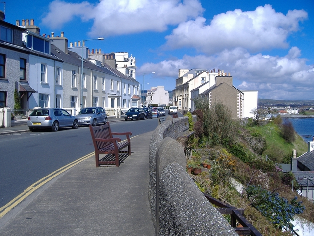
Port St Mary

Port St Mary (Manx: Purt le Moirrey or Purt-noo-Moirrey) is a village district in the south-west of the Isle of Man. The village takes its name from the...

Nearby Amenities

Located within 500m of 54.067285,-4.7639003
Telephone
Booth: K6
Colour: red
Covered: booth
Listed Status: Registered
Note: phone box was previously painted green
Ref Registered Building: 334
Source: Isle of Man Government aerial imagery (2001)
Url Registered Building: https://www.gov.im/media/1374326/rb-334-k6-telephone-kiosk-cregneash-village.pdf
Wikidata: Q118188736
Wikimedia Commons: File:Cregneash Village - Green telephone booth - geograph.org.uk - 1691991.jpg
Lat/Long: 54.0696385/-4.7682749
Barrier: stile
Lat/Long: 54.0643777/-4.7663593
Post Box
Cregneash
Brand: Royal Mail
Brand Wikidata: Q638098
Collection Times: Mo-Fr 11:30; Sa 10:30;
Mapillary: 917177185570918
Operator: Royal Mail
Operator Wikidata: Q638098
Post Box Mounting: stone_wall
Post Box Type: wall
Ref: 148
Royal Cypher: VR
Royal Cypher Wikidata: Q33102356
Survey Date: 2021-09-23
Wikimedia Commons: File:Post Box at Cregneash - geograph.org.uk - 991992.jpg
Lat/Long: 54.0696838/-4.7684184
Crossing
Crossing: unmarked
Crossing Markings: no
Lat/Long: 54.0710291/-4.7656752
Barrier: bollard
Lat/Long: 54.0704924/-4.7669602
Barrier: bollard
Lat/Long: 54.0703876/-4.7668496
Isle of Man
Airmark: beacon
Beacon Channel: 59X
Beacon Code: IOM
Beacon Frequency: 112.2 MHz
Beacon Range: 60nm
Beacon Type: VOR/DME
Ele: 163
Ref: DCS
Source Data: OpenAIP
Wikimedia Commons: File:Beacon above Cregneash - geograph.org.uk - 1426669.jpg
Lat/Long: 54.0669818/-4.7634662
Bus Stop
Cregneash Car Park
Bus: yes
Public Transport: platform
Ref: 1004
Lat/Long: 54.0708425/-4.7659408
Cregneash
Alt Name: Cregneish
Name En: Cregneash
Name Gd: Creneash
Name Gv: Creneash
Place: hamlet
Wikidata: Q3750807
Wikipedia: en:Cregneash
Lat/Long: 54.0696763/-4.7681898
Man Made: mast
Lat/Long: 54.0676611/-4.7628872
Parking Space
Capacity: 1
Parking Space: disabled
Source: Access Guide to Cregneash 2019
Lat/Long: 54.0689949/-4.7679602
Entrance: yes
Lat/Long: 54.0695274/-4.7688312
Cronk ny Arrey
Natural: peak
Source: Isle of Man Government 1:25000 map (2007)
Lat/Long: 54.0667157/-4.7639282
Barrier: stile
Lat/Long: 54.0685371/-4.7679001
Leisure: outdoor_seating
Lat/Long: 54.0689943/-4.7682033
Barrier: bollard
Lat/Long: 54.0703766/-4.7667955
Barrier: bollard
Lat/Long: 54.0704326/-4.7669101
Barrier: bollard
Lat/Long: 54.0704139/-4.7668929
Barrier: bollard
Lat/Long: 54.0703988/-4.7668696
Barrier: bollard
Lat/Long: 54.0703816/-4.7668255
Barrier: bollard
Lat/Long: 54.0703745/-4.7667693
Barrier: bollard
Lat/Long: 54.0704619/-4.7669317
Barrier: bollard
Lat/Long: 54.0704743/-4.766947
Barrier: bollard
Lat/Long: 54.0705112/-4.7669667
Barrier: bollard
Lat/Long: 54.0704491/-4.766924
Church Farm Walk
Information: board
Operator: Manx National Heritage
Tourism: information
Lat/Long: 54.0685108/-4.76854
Entrance: yes
Lat/Long: 54.0694935/-4.7682508
Entrance: yes
Lat/Long: 54.0690495/-4.768154
Entrance: yes
Lat/Long: 54.0690305/-4.7682996
Bus Stop
Cregneash Phone Box
Bus: yes
Public Transport: platform
Ref: 1003
Lat/Long: 54.0697596/-4.7682778
Ford: yes
Lat/Long: 54.0677223/-4.7694507
Street Lamp
Lamp Type: electric
Support: pole
Lat/Long: 54.0697545/-4.7684139
Board Type: welcome_sign
Information: board
Tourism: information
Lat/Long: 54.0706818/-4.7660431
Waste Basket
Lat/Long: 54.0706697/-4.7660156
Grit Bin
Lat/Long: 54.0709037/-4.765883
Waste Basket
Lat/Long: 54.070872/-4.7659337
Cregneash Cross
Cemetery: grave
Tourism: attraction
Wikimedia Commons: File:Cregneash Cross, Isle of Man.jpg
Lat/Long: 54.0695476/-4.7686306
Bench
Material: stone
Lat/Long: 54.0681003/-4.7677303
The Meadow Field
Information: board
Tourism: information
Lat/Long: 54.0683939/-4.771133
Meayll Peninsula
Natural: peninsula
Wikidata: Q3411811
Lat/Long: 54.0704992/-4.7601715
Street Lamp
Lat/Long: 54.0701337/-4.7696864
Bench
Backrest: yes
Material: wood
Memorial: bench
Subject: Edward Ashton Cannell
Subject Wikidata: Q78901420
Lat/Long: 54.0697005/-4.7676223
Bench
Backrest: yes
Material: wood
Lat/Long: 54.0693435/-4.7681844
The data included in this document is from www.openstreetmap.org. The data is made available under ODbL.

Have you been to Cronk ny Arrey?

Leave your review of Cronk ny Arrey below (or comments, questions and feedback).