Campbelton Hill

Hill, Mountain in Ayrshire

Scotland

Campbelton Hill

Mown grass in field north of Portencross Flat farmland by the Firth of Clyde below Waterside Hill.
Mown grass in field north of Portencross Credit: Alan O'Dowd

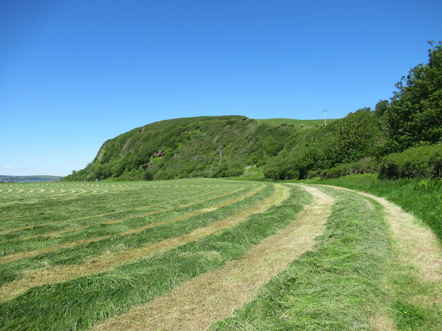
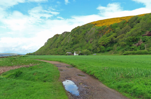
Campbelton Hill, also known as Brown Carrick Hill, is a prominent landmark located in South Ayrshire, Scotland. Rising to a height of 288 meters (945 feet), it is considered a notable hill in the area. It is situated near the town of Maybole, approximately 16 kilometers (10 miles) southeast of Ayr.

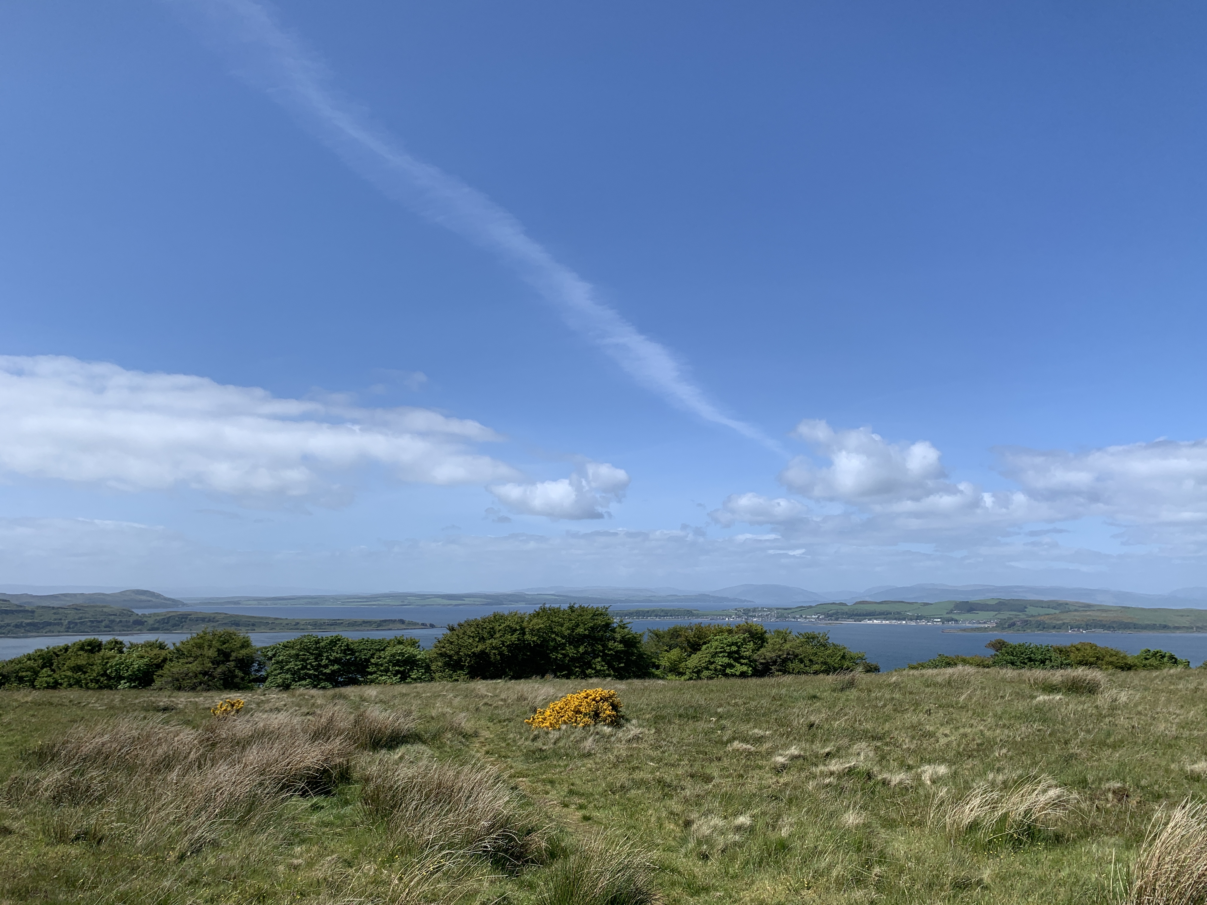
The hill offers breathtaking panoramic views of the surrounding countryside, including the Firth of Clyde and the Ayrshire coast. Its strategic location offers visitors a chance to witness stunning sunsets and picturesque landscapes, making it a popular spot for nature enthusiasts and photographers alike.

Campbelton Hill is part of a larger range known as the Carrick Hills, which is a designated Area of Outstanding Natural Beauty. The hill itself boasts a diverse range of flora and fauna, including heather, bracken, and various species of birds and mammals.

For outdoor enthusiasts, the hill provides numerous hiking and walking trails, allowing visitors to explore its natural beauty at their own pace. The most popular route to the summit is a well-marked path that starts from the nearby village of Dunure. The ascent is relatively moderate, making it accessible to people of different fitness levels.

Overall, Campbelton Hill is a picturesque and easily accessible landmark in Ayrshire. Its stunning views, diverse wildlife, and recreational opportunities make it a must-visit destination for those seeking to immerse themselves in Scotland's natural beauty.

If you have any feedback on the listing, please let us know in the comments section below.

Campbelton Hill Images

Images are sourced within 2km of 55.717937/-4.8820465 or Grid Reference NS1950. Thanks to Geograph Open Source API. All images are credited.

Mown grass in field north of Portencross Flat farmland by the Firth of Clyde below Waterside Hill.
Mown grass in field north of Portencross
Flat farmland by the Firth of Clyde below Waterside Hill.
On the track to Goldenberry Hill The trees of Thicket Plantation lie ahead.
On the track to Goldenberry Hill
The trees of Thicket Plantation lie ahead.
Looking down on Thirdpart Holdings I believe this row of small-holdings was originally established after WW1 for returning servicemen - unless anyone knows better?
Looking down on Thirdpart Holdings
I believe this row of small-holdings was originally established after WW1 for returning servicemen - unless anyone knows better?
The Portencross Murder - Northbank Cottage Northbank Cottage was the scene of the murder of Miss Mary Speir Gunn, on the evening of 18th October 1913.

Murder of Mary Speir Gunn <span class="nowrap"><a title="https://en.wikipedia.org/wiki/Murder_of_Mary_Speir_Gunn" rel="nofollow ugc noopener" href="https://en.wikipedia.org/wiki/Murder_of_Mary_Speir_Gunn">Link</a><img style="margin-left:2px;" alt="External link" title="External link - shift click to open in new window" src="https://s1.geograph.org.uk/img/external.png" width="10" height="10"/></span>
The Portencross Murder - Northbank Cottage
Northbank Cottage was the scene of the murder of Miss Mary Speir Gunn, on the evening of 18th October 1913. Murder of Mary Speir Gunn LinkExternal link
West Kilbride - Forget Me Not This lovely wrought ironwork sign and seat at the junction of the A78 and B782 was gifted by Lodge Royal Arch West Kilbride № 314.
West Kilbride - Forget Me Not
This lovely wrought ironwork sign and seat at the junction of the A78 and B782 was gifted by Lodge Royal Arch West Kilbride № 314.
Northbank Cottage Located on the raised beach at the foot of the old sea cliffs.
Northbank Cottage
Located on the raised beach at the foot of the old sea cliffs.
On the Ayrshire Coast Path below Ardneil Hill near Portencross Evidence of a raised beach with inland cliffs.
On the Ayrshire Coast Path below Ardneil Hill near Portencross
Evidence of a raised beach with inland cliffs.
Straw, Ardneil Straw left out in the rain, a view from a farm road running towards Thirdpart Holdings.
Straw, Ardneil
Straw left out in the rain, a view from a farm road running towards Thirdpart Holdings.
West Kilbride Sign Seat and floral sign for West Kilbride with the A79 in the background.
West Kilbride Sign
Seat and floral sign for West Kilbride with the A79 in the background.
A78 at Carlung Farm Power lines cross road ahead
A78 at Carlung Farm
Power lines cross road ahead
B782 junction from A78
Cycle path by A78 near West Kilbride
On the Ayrshire Coastal Path In the distance, Millport on the Big Cumbrae.  Note for non-locals - although the OS names the two islands to the north 'Little Cumbrae Island' and 'Great Cumbrae Island' they are ALWAYS known to locals as 'Wee Cumbrae' and 'Big Cumbrae'.
On the Ayrshire Coastal Path
In the distance, Millport on the Big Cumbrae. Note for non-locals - although the OS names the two islands to the north 'Little Cumbrae Island' and 'Great Cumbrae Island' they are ALWAYS known to locals as 'Wee Cumbrae' and 'Big Cumbrae'.
Thirdpart Holdings
Thirdpart Holdings
Thirdpart Farm
Thirdpart Farm
Carlung - West Kilbride, Carlung Farm
Thirdpart - West Kilbride, Turf Farming
Thirdpart - West Kilbride, Turf Fields Both fields are being used to cultivate turf for lawns pitches etc. It looks good enough for Wembley.
Thirdpart - West Kilbride, Turf Fields
Both fields are being used to cultivate turf for lawns pitches etc. It looks good enough for Wembley.
Show me another place!

Campbelton Hill is located at Grid Ref: NS1950 (Lat: 55.717937, Lng: -4.8820465)

Unitary Authority: North Ayrshire

Police Authority: Ayrshire

What 3 Words

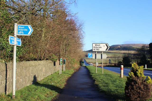
///hood.ants.blunders. Near West Kilbride, North Ayrshire

Nearby Locations

Campbelton Hill

Related Wikis

Hunterston B nuclear power station

Hunterston B nuclear power station is a shut-down AGR nuclear power station in North Ayrshire, Scotland. Located about 6 miles (9.7 km) south of Largs...

Hunterston

Hunterston, by the Firth of Clyde, is a coastal area in Ayrshire, Scotland. It is the seat and estate of the Hunter family. As an area of flat land adjacent...

Hunterston A nuclear power station

Hunterston A nuclear power station is a former Magnox nuclear power station located at Hunterston in Ayrshire, Scotland, adjacent to Hunterston B. The...

Goldenberry Hill

Goldenberry Hill is a hill in North Ayrshire, Scotland, near West Kilbride. It is a popular spot for walks and is visited regularly. It is 140 metres...

Nearby Amenities

Located within 500m of 55.717937,-4.8820465
Power: tower
Source: Bing
Lat/Long: 55.7198992/-4.8852453
Power: tower
Source: Bing
Lat/Long: 55.7190101/-4.8863963
Power: tower
Source: Bing
Lat/Long: 55.7159314/-4.885417
Power: tower
Source: Bing
Lat/Long: 55.7165226/-4.8845532
Campbelton Hill
Ele: 79
Natural: peak
Tourism: viewpoint
Lat/Long: 55.7180702/-4.88142
Whinstone Quarry
Abandoned: yes
Landuse: quarry
Lat/Long: 55.7192393/-4.881409
Whinestone Quarry
Landuse: quarry
Lat/Long: 55.718678/-4.8802939
The Dump
Landuse: landfill
Lat/Long: 55.7170921/-4.8849442
Whinstone Quarry
Abandoned: yes
Landuse: quarry
Tourism: attraction
Lat/Long: 55.7177737/-4.8882974
Access: permissive
Barrier: entrance
Door: hinged
Lat/Long: 55.7222693/-4.8802703
Half Moon Gate
Access: no
Barrier: kissing_gate
Tourism: attraction
Lat/Long: 55.7207399/-4.8799425
Power: tower
Lat/Long: 55.7196482/-4.8892229
Oak Tree
Tourism: attraction
Lat/Long: 55.7203531/-4.8817979
Access: agricultural
Gate: closed
Lat/Long: 55.7142696/-4.8817193
Power: tower
Lat/Long: 55.7200845/-4.8863974
Power: tower
Lat/Long: 55.7199057/-4.886413
Barrier: stile
Bicycle: no
Foot: yes
Horse: no
Motor Vehicle: no
Lat/Long: 55.7183198/-4.8869036
Mini Roundabout
Lat/Long: 55.7196399/-4.8885304
Man Made: water_well
Lat/Long: 55.7177402/-4.878252
Power: transformer
Lat/Long: 55.7213152/-4.8857904
Power: transformer
Lat/Long: 55.7216533/-4.8855212
Power: pole
Lat/Long: 55.7213301/-4.8835427
Power: pole
Lat/Long: 55.7212809/-4.8833428
Power: pole
Lat/Long: 55.721032/-4.8822027
Power: pole
Lat/Long: 55.7199973/-4.875337
Power: pole
Lat/Long: 55.7198682/-4.8766161
Power: pole
Lat/Long: 55.7200571/-4.8775119
Power: pole
Lat/Long: 55.7202918/-4.8786222
Power: pole
Lat/Long: 55.7205323/-4.8797847
Power: pole
Lat/Long: 55.720781/-4.8809596
Power: pole
Lat/Long: 55.719955/-4.8794264
Power: pole
Lat/Long: 55.719393/-4.8790618
Power: pole
Lat/Long: 55.718811/-4.8787202
Power: pole
Lat/Long: 55.7182102/-4.8783452
Location Transition: yes
Lat/Long: 55.7213972/-4.8861265
Location Transition: yes
Lat/Long: 55.721734/-4.885869
Location Transition: yes
Lat/Long: 55.7215739/-4.8849383
Location Transition: yes
Lat/Long: 55.7211252/-4.8853165
Location Transition: yes
Lat/Long: 55.7199403/-4.8869415
Location Transition: yes
Lat/Long: 55.7199488/-4.8872638
Location Transition: yes
Lat/Long: 55.719908/-4.8870999
Location Transition: yes
Lat/Long: 55.7200529/-4.8868556
The data included in this document is from www.openstreetmap.org. The data is made available under ODbL.

Have you been to Campbelton Hill?

Leave your review of Campbelton Hill below (or comments, questions and feedback).