Craigengour Hill

Hill, Mountain in Buteshire

Scotland

Craigengour Hill

'Eastwood' 9-10 Marine Parade, Millport, Isle of Cumbrae This Category B Listed Building is the best preserved example 
of a late Victorian villa in Millport, this semi-detached villa is notable for its 
exuberant three storey bowed bay windows with decorative cast-iron columns with 
bracketed balconies wrapping round the bays at first floor level.

It is  locally known as Brandy Castle.
'Eastwood' 9-10 Marine Parade, Millport, Isle of Cumbrae Credit: Raibeart MacAoidh

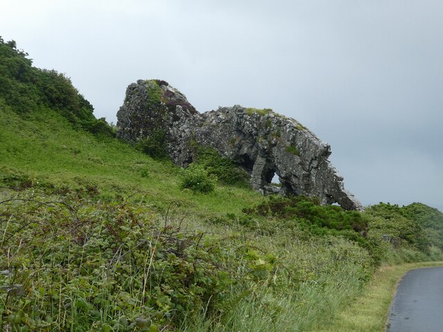
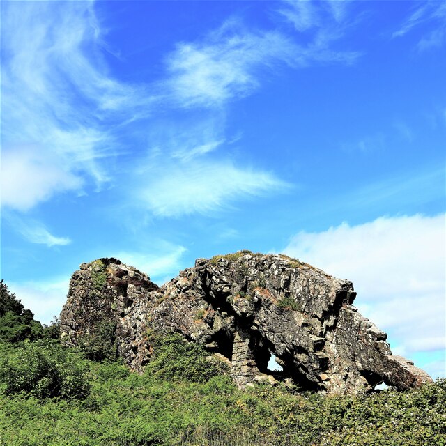
Craigengour Hill is a prominent geographical feature located in the county of Buteshire, situated on the southwestern coast of Scotland. Rising to an elevation of approximately 268 meters (879 feet), it is primarily classified as a hill but is often referred to as a small mountain due to its impressive height compared to the surrounding landscape.

This prominent landmark is characterized by its distinctive conical shape, making it easily recognizable from afar. The hill is primarily composed of basalt, a type of volcanic rock, which contributes to its robust and rugged appearance. Its slopes are covered by a mixture of heather, grasses, and scattered patches of woodland, providing a rich habitat for various flora and fauna.

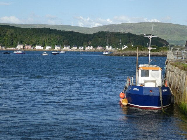
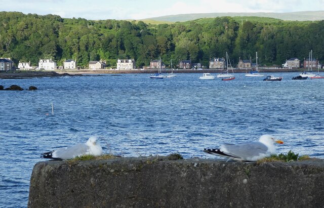
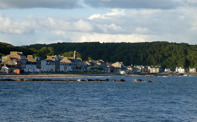
At the summit of Craigengour Hill, visitors are rewarded with breathtaking panoramic views of the surrounding area. On a clear day, one can enjoy vistas extending across the rolling countryside, nearby islands, and the sparkling waters of the Firth of Clyde.

The hill's accessibility and well-maintained paths make it a popular destination for outdoor enthusiasts, hikers, and nature lovers. Its location within a designated nature reserve further enhances its appeal, ensuring the preservation and protection of the local ecosystem.

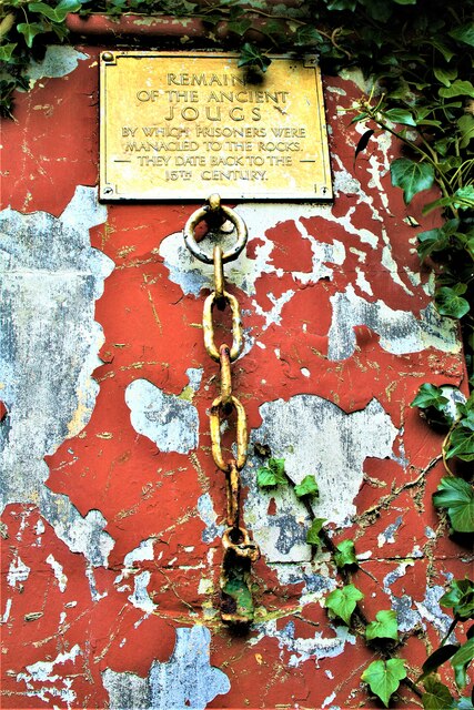
Moreover, Craigengour Hill holds historical significance, with traces of ancient settlements and burial mounds found in its vicinity. These archaeological remains offer insights into the area's rich cultural heritage, adding to its allure as a destination for both recreational and educational purposes.

In conclusion, Craigengour Hill in Buteshire is a striking natural feature that offers both stunning vistas and a glimpse into the region's past. Its combination of scenic beauty, ecological diversity, and historical significance make it an unforgettable destination for visitors.

If you have any feedback on the listing, please let us know in the comments section below.

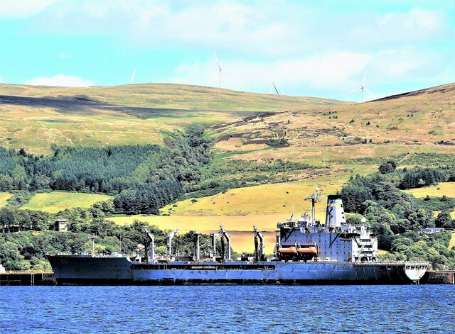
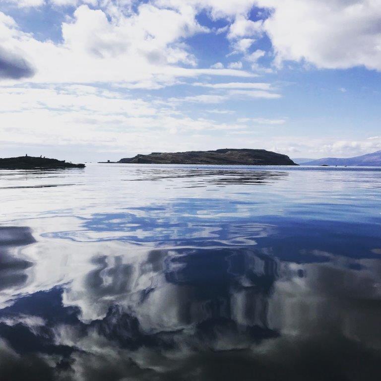
Craigengour Hill Images

Images are sourced within 2km of 55.751715/-4.9107741 or Grid Reference NS1754. Thanks to Geograph Open Source API. All images are credited.

'Eastwood' 9-10 Marine Parade, Millport, Isle of Cumbrae This Category B Listed Building is the best preserved example 
of a late Victorian villa in Millport, this semi-detached villa is notable for its 
exuberant three storey bowed bay windows with decorative cast-iron columns with 
bracketed balconies wrapping round the bays at first floor level.

It is  locally known as Brandy Castle.
'Eastwood' 9-10 Marine Parade, Millport, Isle of Cumbrae
This Category B Listed Building is the best preserved example of a late Victorian villa in Millport, this semi-detached villa is notable for its exuberant three storey bowed bay windows with decorative cast-iron columns with bracketed balconies wrapping round the bays at first floor level. It is locally known as Brandy Castle.
Garrison House (Sunken Garden) - Millport, Isle of Cumbrae Garrison House in Millport was built in 1745 as the residence of the Captain and officers of the Revenue Sailing Ship the ‘Royal George’.

Garrison's Sunken Garden

This restored sunken garden is based on an original design by Robert Weir Schulz.

In 1908 and 1909, the 4th Marquess of Bute hired Schulz to create terraces and a new sunken garden at Garrison House. His design reflects the Arts and Crafts style of the time.

Schulz was an architect based in London. He worked on many of the Bute properties during this period.

Schulz, along with other designers like William Robertson and Gertrude Jerkyll, helped define the Arts and Crafts garden in the U.K. Typical elements included : Drystone walling using local stone, Crazy stone paving, Wild plants instead of glasshouse plants and Plants in niches in rocks in walls, steps and paths.

These elements resulted in a 'Cottage' look that was less formal than previous styles of garden. Quite bold in front of a Gothic Revival house like Garrison !
Garrison House (Sunken Garden) - Millport, Isle of Cumbrae
Garrison House in Millport was built in 1745 as the residence of the Captain and officers of the Revenue Sailing Ship the ‘Royal George’. Garrison's Sunken Garden This restored sunken garden is based on an original design by Robert Weir Schulz. In 1908 and 1909, the 4th Marquess of Bute hired Schulz to create terraces and a new sunken garden at Garrison House. His design reflects the Arts and Crafts style of the time. Schulz was an architect based in London. He worked on many of the Bute properties during this period. Schulz, along with other designers like William Robertson and Gertrude Jerkyll, helped define the Arts and Crafts garden in the U.K. Typical elements included : Drystone walling using local stone, Crazy stone paving, Wild plants instead of glasshouse plants and Plants in niches in rocks in walls, steps and paths. These elements resulted in a 'Cottage' look that was less formal than previous styles of garden. Quite bold in front of a Gothic Revival house like Garrison !
Gouklan Standing Stone - Isle of Cumbrae The Gouklan Stone stands in the southeast corner of Gouklan Wood.
Gouklan Standing Stone - Isle of Cumbrae
The Gouklan Stone stands in the southeast corner of Gouklan Wood.
Gouklan Standing Stone - Isle of Cumbrae The Gouklan Stone stands in the southeast corner of Gouklan Wood.
Gouklan Standing Stone - Isle of Cumbrae
The Gouklan Stone stands in the southeast corner of Gouklan Wood.
Kirkton (c700) - Cumbrae's Medieval Centre Kirkton was a medieval village on Cumbrae and existed for many centuries before Millport was built.
The plaque reads "Remains of the ancient jougs by which prisoners were manacled to the rocks. They date back to the 15th century".

North Ayrshire Heritage Trails <span class="nowrap"><a title="https://www.naheritagetrails.co.uk/heritagetrails_cumbrae_kirkton.php" rel="nofollow ugc noopener" href="https://www.naheritagetrails.co.uk/heritagetrails_cumbrae_kirkton.php">Link</a><img style="margin-left:2px;" alt="External link" title="External link - shift click to open in new window" src="https://s1.geograph.org.uk/img/external.png" width="10" height="10"/></span>
Kirkton (c700) - Cumbrae's Medieval Centre
Kirkton was a medieval village on Cumbrae and existed for many centuries before Millport was built. The plaque reads "Remains of the ancient jougs by which prisoners were manacled to the rocks. They date back to the 15th century". North Ayrshire Heritage Trails LinkExternal link
Great Cumbrae - Millport - Boat moored at the pier A small boat named 'Kestral' is moored longside the pier in Millport. The houses in the background are on Marine Parade.
Great Cumbrae - Millport - Boat moored at the pier
A small boat named 'Kestral' is moored longside the pier in Millport. The houses in the background are on Marine Parade.
Great Cumbrae - Millport - Gulls on the end of the pier Two gulls (Herring Gulls I think) nestled down at the end of Millport's pier.
The houses in the background are across the bay on Marine Parade.
Great Cumbrae - Millport - Gulls on the end of the pier
Two gulls (Herring Gulls I think) nestled down at the end of Millport's pier. The houses in the background are across the bay on Marine Parade.
Great Cumbrae - Millport Looking across Millport Bay from near to the Millport Pier Hotel over to Glasgow Street which hugs the northern end of the bay.
Great Cumbrae - Millport
Looking across Millport Bay from near to the Millport Pier Hotel over to Glasgow Street which hugs the northern end of the bay.
Great Cumbrae - The Cathedral of the Isles - from the south The Cathedral of the Isles and Collegiate Church of the Holy Spirit (to give it its full appellation) is a Category A listed <span class="nowrap"><a title="http://portal.historicenvironment.scot/designation/LB37824" rel="nofollow ugc noopener" href="http://portal.historicenvironment.scot/designation/LB37824">Link</a><img style="margin-left:2px;" alt="External link" title="External link - shift click to open in new window" src="https://s1.geograph.org.uk/img/external.png" width="10" height="10"/></span> cathedral in the town of Millport on the island of Great Cumbrae. It is one of the smallest (possibly *the* smallest) cathedral in Britain, with many a parish church being larger.
For more information, see <span class="nowrap"><a title="http://www.scottishchurches.org.uk/sites/site/id/7562/name/Millport+Episcopal+Cathedral+of+the+Isles+Millport+Strathclyde" rel="nofollow ugc noopener" href="http://www.scottishchurches.org.uk/sites/site/id/7562/name/Millport+Episcopal+Cathedral+of+the+Isles+Millport+Strathclyde">Link</a><img style="margin-left:2px;" alt="External link" title="External link - shift click to open in new window" src="https://s1.geograph.org.uk/img/external.png" width="10" height="10"/></span>

The whole of Millport is a designated conservation area - see <span class="nowrap"><a title="https://www.north-ayrshire.gov.uk/Documents/CorporateServices/LegalProtective/LocalDevelopmentPlan/MillportConservationArea.pdf" rel="nofollow ugc noopener" href="https://www.north-ayrshire.gov.uk/Documents/CorporateServices/LegalProtective/LocalDevelopmentPlan/MillportConservationArea.pdf">Link</a><img style="margin-left:2px;" alt="External link" title="External link - shift click to open in new window" src="https://s1.geograph.org.uk/img/external.png" width="10" height="10"/></span>
Great Cumbrae - The Cathedral of the Isles - from the south
The Cathedral of the Isles and Collegiate Church of the Holy Spirit (to give it its full appellation) is a Category A listed LinkExternal link cathedral in the town of Millport on the island of Great Cumbrae. It is one of the smallest (possibly *the* smallest) cathedral in Britain, with many a parish church being larger. For more information, see LinkExternal link The whole of Millport is a designated conservation area - see LinkExternal link
Great Cumbrae - The Cathedral of the Isles - from the East The Cathedral of the Isles and Collegiate Church of the Holy Spirit (to give it its full appellation) is a Category A listed <span class="nowrap"><a title="http://portal.historicenvironment.scot/designation/LB37824" rel="nofollow ugc noopener" href="http://portal.historicenvironment.scot/designation/LB37824">Link</a><img style="margin-left:2px;" alt="External link" title="External link - shift click to open in new window" src="https://s1.geograph.org.uk/img/external.png" width="10" height="10"/></span> cathedral in the town of Millport on the island of Great Cumbrae. It is one of the smallest (possibly *the* smallest) cathedral in Britain, with many a parish church being larger.
For more information, see <span class="nowrap"><a title="http://www.scottishchurches.org.uk/sites/site/id/7562/name/Millport+Episcopal+Cathedral+of+the+Isles+Millport+Strathclyde" rel="nofollow ugc noopener" href="http://www.scottishchurches.org.uk/sites/site/id/7562/name/Millport+Episcopal+Cathedral+of+the+Isles+Millport+Strathclyde">Link</a><img style="margin-left:2px;" alt="External link" title="External link - shift click to open in new window" src="https://s1.geograph.org.uk/img/external.png" width="10" height="10"/></span>

The whole of Millport is a designated conservation area - see <span class="nowrap"><a title="https://www.north-ayrshire.gov.uk/Documents/CorporateServices/LegalProtective/LocalDevelopmentPlan/MillportConservationArea.pdf" rel="nofollow ugc noopener" href="https://www.north-ayrshire.gov.uk/Documents/CorporateServices/LegalProtective/LocalDevelopmentPlan/MillportConservationArea.pdf">Link</a><img style="margin-left:2px;" alt="External link" title="External link - shift click to open in new window" src="https://s1.geograph.org.uk/img/external.png" width="10" height="10"/></span>
Great Cumbrae - The Cathedral of the Isles - from the East
The Cathedral of the Isles and Collegiate Church of the Holy Spirit (to give it its full appellation) is a Category A listed LinkExternal link cathedral in the town of Millport on the island of Great Cumbrae. It is one of the smallest (possibly *the* smallest) cathedral in Britain, with many a parish church being larger. For more information, see LinkExternal link The whole of Millport is a designated conservation area - see LinkExternal link
Great Cumbrae - Cathedral of the Isles - Nave & Chancel Looking along the nave into the chancel of the Cathedral of the Isles in Millport, Great Cumbrae. See <a href="https://www.geograph.org.uk/photo/7219178">NS1655 : Great Cumbrae - The Cathedral of the Isles - from the south</a> and <a href="https://www.geograph.org.uk/photo/7219182">NS1655 : Great Cumbrae - The Cathedral of the Isles - from the East</a> for more information
Great Cumbrae - Cathedral of the Isles - Nave & Chancel
Looking along the nave into the chancel of the Cathedral of the Isles in Millport, Great Cumbrae. See NS1655 : Great Cumbrae - The Cathedral of the Isles - from the south and NS1655 : Great Cumbrae - The Cathedral of the Isles - from the East for more information
Great Cumbrae - The Cathedral of the Isles - Ancient relics A small plaque above these relics states:
"These Crosses
and
Carved Fragments
Relics of the ancient Christianity of the Island
were deposited within the College precincts
by the Founder
George Frederick, 6th Earl of Glasgow
Ye have considered the days of old and the
years of ancient times. Psalms LXXVII 5"
Great Cumbrae - The Cathedral of the Isles - Ancient relics
A small plaque above these relics states: "These Crosses and Carved Fragments Relics of the ancient Christianity of the Island were deposited within the College precincts by the Founder George Frederick, 6th Earl of Glasgow Ye have considered the days of old and the years of ancient times. Psalms LXXVII 5"
Great Cumbrae - Millport - The Garrison The Category 'B' listed <span class="nowrap"><a title="http://portal.historicenvironment.scot/designation/LB37825" rel="nofollow ugc noopener" href="http://portal.historicenvironment.scot/designation/LB37825">Link</a><img style="margin-left:2px;" alt="External link" title="External link - shift click to open in new window" src="https://s1.geograph.org.uk/img/external.png" width="10" height="10"/></span>  Garrison in Millport, Great Cumbrae has had several uses since its original construction in the C18th as a garrison for the local excise men and associated troops. However, little of the original building remains as the house was extensively renovated in the 19th century for the Earl of Glasgow. It now houses an interesting little museum.
Great Cumbrae - Millport - The Garrison
The Category 'B' listed LinkExternal link Garrison in Millport, Great Cumbrae has had several uses since its original construction in the C18th as a garrison for the local excise men and associated troops. However, little of the original building remains as the house was extensively renovated in the 19th century for the Earl of Glasgow. It now houses an interesting little museum.
Great Cumbrae - Millport - Crocodile Rock The much photographed 'Crocodile Rock' on the coast of Great Cumbrae in the town of Millport. This humorous painted rock has become one of Great Cumbrae's "must see" features!
Great Cumbrae - Millport - Crocodile Rock
The much photographed 'Crocodile Rock' on the coast of Great Cumbrae in the town of Millport. This humorous painted rock has become one of Great Cumbrae's "must see" features!
Great Cumbrae - The Lion This outcrop on the southeastern coast of Great Cumbrae is known as 'The Lion'
More information here <span class="nowrap"><a title="https://millport.org/directory/lion-rock" rel="nofollow ugc noopener" href="https://millport.org/directory/lion-rock">Link</a><img style="margin-left:2px;" alt="External link" title="External link - shift click to open in new window" src="https://s1.geograph.org.uk/img/external.png" width="10" height="10"/></span>
Great Cumbrae - The Lion
This outcrop on the southeastern coast of Great Cumbrae is known as 'The Lion' More information here LinkExternal link
The Lion Rock - Isle of Cumbrae
USNS Patuxent (T-AO-201) at Hunterston Jetty. USNS Patuxent (T-AO-201) is a Henry J. Kaiser-class underway replenishment oiler operated by the Military Sealift Command to support ships of the United States Navy.

USNS Patuxent (T-AO-201) <span class="nowrap"><a title="https://en.wikipedia.org/wiki/USNS_Patuxent_(T-AO-201)" rel="nofollow ugc noopener" href="https://en.wikipedia.org/wiki/USNS_Patuxent_(T-AO-201)">Link</a><img style="margin-left:2px;" alt="External link" title="External link - shift click to open in new window" src="https://s1.geograph.org.uk/img/external.png" width="10" height="10"/></span>
USNS Patuxent (T-AO-201) at Hunterston Jetty.
USNS Patuxent (T-AO-201) is a Henry J. Kaiser-class underway replenishment oiler operated by the Military Sealift Command to support ships of the United States Navy. USNS Patuxent (T-AO-201) LinkExternal link
Great Cumbrae - Millport - The Wedge This house is reckoned to be the narrowest in the world - though as its name suggests it does widen from this ridiculously narrow frontage of just 47" (1.2m).
It was put up for sale in 2015 with an asking price of OIEO £85,000 - Article on it here <span class="nowrap"><a title="https://www.dailymail.co.uk/news/article-2967197/World-s-narrowest-house-sale-85-000-47-inches-wide-really-isn-t-room-swing-cat.html" rel="nofollow ugc noopener" href="https://www.dailymail.co.uk/news/article-2967197/World-s-narrowest-house-sale-85-000-47-inches-wide-really-isn-t-room-swing-cat.html">Link</a><img style="margin-left:2px;" alt="External link" title="External link - shift click to open in new window" src="https://s1.geograph.org.uk/img/external.png" width="10" height="10"/></span>
Great Cumbrae - Millport - The Wedge
This house is reckoned to be the narrowest in the world - though as its name suggests it does widen from this ridiculously narrow frontage of just 47" (1.2m). It was put up for sale in 2015 with an asking price of OIEO £85,000 - Article on it here LinkExternal link
Show me another place!

Craigengour Hill is located at Grid Ref: NS1754 (Lat: 55.751715, Lng: -4.9107741)

Unitary Authority: North Ayrshire

Police Authority: Ayrshire

What 3 Words

///consented.fruity.stubble. Near Millport, North Ayrshire

Related Wikis

FSC Millport

FSC Millport, run by the Field Studies Council, is located on the island of Great Cumbrae in the Firth of Clyde, Scotland. The field centre was formerly...

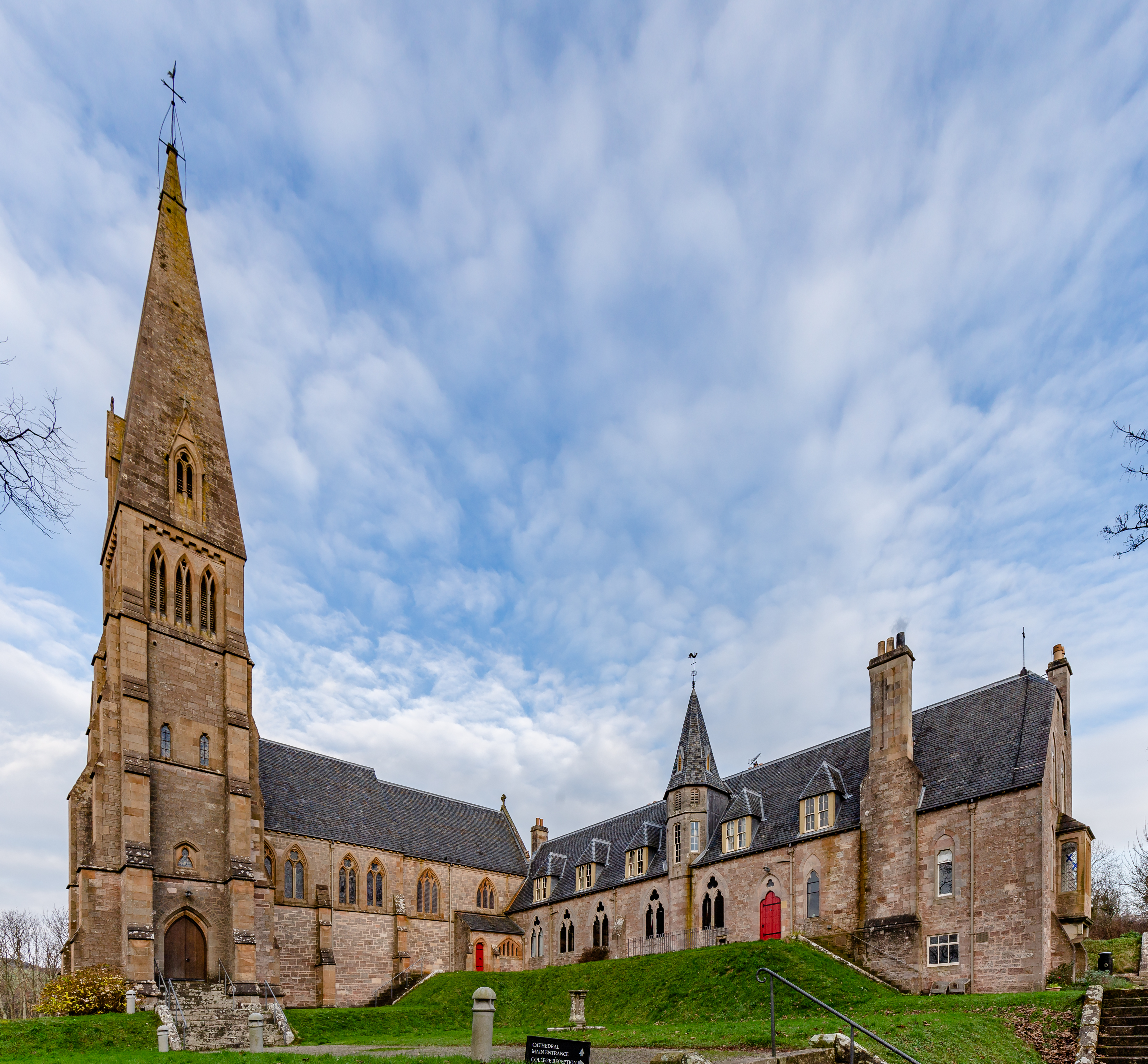
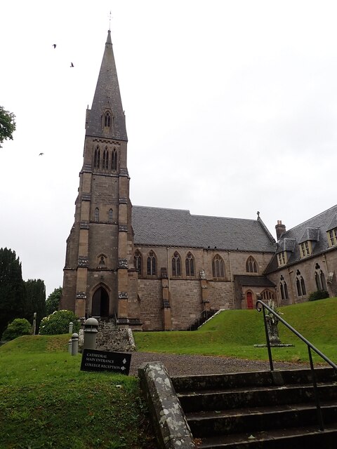
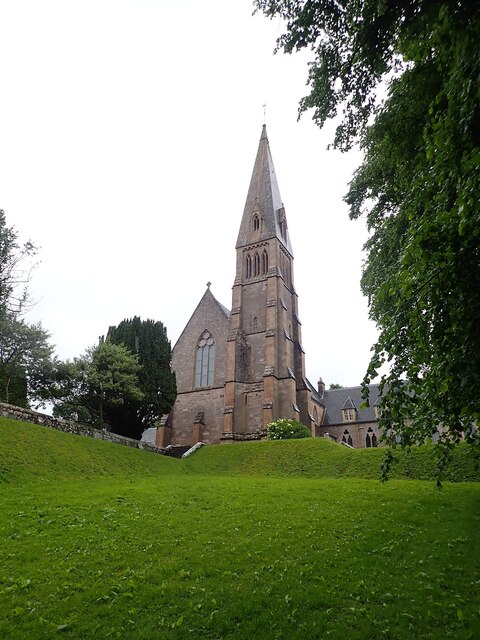
Cathedral of The Isles

The Cathedral of the Isles and Collegiate Church of the Holy Spirit is a Category A listed cathedral of the Scottish Episcopal Church in the town of Millport...

The Eileans

The Eileans are two small, low-lying islands located in Newtown Bay, Millport on the island of Great Cumbrae, Scotland. (grid reference NS164545). The...

Millport Town Hall

Millport Town Hall is a municipal building in Clifton Street, Millport, North Ayrshire, Scotland. The structure is used as a community events centre....

Millport, Great Cumbrae

Millport (Scottish Gaelic: Port a' Mhuilinn) is the only town on the island of Great Cumbrae in the Firth of Clyde off the coast of mainland Scotland,...

Lady Margaret Hospital

Lady Margaret Hospital is a small 10-bedded hospital at Millport on Great Cumbrae in North Ayrshire, Scotland. It is managed by NHS Ayrshire and Arran...

Great Cumbrae

Great Cumbrae (Scots: Muckle Cumbrae; Scottish Gaelic: Cumaradh Mòr; also known as Great Cumbrae Island, Cumbrae or the Isle of Cumbrae) is the larger...

The Cumbraes

The Cumbraes are a group of islands in the Firth of Clyde, Scotland. The islands belong to the traditional county of Bute and the modern unitary authority...

Nearby Amenities

Located within 500m of 55.751715,-4.9107741
Source: PGS+landsat
Lat/Long: 55.7496665/-4.9061468
Source: PGS+landsat
Lat/Long: 55.7493707/-4.9064386
Source: PGS+landsat
Lat/Long: 55.7492397/-4.9066606
Source: PGS+landsat
Lat/Long: 55.7489199/-4.9074145
Source: PGS+landsat
Lat/Long: 55.7487523/-4.9079711
Source: PGS+landsat
Lat/Long: 55.7485531/-4.907907
Source: PGS+landsat
Lat/Long: 55.7484593/-4.9078641
Source: PGS+landsat
Lat/Long: 55.748402/-4.907863
Kames Bay
Natural: bay
Lat/Long: 55.7526817/-4.9170422
Davies Dub
Place: locality
Source: local_knowledge
Lat/Long: 55.753469/-4.9090599
Barrier: kissing_gate
Bicycle: yes
Foot: yes
Source: survey
Lat/Long: 55.748207/-4.9098426
Barrier: kissing_gate
Bicycle: yes
Foot: yes
Lat/Long: 55.7485702/-4.9142232
Board Type: history
Information: board
Source: survey
Tourism: information
Lat/Long: 55.7492476/-4.9073991
Post Box
Operator: Royal Mail
Post Box Type: wall
Ref: KA28 73
Royal Cypher: scottish_crown
Source: survey
Lat/Long: 55.752253/-4.9139334
Bench
Backrest: yes
Colour: green
Material: metal
Source: survey
Lat/Long: 55.7523566/-4.9141322
Telephone
Booth: KX100
Covered: booth
Operator: British Telecom
Payment Coins: yes
Payment Credit Cards: yes
Payment Debit Cards: yes
Source: survey
Lat/Long: 55.7542195/-4.914014
Bench
Backrest: yes
Colour: black
Material: wood
Source: survey
Lat/Long: 55.7545717/-4.9150517
Bench
Backrest: yes
Colour: brown
Material: wood
Source: survey
Lat/Long: 55.7548096/-4.9161301
Power: pole
Lat/Long: 55.7492569/-4.9089376
Power: pole
Lat/Long: 55.7491241/-4.9100075
Power: pole
Lat/Long: 55.7489439/-4.9109129
Power: pole
Lat/Long: 55.7487571/-4.9117848
Power: pole
Lat/Long: 55.7482574/-4.9128081
Power: pole
Lat/Long: 55.7558111/-4.9122695
Power: pole
Lat/Long: 55.7549789/-4.9118794
Power: pole
Lat/Long: 55.7544276/-4.9116509
Power: pole
Lat/Long: 55.7538149/-4.9113874
Power: pole
Lat/Long: 55.7527164/-4.9115766
Power: pole
Lat/Long: 55.752025/-4.9117004
Power: pole
Lat/Long: 55.7515474/-4.9117892
Power: pole
Lat/Long: 55.751096/-4.9118838
Power: pole
Lat/Long: 55.7504423/-4.9108241
Power: pole
Lat/Long: 55.749764/-4.9097324
Power: pole
Lat/Long: 55.7493199/-4.9090322
Power: pole
Lat/Long: 55.7488489/-4.9085097
Power: pole
Lat/Long: 55.7527311/-4.9120177
Bicycle Parking
Bicycle Parking: stands
Capacity: 10
Covered: no
Lat/Long: 55.754138/-4.9138334
Bench
Lat/Long: 55.7542374/-4.9140891
The data included in this document is from www.openstreetmap.org. The data is made available under ODbL.

Have you been to Craigengour Hill?

Leave your review of Craigengour Hill below (or comments, questions and feedback).