An Leth-Chreag

Hill, Mountain in Inverness-shire

Scotland

An Leth-Chreag

The summit of Sgurr na Lapaich Loch Tuill Bhearnach lies below Creag a' Chaorainn.
The summit of Sgurr na Lapaich Credit: Alan Reid

An Leth-Chreag, located in Inverness-shire, Scotland, is a prominent hill and mountain that offers stunning views and outdoor recreational opportunities. Standing at an elevation of approximately 1,221 meters (4,006 feet), it is classified as a Munro, meaning it is one of the 282 mountains in Scotland with a height exceeding 3,000 feet.

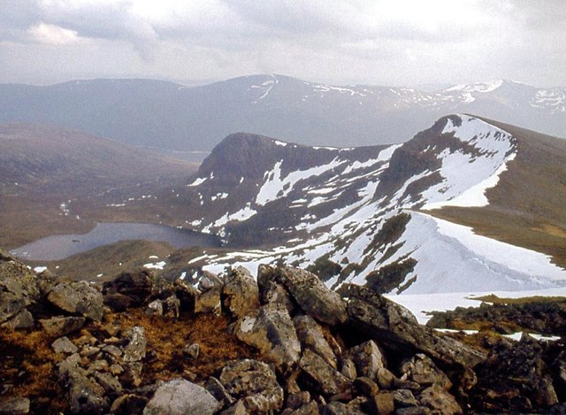
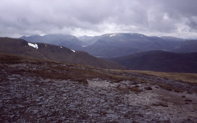
An Leth-Chreag is situated in the Cairngorms National Park, renowned for its rugged landscapes and diverse wildlife. The mountain is a popular destination for hikers and mountaineers due to its accessibility and challenging terrain. Several routes are available to reach the summit, with the most common starting point being the Coire Cas car park near the Cairngorm Mountain ski resort.

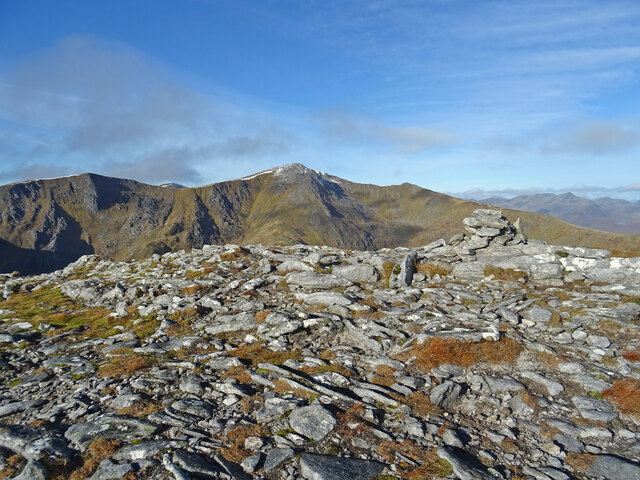
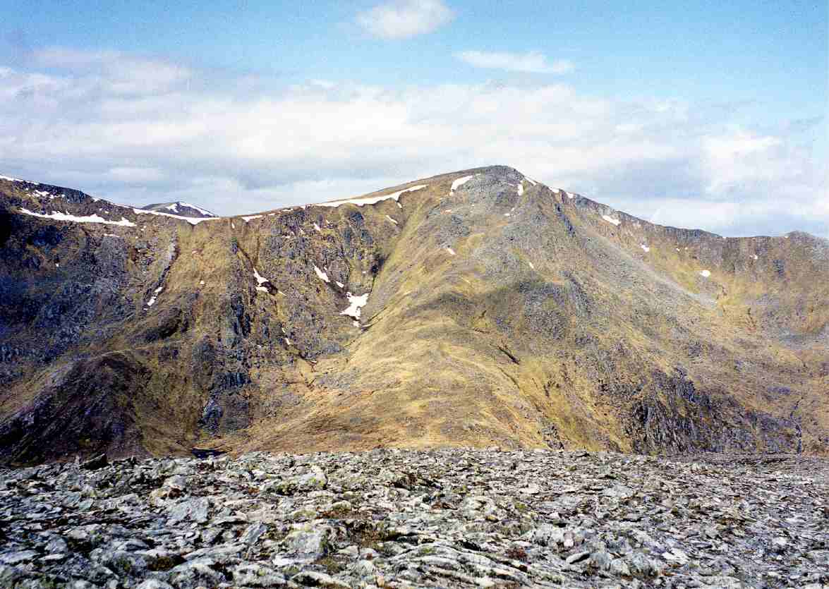
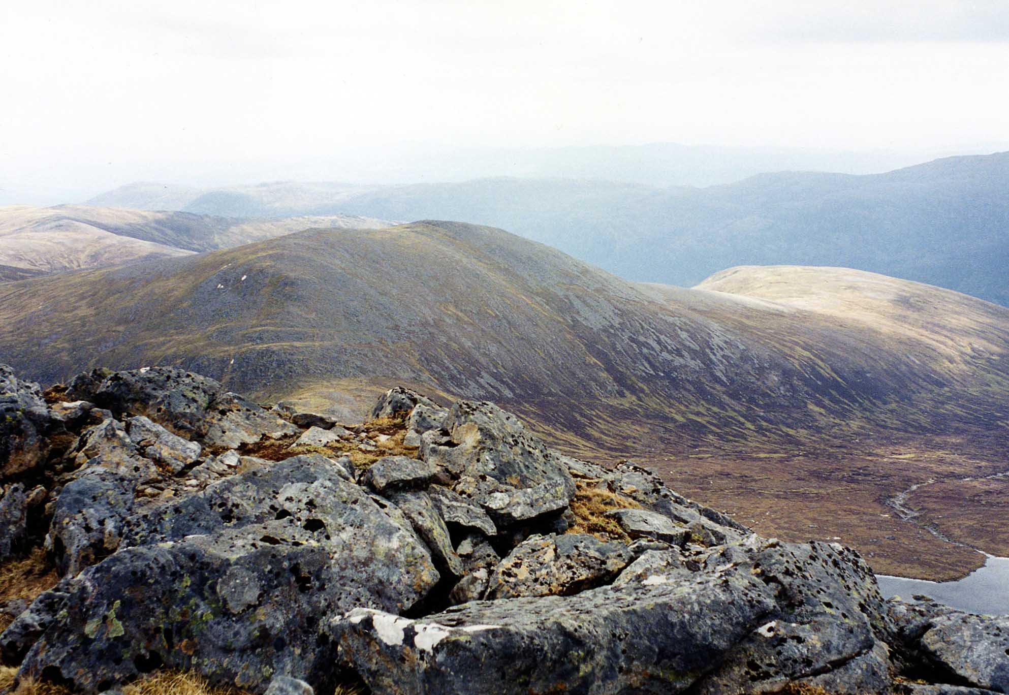
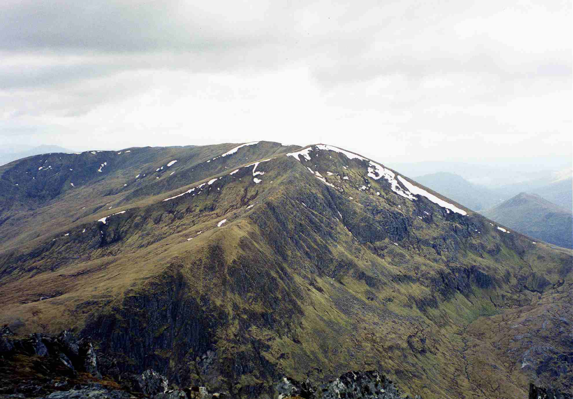
The ascent to An Leth-Chreag is characterized by steep slopes, rocky outcrops, and breathtaking vistas of the surrounding Cairngorms range. The summit rewards climbers with panoramic views of the Cairngorm plateau, Loch Morlich, and the Spey Valley. On clear days, it is possible to see as far as Ben Nevis, the highest mountain in the British Isles.

While An Leth-Chreag can be tackled throughout the year, it is important for climbers to be well-prepared due to the potential for rapidly changing weather conditions and challenging terrain. Proper equipment, navigation skills, and knowledge of the area are crucial for a safe and enjoyable experience.

Overall, An Leth-Chreag is a magnificent mountain that offers adventure enthusiasts a chance to explore the picturesque landscapes of Inverness-shire and experience the beauty of the Scottish Highlands.

If you have any feedback on the listing, please let us know in the comments section below.

An Leth-Chreag Images

Images are sourced within 2km of 57.376954/-5.0418504 or Grid Reference NH1735. Thanks to Geograph Open Source API. All images are credited.

The summit of Sgurr na Lapaich Loch Tuill Bhearnach lies below Creag a' Chaorainn.
The summit of Sgurr na Lapaich
Loch Tuill Bhearnach lies below Creag a' Chaorainn.
Sgùrr nan Clachan Geala The peak of the shining stones. An outcrop of quartzite.
Sgùrr nan Clachan Geala
The peak of the shining stones. An outcrop of quartzite.
Clouds over Sgurr na Lapaich from Glen Strathfarrar
Clach Dubh A big boulder that makes it onto the Ordnance Survey's 1:25k map.  Sgùrr na Lapaich is across the Bealach na Cloiche Duibhe.
Clach Dubh
A big boulder that makes it onto the Ordnance Survey's 1:25k map. Sgùrr na Lapaich is across the Bealach na Cloiche Duibhe.
Loch Tuill Bearnach Corrie lochan beneath Sgùrr na Lapaich
Loch Tuill Bearnach
Corrie lochan beneath Sgùrr na Lapaich
On Càrn nan Gobhair Bare patch near the summit and a view between Bidean an Eòin Deirg and Maoile Lunndaidh to Sgùrr nan Ceannaichean above Achnasheen.
On Càrn nan Gobhair
Bare patch near the summit and a view between Bidean an Eòin Deirg and Maoile Lunndaidh to Sgùrr nan Ceannaichean above Achnasheen.
Sgùrr na Lapaich The highest summit on the ridge between Glen Strathfarrar and Glen Cannich. The main summit is on the right. View from the very steep southern slopes of Beinn na Muice as cloud was evaporating.
Sgùrr na Lapaich
The highest summit on the ridge between Glen Strathfarrar and Glen Cannich. The main summit is on the right. View from the very steep southern slopes of Beinn na Muice as cloud was evaporating.
Sgurr na Laipeach from Upper Glen Strathfarrar
Slopes of Sgùrr na Lapaich Steep grassy slopes on the north side of the hill.
Slopes of Sgùrr na Lapaich
Steep grassy slopes on the north side of the hill.
Allt Garbh-choire Draining a wet corrie to the northeast of Sgùrr na Lapaich
Allt Garbh-choire
Draining a wet corrie to the northeast of Sgùrr na Lapaich
Survey pillar, Carn na Sàile Lèithe A relic of the hydroelectric construction.
Survey pillar, Carn na Sàile Lèithe
A relic of the hydroelectric construction.
On the Goat View from summit of Càrn nan Gobhar - Hill of the Goats - looking to the shapely peak of Sgurr na Lapaich - Peak of the Bog! A fine day in the wild hills north of Loch Mullardoch.
On the Goat
View from summit of Càrn nan Gobhar - Hill of the Goats - looking to the shapely peak of Sgurr na Lapaich - Peak of the Bog! A fine day in the wild hills north of Loch Mullardoch.
Mountain Vista 2 This is the view from the western slopes of Carn nan Gobhar looking to the shapely peak of Sgurr na Lapaich - a proper mountain.
Taken from nearly the same spot as this picture nearly 14 years ago:-
<a title="https://www.geograph.org.uk/photo/1108579" href="https://www.geograph.org.uk/photo/1108579">Link</a>
Only difference is less snow, though 2 days previous to my October 2022 picture there would have been a lot more.
Mountain Vista 2
This is the view from the western slopes of Carn nan Gobhar looking to the shapely peak of Sgurr na Lapaich - a proper mountain. Taken from nearly the same spot as this picture nearly 14 years ago:- Link Only difference is less snow, though 2 days previous to my October 2022 picture there would have been a lot more.
Mountain Rock Looking to Sgurr na Lapaich from the bealach to the east. There are a number of mighty boulders at this location and they lead the eye towards the summit slopes.
Mountain Rock
Looking to Sgurr na Lapaich from the bealach to the east. There are a number of mighty boulders at this location and they lead the eye towards the summit slopes.
Bog, Garbh-choire Some of the bogs around here are awkward. I was a bit of a mess when I got back down.
Bog, Garbh-choire
Some of the bogs around here are awkward. I was a bit of a mess when I got back down.
Bog, Carn na Sàile Lèithe This one was very tricky - stepping on the wood did not work as some of the bogwood was just floating on the surface. Most bogs that I have encountered are pretty well harmless. This one was not.
Bog, Carn na Sàile Lèithe
This one was very tricky - stepping on the wood did not work as some of the bogwood was just floating on the surface. Most bogs that I have encountered are pretty well harmless. This one was not.
Carn na Sàile Lèithe Cloud moving up Gleann Innis an Loichel
Carn na Sàile Lèithe
Cloud moving up Gleann Innis an Loichel
Allt Garbh-choire The head of the corrie and a pass over to Glen Cannich is in the background.
Allt Garbh-choire
The head of the corrie and a pass over to Glen Cannich is in the background.
Show me another place!

An Leth-Chreag is located at Grid Ref: NH1735 (Lat: 57.376954, Lng: -5.0418504)

Unitary Authority: Highland

Police Authority: Highlands and Islands

What 3 Words

///shaver.narrow.suave. Near Cannich, Highland

Nearby Locations

An Leth-Chreag

Related Wikis

Sgùrr na Lapaich

Sgurr na Lapaich is a mountain in the Northwest Highlands of Scotland, situated north of Loch Mullardoch in the high ground that separates Glen Cannich...

Càrn nan Gobhar (Mullardoch)

Càrn nan Gobhar is a mountain rising to 993 metres (3,258 ft) in the Northwest Highlands of Scotland. It stands on the northern side of Loch Mullardoch...

An Riabhachan

An Riabhachan is a Scottish mountain in the Skye and Lochalsh district of the Highland council area. It is situated 35 kilometres east of Kyle of Lochalsh...

Loch Mullardoch

Loch Mullardoch is a major reservoir in Glen Cannich in the Northwest Highlands of Scotland. It was created by the damming in 1951 of the River Cannich...

Have you been to An Leth-Chreag?

Leave your review of An Leth-Chreag below (or comments, questions and feedback).