Meall Beithe

Hill, Mountain in Argyllshire

Scotland

Meall Beithe

Beinn Larachan The summit of Beinn Larachan (589m) is on the left, then next right is Beinn Lurachen (719m) followed by the summit of the munro, Beinn Eunaich (989m) with snow on it. Meall Beith (693m) is the rounded hill to the right - really part of the ridge of Beinn Lurachen.
Beinn Larachan Credit: Andrew Spenceley

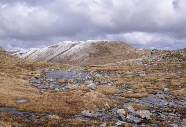
Meall Beithe is a stunning hill located in the region of Argyllshire, Scotland. It stands proudly amidst the picturesque landscape, offering breathtaking views and a serene atmosphere for outdoor enthusiasts. With an elevation of approximately 1,792 feet (546 meters), it is considered a prominent mountain in the area.

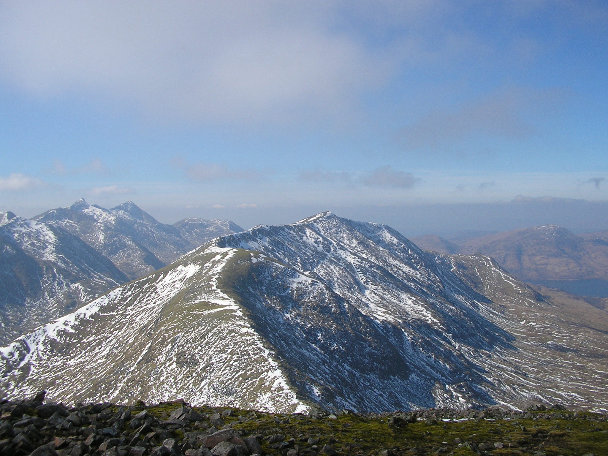
This majestic hill is a popular destination for hikers, mountaineers, and nature lovers. Its well-defined trails and paths make it accessible to both experienced climbers and casual walkers. The ascent to the summit presents a moderate challenge, rewarding visitors with panoramic vistas of the surrounding countryside, including the nearby Loch Awe and the rolling hills of Argyll.

Meall Beithe is blessed with diverse flora and fauna, showcasing the natural beauty of the Scottish Highlands. The lower slopes are adorned with heather, while the higher reaches are characterized by a blend of grasses and scattered rocky outcrops. The hill is also home to various bird species, including golden eagles, buzzards, and peregrine falcons, providing an opportunity for birdwatchers to observe these magnificent creatures in their natural habitat.

For those seeking a longer adventure, Meall Beithe can be incorporated into a multi-day trek, such as the West Highland Way or the Cowal Way. These long-distance trails offer a chance to explore the region's stunning landscapes, quaint villages, and historical sites.

Meall Beithe truly encapsulates the rugged beauty and tranquility of the Scottish Highlands, making it an ideal destination for outdoor enthusiasts looking to immerse themselves in nature's wonders.

If you have any feedback on the listing, please let us know in the comments section below.
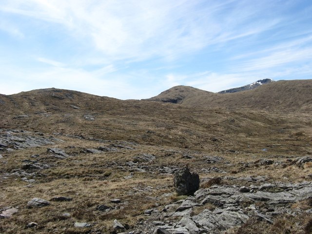
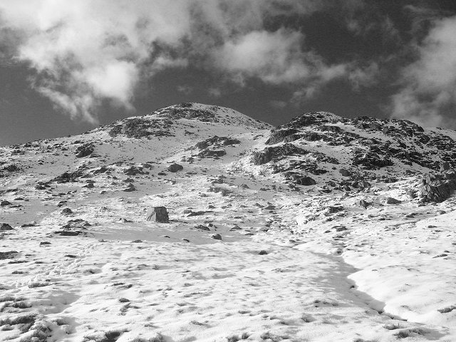
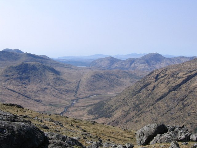
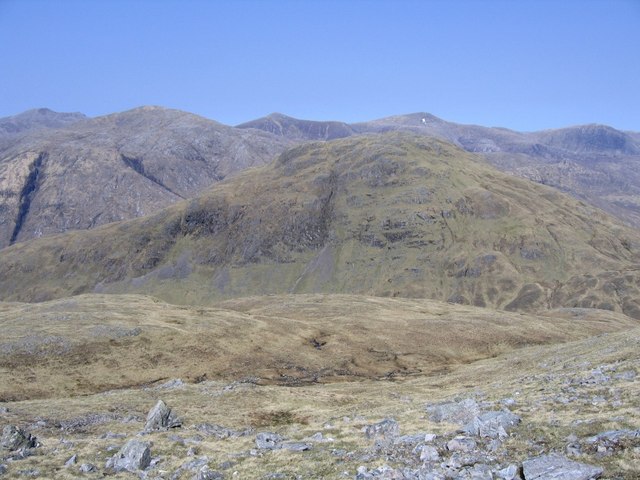
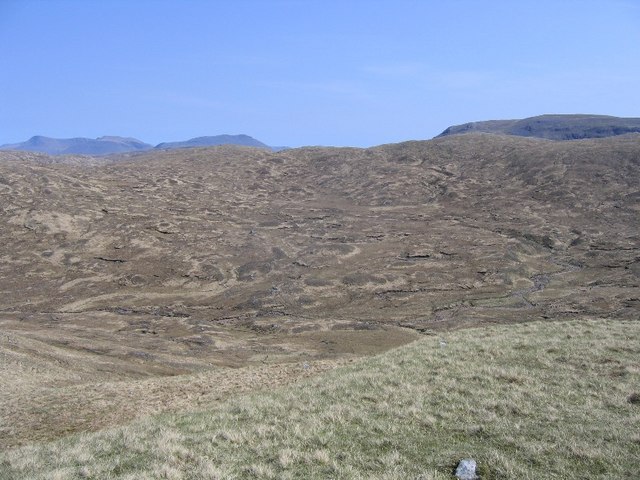
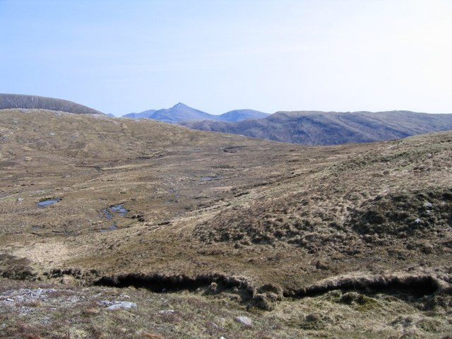
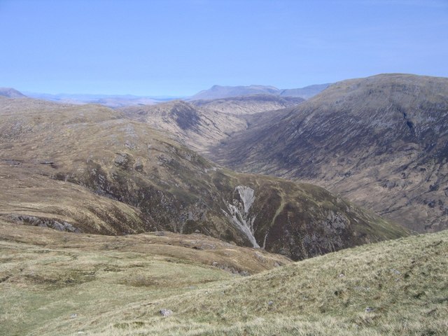
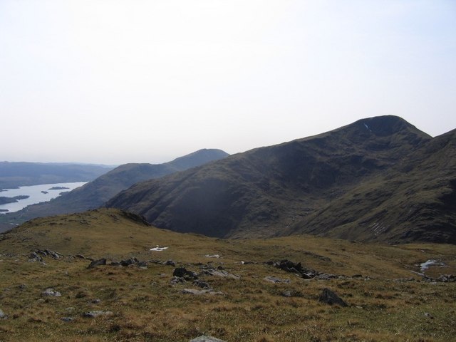
Meall Beithe Images

Images are sourced within 2km of 56.472001/-4.9757269 or Grid Reference NN1635. Thanks to Geograph Open Source API. All images are credited.

Beinn Larachan The summit of Beinn Larachan (589m) is on the left, then next right is Beinn Lurachen (719m) followed by the summit of the munro, Beinn Eunaich (989m) with snow on it. Meall Beith (693m) is the rounded hill to the right - really part of the ridge of Beinn Lurachen.
Beinn Larachan
The summit of Beinn Larachan (589m) is on the left, then next right is Beinn Lurachen (719m) followed by the summit of the munro, Beinn Eunaich (989m) with snow on it. Meall Beith (693m) is the rounded hill to the right - really part of the ridge of Beinn Lurachen.
Lairig Doireann Looking down on the pass between Meall Copagach and Beinn Lurachan from the tricky descent from Meall Copagach. Notice there is less snow on the southern side.
Lairig Doireann
Looking down on the pass between Meall Copagach and Beinn Lurachan from the tricky descent from Meall Copagach. Notice there is less snow on the southern side.
Meall Copagach Looking up the steep east ridge.
Meall Copagach
Looking up the steep east ridge.
View from summit of Meall Garbh Taken from just north of the summit, high above Glen Kinglass. The island of Mull can be seen in the far distance.
View from summit of Meall Garbh
Taken from just north of the summit, high above Glen Kinglass. The island of Mull can be seen in the far distance.
Looking towards the Lairig Dhoirrean Looking across the slope of Beinn Lurachan to the col of Lairig Dhoirrean. The high mountain at the back is the munro, Beinn Eunaich (988m)
Looking towards the Lairig Dhoirrean
Looking across the slope of Beinn Lurachan to the col of Lairig Dhoirrean. The high mountain at the back is the munro, Beinn Eunaich (988m)
View from Meall Bheithe summit Looking from the northern edge of the summit plateau of Meall Bheithe. The steep slope and drop separates this hill from the rocky little hill of Meall Garbh that is clearly seen. The far ridge consists of 5 Munros with Ben Starav on the extreme left.
View from Meall Bheithe summit
Looking from the northern edge of the summit plateau of Meall Bheithe. The steep slope and drop separates this hill from the rocky little hill of Meall Garbh that is clearly seen. The far ridge consists of 5 Munros with Ben Starav on the extreme left.
Typical peat bog From the slopes of Meall Garbh, looking across the upper drainage area (i.e. peat bog!) of the Allt nan Clach Sgoilte. The munros of Beinn an Dothaidh and Beinn Dorain can be seen poking about the ridge to the left, while the corbett, Beinn Mhic-Mhonaidh, is just as shyly poking above the ridge to the right.
Typical peat bog
From the slopes of Meall Garbh, looking across the upper drainage area (i.e. peat bog!) of the Allt nan Clach Sgoilte. The munros of Beinn an Dothaidh and Beinn Dorain can be seen poking about the ridge to the left, while the corbett, Beinn Mhic-Mhonaidh, is just as shyly poking above the ridge to the right.
Upper drainage basin of the Allt nan Clach Sgoilte This is the upper drainage basin of the Allt nan Clach Sgoilte. While it is a gentle slope here (and hence boggy), once over the col in the centre of the photo, the hillside drops in steep cliffs and slopes down to Gen Strae.
Upper drainage basin of the Allt nan Clach Sgoilte
This is the upper drainage basin of the Allt nan Clach Sgoilte. While it is a gentle slope here (and hence boggy), once over the col in the centre of the photo, the hillside drops in steep cliffs and slopes down to Gen Strae.
Steep sided coire Looking down into Coire Dubh Ealcha and the upper reaches of Glen Strae. The hill on the right is the corbett Bheinn Mhic-Mhonaidh.
Steep sided coire
Looking down into Coire Dubh Ealcha and the upper reaches of Glen Strae. The hill on the right is the corbett Bheinn Mhic-Mhonaidh.
Summit of Beinn Lurachan From the summit of Beinn Lurachan, looking at Beinn Eunaich, with just a tiny patch of snow left on it, and Loch Awe.
Summit of Beinn Lurachan
From the summit of Beinn Lurachan, looking at Beinn Eunaich, with just a tiny patch of snow left on it, and Loch Awe.
Eroded hillside
Eroded hillside
Lochan Dhoireann In the distance can be seen Loch Awe.
Lochan Dhoireann
In the distance can be seen Loch Awe.
Slopes of Beinn Larachan The entrance to Coire Dubh Ealcha can be seen from the left.
Slopes of Beinn Larachan
The entrance to Coire Dubh Ealcha can be seen from the left.
Glen Strae The track leads ahead up Glen Strae.
Glen Strae
The track leads ahead up Glen Strae.
Beinn Lurachan (summit) Looking towards Beinn Eunaich from the summit cairn on Beinn Lurachan.
Beinn Lurachan (summit)
Looking towards Beinn Eunaich from the summit cairn on Beinn Lurachan.
Pools and rocks on shelf above Lairig Dhoireann The Lairig Dhoireann is the pass between Meall Copagach and Beinn Lurachan its low point is below the camera position to the right. Meall Beithe is the central, lightly snowed mountain.
Pools and rocks on shelf above Lairig Dhoireann
The Lairig Dhoireann is the pass between Meall Copagach and Beinn Lurachan its low point is below the camera position to the right. Meall Beithe is the central, lightly snowed mountain.
Meall Beithe The mountain, Meall Beithe seen  past the lightly snowed north-west flank of Beinn Lurachan.
Meall Beithe
The mountain, Meall Beithe seen past the lightly snowed north-west flank of Beinn Lurachan.
Perched boulder on ridge of Beinn Lurachan A perched boulder on the declining south-west ridge of Beinn Lurachan with the Ben Lui group of Munros in the distance.
Perched boulder on ridge of Beinn Lurachan
A perched boulder on the declining south-west ridge of Beinn Lurachan with the Ben Lui group of Munros in the distance.
Show me another place!

Meall Beithe is located at Grid Ref: NN1635 (Lat: 56.472001, Lng: -4.9757269)

Unitary Authority: Argyll and Bute

Police Authority: Argyll and West Dunbartonshire

What 3 Words

///riverboat.done.carver. Near Tyndrum, Stirling

Nearby Locations

Meall Beithe

Related Wikis

Beinn Eunaich

Beinn Eunaich (989 m) is a mountain in the Grampian Mountains of Scotland, located north of the village of Dalmally in Argyll and Bute. The mountain rises...

Beinn Mhic-Mhonaidh

Beinn Mhic-Mhonaidh (796 m) is a mountain in the Grampian Mountains of Scotland, west of Glen Orchy in Argyll and Bute. Climbs usually start from the Eas...

Beinn nan Aighenan

Beinn nan Aighenan is a 960-metre (3,150 ft) high mountain in the Grampian Mountains of Scotland. It lies in Argyll and Bute, north of the village of Taynuilt...

Beinn a' Chochuill

Beinn a' Chochuill (980 m) is a mountain in the Grampian Mountains of Scotland, located east of Loch Etive in Argyll and Bute. Somewhat hidden away by...

Nearby Amenities

Located within 500m of 56.472001,-4.9757269
Meall Beithe
Ele: 693
Natural: peak
Wikidata: Q13129992
Lat/Long: 56.4722696/-4.9744892
The data included in this document is from www.openstreetmap.org. The data is made available under ODbL.

Have you been to Meall Beithe?

Leave your review of Meall Beithe below (or comments, questions and feedback).