Carn Ddafad-las

Hill, Mountain in Pembrokeshire

Wales

Carn Ddafad-las

Ordnance Survey Cut Mark This OS cut mark can be found on the gatepost SW side of the track. It marks a point 759.8ft above mean sea level.
Ordnance Survey Cut Mark Credit: Adrian Dust

Carn Ddafad-las is a prominent hill/mountain located in the county of Pembrokeshire, Wales. It forms part of the Preseli Hills, a range of hills known for their rugged and picturesque landscapes.

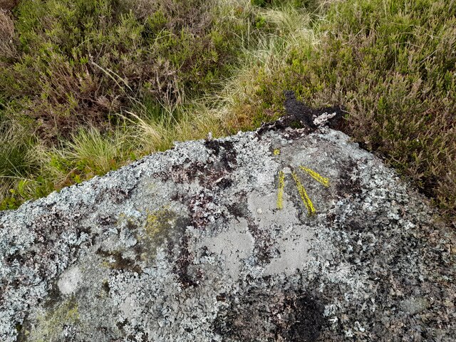
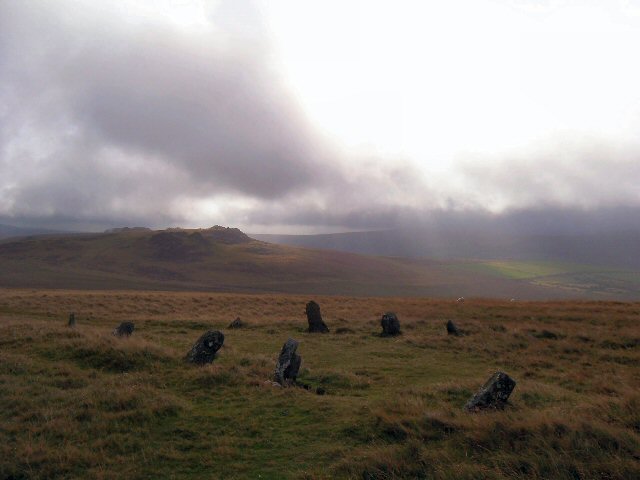
Standing at an elevation of approximately 519 meters (1,703 feet), Carn Ddafad-las offers breathtaking panoramic views of the surrounding countryside, including the Preseli Hills and the nearby Pembrokeshire Coast National Park. The hill/mountain is characterized by its rocky terrain, with large boulders and outcrops scattered across its slopes.

Carn Ddafad-las is a popular destination for hikers and outdoor enthusiasts due to its relatively accessible trails and stunning vistas. Several footpaths lead to the summit, providing visitors with a variety of options to explore the hill/mountain. The climb can be challenging in some sections, but the effort is rewarded with magnificent views at the top.

The hill/mountain is also of historical significance, as it is believed to be the source of the distinctive blue stones used in the construction of Stonehenge, located over 200 kilometers (124 miles) away in England. This has led to speculation about the ancient trade routes and cultural connections between the regions during prehistoric times.

Overall, Carn Ddafad-las is a remarkable natural landmark in Pembrokeshire, offering visitors an opportunity to immerse themselves in the beauty of the Welsh countryside and discover its historical significance.

If you have any feedback on the listing, please let us know in the comments section below.

Carn Ddafad-las Images

Images are sourced within 2km of 51.964224/-4.6975054 or Grid Reference SN1432. Thanks to Geograph Open Source API. All images are credited.

Ordnance Survey Cut Mark This OS cut mark can be found on the gatepost SW side of the track. It marks a point 759.8ft above mean sea level.
Ordnance Survey Cut Mark
This OS cut mark can be found on the gatepost SW side of the track. It marks a point 759.8ft above mean sea level.
Ordnance Survey Cut Mark This OS cut mark can be found on the gatepost west side of the track. It marks a point 804.7ft above mean sea level.
Ordnance Survey Cut Mark
This OS cut mark can be found on the gatepost west side of the track. It marks a point 804.7ft above mean sea level.
Leaning Gatepost
Leaning Gatepost
Ordnance Survey Cut Mark This OS cut mark can be found on the gatepost NE side of the track. It marks a point 908.7ft above mean sea level.
Ordnance Survey Cut Mark
This OS cut mark can be found on the gatepost NE side of the track. It marks a point 908.7ft above mean sea level.
Ordnance Survey Cut Mark This OS cut mark can be found on the gatepost NE side of the track. It marks a point 887.9ft above mean sea level.
Ordnance Survey Cut Mark
This OS cut mark can be found on the gatepost NE side of the track. It marks a point 887.9ft above mean sea level.
Carn Menyn Cairn or Coetan Arthur A circular disturbed cairn 15m in diameter by 1.5m high. The capstone is 2.8m by 2.5m.
Carn Menyn Cairn or Coetan Arthur
A circular disturbed cairn 15m in diameter by 1.5m high. The capstone is 2.8m by 2.5m.
Boundary Stone <a title="https://www.geograph.org.uk/photo/7171258" href="https://www.geograph.org.uk/photo/7171258">Link</a>
Boundary Stone
Boundary Stone <a title="https://www.geograph.org.uk/photo/7171257" href="https://www.geograph.org.uk/photo/7171257">Link</a>
Boundary Stone
Carn Ferched Cairn, 16m in diameter by 0.7m high.
Carn Ferched
Cairn, 16m in diameter by 0.7m high.
Carn Maen-llwydrhos
Carn Maen-llwydrhos
Ordnance Survey Cut Mark This OS cut mark can be found on a stone south of Carn Ferched. It marks a point 1115.5ft above mean sea level.
Ordnance Survey Cut Mark
This OS cut mark can be found on a stone south of Carn Ferched. It marks a point 1115.5ft above mean sea level.
Ordnance Survey Pivot This OS pivot can be found on a stone south of the track and north of the bank. It marks a point 1040.1ft above mean sea level.
Ordnance Survey Pivot
This OS pivot can be found on a stone south of the track and north of the bank. It marks a point 1040.1ft above mean sea level.
Ordnance Survey Pivot This OS pivot can be found on a stone NE of Carn Ferched. It marks a point 1071.8ft above mean sea level.
Ordnance Survey Pivot
This OS pivot can be found on a stone NE of Carn Ferched. It marks a point 1071.8ft above mean sea level.
Ordnance Survey Rivet/Pivot This OS Rivet/Pivot can be found on at the wall angle NE side of the track. It marks a point 792.0ft above mean sea level.
Ordnance Survey Rivet/Pivot
This OS Rivet/Pivot can be found on at the wall angle NE side of the track. It marks a point 792.0ft above mean sea level.
Gateway Foel Drygarn
Track down from Foel Drygarn
Trig point on Foel Drygarn Carningli in the distance.
Trig point on Foel Drygarn
Carningli in the distance.
Foel Drygarn The westernmost of the three Bronze Age burial cairns.
Foel Drygarn
The westernmost of the three Bronze Age burial cairns.
Show me another place!

Carn Ddafad-las is located at Grid Ref: SN1432 (Lat: 51.964224, Lng: -4.6975054)

Unitary Authority: Pembrokeshire

Police Authority: Dyfed Powys

What 3 Words

///charted.quarrel.mistaking. Near Crymych, Pembrokeshire

Nearby Locations

Carn Ddafad-las Carn Menyn

Related Wikis

Carn Menyn

Carn Menyn is a grouping of craggy rock outcrops or tors in the Preseli Hills in the Welsh county of Pembrokeshire. == Name and location == The name means...

Foel Drygarn

Foel Drygarn ("The hill of the three cairns") is an Iron Age hillfort, within which are three Bronze Age burial cairns. The site is about 1.5 miles (2...

Bedd Arthur

Bedd Arthur ("Arthur's Grave") is a possibly Neolithic hengiform monument megalithic site in the Preseli Hills in the Welsh county of Pembrokeshire. Thirteen...

Gweunydd Blaencleddau

Gweunydd Blaencleddau is a large wetland complex in a shallow south-west valley around the headwaters of the Eastern Cleddau river. It is a Site of Special...

Nearby Amenities

Located within 500m of 51.964224,-4.6975054
Carn Gyfrwy
Natural: peak
Lat/Long: 51.9606653/-4.7004243
The data included in this document is from www.openstreetmap.org. The data is made available under ODbL.

Have you been to Carn Ddafad-las?

Leave your review of Carn Ddafad-las below (or comments, questions and feedback).