Bencummin

Hill, Mountain in Ayrshire

Scotland

Bencummin

Livevstock pens in the Stinchar valley
Livevstock pens in the Stinchar valley Credit: Oliver Dixon

Bencummin is a prominent hill located in Ayrshire, Scotland. It is situated in the southern part of the country, approximately 8 miles southeast of the town of Ayr. With an elevation of 521 meters (1,709 feet), Bencummin is often referred to as a mountain due to its height.

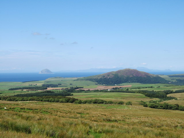
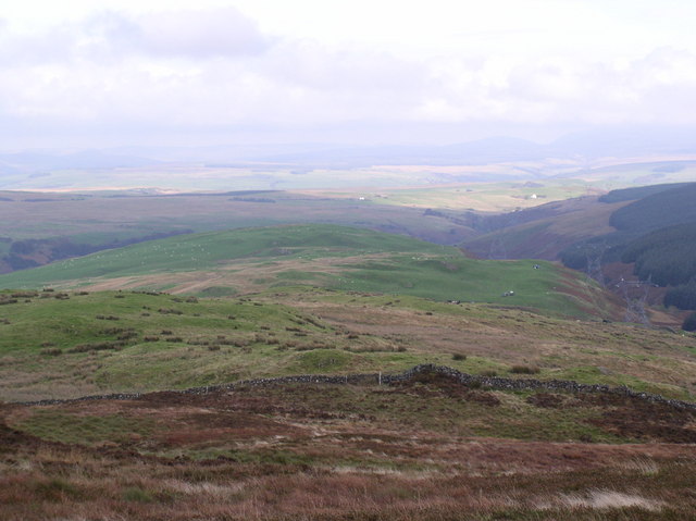
The hill is part of the Galloway Hills range and is known for its stunning natural beauty and panoramic views of the surrounding countryside. It is a popular destination for hikers and outdoor enthusiasts, offering a range of walking routes and trails to suit all abilities.

Bencummin is covered in heather and grass, providing a habitat for various wildlife species, including red deer and mountain hares. The hill is also home to a diverse range of birdlife, making it an ideal spot for birdwatchers.

At the summit of Bencummin, on a clear day, visitors can enjoy breathtaking views across the Ayrshire countryside and even catch a glimpse of the nearby coast. The hill's location makes it an excellent vantage point to appreciate the beauty of the surrounding landscape.

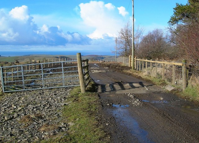
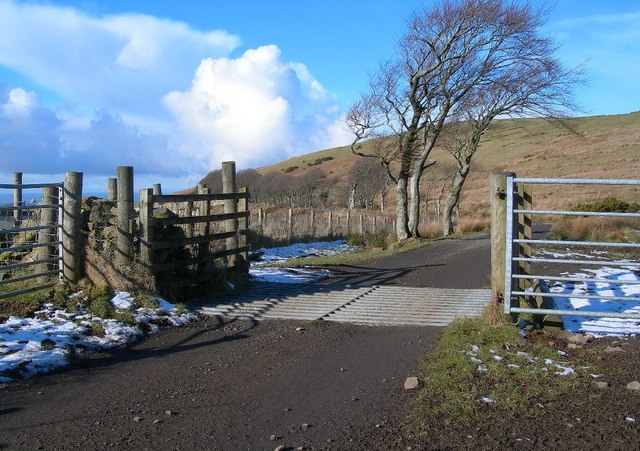
Access to Bencummin is relatively straightforward, with several routes leading to the summit. The hill can be reached by foot from various starting points, including Loch Doon and the nearby village of Dalmellington. It is recommended to come prepared with appropriate clothing and equipment for the challenging terrain and changeable Scottish weather.

Overall, Bencummin offers a rewarding outdoor experience for those seeking to explore the natural wonders of Ayrshire and enjoy stunning views from its summit.

If you have any feedback on the listing, please let us know in the comments section below.
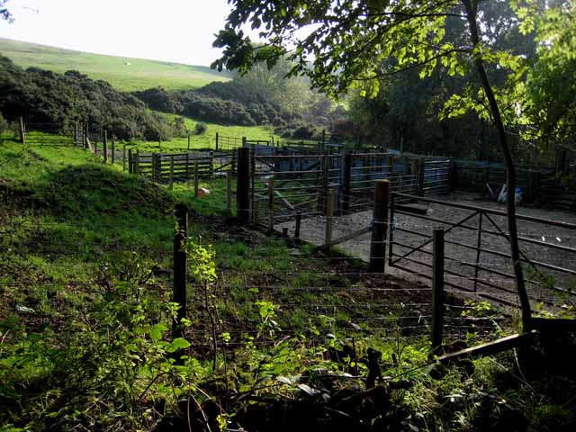
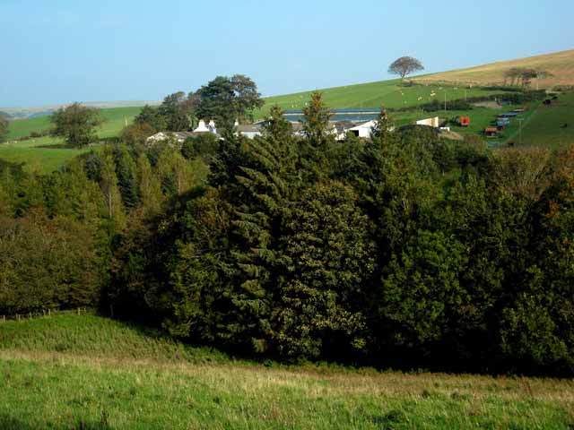
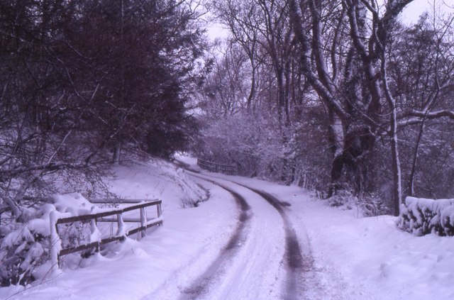
Bencummin Images

Images are sourced within 2km of 55.108822/-4.9151887 or Grid Reference NX1483. Thanks to Geograph Open Source API. All images are credited.

Livevstock pens in the Stinchar valley
Mains of Tig Looking across Glen Tig.
Mains of Tig
Looking across Glen Tig.
Derelict cottage at Craigneil, near Colmonell
Bridge towards Balrazzie All part of a day's work.
Bridge towards Balrazzie
All part of a day's work.
Knockdhu (230 metres) near to Ballantrae and Colmonell, South Ayrshire. The hill Knockdhu taken from the footpath from Penwhirn Reservoir to Ballantrae near to Benawhirter, Smyrton. The photo has good views of the Irish Sea and clearly shows Ailsa Craig with the island of Arran in the background.
Knockdhu (230 metres) near to Ballantrae and Colmonell, South Ayrshire.
The hill Knockdhu taken from the footpath from Penwhirn Reservoir to Ballantrae near to Benawhirter, Smyrton. The photo has good views of the Irish Sea and clearly shows Ailsa Craig with the island of Arran in the background.
Leffin Donald Hill Leffin Donald in the centre with Barhallan Hill above.
Leffin Donald Hill
Leffin Donald in the centre with Barhallan Hill above.
At Craig Wood The wood on the left has been cleared recently, with the trees on the right still in place.  The Firth of Clyde is visible in the far distance.
At Craig Wood
The wood on the left has been cleared recently, with the trees on the right still in place. The Firth of Clyde is visible in the far distance.
Cattle Grid in Glen Tig This track lies on the north side of Glen Tig, high above the Water of Tig.  Viewed on a fine February morning.
Cattle Grid in Glen Tig
This track lies on the north side of Glen Tig, high above the Water of Tig. Viewed on a fine February morning.
Glen Tig View Looking down Glen Tig from improved grazing fields on the north side.  Viewed in February with the land in winter colours.
Glen Tig View
Looking down Glen Tig from improved grazing fields on the north side. Viewed in February with the land in winter colours.
Snow on the Moor in Glen Tig The remains of a recent snowfall on the moor in the upper part of Glen Tig.  Viewed on a fine February day.
Snow on the Moor in Glen Tig
The remains of a recent snowfall on the moor in the upper part of Glen Tig. Viewed on a fine February day.
Wind-Blown Trees Near Loch Meraddie These trees lie along the fence line between Loch Meraddie and Knockdhu, to the north of Glen Tig.  The snow had fallen a few days earlier, in mid-February.  Although it had thinned out a lot, the ground was still frozen.  This did improve the walking conditions, however!
Wind-Blown Trees Near Loch Meraddie
These trees lie along the fence line between Loch Meraddie and Knockdhu, to the north of Glen Tig. The snow had fallen a few days earlier, in mid-February. Although it had thinned out a lot, the ground was still frozen. This did improve the walking conditions, however!
Down The Track Looking down the farm track on the north side of Glen Tig, on a fine but chilly February morning.
Down The Track
Looking down the farm track on the north side of Glen Tig, on a fine but chilly February morning.
Beech Trees by the Track A line of beautifully shaped beech trees along the track on the northern side of Glen Tig.
Beech Trees by the Track
A line of beautifully shaped beech trees along the track on the northern side of Glen Tig.
Glen Tig View Looking down Glen Tig on a frosty February morning.  The Firth of Clyde is visible in the far distance.
Glen Tig View
Looking down Glen Tig on a frosty February morning. The Firth of Clyde is visible in the far distance.
Glen Tig View Looking down the farm track on the northern side of Glen Tig. The huge clouds were heading for Northern Ireland.
Glen Tig View
Looking down the farm track on the northern side of Glen Tig. The huge clouds were heading for Northern Ireland.
Down The Farm Track Looking down the farm track on the northern side of Glen Tig, with the Firth of Clyde in the background.
Down The Farm Track
Looking down the farm track on the northern side of Glen Tig, with the Firth of Clyde in the background.
A Line of Trees in Glen Tig This line of straggly trees might have originated as a beech hedge, many years ago.
A Line of Trees in Glen Tig
This line of straggly trees might have originated as a beech hedge, many years ago.
Farm Track in Glen Tig This track gives access to fields on the north side of the glen.  Viewed on a fine February morning.  The snow was all that remained from a fall a few days earlier.
Farm Track in Glen Tig
This track gives access to fields on the north side of the glen. Viewed on a fine February morning. The snow was all that remained from a fall a few days earlier.
Show me another place!

Bencummin is located at Grid Ref: NX1483 (Lat: 55.108822, Lng: -4.9151887)

Unitary Authority: South Ayrshire

Police Authority: Ayrshire

What 3 Words

///gurgling.unwound.anchovies. Near Girvan, South Ayrshire

Nearby Locations

Bencummin

Related Wikis

Heronsford

Heronsford is a village located in South Ayrshire, South-West Scotland. == About == Heronsford is a hamlet located near Ballantrae that sits along the...

Colmonell

Colmonell (Scottish Gaelic: Cill Cholmain Eala) (meaning the church of St. Colman of Lainn Eala - in Lynally, County Offaly, Ireland) is a small village...

Ballantrae Windmill

The Ballantrae Windmill, on Mill Hill was a late 17th or early 18th century vaulted tower windmill, the ruins of which are located above the old raised...

Glenapp Castle

Glenapp Castle, formerly the family seat of the Earl of Inchcape, is now a luxury hotel and restaurant located about 1+1⁄2 miles (2.5 kilometres) southeast...

Nearby Amenities

Located within 500m of 55.108822,-4.9151887
Natural: peak
Lat/Long: 55.1094259/-4.9158972
The data included in this document is from www.openstreetmap.org. The data is made available under ODbL.

Have you been to Bencummin?

Leave your review of Bencummin below (or comments, questions and feedback).