Aonach Dubh

Hill, Mountain in Ross-shire

Scotland

Aonach Dubh

Meall a' Chaorainn, summit cairn Looking to Sgùrr a' Ghlas-leathaid.
Meall a' Chaorainn, summit cairn Credit: Alan Reid

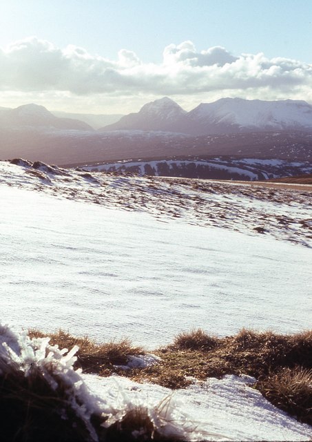
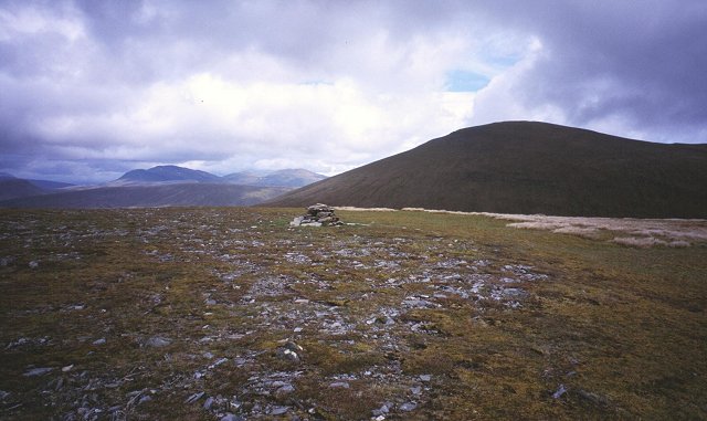
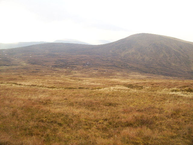
Aonach Dubh is a prominent hill located in Ross-shire, Scotland. It is part of the Scottish Highlands and lies within the wider mountain range known as the Monadhliath Mountains. Standing at an impressive height of 907 meters (2,976 feet), it is a popular destination for hikers and hillwalkers seeking breathtaking views and challenging terrains.

The hill is characterized by its distinctive conical shape and dark appearance, which gives it its Gaelic name "Aonach Dubh" meaning "Black Ridge." Its summit offers panoramic vistas of the surrounding landscape, including the nearby hills and lochs, such as Loch Ness to the northeast.

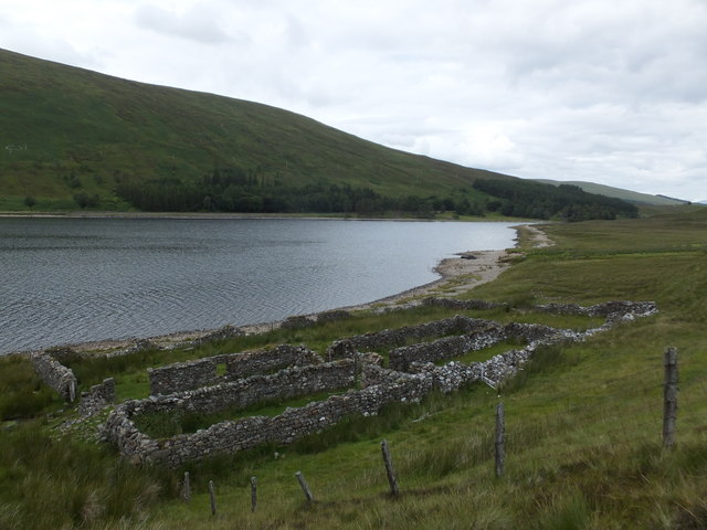
Access to Aonach Dubh is typically gained from the nearby village of Farr, where a path leads to the hill's lower slopes. From there, the ascent becomes steeper, requiring a moderate level of fitness and proper hiking equipment. The hill is often traversed by experienced mountaineers as part of longer routes that connect various peaks in the Monadhliath Mountains.

Aonach Dubh's location within the Scottish Highlands provides an opportunity for wildlife enthusiasts to spot a range of species. The hill is home to several bird species, including golden eagles and ptarmigans, as well as various mammals like red deer and mountain hares.

Overall, Aonach Dubh offers a challenging yet rewarding experience for those seeking to explore the natural beauty and rugged terrain of the Scottish Highlands. Its striking appearance, coupled with its stunning views, makes it a must-visit destination for outdoor enthusiasts and nature lovers alike.

If you have any feedback on the listing, please let us know in the comments section below.
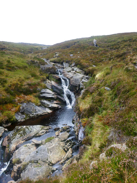
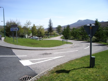
Aonach Dubh Images

Images are sourced within 2km of 57.589623/-5.1192973 or Grid Reference NH1359. Thanks to Geograph Open Source API. All images are credited.

Meall a' Chaorainn, summit cairn Looking to Sgùrr a' Ghlas-leathaid.
Meall a' Chaorainn, summit cairn
Looking to Sgùrr a' Ghlas-leathaid.
Meall a' Chaorainn snowscape Looking towards Torridon mountains.
Meall a' Chaorainn snowscape
Looking towards Torridon mountains.
Plateau of Meall a' Chaoruinn Gentle hill above Loch a'Croisg. The vegetation is close cropped moss and the going is like walking on a carpet. The hill gives fine views of the Torridon and Fisherfield hills, but is completely overshadowed by bulky Fionn Bheinn (933m) to the east.
Plateau of Meall a' Chaoruinn
Gentle hill above Loch a'Croisg. The vegetation is close cropped moss and the going is like walking on a carpet. The hill gives fine views of the Torridon and Fisherfield hills, but is completely overshadowed by bulky Fionn Bheinn (933m) to the east.
Summit, Meall a' Chaoruinn. Overshadowed by the bulk of Fionn Bheinn, a mossy 705m top.
Summit, Meall a' Chaoruinn.
Overshadowed by the bulk of Fionn Bheinn, a mossy 705m top.
Boggy Pass near Achnasheen This boggy ground feeds the burns Allt Achadh na Sìne to the south-east and Allt a' Choire Bhuig to the north-west. The hill in the background is Meall a' Chaorainn. (The position of this image is uncertain, but is believed to be in the correct square).
Boggy Pass near Achnasheen
This boggy ground feeds the burns Allt Achadh na Sìne to the south-east and Allt a' Choire Bhuig to the north-west. The hill in the background is Meall a' Chaorainn. (The position of this image is uncertain, but is believed to be in the correct square).
Bog pool, Creagan nan Laogh looking ESE, Sgurr a'Mhuilinn in the distance
Bog pool, Creagan nan Laogh
looking ESE, Sgurr a'Mhuilinn in the distance
Sheep pens (fank) by Lochrosque (Loch a' Chroisg) The circular structure on the hillside opposite is the fank in <a title="https://www.geograph.org.uk/photo/3763440" href="https://www.geograph.org.uk/photo/3763440">Link</a>.
Sheep pens (fank) by Lochrosque (Loch a' Chroisg)
The circular structure on the hillside opposite is the fank in Link.
Old boundary wall at Leanach What was once a substantial wall around an enclosure at Leanach is now largely broken down.
Old boundary wall at Leanach
What was once a substantial wall around an enclosure at Leanach is now largely broken down.
Loch a' Chroisg
Loch a' Chroisg
Birch in winter beside Loch a' Chroisg
Looking east along the A832
Loch a' Chroisg
Loch a' Chroisg
Treelined shore of Loch a' Chroisg
Looking across Loch a' Chroisg
Allt Achadh na Sìne Fionn Bheinn was always a Munro I had intended to save for a ski ascent, with a deep snow cover. Not merely because it is the sort of rounded mountain that is eminently suited to ski touring, and has little technical interest in the summer, but also because it has a reputation for bogginess whenever the ground is not suitably hard frozen. However, as we were in the vicinity and this hill lies in an area where I'd already done all the others, it seemed fated that we would plod up the side of the Allt Achadh na Sìne today. Whilst the ground was probably drier than most of the year, it was certainly not easy going, even close to the steep drainage.
Allt Achadh na Sìne
Fionn Bheinn was always a Munro I had intended to save for a ski ascent, with a deep snow cover. Not merely because it is the sort of rounded mountain that is eminently suited to ski touring, and has little technical interest in the summer, but also because it has a reputation for bogginess whenever the ground is not suitably hard frozen. However, as we were in the vicinity and this hill lies in an area where I'd already done all the others, it seemed fated that we would plod up the side of the Allt Achadh na Sìne today. Whilst the ground was probably drier than most of the year, it was certainly not easy going, even close to the steep drainage.
Pines on the slopes of Aonach Dubh
Pines on Aonach Dubh
Show me another place!

Aonach Dubh is located at Grid Ref: NH1359 (Lat: 57.589623, Lng: -5.1192973)

Unitary Authority: Highland

Police Authority: Highlands and Islands

What 3 Words

///grudges.continued.diet. Near Achnasheen, Highland

Nearby Locations

Aonach Dubh

Related Wikis

Fionn Bheinn

Fionn Bheinn is a mountain located south of Loch Fannich in the northwestern Scottish Highlands. It has a height of 933 m (3061 ft) and is listed as a...

Achnasheen railway station

Achnasheen railway station is a remote railway station on the Kyle of Lochalsh Line, serving the village of Achnasheen in the north of Scotland. The station...

Achnasheen

Achnasheen (Gaelic Achadh na Sìne) is a small village in Ross-shire in the Highland council area of Scotland. The village is situated on the River Bran...

Ledgowan Forest

Ledgowan Forest is a deer forest in the Northwest Highlands of Scotland. It stands in Wester Ross to the southwest of Achnasheen. Ledgowan Forest is the...

Have you been to Aonach Dubh?

Leave your review of Aonach Dubh below (or comments, questions and feedback).